Category:Steeple with Tyneham
civil parish in Dorset, England | |||||
| Upload media | |||||
| Instance of |
| ||||
|---|---|---|---|---|---|
| Location |
| ||||
 | |||||
English: Steeple with Tyneham is a civil parish in the Purbeck district, in the county of Dorset, England.
Subcategories
This category has the following 5 subcategories, out of 5 total.
Media in category "Steeple with Tyneham"
The following 200 files are in this category, out of 242 total.
(previous page) (next page)-
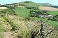
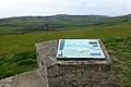 "Explore the Dorset Coast" - geograph.org.uk - 4902212.jpg 640 × 427; 87 KB
-
 A steep drive down - geograph.org.uk - 2163287.jpg 800 × 600; 85 KB
-
 A summer visit to Steeple Churchyard (a) - geograph.org.uk - 6222425.jpg 640 × 480; 124 KB
-
 A summer visit to Steeple Churchyard (b) - geograph.org.uk - 6222426.jpg 640 × 480; 113 KB
-
 A summer visit to Steeple Churchyard (c) - geograph.org.uk - 6222428.jpg 640 × 480; 104 KB
-
 A summer visit to Steeple Churchyard (d) - geograph.org.uk - 6222431.jpg 640 × 480; 102 KB
-
 A summer visit to Steeple Churchyard (e) - geograph.org.uk - 6222433.jpg 640 × 480; 118 KB
-

-
 Abandoned farmstead at North Egliston - geograph.org.uk - 3103671.jpg 1,024 × 810; 182 KB
-
 Abandoned farmstead at North Egliston - geograph.org.uk - 3104068.jpg 1,024 × 768; 196 KB
-

-
 Along Kimmeridge ridge - geograph.org.uk - 2133741.jpg 640 × 426; 172 KB
-
 Along Kimmeridge ridge - geograph.org.uk - 2133788.jpg 640 × 427; 199 KB
-
 Arable land - geograph.org.uk - 4414920.jpg 640 × 426; 84 KB
-
 Army Tank Range - geograph.org.uk - 3329436.jpg 640 × 480; 95 KB
-
 Army Tank Ranges - geograph.org.uk - 3329435.jpg 640 × 480; 88 KB
-
 Ascending Worbarrow Tout - geograph.org.uk - 5245316.jpg 640 × 427; 80 KB
-
 Barn at Lutton Farm - geograph.org.uk - 2076685.jpg 800 × 459; 59 KB
-
 Below Smedmore Hill - geograph.org.uk - 3133635.jpg 640 × 480; 67 KB
-
 Benchmark on Grange Arch - geograph.org.uk - 5245320.jpg 640 × 427; 95 KB
-
 Boundary stone on Ridgeway Hill - geograph.org.uk - 5245347.jpg 640 × 427; 89 KB
-
-
 Brandy Bay - geograph.org.uk - 2039778.jpg 640 × 426; 175 KB
-
 Brandy Bay - geograph.org.uk - 2039789.jpg 640 × 426; 189 KB
-
 Brandy Bay ^ Kimmeridge Bay beyond from Gad Cliff - geograph.org.uk - 6441016.jpg 1,802 × 1,201; 434 KB
-
 Bridleway along Kimmeridge ridge - geograph.org.uk - 2133771.jpg 640 × 427; 172 KB
-
 Bridleway to Steeple Leaze Farm - geograph.org.uk - 2133735.jpg 640 × 427; 192 KB
-
 Broad Bench peninsula - geograph.org.uk - 4115668.jpg 1,600 × 1,064; 306 KB
-
 Burnt offering at West Creech Hill - geograph.org.uk - 2043800.jpg 640 × 426; 181 KB
-
 Camping at Kimmeridge - geograph.org.uk - 2133807.jpg 640 × 426; 193 KB
-
 Can we go in^ - geograph.org.uk - 2039676.jpg 640 × 427; 181 KB
-
 Car Park on the Purbeck Hills - geograph.org.uk - 2558054.jpg 1,024 × 768; 189 KB
-

-
 Cliff at Kimmeridge Bay - geograph.org.uk - 6267282.jpg 3,456 × 5,184; 2.19 MB
-
 Cliff at Kimmeridge Bay - geograph.org.uk - 6267287.jpg 800 × 534; 120 KB
-
 Cliff at Kimmeridge Bay - geograph.org.uk - 6267288.jpg 800 × 534; 114 KB
-
 Coastal path at Charnel - geograph.org.uk - 2039764.jpg 640 × 426; 175 KB
-
 Corfe River Valley - geograph.org.uk - 4414922.jpg 640 × 426; 72 KB
-
 Corfe River Valley - geograph.org.uk - 4429029.jpg 640 × 426; 60 KB
-
 Corfe River Valley - geograph.org.uk - 4429030.jpg 640 × 426; 57 KB
-
 Corfe River Valley - geograph.org.uk - 4429037.jpg 640 × 426; 63 KB
-
 Corfe River Valley - geograph.org.uk - 4429802.jpg 640 × 426; 60 KB
-
 Country Lane, near Creech, Dorset - geograph.org.uk - 4177655.jpg 800 × 521; 150 KB
-
 Cows at Tyneham - geograph.org.uk - 6268488.jpg 800 × 534; 166 KB
-
 Creech Grange as seen from Grange Arch, Purbeck Hills - geograph.org.uk - 6440917.jpg 1,802 × 1,201; 510 KB
-
 Creech Grange from the south - geograph.org.uk - 2658117.jpg 1,024 × 768; 221 KB
-
 Creech, the old post office - geograph.org.uk - 4424444.jpg 640 × 480; 129 KB
-

-
 Descending Tyneham Cap - geograph.org.uk - 5408495.jpg 1,024 × 733; 182 KB
-
 Descending Whiteway Hill to Tyneham - geograph.org.uk - 5245313.jpg 640 × 427; 95 KB
-
 East Holme, bridleway - geograph.org.uk - 5601952.jpg 1,024 × 768; 291 KB
-

-
 Entrance to Range Walk - geograph.org.uk - 3329445.jpg 640 × 480; 110 KB
-
 Farm buildings, Lutton Farm - geograph.org.uk - 2076689.jpg 800 × 480; 56 KB
-
 Farming at Kimmeridge - geograph.org.uk - 2039715.jpg 640 × 425; 213 KB
-
 Farmland above Lutton Gwyle - geograph.org.uk - 2043767.jpg 640 × 426; 186 KB
-
 Farmland opposite Cheech Church - geograph.org.uk - 6222435.jpg 640 × 480; 69 KB
-
 Field Boundary - geograph.org.uk - 2558003.jpg 1,024 × 768; 247 KB
-
 Field Boundary below Tyneham Cap - geograph.org.uk - 2557946.jpg 1,024 × 768; 229 KB
-
 Field of Sugar Beet - geograph.org.uk - 4414309.jpg 640 × 426; 102 KB
-
 Field of sugar beet - geograph.org.uk - 4414312.jpg 640 × 426; 94 KB
-
 Field off Grange Hill - geograph.org.uk - 6268482.jpg 800 × 534; 101 KB
-
 Findings on the coastal path - geograph.org.uk - 2039640.jpg 640 × 426; 187 KB
-
 Firing Range Perimeter - geograph.org.uk - 3329844.jpg 640 × 480; 137 KB
-
 Footpath at West Creech Hill - geograph.org.uk - 2043777.jpg 640 × 426; 193 KB
-
 Footpath on Povington Hill - geograph.org.uk - 5245326.jpg 427 × 640; 53 KB
-
 Footpath to Kimmeridge - geograph.org.uk - 4414884.jpg 640 × 426; 105 KB
-

-
 Footpaths leaving Kimmeridge - Steeple road - geograph.org.uk - 6439256.jpg 1,024 × 768; 372 KB
-
 Forbidden Land - geograph.org.uk - 4157870.jpg 640 × 396; 399 KB
-
 Fossilised Tree stump, Worbarrow Tout - geograph.org.uk - 3602334.jpg 4,608 × 3,456; 5.78 MB
-
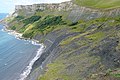
 Gad Cliff as seen from western end of Hobarrow Bay - geograph.org.uk - 6440940.jpg 1,799 × 1,199; 519 KB
-
 Gardener's Cottage - geograph.org.uk - 5050831.jpg 1,024 × 683; 237 KB
-

-
 Gorse on Whiteway Hill - geograph.org.uk - 2076645.jpg 800 × 426; 68 KB
-
 Gorse, Whiteway Hill - geograph.org.uk - 2076649.jpg 800 × 484; 71 KB
-
 Grange Arch - geograph.org.uk - 6022014.jpg 1,024 × 768; 176 KB
-
 Grange Arch NT, Purbeck Hills - geograph.org.uk - 4288419.jpg 1,024 × 768; 177 KB
-
 Grange Arch, Purbeck Hills - geograph.org.uk - 5245312.jpg 640 × 427; 65 KB
-
 Grange Arch, Purbeck Hills - geograph.org.uk - 6440912.jpg 1,799 × 1,199; 436 KB
-
 Grange Arch, Ridgeway Hill - geograph.org.uk - 3336834.jpg 2,592 × 1,944; 1.84 MB
-
 Grange Hill - geograph.org.uk - 5017684.jpg 1,600 × 1,200; 360 KB
-
 Grange Hill - geograph.org.uk - 6268480.jpg 800 × 534; 124 KB
-
 Grange Road, East Creech, Dorset - geograph.org.uk - 2741356.jpg 1,600 × 1,152; 653 KB
-
 Grange Viewpoint - geograph.org.uk - 6021923.jpg 1,024 × 768; 171 KB
-
 Grange, bales - geograph.org.uk - 6021959.jpg 1,024 × 768; 208 KB
-
 Grange, bridleway - geograph.org.uk - 6021935.jpg 1,024 × 768; 237 KB
-
 Grange, gate - geograph.org.uk - 6021951.jpg 1,024 × 768; 291 KB
-
 Grange, other route - geograph.org.uk - 6021969.jpg 1,024 × 768; 194 KB
-
 Grange, other route - geograph.org.uk - 6022006.jpg 1,024 × 768; 215 KB
-
 Grange, red flag - geograph.org.uk - 6021931.jpg 1,024 × 768; 177 KB
-
 Grassland at Kimmeridge - geograph.org.uk - 2039698.jpg 640 × 425; 182 KB
-
 Harvesting at Kimmeridge Coppice - geograph.org.uk - 2133766.jpg 427 × 640; 192 KB
-
 Hay Bales with a View - geograph.org.uk - 3160589.jpg 640 × 480; 83 KB
-
 Heading along Whiteway Hill - geograph.org.uk - 2163324.jpg 800 × 600; 126 KB
-
 Heading to Bradle Farm - geograph.org.uk - 4414907.jpg 640 × 426; 66 KB
-
 Heathland near Tyneham - geograph.org.uk - 5004067.jpg 800 × 600; 160 KB
-
 Huge puddle at Grange Hill Car Park - geograph.org.uk - 5245334.jpg 640 × 427; 78 KB
-
 Into the army range - geograph.org.uk - 2133725.jpg 640 × 427; 188 KB
-
 Into the Cloud - geograph.org.uk - 2538897.jpg 1,024 × 768; 224 KB
-
 Ivy on a phone box - geograph.org.uk - 4948751.jpg 1,280 × 1,280; 459 KB
-
 Junction with cows and ladies - geograph.org.uk - 4115619.jpg 1,600 × 1,064; 340 KB
-
 Kimmeridge Bay - geograph.org.uk - 6267280.jpg 800 × 534; 164 KB
-
 Kimmeridge Bay - geograph.org.uk - 6267313.jpg 800 × 534; 173 KB
-

-
 Kimmeridge oil well - geograph.org.uk - 2039669.jpg 640 × 427; 178 KB
-
 Kimmeridge Oil Well - geograph.org.uk - 2895537.jpg 1,024 × 768; 230 KB
-
 Kimmeridge Oil Well - geograph.org.uk - 5408509.jpg 1,024 × 768; 275 KB
-
 Kimmeridge Village - geograph.org.uk - 3775273.jpg 3,872 × 2,592; 4.08 MB
-
 Kimmeridge Village - geograph.org.uk - 3775277.jpg 3,872 × 2,592; 3.88 MB
-
 Kimmeridge Village - geograph.org.uk - 4414304.jpg 640 × 426; 87 KB
-

-

-
 Lane along Grange Hill - geograph.org.uk - 2163421.jpg 640 × 480; 105 KB
-
 Lane east of Kimmeridge - geograph.org.uk - 4414891.jpg 640 × 426; 61 KB
-
 Lane heading east - geograph.org.uk - 4414916.jpg 640 × 426; 47 KB
-
 Lane to Bradle Farm - geograph.org.uk - 4429035.jpg 640 × 488; 87 KB
-
 Lane to Church Knowle - geograph.org.uk - 4429021.jpg 640 × 426; 68 KB
-
 Lane to Kimmeridge - geograph.org.uk - 4414316.jpg 640 × 426; 89 KB
-
 Lane to Kimmeridge - geograph.org.uk - 4414877.jpg 640 × 426; 70 KB
-
 Lane to Steeple - geograph.org.uk - 4414887.jpg 640 × 426; 60 KB
-
 Lane to Tyneham - geograph.org.uk - 2043694.jpg 640 × 425; 168 KB
-
 Lane to Tyneham - geograph.org.uk - 2043772.jpg 640 × 426; 198 KB
-
 Looking east along Gad Cliff - geograph.org.uk - 6460038.jpg 1,799 × 1,199; 403 KB
-
 Looking east along Gad Cliff - geograph.org.uk - 6460045.jpg 1,799 × 1,199; 427 KB
-

-
 Low tide in Brandy Bay - geograph.org.uk - 2890492.jpg 768 × 1,024; 189 KB
-
 Lulworth coastal walk - geograph.org.uk - 3792700.jpg 6,440 × 2,072; 4.22 MB
-
 Lulworth Estate-Park - geograph.org.uk - 3814464.jpg 6,031 × 2,229; 6.03 MB
-
 Minor road to Tyneham - geograph.org.uk - 2742524.jpg 1,024 × 710; 264 KB
-
 MOD firing range - geograph.org.uk - 2163375.jpg 1,024 × 768; 185 KB
-
 Nodding donkey - geograph.org.uk - 4115657.jpg 1,600 × 1,064; 499 KB
-
 North Egliston - Derelict Farm Buildings - geograph.org.uk - 3790538.jpg 3,872 × 2,592; 3.56 MB
-
 North Egliston - geograph.org.uk - 2043731.jpg 640 × 427; 196 KB
-
 North Egliston - geograph.org.uk - 2043736.jpg 640 × 425; 187 KB
-
 North Egliston - geograph.org.uk - 2043743.jpg 640 × 426; 177 KB
-
 Old defensive look out or pill box at Flowers Barrow - geograph.org.uk - 2006500.jpg 3,648 × 2,736; 2.2 MB
-
 Old tank on Gold Down - geograph.org.uk - 5245324.jpg 640 × 427; 83 KB
-
 On the ranges path up Tyneham Cap - geograph.org.uk - 4115674.jpg 1,600 × 1,064; 483 KB
-
 On top of Broad Bench - geograph.org.uk - 5408506.jpg 1,024 × 768; 265 KB
-
 Path to Worbarrow - geograph.org.uk - 2023504.jpg 800 × 600; 246 KB
-
 Path Up Worbarrow Tout - geograph.org.uk - 2023512.jpg 800 × 600; 305 KB
-
 Post Office Row - geograph.org.uk - 5049856.jpg 1,024 × 683; 296 KB
-
 Puddle and gateway on track to Swyre Head - geograph.org.uk - 6439548.jpg 1,024 × 768; 403 KB
-
 Purbeck Hills at Lutton Gwyle - geograph.org.uk - 1945378.jpg 640 × 480; 69 KB
-
 Purbeck Hills panorama - geograph.org.uk - 3130607.jpg 1,600 × 362; 122 KB
-
 Purbeck in the mist - geograph.org.uk - 2741575.jpg 1,600 × 1,200; 209 KB
-
 Purbeck scenery - geograph.org.uk - 4414926.jpg 640 × 426; 64 KB
-
 Purbeck Scenery - geograph.org.uk - 4429041.jpg 640 × 426; 66 KB
-
 Ranges walk at West Creech Hill - geograph.org.uk - 5245338.jpg 427 × 640; 121 KB
-
 Ridge west of Kimmeridge - geograph.org.uk - 4414310.jpg 640 × 426; 74 KB
-
 Road from Tyneham - geograph.org.uk - 6268485.jpg 800 × 534; 103 KB
-
 Road near Lawford Sheard Gate - geograph.org.uk - 6268496.jpg 800 × 600; 98 KB
-
 Road near Tyneham View - geograph.org.uk - 6268495.jpg 800 × 534; 125 KB
-
 Road on the Ranges - geograph.org.uk - 4117695.jpg 1,600 × 1,064; 305 KB
-
 Road on Whiteway Hill - geograph.org.uk - 2163335.jpg 800 × 600; 110 KB
-
 Road to Tyneham - geograph.org.uk - 6268486.jpg 800 × 534; 92 KB
-
 Road to Tyneham - geograph.org.uk - 6268494.jpg 800 × 534; 135 KB
-
 Rock strata in cliff - geograph.org.uk - 2539382.jpg 480 × 640; 124 KB
-
 Rocks and cliff at Worbarrow - geograph.org.uk - 2023515.jpg 800 × 600; 273 KB
-
 Rolled bales - geograph.org.uk - 4414313.jpg 640 × 426; 82 KB
-
 Rolled bales - geograph.org.uk - 4414894.jpg 640 × 426; 70 KB
-
 Rolled bales - geograph.org.uk - 4414904.jpg 640 × 426; 81 KB
-
 Rough Grassland above Broad Bench - geograph.org.uk - 2557967.jpg 1,024 × 768; 213 KB
-
 Rows of bales - geograph.org.uk - 6439506.jpg 1,024 × 768; 362 KB
-
 Sheep grazing on Smedmore Hill - geograph.org.uk - 3128709.jpg 640 × 480; 62 KB
-
 Sheep near Tyneham - geograph.org.uk - 6268483.jpg 800 × 534; 109 KB
-
 Sheep near Tyneham - geograph.org.uk - 6268484.jpg 800 × 534; 122 KB
-
 Sheep on the range - geograph.org.uk - 4115693.jpg 1,600 × 1,064; 542 KB
-
 Sheep on West Creech Hill - geograph.org.uk - 2133676.jpg 640 × 426; 176 KB
-
 Smedmore Hill view - geograph.org.uk - 3133592.jpg 640 × 480; 77 KB
-
 Smedmore Hill view - geograph.org.uk - 3133620.jpg 640 × 480; 66 KB
-
 South West Coast Path on Gad Cliff - geograph.org.uk - 5408427.jpg 1,024 × 755; 232 KB
-
 South-west coast path at Gold Down - geograph.org.uk - 5245329.jpg 640 × 427; 58 KB
-
 Steeple Leaze Farm - geograph.org.uk - 2133728.jpg 640 × 425; 175 KB
-
 Steeple Leaze Farm - geograph.org.uk - 5245352.jpg 640 × 427; 59 KB
-
 Storm Clouds over Weymouth Bay - geograph.org.uk - 2950555.jpg 640 × 480; 120 KB
-
 Telephone box on Grange Road - geograph.org.uk - 4902214.jpg 640 × 427; 115 KB
-
 The 'Nodding Donkey' at Kimmeridge Bay - geograph.org.uk - 2603738.jpg 1,024 × 664; 240 KB
-
 The 'Nodding donkey' Oil well at Kimmeridge Bay - geograph.org.uk - 6440934.jpg 1,802 × 1,201; 448 KB
-
 The Bay on the South Side of Worbarrow Tout - geograph.org.uk - 2538922.jpg 1,024 × 768; 192 KB
-
 The Coastal Footpath Along Gad Cliff - geograph.org.uk - 2557932.jpg 1,024 × 768; 167 KB
-
 The dos and the don'ts - geograph.org.uk - 2039693.jpg 427 × 640; 202 KB
-
 The Nodding Donkey at Kimmeridge - geograph.org.uk - 5245323.jpg 640 × 427; 66 KB
-
 The northern flank of Whiteway Hill - geograph.org.uk - 2274000.jpg 1,024 × 768; 268 KB
-
 The Path Down from Smedmore Hill - geograph.org.uk - 2608358.jpg 1,024 × 768; 294 KB
-
 The Path from Worbarrow to Tyneham - geograph.org.uk - 2538902.jpg 1,024 × 768; 304 KB
-

-
 The ridge of Smedmore Hill - geograph.org.uk - 5367774.jpg 640 × 427; 46 KB
-
 The road to Tyneham - geograph.org.uk - 764609.jpg 640 × 430; 134 KB
-
 The Schoolhouse - geograph.org.uk - 5050877.jpg 1,024 × 683; 313 KB
-

-
 Thrift on Gold Down - geograph.org.uk - 4848892.jpg 640 × 480; 65 KB
-
 To Church Knowle - geograph.org.uk - 4429025.jpg 640 × 426; 91 KB
-
 Towards Kimmeridge - geograph.org.uk - 2133787.jpg 640 × 427; 190 KB
-
 Towards Lutton - geograph.org.uk - 2043793.jpg 640 × 426; 201 KB
-
 Towards Lutton Gwyle - geograph.org.uk - 2133672.jpg 640 × 426; 178 KB
-
 Towards Tyneham - geograph.org.uk - 2043711.jpg 640 × 425; 187 KB
-
 Track below Steeple Car Park and view of Tyneham Valley - geograph.org.uk - 6440921.jpg 1,799 × 1,199; 482 KB
-
 Track descending from Smedmore Hill - geograph.org.uk - 6439519.jpg 1,024 × 768; 536 KB


_-_geograph.org.uk_-_6222425.jpg)
_-_geograph.org.uk_-_6222426.jpg)
_-_geograph.org.uk_-_6222428.jpg)
_-_geograph.org.uk_-_6222431.jpg)
_-_geograph.org.uk_-_6222433.jpg)
_-_geograph.org.uk_-_6222434.jpg)


