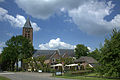
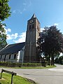
Category:Stefanuskerk (Zoelen)
| Object location | | View all coordinates using: OpenStreetMap |
|---|
church in Zoelen, Netherlands  | |||||
| Upload media | |||||
| Instance of | |||||
|---|---|---|---|---|---|
| Dedicated to | |||||
| Location | Zoelen, Buren, Gelderland, Netherlands | ||||
| Street address |
| ||||
| Located on street |
| ||||
| Heritage designation |
| ||||
 | |||||
Kerk:
|
This is a category about rijksmonument number 11431
|
Toren:
|
This is a category about rijksmonument number 11432
|
| Address |
|
Media in category "Stefanuskerk (Zoelen)"
The following 132 files are in this category, out of 132 total.
-
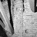
 Aanzicht muurwerk zuid koormuur boven gevel van kapel - Zoelen - 20224329 - RCE.jpg 1,200 × 1,200; 339 KB
-
 Avondmaalsbeker - Zoelen - 20224272 - RCE.jpg 942 × 1,200; 218 KB
-
 De kerktoren van Zoelen vanaf beneden.jpg 3,456 × 4,608; 5.84 MB
-
 De Stefanuskerk uit de 16e eeuw Zoelen.jpg 4,770 × 3,177; 2.33 MB
-
 Detail kap zuid zijbeuk naar het noord-westen - Zoelen - 20224320 - RCE.jpg 1,193 × 1,200; 295 KB
-
 Detail oostgevel interieur - Zoelen - 20224297 - RCE.jpg 1,190 × 1,200; 205 KB
-
 Detail schildering oostzijde kap-oostwand - Zoelen - 20224284 - RCE.jpg 1,200 × 1,190; 351 KB
-
 Detail schildering westzijde kap toren - Zoelen - 20224283 - RCE.jpg 1,200 × 1,186; 352 KB
-
 Detail schilderingen noordzijde kap - Zoelen - 20224282 - RCE.jpg 1,200 × 1,200; 320 KB
-
 Detail schilderingen zuidzijde kap - Zoelen - 20224281 - RCE.jpg 1,200 × 1,200; 345 KB
-
 Doophek - Zoelen - 20224286 - RCE.jpg 1,188 × 1,200; 252 KB
-
 Doophek - Zoelen - 20224309 - RCE.jpg 1,190 × 1,200; 235 KB
-
 Doophek, gevonden op zolder van het koor - Zoelen - 20224285 - RCE.jpg 1,197 × 1,200; 242 KB
-
-

-
 Exterieur METSELWERK NOORDGEVEL - Zoelen - 20290653 - RCE.jpg 1,190 × 1,200; 389 KB
-
 Exterieur METSELWERK NOORDGEVEL - Zoelen - 20290654 - RCE.jpg 1,200 × 1,192; 394 KB
-
 Exterieur METSELWERK OOSTGEVEL - Zoelen - 20290655 - RCE.jpg 1,188 × 1,200; 394 KB
-
 Exterieur METSELWERK ZUIDGEVEL - Zoelen - 20290656 - RCE.jpg 1,200 × 1,200; 440 KB
-
 Exterieur METSELWERK ZUIDGEVEL - Zoelen - 20290657 - RCE.jpg 1,200 × 1,197; 454 KB
-
 Exterieur NIEUW EN OUD METSELWERK BOVEN AAN DE TOREN - Zoelen - 20290648 - RCE.jpg 1,197 × 1,200; 364 KB
-
 Exterieur NIEUW METSELWERK BOVEN AAN DE TOREN - Zoelen - 20290647 - RCE.jpg 1,197 × 1,200; 407 KB
-
 Exterieur NIEUWE WATERLIJST AAN TOREN - Zoelen - 20290652 - RCE.jpg 1,192 × 1,200; 370 KB
-
 Exterieur OUDE WATERLIJST AAN TOREN MET BOOMGROEI - Zoelen - 20290649 - RCE.jpg 1,190 × 1,200; 456 KB
-
 Exterieur OUDE WATERLIJST MET BOOMGROEI AAN DE TOREN - Zoelen - 20290650 - RCE.jpg 1,200 × 1,190; 417 KB
-
 Herenbank - Zoelen - 20224310 - RCE.jpg 1,193 × 1,200; 190 KB
-
 Het topje van de Stefanuskerk.jpg 4,608 × 3,456; 5.22 MB
-
 Houten gewelf koor - Zoelen - 20224326 - RCE.jpg 1,198 × 1,200; 357 KB
-
 Houten gewelf koor - Zoelen - 20224327 - RCE.jpg 1,195 × 1,200; 355 KB
-
 Interieur - Zoelen - 20224268 - RCE.jpg 945 × 1,200; 169 KB
-
 Interieur afkomend pleisterwerk - Zoelen - 20224343 - RCE.jpg 1,200 × 1,195; 359 KB
-
 Interieur detail gewelf - Zoelen - 20224341 - RCE.jpg 1,195 × 1,200; 351 KB
-
 Interieur detail gewelf middenschip - Zoelen - 20224339 - RCE.jpg 1,195 × 1,200; 247 KB
-
 Interieur gewelf - Zoelen - 20224340 - RCE.jpg 1,200 × 1,195; 233 KB
-
 Interieur gewelf koor - Zoelen - 20224342 - RCE.jpg 1,190 × 1,200; 319 KB
-
 Interieur gewelf naar het westen - Zoelen - 20224331 - RCE.jpg 1,200 × 1,190; 218 KB
-
 Interieur gewelven gezien naar het zuid-oosten - Zoelen - 20224334 - RCE.jpg 1,197 × 1,200; 189 KB
-
 Interieur naar het oosten - Zoelen - 20224293 - RCE.jpg 1,200 × 1,200; 266 KB
-
 Interieur naar het oosten - Zoelen - 20224294 - RCE.jpg 1,197 × 1,200; 233 KB
-
 Interieur naar het oosten - Zoelen - 20224335 - RCE.jpg 1,188 × 1,200; 260 KB
-
 Interieur naar het westen - Zoelen - 20224270 - RCE.jpg 954 × 1,200; 164 KB
-
 Interieur naar het westen - Zoelen - 20224295 - RCE.jpg 1,200 × 953; 175 KB
-
 Interieur naar het westen - Zoelen - 20224296 - RCE.jpg 1,198 × 1,200; 211 KB
-
 Interieur noord gewelf - Zoelen - 20224337 - RCE.jpg 1,197 × 1,200; 203 KB
-
 Interieur noord gewelf - Zoelen - 20224338 - RCE.jpg 1,200 × 1,199; 253 KB
-
 Interieur noordzijde koor (boven toneel) - Zoelen - 20224336 - RCE.jpg 1,192 × 1,200; 260 KB
-
 Interieur raam (dagkant) - Zoelen - 20224344 - RCE.jpg 1,200 × 1,200; 203 KB
-
 Interieur tekstbord - Zoelen - 20224346 - RCE.jpg 1,197 × 1,200; 204 KB
-
 Interieur tekstbord - Zoelen - 20224347 - RCE.jpg 1,200 × 1,200; 211 KB
-
 Interieur vloer (zuidwest zijde) - Zoelen - 20224345 - RCE.jpg 1,200 × 1,195; 245 KB
-
 Interieur zijbeuk - Zoelen - 20224298 - RCE.jpg 1,195 × 1,200; 204 KB
-
 Interieur zuid-oost gewelf - Zoelen - 20224332 - RCE.jpg 1,197 × 1,200; 248 KB
-
 Interieur zuid-west gewelf - Zoelen - 20224333 - RCE.jpg 1,200 × 1,197; 233 KB
-
 Interieur, aanzicht orgel, orgelnummer 1760 - Zoelen - 20417379 - RCE.jpg 701 × 1,200; 124 KB
-
 INTERIEUR, DETAIL KLOKKENSTOEL - Zoelen - 20290662 - RCE.jpg 1,200 × 1,197; 314 KB
-
 INTERIEUR, DETAIL KLOKKENSTOEL - Zoelen - 20290665 - RCE.jpg 1,188 × 1,200; 315 KB
-
 INTERIEUR, DETAIL KLOKKENSTOEL - Zoelen - 20290666 - RCE.jpg 1,200 × 1,192; 256 KB
-
 INTERIEUR, DETAIL KLOKKENSTOEL - Zoelen - 20290667 - RCE.jpg 1,197 × 1,200; 334 KB
-
 INTERIEUR, DETAIL KLOKKENSTOEL - Zoelen - 20290668 - RCE.jpg 1,197 × 1,200; 256 KB
-
 INTERIEUR, GEWELF IN TOREN - Zoelen - 20290658 - RCE.jpg 1,200 × 1,200; 312 KB
-
 INTERIEUR, KLOKKENSTOEL - Zoelen - 20290661 - RCE.jpg 1,200 × 1,200; 307 KB
-
 INTERIEUR, KLOKKENSTOEL - Zoelen - 20290663 - RCE.jpg 1,200 × 1,200; 313 KB
-
 INTERIEUR, KLOKKENSTOEL - Zoelen - 20290664 - RCE.jpg 1,195 × 1,200; 296 KB
-
 Interieur, netgewelven van het schip - Zoelen - 20373939 - RCE.jpg 1,197 × 1,200; 244 KB
-
 Interieur, overzicht met herenbank - Zoelen - 20373938 - RCE.jpg 1,200 × 1,200; 179 KB
-
 Interieur, overzicht noordwand oostelijk blindraam - Zoelen - 20224273 - RCE.jpg 1,193 × 1,200; 251 KB
-
 Interieur, overzicht schip met preekstoel - Zoelen - 20373937 - RCE.jpg 1,200 × 1,199; 209 KB
-
 INTERIEUR, PLAFOND IN TOREN - Zoelen - 20290659 - RCE.jpg 1,195 × 1,200; 420 KB
-
 INTERIEUR, PLAFOND IN TOREN - Zoelen - 20290660 - RCE.jpg 1,197 × 1,200; 439 KB
-
 INTERIEUR, TEKSTBORD (GEBED DES HEREN) - Zoelen - 20289427 - RCE.jpg 1,200 × 1,200; 221 KB
-
 INTERIEUR, TEKSTBORD (XII ARTIKELEN DES GELOOFS) - Zoelen - 20289428 - RCE.jpg 1,197 × 1,200; 204 KB
-
 INTERIEUR, TEKSTBORD - Zoelen - 20289429 - RCE.jpg 1,200 × 1,197; 284 KB
-
 Inwendig naar het oosten - Zoelen - 20224269 - RCE.jpg 884 × 1,200; 118 KB
-
 Kap schip naar het oosten - Zoelen - 20224318 - RCE.jpg 1,200 × 1,199; 351 KB
-
 Kap schip naar toren - Zoelen - 20224330 - RCE.jpg 1,200 × 1,199; 367 KB
-
 Kap schip naar triomfboog - Zoelen - 20224317 - RCE.jpg 1,200 × 1,197; 377 KB
-
 Kap schip noordzijde - Zoelen - 20224315 - RCE.jpg 1,195 × 1,200; 315 KB
-
 Kap schip noordzijde - Zoelen - 20224316 - RCE.jpg 1,200 × 1,197; 395 KB
-
 Kap schip zuidzijde naar toren - Zoelen - 20224322 - RCE.jpg 1,193 × 1,200; 348 KB
-
 Kap schip zuidzijde toren - Zoelen - 20224323 - RCE.jpg 1,188 × 1,200; 369 KB
-
 Kap zuidzijde - Zoelen - 20224321 - RCE.jpg 1,188 × 1,200; 369 KB
-
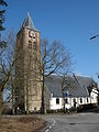
 Kerk naar het noord-oosten - Zoelen - 20224265 - RCE.jpg 945 × 1,200; 193 KB
-
 Kerk vanuit het zuid-westen - Zoelen - 20224267 - RCE.jpg 891 × 1,200; 163 KB
-
 Klankbord van de preekstoel - Zoelen - 20224306 - RCE.jpg 1,197 × 1,200; 226 KB
-
 Klankbord van de preekstoel - Zoelen - 20224307 - RCE.jpg 1,200 × 1,192; 224 KB
-
 Koor - Zoelen - 20224292 - RCE.jpg 960 × 1,200; 305 KB
-
 Lezenaar - Zoelen - 20224308 - RCE.jpg 1,197 × 1,200; 230 KB
-
 N-H Stefanus-kerk Zoelen.jpg 2,448 × 3,264; 1.37 MB
-
 Noordbeuk oostzijde - Zoelen - 20224324 - RCE.jpg 1,200 × 1,197; 220 KB
-
 Noordgevel - Zoelen - 20224289 - RCE.jpg 948 × 1,200; 314 KB
-
 Noordwand oostzijde - Zoelen - 20224325 - RCE.jpg 1,200 × 1,200; 287 KB
-
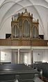
 Orgel - Zoelen - 20224299 - RCE.jpg 1,200 × 1,197; 275 KB
-
 Orgelbalkon - Zoelen - 20224300 - RCE.jpg 1,200 × 1,200; 199 KB
-
 Orgelbalkon - Zoelen - 20224301 - RCE.jpg 1,190 × 1,200; 223 KB
-
 Overzicht - Zoelen - 20224288 - RCE.jpg 960 × 1,200; 269 KB
-
 Overzicht naar het noorden - Zoelen - 20224370 - RCE.jpg 1,200 × 960; 236 KB
-
 Overzicht noordgevel - Zoelen - 20373934 - RCE.jpg 1,197 × 1,200; 336 KB
-
 Overzicht silhouet - Zoelen - 20224229 - RCE.jpg 1,200 × 963; 293 KB
-
 Overzicht van de kerk met kerktoren en omgeving - Zoelen - 20373935 - RCE.jpg 1,200 × 1,199; 219 KB
-
 Preekstoel - Zoelen - 20224271 - RCE.jpg 954 × 1,200; 179 KB
-
 Preekstoel - Zoelen - 20224302 - RCE.jpg 1,198 × 1,200; 265 KB
-
 Preekstoel - Zoelen - 20224303 - RCE.jpg 1,195 × 1,200; 250 KB
-
 Preekstoel lezenaar - Zoelen - 20224305 - RCE.jpg 1,188 × 1,200; 261 KB
-

-

-

-

-

-

-

-
 Schotwerk met panelen gevonden op zolder van het koor - Zoelen - 20224287 - RCE.jpg 1,181 × 1,200; 294 KB
-
 Stefanuskerk in Zoelen.jpg 3,456 × 4,608; 5.55 MB
-
 Stefanustoren te Zoelen.jpg 3,456 × 4,608; 5.75 MB
-
 Tekstbord - Zoelen - 20224311 - RCE.jpg 1,200 × 1,200; 192 KB
-
 Tekstbord - Zoelen - 20224312 - RCE.jpg 1,200 × 1,194; 234 KB
-
 Tekstbord - Zoelen - 20224313 - RCE.jpg 1,193 × 1,200; 194 KB
-
 Tekstbord - Zoelen - 20224314 - RCE.jpg 1,200 × 1,197; 258 KB
-
 Voet van de preekstoel - Zoelen - 20224304 - RCE.jpg 1,200 × 1,190; 298 KB
-
 Zicht op gedeelte van de zuidgevel en het kerkhof - Zoelen - 20373933 - RCE.jpg 1,200 × 1,200; 274 KB
-
 Zicht over landweg vanuit het zuidwesten - Zoelen - 20326822 - RCE.jpg 1,200 × 863; 173 KB
-
 Zoelen - Kerkstraat 2 - Stephanuskerktoren.JPG 2,998 × 1,999; 3.82 MB
-
 ZOELEN ST STEFANUSKERK.jpg 3,456 × 4,608; 3.52 MB
-
 Zoelen Stefanuskerk.jpg 2,519 × 4,196; 4.02 MB
-
 Zoelen-Stefanuskerk (1).jpg 3,000 × 4,000; 4.04 MB
-
 Zoelen-Stefanuskerk (2).jpg 4,000 × 3,000; 4.14 MB
-
 Zoelen-Stefanuskerk (3).jpg 4,000 × 3,000; 3.99 MB
-
 Zoelen-Stefanuskerk (4).jpg 3,000 × 4,000; 3.88 MB
-
 Zoelen-Stefanuskerk (5).jpg 3,000 × 4,000; 4.16 MB
-
 Zuid zijbeuk westzijde - Zoelen - 20224319 - RCE.jpg 1,185 × 1,200; 210 KB
-
 Zuidgevel - Zoelen - 20224290 - RCE.jpg 1,200 × 960; 348 KB
-
 Zuidgevel - Zoelen - 20224291 - RCE.jpg 1,200 × 948; 276 KB
-
 Zuidzijde aanzicht scheiding koor en schip - Zoelen - 20224328 - RCE.jpg 1,200 × 1,200; 365 KB


_-_Zoelen_-_20224336_-_RCE.jpg)
_-_Zoelen_-_20224344_-_RCE.jpg)


_-_Zoelen_-_20224345_-_RCE.jpg)


_-_Zoelen_-_20289427_-_RCE.jpg)
_-_Zoelen_-_20289428_-_RCE.jpg)


.jpg)
.jpg)
.jpg)
.jpg)
.jpg)


