Category:Steigelfadbalm
| Object location | | View all coordinates using: OpenStreetMap |
|---|
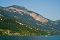
archaeological site in Vitznau in the canton of Lucerne, Switzerland   | |||||
| Upload media | |||||
| Instance of | |||||
|---|---|---|---|---|---|
| Part of | |||||
| Location | Vitznau, Luzern-Land Constituency, Lucerne, Switzerland | ||||
| Heritage designation | |||||
| Elevation above sea level |
| ||||
 | |||||
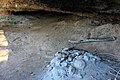
Media in category "Steigelfadbalm"
The following 7 files are in this category, out of 7 total.
-
 Luzern Vitznau Steigelfadbalm.jpg 3,000 × 1,996; 4.56 MB
-
 Steigelfadbalm 1.JPG 3,456 × 2,304; 2.51 MB
-
 Steigelfadbalm 2.JPG 3,456 × 2,304; 2.35 MB
-
 Steigelfadbalm Felswand.JPG 3,456 × 2,304; 3.2 MB
-
 Steigelfadbalm Panorama.JPG 3,456 × 2,304; 2.81 MB
-
 Steigelfadbalm Tafel.JPG 3,456 × 2,304; 1.84 MB
-
 Steigelfadbalm Wasserfall.JPG 2,304 × 3,456; 3.27 MB


