Category:Stichting Hermans Dijkstra
| Object location | | View all coordinates using: OpenStreetMap |
|---|
farmhouse in Oldambt, Netherlands  | |||||
| Upload media | |||||
| Instance of | |||||
|---|---|---|---|---|---|
| Part of | |||||
| Location | Midwolda, Groningen, Netherlands | ||||
| Located on street |
| ||||
| Architectural style | |||||
| Heritage designation |
| ||||
 | |||||
|
This is a category about rijksmonumentcomplex number 506445
|
Huis:
|
This is a category about rijksmonument number 506446
|
Tuin:
|
This is a category about rijksmonument number 506450
|
Schuur:
|
This is a category about rijksmonument number 506451
|
Stookhok:
|
This is a category about rijksmonument number 506452
|
Tuinhuis:
|
This is a category about rijksmonument number 506453
|
| Address |
|
Subcategories
This category has only the following subcategory.
T
Media in category "Stichting Hermans Dijkstra"
The following 80 files are in this category, out of 80 total.
-
 20150917 Boerderij1 Hermans Dijkstra Midwolda.jpg 4,896 × 3,672; 1.25 MB
-
 20150917 Boerderij2 Hermans Dijkstra Midwolda.jpg 4,896 × 3,672; 1.52 MB
-
 20150917 Gevelsteen Boerderij Hermans Dijkstra Midwolda.jpg 4,896 × 3,672; 1.71 MB
-
 20150917 Tuin Boerderij Hermans Dijkstra Midwolda.jpg 4,896 × 3,672; 2.1 MB
-
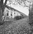
 Achtergevel - Midwolda - 20502448 - RCE.jpg 1,200 × 900; 116 KB
-
 Bedstede - Midwolda - 20502463 - RCE.jpg 1,200 × 900; 73 KB
-
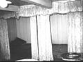 Bedsteden gastenkamer 1e verdieping - Midwolda - 20502459 - RCE.jpg 1,200 × 900; 125 KB
-
 Dekbalkgebint - Midwolda - 20502468 - RCE.jpg 1,200 × 900; 64 KB
-
 Detail dekbalkgebint - Midwolda - 20502458 - RCE.jpg 1,200 × 900; 52 KB
-
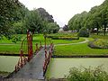
 Exterieur BRUG IN TUIN - Midwolda - 20298603 - RCE.jpg 1,197 × 1,200; 523 KB
-
 Exterieur DEUR, ZIJ INGANG - Midwolda - 20298610 - RCE.jpg 1,188 × 1,200; 407 KB
-
 Exterieur GEVELSTEEN, GEVELBEKRONING - Midwolda - 20298604 - RCE.jpg 1,200 × 1,200; 238 KB
-
 Exterieur KOETSHUIS, RECHTER ZIJGEVEL, ACHTERGEVEL - Midwolda - 20298612 - RCE.jpg 1,168 × 1,200; 395 KB
-
 Exterieur KOETSHUIS, VOORGEVEL - Midwolda - 20298611 - RCE.jpg 1,185 × 1,200; 403 KB
-
 Exterieur LINKER ZIJGEVEL (WOONGEDEELTE) - Midwolda - 20298609 - RCE.jpg 1,179 × 1,200; 482 KB
-
 Exterieur OVERZICHT BOMENLAAN - Midwolda - 20298600 - RCE.jpg 1,187 × 1,200; 474 KB
-
 Exterieur OVERZICHT TUIN - Midwolda - 20298601 - RCE.jpg 1,188 × 1,200; 381 KB
-
 Exterieur OVERZICHT VIJVER - Midwolda - 20298602 - RCE.jpg 1,190 × 1,200; 470 KB
-
 Exterieur OVERZICHT, VOORGEVEL, LINKER ZIJGEVEL - Midwolda - 20298607 - RCE.jpg 1,188 × 1,200; 409 KB
-
 Exterieur RECHTER ZIJGEVEL (WOONGEDEELTE) - Midwolda - 20298608 - RCE.jpg 1,181 × 1,200; 488 KB
-
 Exterieur SCHUUR, LINKER ZIJGEVEL - Midwolda - 20298616 - RCE.jpg 1,192 × 1,200; 433 KB
-
 Exterieur SCHUUR, OVERZICHT VOORGEVEL - Midwolda - 20298615 - RCE.jpg 1,183 × 1,200; 438 KB
-
 Exterieur STOOKHUT - Midwolda - 20298614 - RCE.jpg 1,186 × 1,200; 515 KB
-
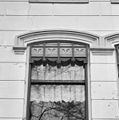 Exterieur VOORGEVEL, DETAIL BOVENLICHT - Midwolda - 20298606 - RCE.jpg 1,188 × 1,200; 265 KB
-
 Exterieur VOORGEVEL, DEURPARTIJ - Midwolda - 20298605 - RCE.jpg 1,198 × 1,200; 316 KB
-
 Gang - Midwolda - 20502464 - RCE.jpg 1,200 × 953; 64 KB
-
 Hermans Dijkstra - huis.jpg 4,000 × 3,000; 4.69 MB
-
 Hermans Dijkstra - stookhut.jpg 3,793 × 2,845; 3.29 MB
-
 Hermans Dijkstra - wagenschuur.jpg 3,492 × 2,619; 2.85 MB
-
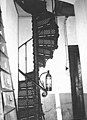 Ijzeren spiltrap - Midwolda - 20502467 - RCE.jpg 645 × 891; 77 KB
-
 INTERIEUR, BEGANE GROND, SLAAPKAMER - Midwolda - 20298638 - RCE.jpg 1,195 × 1,200; 258 KB
-
 INTERIEUR, BEGANE GROND, SLAAPKAMER, PLAFOND, DETAIL - Midwolda - 20298639 - RCE.jpg 1,192 × 1,200; 303 KB
-
 INTERIEUR, DOORZICHT NAAR PRONKKAMER - Midwolda - 20298625 - RCE.jpg 1,139 × 1,200; 233 KB
-
 INTERIEUR, EERSTE VERDIEPING, SLAAPKAMER - Midwolda - 20298641 - RCE.jpg 1,195 × 1,200; 273 KB
-
 INTERIEUR, EETKAMER, DEUR - Midwolda - 20298632 - RCE.jpg 1,200 × 1,195; 366 KB
-

-
 INTERIEUR, GANG, DEUROMLIJSTING (ART NOUVEAU) - Midwolda - 20298621 - RCE.jpg 1,197 × 1,200; 227 KB
-
 INTERIEUR, GANG, PLAFOND - Midwolda - 20298620 - RCE.jpg 1,192 × 1,200; 347 KB
-
 INTERIEUR, HAL, TUSSENDEUR - Midwolda - 20298618 - RCE.jpg 1,186 × 1,200; 293 KB
-
 INTERIEUR, KELDER, OVERZICHT TEGELWAND - Midwolda - 20298623 - RCE.jpg 1,177 × 1,200; 282 KB
-
 INTERIEUR, KELDER, PLAVUIZEN VLOER - Midwolda - 20298624 - RCE.jpg 1,197 × 1,200; 272 KB
-
 INTERIEUR, KEUKEN, OVERZICHT TEGELVLOER - Midwolda - 20298622 - RCE.jpg 1,181 × 1,200; 272 KB
-
 INTERIEUR, OVERZICHT EETKAMER - Midwolda - 20298630 - RCE.jpg 1,192 × 1,200; 334 KB
-
 INTERIEUR, OVERZICHT GANG - Midwolda - 20298619 - RCE.jpg 1,183 × 1,200; 231 KB
-
 INTERIEUR, OVERZICHT GIETIJZEREN SPILTRAP - Midwolda - 20298640 - RCE.jpg 1,190 × 1,200; 252 KB
-
 INTERIEUR, OVERZICHT HAL - Midwolda - 20298617 - RCE.jpg 1,181 × 1,200; 277 KB
-
 INTERIEUR, OVERZICHT PAARDENSTAL - Midwolda - 20298644 - RCE.jpg 1,197 × 1,200; 409 KB
-
 INTERIEUR, OVERZICHT PAARDENSTAL - Midwolda - 20298645 - RCE.jpg 1,195 × 1,200; 320 KB
-
 INTERIEUR, OVERZICHT PRONKKAMER - Midwolda - 20298626 - RCE.jpg 1,183 × 1,200; 336 KB
-
 INTERIEUR, OVERZICHT PRONKKAMER - Midwolda - 20298627 - RCE.jpg 1,192 × 1,200; 335 KB
-
 INTERIEUR, OVERZICHT STAL - Midwolda - 20298642 - RCE.jpg 1,181 × 1,200; 403 KB
-
 INTERIEUR, OVERZICHT STAL - Midwolda - 20298643 - RCE.jpg 1,190 × 1,200; 334 KB
-
 INTERIEUR, OVERZICHT WOONKAMER - Midwolda - 20298633 - RCE.jpg 1,185 × 1,200; 330 KB
-
 INTERIEUR, PRONKKAMER, STUCPLAFOND, DETAIL - Midwolda - 20298629 - RCE.jpg 1,197 × 1,200; 356 KB
-
 INTERIEUR, PRONKKAMER, VENSTERBANK - Midwolda - 20298628 - RCE.jpg 1,200 × 1,195; 328 KB
-
 INTERIEUR, WOONKAMER, KROONLIJST BOVEN SCHOORSTEENMANTEL - Midwolda - 20298636 - RCE.jpg 1,188 × 1,200; 330 KB
-
 INTERIEUR, WOONKAMER, lambrisering (ART DECO) - Midwolda - 20298637 - RCE.jpg 1,190 × 1,200; 536 KB
-
 INTERIEUR, WOONKAMER, VENSTERBANK - Midwolda - 20298634 - RCE.jpg 1,195 × 1,200; 359 KB
-
 INTERIEUR, WOONKAMER, VENSTERBANK - Midwolda - 20298635 - RCE.jpg 1,197 × 1,200; 384 KB
-
 Keuken - Midwolda - 20502471 - RCE.jpg 1,200 × 900; 125 KB
-
 Keuken - Midwolda - 20502472 - RCE.jpg 1,200 × 900; 93 KB
-
 Midwolda Boerderij Hermans Dijkstra.JPG 4,000 × 3,000; 5.52 MB
-
 Midwolda Hermans Dijkstra Slingertuin.JPG 4,000 × 3,000; 6.54 MB
-
 Plafond in de slaapkamer - Midwolda - 20502470 - RCE.jpg 1,200 × 900; 108 KB
-
 Schouw in de slaapkamer - Midwolda - 20502469 - RCE.jpg 1,200 × 900; 91 KB
-
 Schouw voorkamer - Midwolda - 20502474 - RCE.jpg 1,200 × 900; 79 KB
-
 Schouw voorkamer links - Midwolda - 20502449 - RCE.jpg 1,200 × 900; 84 KB
-
 Schouw voorkamer rechts - Midwolda - 20502460 - RCE.jpg 1,200 × 900; 82 KB
-
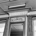
 Stucdecoratie in de gang - Midwolda - 20502462 - RCE.jpg 1,200 × 900; 123 KB
-
 Tegels in de kelder - Midwolda - 20502465 - RCE.jpg 1,200 × 900; 140 KB
-
 Tegels in de kelder - Midwolda - 20502476 - RCE.jpg 1,200 × 900; 80 KB
-
 Tuin - Midwolda - 20502457 - RCE.jpg 1,200 × 900; 179 KB
-
 Turfkoker - Midwolda - 20502466 - RCE.jpg 1,200 × 900; 74 KB
-
 Voorgevel - Midwolda - 20502454 - RCE.jpg 1,200 × 900; 153 KB
-
 Voorgevel - Midwolda - 20502455 - RCE.jpg 1,200 × 900; 122 KB
-
 Voorgevel FOTO- F.MULDER - Midwolda - 20502461 - RCE.jpg 1,200 × 900; 146 KB
-
 Voorgevel siertuin kleur - Midwolda - 20502450 - RCE.jpg 1,200 × 900; 174 KB
-
 Voorgevel Stichting Hermans Dijkstra - Midwolda - 20502451 - RCE.jpg 1,200 × 900; 194 KB
-
 Zaadzolder zinkbekleding tegen muizen - Midwolda - 20502456 - RCE.jpg 1,200 × 900; 152 KB
-
 Zijgevel - Midwolda - 20502453 - RCE.jpg 1,200 × 900; 156 KB


_-_Midwolda_-_20298609_-_RCE.jpg)


_-_Midwolda_-_20298608_-_RCE.jpg)


_-_Midwolda_-_20298621_-_RCE.jpg)


_-_Midwolda_-_20298637_-_RCE.jpg)


