Category:Stoke Ferry
English: Stoke Ferry is a civil parish in the English county of Norfolk, 6.5 miles south-east of Downham Market. The village lies on the River Wissey which has also been known as the River Stoke.
village and civil parish in Norfolk, UK  | |||||
| Upload media | |||||
| Instance of | |||||
|---|---|---|---|---|---|
| Location | King's Lynn and West Norfolk, Norfolk, East of England, England | ||||
| Population |
| ||||
| Area |
| ||||
 | |||||
Subcategories
This category has the following 2 subcategories, out of 2 total.
S
- Stoke Ferry railway station (2 F)
- Stoke Ferry War Memorial (1 F)
Media in category "Stoke Ferry"
The following 131 files are in this category, out of 131 total.
-
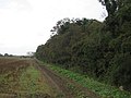
 A shelter belt by the road north of Stoke Ferry - geograph.org.uk - 5984766.jpg 1,600 × 799; 704 KB
-
 A134 in cutting by-passing Stoke Ferry - geograph.org.uk - 5984761.jpg 1,600 × 1,199; 924 KB
-
 A134 Stoke Ferry by-pass - geograph.org.uk - 4555775.jpg 640 × 480; 54 KB
-
 A134 Stoke Ferry Bypass, Stoke Ferry - geograph.org.uk - 6177940.jpg 4,608 × 3,456; 4.4 MB
-
 All Saints Church, Stoke Ferry - geograph.org.uk - 6177801.jpg 4,608 × 3,456; 3.85 MB
-

-
 All Saints' church in Stoke Ferry - geograph.org.uk - 1875892.jpg 640 × 480; 175 KB
-
 All Saints' church in Stoke Ferry - geograph.org.uk - 1875901.jpg 640 × 480; 116 KB
-

-

-
 All Saints' Lodge, Stoke Ferry (geograph 7204655).jpg 1,024 × 745; 150 KB
-
 All Saints, Stoke Ferry - geograph.org.uk - 2280861.jpg 662 × 1,000; 175 KB
-
 All Saints, Stoke Ferry - geograph.org.uk - 2280864.jpg 1,000 × 696; 176 KB
-
 All Saints, Stoke Ferry - geograph.org.uk - 2280865.jpg 1,000 × 664; 180 KB
-
 All Saints, Stoke Ferry - geograph.org.uk - 2280867.jpg 1,000 × 613; 229 KB
-
 All Saints, Stoke Ferry - geograph.org.uk - 2280868.jpg 1,000 × 611; 182 KB
-
 All Saints, Stoke Ferry - geograph.org.uk - 2280871.jpg 1,000 × 722; 229 KB
-
 All Saints, Stoke Ferry - Gravestones - geograph.org.uk - 2280869.jpg 1,000 × 667; 230 KB
-
 Barn Owl nest box - geograph.org.uk - 566792.jpg 640 × 480; 171 KB
-
 Boughton , Norfolk - sign on southern entrance road - geograph.org.uk - 6074346.jpg 4,032 × 3,024; 6.94 MB
-
 Boughton Fen - geograph.org.uk - 518464.jpg 640 × 480; 125 KB
-
 Brandon 10 Lynn 14 - geograph.org.uk - 1417414.jpg 480 × 640; 118 KB
-
 Bridge over the River Wissey - geograph.org.uk - 6177803.jpg 4,000 × 3,000; 4.03 MB
-
 Bridge over the Wissey - geograph.org.uk - 566800.jpg 640 × 480; 161 KB
-
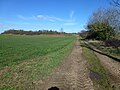
 Bridleway over Stoke Ferry Fen - geograph.org.uk - 566794.jpg 640 × 480; 150 KB
-
 Brown sign - geograph.org.uk - 397839.jpg 640 × 480; 91 KB
-
 Bus shelter at Stoke Ferry - geograph.org.uk - 4522033.jpg 768 × 1,024; 363 KB
-
 Canterbury House, Stoke Ferry (geograph 7204682).jpg 1,024 × 768; 145 KB
-
 Cemetery in Stoke Ferry, Norfolk - geograph.org.uk - 6074348.jpg 3,902 × 2,927; 1.89 MB
-
 Chapel, Stoke Ferry - geograph.org.uk - 2280873.jpg 1,000 × 571; 155 KB
-
 Chapel, Stoke Ferry - geograph.org.uk - 2280874.jpg 1,000 × 617; 156 KB
-
 Chapel, Stoke Ferry - geograph.org.uk - 2280876.jpg 1,000 × 672; 187 KB
-
 Chapel, Stoke Ferry - geograph.org.uk - 2280877.jpg 1,000 × 629; 150 KB
-
 Cobbles, Stoke Ferry (geograph 7204647).jpg 1,024 × 768; 125 KB
-
 Cottage on Lynn Road, Stoke Ferry - geograph.org.uk - 4554479.jpg 640 × 480; 62 KB
-

-

-
 Cottages on Lynn Road, Stoke Ferry - geograph.org.uk - 4554482.jpg 640 × 480; 56 KB
-
 Crown House, Stoke Ferry (geograph 7204675).jpg 1,024 × 768; 118 KB
-
 Cut Off Channel - geograph.org.uk - 570152.jpg 640 × 480; 56 KB
-
 Cut-Off Channel - geograph.org.uk - 6197974.jpg 3,810 × 2,858; 6 MB
-
 Elizabeth Truss Election Poster - geograph.org.uk - 4483153.jpg 3,679 × 2,456; 6.4 MB
-
 Entering Stoke Ferry - geograph.org.uk - 4554467.jpg 640 × 480; 40 KB
-
 Entrance off Lynn Road - geograph.org.uk - 6179055.jpg 4,608 × 3,456; 3.84 MB
-
 Eroding drove - geograph.org.uk - 566786.jpg 640 × 480; 196 KB
-
 Farmland near Stoke Ferry, Norfolk - geograph.org.uk - 6074367.jpg 4,032 × 3,024; 3.3 MB
-
 Flat landscape north of Stoke Ferry - geograph.org.uk - 5984764.jpg 1,600 × 667; 520 KB
-
 Former church of All Saints'. Stoke Ferry (geograph 7204579).jpg 1,024 × 761; 181 KB
-
 Former miller's house, Stoke Ferry (geograph 7204632).jpg 1,024 × 768; 200 KB
-
 Furlong Drove, Stoke Ferry - geograph.org.uk - 6177424.jpg 4,608 × 3,456; 4.07 MB
-
 Furlong Drove, Stoke Ferry - geograph.org.uk - 6177934.jpg 4,608 × 3,456; 4.05 MB
-
 Furlong Road, Stoke Ferry - geograph.org.uk - 6177430.jpg 4,000 × 3,000; 3.34 MB
-
 Geese in the Meadow - geograph.org.uk - 577453.jpg 640 × 426; 82 KB
-
 Heading north east on Oxborough Road - geograph.org.uk - 4555785.jpg 640 × 480; 60 KB
-

-
 High Street in Stoke Ferry - geograph.org.uk - 5605977.jpg 640 × 360; 66 KB
-
 High Street in Stoke Ferry - geograph.org.uk - 5605979.jpg 640 × 360; 64 KB
-
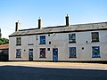
 Houses in High Street, Stoke Ferry - geograph.org.uk - 1875833.jpg 640 × 480; 132 KB
-
 Into the High Street, Stoke Ferry - geograph.org.uk - 5605991.jpg 640 × 360; 49 KB
-
 Lynn Road sign - geograph.org.uk - 6177610.jpg 4,608 × 3,456; 3.73 MB
-
 Lynn Road, Stoke Ferry - geograph.org.uk - 4555766.jpg 640 × 480; 63 KB
-
 Lynn Road, Stoke Ferry - geograph.org.uk - 5605996.jpg 640 × 360; 37 KB
-
 Lynn Road, Stoke Ferry - geograph.org.uk - 6177606.jpg 4,608 × 3,456; 3.92 MB
-
 Lynn Road, Stoke Ferry - geograph.org.uk - 6177907.jpg 4,608 × 3,456; 4.27 MB
-
 Lynn Road, Stoke Ferry - geograph.org.uk - 6177917.jpg 4,608 × 3,456; 3.73 MB
-
 Oilseed rape crop and poppies - geograph.org.uk - 4555794.jpg 640 × 480; 95 KB
-
 Old Milestone - geograph.org.uk - 1417418.jpg 640 × 480; 114 KB
-
 Oxborough Road - geograph.org.uk - 4555782.jpg 640 × 480; 67 KB
-
 Park House, Stoke Ferry (geograph 7204559).jpg 1,024 × 768; 219 KB
-
 Potato crop off Oxborough Road - geograph.org.uk - 4555779.jpg 640 × 480; 100 KB
-
 Pump House - geograph.org.uk - 556049.jpg 640 × 476; 174 KB
-
 Road junction on road to Oxborough - geograph.org.uk - 5984767.jpg 1,600 × 1,200; 887 KB
-
 Roadsigns on Furlong Road - geograph.org.uk - 6177601.jpg 4,608 × 3,456; 3.86 MB
-
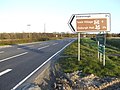
 Roadsigns on the A134 Stoke Ferry Bypass - geograph.org.uk - 6177938.jpg 4,608 × 3,456; 3.87 MB
-
 Roundabout Ahead - geograph.org.uk - 506073.jpg 640 × 480; 90 KB
-
 Sign on the Blue Bell, Stoke Ferry - geograph.org.uk - 4554476.jpg 2,249 × 1,147; 343 KB
-
 Signpost on Lynn Road - geograph.org.uk - 6179066.jpg 2,917 × 3,890; 5.73 MB
-
 Stoke Ferry - Disused building - geograph.org.uk - 2280870.jpg 1,000 × 635; 127 KB
-
 Stoke Ferry All Saints church - geograph.org.uk - 4345781.jpg 640 × 480; 63 KB
-
 Stoke Ferry cemetery - geograph.org.uk - 5311767.jpg 3,456 × 2,592; 3.87 MB
-
 Stoke Ferry Fen - geograph.org.uk - 566798.jpg 640 × 480; 186 KB
-
 Stoke Ferry Hall (geograph 1875840).jpg 640 × 480; 95 KB
-
 Stoke Ferry Hall and The Hill - geograph.org.uk - 5605989.jpg 640 × 360; 51 KB
-
 Stoke Ferry High Street - geograph.org.uk - 5605982.jpg 640 × 360; 46 KB
-
 Stoke Ferry Post Office - geograph.org.uk - 4555770.jpg 640 × 480; 72 KB
-
 Stoke Ferry Village sign - geograph.org.uk - 6177811.jpg 4,608 × 3,456; 4.15 MB
-
 Stoke Ferry Village sign - geograph.org.uk - 6179038.jpg 3,456 × 4,608; 3.81 MB
-
 Stoke Ferry Village sign - geograph.org.uk - 6180574.jpg 2,944 × 3,926; 5.6 MB
-
 Stoke Ferry War Memorial - geograph.org.uk - 2280863.jpg 1,000 × 667; 209 KB
-
 The Blue Bell - geograph.org.uk - 3566294.jpg 640 × 478; 112 KB
-
 The Blue Bell, Stoke Ferry - geograph.org.uk - 4554470.jpg 640 × 480; 63 KB
-
 The New Stoke Ferry Village sign - geograph.org.uk - 6177790.jpg 3,456 × 4,608; 3.87 MB
-
 The Old A.134 - geograph.org.uk - 506057.jpg 640 × 480; 80 KB
-
 The Old Chemist's Shop, Stoke Ferry (geograph 7204597).jpg 1,024 × 810; 209 KB
-
 The Old Granary, Stoke Ferry (geograph 7204621).jpg 1,024 × 768; 167 KB
-
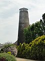 The old Windmill at Stoke Ferry (geograph 4521960).jpg 768 × 1,024; 334 KB
-
 The old Windmill at Stoke Ferry - geograph.org.uk - 4521963.jpg 1,024 × 768; 346 KB
-
 Top of the High Street, Stoke Ferry - geograph.org.uk - 5606677.jpg 640 × 360; 65 KB
-
 Track to a disused pit near Stoke Ferry - geograph.org.uk - 5308210.jpg 4,320 × 3,240; 5.68 MB
-
 Turn right for Oxborough - geograph.org.uk - 4555798.jpg 640 × 480; 62 KB
-
 UK StokeFerry.jpg 944 × 1,465; 350 KB
-

-
 Window graffiti - geograph.org.uk - 1875823.jpg 640 × 480; 82 KB
-
 Wissey Sluice and Pumping Station - geograph.org.uk - 566780.jpg 640 × 480; 168 KB
-
 Wissey Sluices - geograph.org.uk - 566782.jpg 640 × 475; 157 KB
-
 Wretton Road, Stoke Ferry - geograph.org.uk - 1875830.jpg 640 × 480; 86 KB
-
 Wretton Road, Stoke Ferry - geograph.org.uk - 6177777.jpg 4,000 × 3,000; 4.32 MB
-
 Bend on the River Wissey - geograph.org.uk - 556067.jpg 640 × 480; 170 KB
-
 Black as the ace of spades^ - geograph.org.uk - 570045.jpg 640 × 480; 55 KB
-
 Bridge over Common Drain - geograph.org.uk - 555990.jpg 640 × 480; 88 KB
-
 Bungalow and rape field - geograph.org.uk - 397833.jpg 640 × 480; 130 KB
-
 Catsholme Farm - geograph.org.uk - 556044.jpg 640 × 425; 102 KB
-
 Common Drain, Methwold Severals - geograph.org.uk - 416496.jpg 455 × 640; 71 KB
-
 Hemplands - geograph.org.uk - 556033.jpg 640 × 476; 100 KB
-
 Hemplands Farm - geograph.org.uk - 556024.jpg 640 × 480; 95 KB
-
 Lettuce harvest, Methwold Common, Norfolk - geograph.org.uk - 49141.jpg 640 × 463; 330 KB
-
 Limehouse Drove - geograph.org.uk - 411294.jpg 426 × 640; 140 KB
-
 Looking along Long Plantation - geograph.org.uk - 570053.jpg 640 × 480; 67 KB
-
 Methwold Lode - geograph.org.uk - 556062.jpg 640 × 480; 171 KB
-
 Methwold Severals - geograph.org.uk - 555995.jpg 640 × 480; 84 KB
-
 Notice (OS coordinates) - geograph.org.uk - 566784.jpg 640 × 480; 163 KB
-
 Oh^ Deer^ - geograph.org.uk - 570012.jpg 640 × 480; 66 KB
-
 Pumping Station viewed from Wissey Sluice - geograph.org.uk - 564646.jpg 640 × 480; 148 KB
-
 Reflections in Aqueduct - geograph.org.uk - 566791.jpg 640 × 470; 163 KB
-
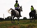 Riding on top of the river bank - geograph.org.uk - 566801.jpg 640 × 480; 168 KB
-
 Small field east of Boughton - geograph.org.uk - 518469.jpg 640 × 480; 112 KB
-
 Stringside Drove - geograph.org.uk - 518442.jpg 640 × 480; 108 KB
-
 The Bungalows - geograph.org.uk - 556018.jpg 640 × 480; 88 KB
-
 The end of the track - geograph.org.uk - 577913.jpg 640 × 480; 165 KB
-
 View across Boughton airstrip - geograph.org.uk - 397897.jpg 640 × 480; 89 KB
-
 Young plantation east of Boughton - geograph.org.uk - 397878.jpg 640 × 480; 136 KB


.jpg)


.jpg)


.jpg)


.jpg)


.jpg)
.jpg)


.jpg)


.jpg)


.jpg)
.jpg)
.jpg)


_-_geograph.org.uk_-_566784.jpg)


