Category:Stoke Hammond
Main Wikipedia article: Stoke Hammond.
village in the United Kingdom  | |||||
| Upload media | |||||
| Instance of | |||||
|---|---|---|---|---|---|
| Location | Buckinghamshire, South East England, England | ||||
| Said to be the same as | Stoke Hammond (Wikimedia duplicated page, civil parish) | ||||
 | |||||
Subcategories
This category has only the following subcategory.
L
Media in category "Stoke Hammond"
The following 140 files are in this category, out of 140 total.
-
 41 Miles to Braunston - geograph.org.uk - 1354578.jpg 480 × 640; 111 KB
-
 A river runs by... - geograph.org.uk - 153763.jpg 480 × 640; 119 KB
-
 A4146 (new alignment) - geograph.org.uk - 2493723.jpg 640 × 430; 56 KB
-
 A4146 - geograph.org.uk - 4348732.jpg 640 × 430; 71 KB
-
 A4146 - geograph.org.uk - 4853814.jpg 640 × 426; 69 KB
-
 A505 construction works - geograph.org.uk - 210525.jpg 640 × 480; 126 KB
-
 Approaching Stoke Hammond Lock - geograph.org.uk - 4757829.jpg 4,608 × 3,456; 3.57 MB
-
 At Stoke Hammond Lock - geograph.org.uk - 4757832.jpg 4,608 × 3,456; 4.87 MB
-

-
 Aylesbury Vale , Drayton Road - geograph.org.uk - 5732806.jpg 6,000 × 4,000; 6.63 MB
-
 Aylesbury Vale , Grassy Field - geograph.org.uk - 5732791.jpg 5,623 × 3,749; 6.79 MB
-

-

-

-

-
 Aylesbury Vale , Stoke Road - geograph.org.uk - 5732801.jpg 6,000 × 4,000; 5.56 MB
-
 Aylesbury Vale , Stoke Road - geograph.org.uk - 5732815.jpg 5,879 × 3,919; 6.87 MB
-
 B488 to Bletchley - geograph.org.uk - 3994731.jpg 640 × 480; 120 KB
-
 Bletchley near Stoke Hammond Box geograph-2730868-by-Ben-Brooksbank.jpg 2,311 × 1,429; 1.84 MB
-
 Boats moored along the Grand Union Canal - geograph.org.uk - 4999733.jpg 800 × 542; 123 KB
-
 Bridge 100, Grand Junction Canal - geograph.org.uk - 3077422.jpg 4,000 × 3,000; 5.18 MB
-
 Bridge 101, Grand Junction Canal - geograph.org.uk - 3077421.jpg 4,000 × 3,000; 4.66 MB
-
 Bridge 102, Grand Junction Canal (original site) - geograph.org.uk - 3077427.jpg 4,000 × 3,000; 4.84 MB
-
 Bridge 102, Grand Junction Canal - geograph.org.uk - 2702156.jpg 4,000 × 3,000; 4.96 MB
-
 Bridge 102, Grand Union Canal - geograph.org.uk - 3994737.jpg 640 × 480; 148 KB
-
 Bridge 103, Grand Junction Canal - geograph.org.uk - 3077428.jpg 4,000 × 3,000; 4.61 MB
-
 Bridge 104 on the Grand Union Canal - geograph.org.uk - 3136015.jpg 1,600 × 1,067; 376 KB
-
 Bridge 104, Grand Junction Canal - geograph.org.uk - 2705145.jpg 4,000 × 3,000; 5.07 MB
-
 Bridge 105, Grand Junction Canal - geograph.org.uk - 2705154.jpg 4,000 × 3,000; 4.83 MB
-
 Bridge 143, Euston Main Line - geograph.org.uk - 810059.jpg 640 × 480; 70 KB
-
 Bridge 99A, Grand Junction Canal - A4146 - geograph.org.uk - 2702184.jpg 4,000 × 3,000; 5.24 MB
-
 Bridge carrying the Stoke Hammond bypass - geograph.org.uk - 3184056.jpg 1,600 × 1,068; 363 KB
-
 Bridge under the West Coast Mainline - geograph.org.uk - 3184043.jpg 1,600 × 1,068; 463 KB
-
 Bridleway by the A4146 - geograph.org.uk - 3135884.jpg 1,200 × 1,600; 447 KB
-
 Bridleway by the Stoke Hammond bypass - geograph.org.uk - 3135891.jpg 1,600 × 1,067; 555 KB
-
 Bridleway towards Chadwell Farm - geograph.org.uk - 3135889.jpg 1,600 × 1,065; 445 KB
-
 Canal Bridge 102 - geograph.org.uk - 1354618.jpg 640 × 480; 101 KB
-
 Canal Side crawler crane - geograph.org.uk - 2952908.jpg 1,920 × 2,560; 1.05 MB
-
 Canal view from a bridge at Mill Lane - geograph.org.uk - 4757839.jpg 4,608 × 3,456; 4.55 MB
-
 Canalside building - geograph.org.uk - 3135999.jpg 1,600 × 1,066; 662 KB
-
 Common Farm - geograph.org.uk - 211767.jpg 640 × 480; 135 KB
-

-
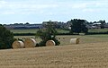
 Countryside north of Stoke Hammond - geograph.org.uk - 4916998.jpg 640 × 426; 39 KB
-
 Countryside south of Milton Keynes - geograph.org.uk - 3879780.jpg 640 × 388; 54 KB
-
 Countryside south of Milton Keynes - geograph.org.uk - 4916993.jpg 640 × 426; 37 KB
-
 Dorcas Lane, Stoke Hammond - geograph.org.uk - 211779.jpg 640 × 480; 175 KB
-
 Dorcas Lane, Stoke Hammond - geograph.org.uk - 211783.jpg 640 × 480; 202 KB
-

-
 Farm track bridges the West Coast Mainline - geograph.org.uk - 3135886.jpg 1,600 × 1,067; 409 KB
-
 Farm track over the A4146 - geograph.org.uk - 3135882.jpg 1,600 × 1,067; 354 KB
-
 Farmland near Borough Farm - geograph.org.uk - 4999400.jpg 800 × 508; 87 KB
-
 Farmland near Stoke Hammond - geograph.org.uk - 3879782.jpg 640 × 361; 36 KB
-
 Field by the Hollingdon path - geograph.org.uk - 3184073.jpg 1,600 × 1,066; 603 KB
-
 Former Methodist Church, Stoke Hammond (1) - geograph.org.uk - 6144078.jpg 2,592 × 1,944; 1.4 MB
-
 Former Methodist Church, Stoke Hammond (2) - geograph.org.uk - 6144086.jpg 2,592 × 1,944; 1.35 MB
-
 Former Methodist Church, Stoke Hammond (3) - geograph.org.uk - 6144094.jpg 2,592 × 1,944; 1.35 MB
-
 Grand Union Canal - geograph.org.uk - 3994734.jpg 640 × 480; 151 KB
-
 Grand Union Canal - Stoke Hammond - geograph.org.uk - 153739.jpg 640 × 480; 79 KB
-
 Grand Union Canal near to Stoke Hammond - geograph.org.uk - 4757825.jpg 4,608 × 3,456; 3.94 MB
-
 Grand Union Canal Walk - geograph.org.uk - 5628286.jpg 640 × 480; 92 KB
-
 Grand Union Canal Walk - geograph.org.uk - 5628290.jpg 640 × 480; 74 KB
-
 Grand Union Canal Walk by the canal - geograph.org.uk - 3135952.jpg 1,600 × 1,068; 541 KB
-
 Grand Union Canal, Bridge Number 102 - geograph.org.uk - 3688494.jpg 640 × 480; 100 KB
-
 Grand Union Canal, Bridge Number 105 - geograph.org.uk - 3689953.jpg 640 × 480; 66 KB
-
 Grand Union Canal, Bridge Number 106 - geograph.org.uk - 3690011.jpg 640 × 480; 76 KB
-
 Grand Union Canal, Bridge Number 99 - geograph.org.uk - 3686885.jpg 640 × 480; 100 KB
-
 Grand Union Canal, Bridge Number 99A - geograph.org.uk - 3688463.jpg 640 × 480; 66 KB
-

-
-

-

-

-
 Hedgerow by the mainline - geograph.org.uk - 3879777.jpg 640 × 388; 56 KB
-
 Heron along the Grand Union Canal - geograph.org.uk - 4999701.jpg 793 × 800; 214 KB
-
 Heron along the Grand Union Canal - geograph.org.uk - 4999707.jpg 800 × 588; 121 KB
-

-

-
 Large field by the WCML - geograph.org.uk - 3628814.jpg 640 × 391; 32 KB
-

-
 Lock 23, Grand Junction Canal - Stoke Hammond Lock - geograph.org.uk - 2705150.jpg 4,000 × 3,000; 4.88 MB
-
 Lock No 23 - geograph.org.uk - 2747477.jpg 1,024 × 768; 143 KB
-
 Milestone 41 - geograph.org.uk - 4797525.jpg 1,000 × 750; 220 KB
-
 Milton Keynes Boundary Walk north of Stoke Hammond Lock - geograph.org.uk - 4757835.jpg 3,456 × 4,608; 3.22 MB
-

-

-
 Near Stoke Hammond - geograph.org.uk - 3879786.jpg 640 × 401; 60 KB
-
 New housing across the field - geograph.org.uk - 3135871.jpg 1,600 × 1,067; 586 KB
-
 New housing at Newton Leys - geograph.org.uk - 4999410.jpg 800 × 501; 136 KB
-
 New housing estate at Newton Leys - geograph.org.uk - 4999406.jpg 800 × 541; 120 KB
-

-
 Old School Lane, Stoke Hammond - geograph.org.uk - 2593906.jpg 640 × 480; 90 KB
-
 Old Swing Bridge - geograph.org.uk - 1354533.jpg 640 × 480; 103 KB
-
 Orchard Cottage, Stoke Hammond - geograph.org.uk - 3994732.jpg 640 × 480; 115 KB
-
 Orchard Cottage, Stoke Hammond.jpg 4,000 × 3,000; 2.72 MB
-
 Orchard Mill Bridge No 102 - geograph.org.uk - 4999721.jpg 800 × 614; 188 KB
-
 Over bridge 104 on the Grand Union - geograph.org.uk - 3136007.jpg 1,600 × 1,068; 494 KB
-
 Overflow from the Grand Union - geograph.org.uk - 3136010.jpg 1,600 × 1,067; 746 KB
-
 Pastoral scene to the east of the Grand Union Canal - geograph.org.uk - 4757821.jpg 4,608 × 3,456; 5.46 MB
-
 Path to Newton Leys - geograph.org.uk - 3135872.jpg 1,600 × 1,069; 863 KB
-
 Public footpath at Water Eaton - geograph.org.uk - 4999437.jpg 800 × 617; 214 KB
-
 Public Footpath Stile - geograph.org.uk - 401789.jpg 640 × 480; 127 KB
-
 Rectory Farm - geograph.org.uk - 211791.jpg 640 × 480; 141 KB
-

-
 Road Leading to Bletchley, Milton Keynes - geograph.org.uk - 2483042.jpg 800 × 533; 438 KB
-
 Rough grassland, Stoke Hammond - geograph.org.uk - 4917007.jpg 640 × 361; 43 KB
-

-
 Site of old bridge - geograph.org.uk - 3135991.jpg 1,600 × 1,068; 453 KB
-

-

-

-

-
 Steps up to bridge 106 on the Grand Union - geograph.org.uk - 3136023.jpg 1,600 × 1,067; 556 KB
-
 Stile on the path to Hollingdon - geograph.org.uk - 3184066.jpg 1,200 × 1,600; 669 KB
-
 Stoke Hammond and the A4146 - geograph.org.uk - 5463130.jpg 3,264 × 2,448; 3.67 MB
-
 Stoke Hammond Box geograph-2397764-by-Ben-Brooksbank.jpg 2,149 × 1,449; 532 KB
-
 Stoke Hammond Box geograph-2711533-by-Ben-Brooksbank.jpg 2,381 × 1,374; 699 KB
-
 Stoke Hammond Community Centre - geograph.org.uk - 2952903.jpg 1,024 × 768; 210 KB
-
 Stoke Hammond Lock - geograph.org.uk - 1354558.jpg 640 × 480; 112 KB
-
 Stoke Hammond Lock - geograph.org.uk - 3135995.jpg 1,600 × 1,067; 378 KB
-
 Stoke Hammond recreation ground and pavilion - geograph.org.uk - 3135897.jpg 1,600 × 1,066; 517 KB
-
 Stoke Hammond to Milton Keynes, aerial - geograph.org.uk - 3478667.jpg 683 × 1,024; 153 KB
-
 Stoke Hammond, south of Bletchley geograph-2737884-by-Ben-Brooksbank.jpg 2,150 × 1,448; 1.38 MB
-

-
 Stoke Hammond, St Luke, churchyard (2) - geograph.org.uk - 2599953.jpg 640 × 480; 105 KB
-

-
 Stoke Hammond, St Luke, churchyard (4) - geograph.org.uk - 2599963.jpg 480 × 640; 110 KB
-

-
 Stoke Hammond, St Luke, porch - geograph.org.uk - 2599950.jpg 480 × 640; 99 KB
-
 Stoke Road at Newton Leys - geograph.org.uk - 4999418.jpg 800 × 600; 149 KB
-
 The A4146 - geograph.org.uk - 2493728.jpg 640 × 430; 53 KB
-
 The A4146 between Stoke Hammond and Soulbury - geograph.org.uk - 5552764.jpg 3,264 × 2,448; 3.14 MB
-

-
 The Old Pumphouse at Stoke Hammond - geograph.org.uk - 4999756.jpg 800 × 585; 154 KB
-

-
 Tumbledown building at Brook Farm - geograph.org.uk - 3184041.jpg 1,600 × 1,068; 751 KB
-
 Weir at Paper Mill Farm - geograph.org.uk - 810035.jpg 640 × 480; 117 KB
-
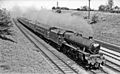
 West Coast Main Line at Stoke Hammond, 1960 - geograph.org.uk - 4250330.jpg 2,108 × 1,546; 1.63 MB
-
 Willow Lodge - geograph.org.uk - 4917014.jpg 640 × 338; 37 KB
-
 Willowbridge Marina - geograph.org.uk - 210522.jpg 640 × 480; 153 KB
-
 Towpath - geograph.org.uk - 153728.jpg 640 × 480; 131 KB


_-_geograph.org.uk_-_2493723.jpg)


_-_geograph.org.uk_-_3077427.jpg)


_-_geograph.org.uk_-_6144078.jpg)
_-_geograph.org.uk_-_6144086.jpg)
_-_geograph.org.uk_-_6144094.jpg)


_-_geograph.org.uk_-_2599953.jpg)
_-_geograph.org.uk_-_2599956.jpg)
_-_geograph.org.uk_-_2599963.jpg)
_-_geograph.org.uk_-_2599967.jpg)


