Category:Stoke Row
village and civil parish in South Oxfordshire district, Oxfordshire, England  | |||||
| Upload media | |||||
| Instance of | |||||
|---|---|---|---|---|---|
| Location | South Oxfordshire, Oxfordshire, South East England, England | ||||
| Area |
| ||||
| official website | |||||
 | |||||
English: Stoke Row is a village and civil parish in the Chiltern Hills, about west of Henley-on-Thames in South Oxfordshire.
Subcategories
This category has the following 4 subcategories, out of 4 total.
Media in category "Stoke Row"
The following 137 files are in this category, out of 137 total.
-
 After rain, Stoke Row, Oxfordshire - geograph.org.uk - 4739819.jpg 2,363 × 2,777; 5.67 MB
-
 At the Edge of Bush Wood - geograph.org.uk - 2840111.jpg 3,707 × 2,232; 2.01 MB
-
 Barn at Uxmore House - geograph.org.uk - 5333471.jpg 1,024 × 679; 249 KB
-
 Basset Manor - geograph.org.uk - 3027079.jpg 1,600 × 1,199; 589 KB
-
 Basset Manor buildings beside Uxmore Road - geograph.org.uk - 5265066.jpg 1,024 × 683; 199 KB
-
 Bassett Wood - geograph.org.uk - 37095.jpg 640 × 481; 358 KB
-
 Beech woodland, Stoke Row, Oxfordshire - geograph.org.uk - 4739931.jpg 640 × 482; 212 KB
-
 Bench mark, St John's Church, Stoke Row - geograph.org.uk - 4070194.jpg 1,280 × 960; 369 KB
-
 Benchmark on barn at Basset Manor - geograph.org.uk - 5265016.jpg 1,024 × 666; 297 KB
-
 Benchmark on Clare Cottage - geograph.org.uk - 5582505.jpg 683 × 1,024; 240 KB
-
 Benchmark on Nottwood Cottage - geograph.org.uk - 5330697.jpg 683 × 1,024; 210 KB
-
 Benchmark on Old Farmhouse, Cox's Lane - geograph.org.uk - 5582438.jpg 622 × 1,024; 207 KB
-
 Benchmark on outbuilding at Ipsden Heath Farm - geograph.org.uk - 5237526.jpg 662 × 1,024; 239 KB
-
 Benchmark on St John - geograph.org.uk - 5394698.jpg 533 × 800; 164 KB
-
 Benchmark on Stoke Row Chapel - geograph.org.uk - 5333511.jpg 671 × 1,024; 237 KB
-

-
 Between a Bear and a Bush - geograph.org.uk - 2890102.jpg 3,334 × 2,546; 1.39 MB
-
 Binksholme Bungalow - geograph.org.uk - 5333555.jpg 1,024 × 648; 257 KB
-
 Board and Church - geograph.org.uk - 5400519.jpg 1,024 × 683; 141 KB
-
 Board on Ishree Bagh - geograph.org.uk - 5400864.jpg 533 × 800; 96 KB
-
 Bridleway, Stoke Row, Oxfordshire - geograph.org.uk - 4742966.jpg 3,492 × 4,369; 5.31 MB
-
 Buckets and handle - geograph.org.uk - 5400692.jpg 533 × 800; 108 KB
-
 Buffalo and Stokerow Farm - geograph.org.uk - 595030.jpg 640 × 477; 121 KB
-
 Busgrove Wood - geograph.org.uk - 593918.jpg 640 × 477; 133 KB
-
 Busgrove Wood - geograph.org.uk - 594866.jpg 640 × 477; 150 KB
-
 Byway to Whitcall's Farm - geograph.org.uk - 595091.jpg 640 × 477; 140 KB
-
 The Cherry Tree, Stoke Row - geograph.org.uk - 36354.jpg 640 × 481; 60 KB
-
 Cherry Tree - geograph.org.uk - 3471127.jpg 3,608 × 2,232; 2.06 MB
-
 Church View, Stoke Row - geograph.org.uk - 2229056.jpg 640 × 480; 103 KB
-
 Clare Cottage - geograph.org.uk - 5582561.jpg 1,024 × 683; 232 KB
-
 Coppiced woodland with bluebells, Ipsden Heath - geograph.org.uk - 6150899.jpg 768 × 1,024; 375 KB
-
 Corner of graveyard, Stoke Row - geograph.org.uk - 5513084.jpg 640 × 480; 161 KB
-
 Country lane, Ipsden, Oxfordshire - geograph.org.uk - 4742959.jpg 3,867 × 4,265; 3.81 MB
-
 Country lane, Stoke Row, Oxfordshire - geograph.org.uk - 4755175.jpg 3,555 × 4,263; 7.54 MB
-
 Couple of Tombs - geograph.org.uk - 5395724.jpg 1,024 × 683; 216 KB
-
 Crosses in the Corner - geograph.org.uk - 5395726.jpg 1,024 × 683; 212 KB
-
 Don't be a Fool - geograph.org.uk - 5400393.jpg 1,024 × 683; 138 KB
-
 Edward Percy Evans - geograph.org.uk - 5395595.jpg 533 × 800; 107 KB
-
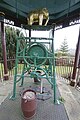
 Elephant on the Well - geograph.org.uk - 5400701.jpg 1,024 × 683; 93 KB
-
 Fence at the School - geograph.org.uk - 5400389.jpg 1,024 × 683; 166 KB
-
 Footpath South of Stoke Row - geograph.org.uk - 594879.jpg 640 × 477; 127 KB
-
 Footpath through Stokerow Farm - geograph.org.uk - 595039.jpg 640 × 477; 104 KB
-
 Forgotten Graves - geograph.org.uk - 5395720.jpg 1,024 × 683; 222 KB
-
 Foundry Name - geograph.org.uk - 5400689.jpg 1,024 × 683; 109 KB
-
 Foxgloves in Ipsden Wood - geograph.org.uk - 3036351.jpg 3,076 × 2,160; 1.69 MB
-
 Front of the Well - geograph.org.uk - 5400704.jpg 533 × 800; 125 KB
-
 Gate pillar on Cox's Lane - geograph.org.uk - 595024.jpg 640 × 477; 152 KB
-
 Gunner D.D.Stallwood - geograph.org.uk - 5395648.jpg 533 × 800; 100 KB
-
 Head of the Elephant - geograph.org.uk - 5400703.jpg 1,024 × 683; 90 KB
-
 Headstone for Rudolf Scholz - geograph.org.uk - 4070206.jpg 960 × 1,280; 274 KB
-
 House at Little Farm - geograph.org.uk - 5583021.jpg 667 × 1,024; 286 KB
-

-
 Information on the Well - geograph.org.uk - 5400542.jpg 533 × 800; 94 KB
-
 It's 30, OK^ - geograph.org.uk - 594872.jpg 640 × 477; 135 KB
-
 Judges Road, Checkendon - geograph.org.uk - 2229055.jpg 640 × 480; 179 KB
-

-
 Junction on Neals Lane and Busgrove Lane - geograph.org.uk - 5326582.jpg 1,024 × 683; 230 KB
-
 Junction ^ Signpost, Stoke Row - geograph.org.uk - 2670949.jpg 3,648 × 2,736; 1.68 MB
-
 Lane through a Chiltern beech wood - geograph.org.uk - 1751188.jpg 1,024 × 683; 390 KB
-
 Logging in Nott Wood - geograph.org.uk - 5330678.jpg 1,024 × 683; 322 KB
-
 Looking across the Churchyard - geograph.org.uk - 5395716.jpg 1,024 × 683; 150 KB
-
 Looking East - geograph.org.uk - 5394691.jpg 1,024 × 683; 175 KB
-
 Looking South - geograph.org.uk - 5394701.jpg 1,024 × 683; 179 KB
-
 Maharajah's Well - geograph.org.uk - 6078136.jpg 640 × 480; 99 KB
-
 Maharajah's Well and Well Cottage - geograph.org.uk - 4070167.jpg 1,280 × 960; 280 KB
-
 Notices, Stoke Row village green - geograph.org.uk - 4070155.jpg 1,280 × 960; 297 KB
-
 Nott Wood - geograph.org.uk - 6078203.jpg 640 × 480; 120 KB
-
 Nott Wood - geograph.org.uk - 6078207.jpg 640 × 480; 107 KB
-
 Nottwood Cottage - geograph.org.uk - 5330729.jpg 1,024 × 683; 267 KB
-
 Nottwood Lane - geograph.org.uk - 6078138.jpg 640 × 480; 91 KB
-
 Old Cars Behind The Pub - geograph.org.uk - 2840098.jpg 3,968 × 2,232; 1.45 MB
-
 Old Farmhouse, Cox's Lane - geograph.org.uk - 5582445.jpg 1,024 × 683; 196 KB
-
 Outbuilding and greenhouse at Ipsden Heath Farm - geograph.org.uk - 5237533.jpg 1,024 × 683; 261 KB
-
 Part of benchmark on Little Farm - geograph.org.uk - 5583003.jpg 668 × 1,024; 207 KB
-
 Pasture, Stoke Row - geograph.org.uk - 2229879.jpg 640 × 480; 111 KB
-
 Pasture, Stoke Row - geograph.org.uk - 2229958.jpg 640 × 480; 144 KB
-
 Path through the Churchyard - geograph.org.uk - 5395599.jpg 1,024 × 683; 146 KB
-
 Path to the Cottage - geograph.org.uk - 5400847.jpg 1,024 × 683; 222 KB
-
 Pavilion, Stoke Row Recreation Ground - geograph.org.uk - 4070157.jpg 1,280 × 960; 196 KB
-
 Phone box and signs, Stoke Row - geograph.org.uk - 5513074.jpg 640 × 428; 131 KB
-
 Private G Pitt - geograph.org.uk - 5395644.jpg 533 × 800; 113 KB
-
 Private Henry Webb - geograph.org.uk - 5394707.jpg 533 × 800; 116 KB
-
 Restricted Byway - geograph.org.uk - 6078141.jpg 640 × 480; 141 KB
-
 RIP on the Cross - geograph.org.uk - 5395640.jpg 1,024 × 683; 192 KB
-
 Road in woodland, Stoke Row - geograph.org.uk - 2229871.jpg 640 × 480; 184 KB
-
 Road through Stoke Row - geograph.org.uk - 5400861.jpg 1,024 × 683; 127 KB
-
 Rudolf Scholz - geograph.org.uk - 5395607.jpg 533 × 800; 108 KB
-
 Second memorial - geograph.org.uk - 5395592.jpg 533 × 800; 129 KB
-
 Side of the Maharajah's Well - geograph.org.uk - 5400707.jpg 533 × 800; 118 KB
-
 Sign in the Corner - geograph.org.uk - 5394702.jpg 1,024 × 683; 180 KB
-
 Field north of Stoke Row - geograph.org.uk - 595075.jpg 640 × 477; 132 KB
-
 Scot's Farm - geograph.org.uk - 1005666.jpg 640 × 427; 172 KB
-
 Stoke Row C of E Primary School - geograph.org.uk - 4070185.jpg 1,280 × 960; 219 KB
-
 Stoke Row Chapel - geograph.org.uk - 5333526.jpg 1,024 × 669; 231 KB
-
 Stoke Row Garage - geograph.org.uk - 4070163.jpg 1,280 × 960; 170 KB
-
 Stoke Row Garage - geograph.org.uk - 5400870.jpg 1,024 × 683; 149 KB
-
 Stoke Row School - geograph.org.uk - 5400384.jpg 1,024 × 683; 155 KB
-
 Stoke Row Village Green - geograph.org.uk - 38842.jpg 640 × 481; 35 KB
-
 Stoke Row Village Hall - geograph.org.uk - 2836585.jpg 640 × 480; 270 KB
-
 Stoke Row Village Hall - geograph.org.uk - 4070162.jpg 1,280 × 960; 247 KB
-
 Stoke Row Village Hall - geograph.org.uk - 5400868.jpg 1,024 × 683; 170 KB
-
 The Cherry Orchard - geograph.org.uk - 5400866.jpg 1,024 × 683; 163 KB
-
 The Cherry Orchard - geograph.org.uk - 594998.jpg 640 × 477; 127 KB
-
 The Cherry Orchard - geograph.org.uk - 595018.jpg 640 × 477; 123 KB
-
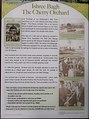 The Cherry Orchard, information sign - geograph.org.uk - 594981.jpg 477 × 640; 84 KB
-
 The Cherry Tree pub, Stoke Row - geograph.org.uk - 6095290.jpg 3,206 × 1,802; 2.74 MB
-
 The green at Stoke Row - geograph.org.uk - 4070147.jpg 1,280 × 960; 204 KB
-
 The High Street in Stoke Row - geograph.org.uk - 2127263.jpg 1,500 × 1,000; 197 KB
-
 The Maharajah's Well - geograph.org.uk - 5400530.jpg 1,024 × 683; 133 KB
-
 The Oak, Stoke Row - geograph.org.uk - 4070152.jpg 1,280 × 960; 243 KB
-
 The road past Threelandboard Wood - geograph.org.uk - 4758210.jpg 1,500 × 1,125; 225 KB
-
 The Road to Neal's Farm - geograph.org.uk - 37094.jpg 640 × 481; 352 KB
-

-
 Track junction - geograph.org.uk - 595817.jpg 640 × 477; 113 KB
-
 Uxmore Road in Dogmore End - geograph.org.uk - 4758208.jpg 1,500 × 1,125; 201 KB
-
 Uxmore Road junction with Kit Lane - geograph.org.uk - 2889999.jpg 3,073 × 2,394; 1.38 MB
-
 Uxmore Road junction with lane to Dogmore End - geograph.org.uk - 2889974.jpg 2,915 × 2,120; 1,006 KB
-
 View of the Well - geograph.org.uk - 5400538.jpg 533 × 800; 330 KB
-
 War grave in St John's Churchyard, Stoke Row - geograph.org.uk - 4070200.jpg 1,280 × 960; 361 KB
-
 Well Cottage - geograph.org.uk - 5400844.jpg 1,024 × 683; 206 KB
-
 Well Cottage - geograph.org.uk - 594976.jpg 640 × 477; 113 KB
-
 Well Cottage in the Snow - geograph.org.uk - 3071542.jpg 1,373 × 1,787; 913 KB
-
 Well Cottage, Stoke Row - geograph.org.uk - 2836583.jpg 640 × 427; 241 KB
-
 Well Cottage, Stoke Row - geograph.org.uk - 412530.jpg 640 × 453; 134 KB
-
 Well House in Stoke Row - geograph.org.uk - 2127261.jpg 1,500 × 1,000; 460 KB
-
 Well View - geograph.org.uk - 5400857.jpg 1,024 × 683; 138 KB
-
 Wellside Villas, Stoke Row - geograph.org.uk - 4070169.jpg 1,280 × 960; 276 KB
-
 Windows in the Church - geograph.org.uk - 5400522.jpg 533 × 800; 104 KB
-
 Wisteria Cottage, Dogmore End - geograph.org.uk - 5251333.jpg 1,024 × 683; 182 KB
-
 Wooden Cross by the Church - geograph.org.uk - 5395638.jpg 533 × 800; 113 KB
-
 Woodland crossroads - geograph.org.uk - 5513096.jpg 640 × 480; 205 KB
-
 Woodland, Stoke Row - geograph.org.uk - 2818723.jpg 640 × 480; 236 KB
-
 You have been warned - geograph.org.uk - 595753.jpg 640 × 477; 68 KB
-
 Bridleway through Bush Wood - geograph.org.uk - 595756.jpg 640 × 477; 88 KB
-
 Disused pit - geograph.org.uk - 595742.jpg 640 × 477; 141 KB
-
 Footpath marker post - geograph.org.uk - 595081.jpg 640 × 477; 69 KB
-
 Red kites - geograph.org.uk - 595067.jpg 477 × 640; 26 KB


,_Stoke_Row_-_geograph.org.uk_-_4070145.jpg)


