Category:Stone barns in West Yorkshire
Subcategories
This category has only the following subcategory.
Media in category "Stone barns in West Yorkshire"
The following 44 files are in this category, out of 44 total.
-
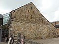
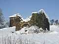
 18C barn, Kirklees Home Farm, Clifton - geograph.org.uk - 178213.jpg 640 × 471; 88 KB
-
 Aisled Barn To West Of Crag House.jpg 3,665 × 2,749; 1.9 MB
-
 Ash Barn - Syke Lane - geograph.org.uk - 1911059.jpg 640 × 429; 55 KB
-
 Badsworth Barn (29422857960).jpg 3,000 × 3,650; 10.68 MB
-
 Barn - Main Street, Hawksworth - geograph.org.uk - 996500.jpg 640 × 452; 98 KB
-
 Barn - Queen Street, Sowerby - geograph.org.uk - 823883.jpg 640 × 479; 77 KB
-
 Barn - Roker Lane - geograph.org.uk - 421025.jpg 640 × 473; 74 KB
-
 Barn 100 yards to north of Blake House.jpg 4,000 × 3,000; 5.28 MB
-
 Barn and White Cross Farm - geograph.org.uk - 109169.jpg 640 × 480; 107 KB
-
 Barn at Bradley Mill Farm - geograph.org.uk - 3709193.jpg 2,000 × 1,488; 1,024 KB
-
-

-
 Barn Door, former Moorcock Inn - geograph.org.uk - 1320331.jpg 640 × 480; 111 KB
-
 Barn east of Upper Fold Farmhouse, Thurstonland.jpg 4,000 × 3,000; 5.19 MB
-
 Barn To South West Of Crag House.jpg 4,608 × 3,456; 3.75 MB
-
-
 Barn, Dewsbury Road, Rastrick - geograph.org.uk - 72556.jpg 640 × 480; 123 KB
-
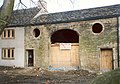
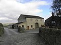
 Blacker Hall Farm Shop - geograph.org.uk - 79576.jpg 640 × 480; 121 KB
-
 Blacker Hall Farm shop. - geograph.org.uk - 518676.jpg 640 × 439; 124 KB
-
 Bottom Farm Barn-2-1200.jpg 1,200 × 900; 230 KB
-
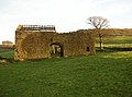
 Cocklick Laithe - geograph.org.uk - 473255.jpg 640 × 480; 87 KB
-
 Converted barn near to Clay Hall, Greetland - geograph.org.uk - 4815589.jpg 2,048 × 1,356; 869 KB
-
-
 East Riddlesden Hall Barn.jpg 2,288 × 1,712; 1.32 MB
-
 Eastfield Lane, Burley-in-Wharfedale - geograph.org.uk - 752472.jpg 640 × 424; 94 KB
-
 Eroded barn wall - geograph.org.uk - 980255.jpg 480 × 640; 136 KB
-
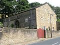
 Farmer Copley's Farm Shop. - geograph.org.uk - 524317.jpg 640 × 480; 93 KB
-
 Former barn of Royds Farm - geograph.org.uk - 193523.jpg 640 × 508; 116 KB
-
 Hainworth - Hill Top Road - geograph.org.uk - 1272800.jpg 640 × 480; 98 KB
-
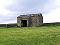
 High House Barn - geograph.org.uk - 1540310.jpg 640 × 480; 61 KB
-
 Laithe, Cow Side - geograph.org.uk - 102120.jpg 640 × 458; 151 KB
-
 Marchup Barn, Addingham - geograph.org.uk - 1551626.jpg 640 × 369; 55 KB
-
 Old barn - geograph.org.uk - 846960.jpg 640 × 480; 85 KB
-
 Old Barn - Tetley Lane, Northowram - geograph.org.uk - 825247.jpg 640 × 442; 78 KB
-
 Out Laith - geograph.org.uk - 293384.jpg 640 × 480; 112 KB
-

-
 Roof detail, interior, Cocklick Laithe - geograph.org.uk - 473267.jpg 640 × 480; 146 KB
-
 Rough Edge, Erringden Moor - geograph.org.uk - 362577.jpg 640 × 487; 99 KB
-
 Small barn at Upper Fold Farm, Thurstonland.jpg 4,000 × 3,000; 1.35 MB
-
 Springfield Barn, Scholes, Cleckheaton - geograph.org.uk - 217697.jpg 640 × 477; 149 KB
-
 Stanbury Barn.JPG 1,944 × 2,592; 1.85 MB
-
 Stock Lane Barn - geograph.org.uk - 909749.jpg 640 × 475; 289 KB
-
 Stocksmoor Farm, Midgley, Sitlington - geograph.org.uk - 64591.jpg 640 × 452; 131 KB
-
 The Old Barn - Westgate, Clifton - geograph.org.uk - 802317.jpg 640 × 428; 41 KB


.jpg)


