Category:Stone houses in Oxfordshire
Ceremonial counties of England: Oxfordshire · West Yorkshire ·
City-counties:
Former historic counties:
Other former counties:
City-counties:
Former historic counties:
Other former counties:
Subcategories
This category has the following 74 subcategories, out of 74 total.
2
5
- 566 Banbury Road, Cutteslowe (2 F)
A
- Long Alley Almshouses, Abingdon (23 F)
- Appleton Manor (4 F)
B
- The Baker's Arms, Bodicote (3 F)
- 1 Parsons Street, Banbury (3 F)
- Bell Inn, Lower Heyford (6 F)
- Combe Lodge (2 F)
- Bourton Grange (2 F)
C
- Sunrising, Claydon (2 F)
- Cock Inn, Combe (4 F)
- Court House, Great Coxwell (4 F)
- Brasenose Arms, Cropredy (4 F)
- Constone (2 F)
- The Red Lion, Cropredy (5 F)
D
- Castle House, Deddington (12 F)
- Deddington Manor (2 F)
- Holcombe House, Deddington (2 F)
- The Hermitage, Deddington (3 F)
- Ridge House (2 F)
E
- Rose Cottage, East Hendred (2 F)
- Pinfolds, Church Enstone (3 F)
F
- Peartree Farmhouse (2 F)
- Finstock Manor House (4 F)
G
- Glympton Almshouses (3 F)
- Danes Cottage, Great Coxwell (2 F)
- Danes House, Great Coxwell (4 F)
H
- Hampton Gay Manor (5 F)
I
- 2 Mill Lane, Iffley (3 F)
K
- Kirtlington Manor House (2 F)
L
- The Leadenporch House (2 F)
- Longworth Manor (6 F)
- The Thatch, Lyford (3 F)
M
- Manor Farm, Nether Worton (4 F)
- Manor House, Elsfield (4 F)
N
- North Arms, Wroxton (7 F)
- North Aston Hall (5 F)
- Forge Cottage, North Moreton (4 F)
O
- Bartlemas House, Oxford (2 F)
- 37–39 Cowley Road, Oxford (8 F)
P
- Prescote Manor (2 F)
R
- Rectory Farm, Northmoor (2 F)
S
- 16 St Giles', Oxford (4 F)
- Bell Inn, Shenington (2 F)
- Sibford Gower Manor House (2 F)
- Small's House, Oxfordshire (2 F)
U
- Unicorn Inn, Deddington (6 F)
- Chapel House, Upper Heyford (2 F)
W
- Wheatsheaf, Wardington (3 F)
- Wardington Manor (2 F)
- Northfield Farmhouse (2 F)
- Water Eaton Manor House (10 F)
- Water Eaton North Pavilion (4 F)
- Water Eaton South Pavilion (5 F)
- Parrotts, Wootton (3 F)
- Wykham Arms, Sibford Gower (2 F)
- Wytham Abbey (3 F)
Y
- Yarnton Manor (14 F)
Media in category "Stone houses in Oxfordshire"
The following 200 files are in this category, out of 275 total.
(previous page) (next page)-
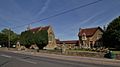
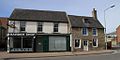
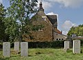
 Abingdon Cemetery Entrance - geograph.org.uk - 15364.jpg 640 × 480; 108 KB
-
 Abingdon OurLady&StEdmund SE&Presbytery.jpg 1,280 × 719; 481 KB
-
 Cross Hill Road - geograph.org.uk - 829069.jpg 640 × 457; 335 KB
-
 Cross Hill Road - geograph.org.uk - 829077.jpg 640 × 457; 355 KB
-
 Cross Hill Road - geograph.org.uk - 829080.jpg 640 × 457; 362 KB
-
 Entering Alkerton - geograph.org.uk - 1566913.jpg 640 × 448; 123 KB
-
 Alvescot Lodge, rear view, 1979 - geograph.org.uk - 1274684.jpg 640 × 410; 76 KB
-
 Ambrosden HollyTreeCottage.JPG 2,450 × 1,960; 723 KB
-
 Ambrosden ParkFarmhouse.JPG 3,000 × 2,000; 3.08 MB
-
 Appleton, Oxfordshire.jpg 640 × 480; 90 KB
-
 A house in Balscote - geograph.org.uk - 485918.jpg 640 × 427; 156 KB
-
 Bridge Street, Bampton - geograph.org.uk - 1546643.jpg 640 × 427; 96 KB
-
 High Street Bampton - geograph.org.uk - 920204.jpg 640 × 489; 98 KB
-
 The Rectory-Bampton.JPG 3,872 × 2,592; 1.87 MB
-
 Bampton high street - geograph.org.uk - 1542119.jpg 640 × 427; 69 KB
-
 Banbury HorseFair 24.jpg 785 × 785; 550 KB
-
 Bend in the road in Langford - geograph.org.uk - 1631540.jpg 640 × 480; 100 KB
-
 Bicester LondonRd 13Gable.jpg 731 × 1,024; 436 KB
-
 Bicester LondonRd Hermitage.jpg 1,024 × 512; 296 KB
-
 Bicester NorthSt 31–33.jpg 1,024 × 614; 359 KB
-
 Bicester SheepSt 73–75.jpg 1,024 × 512; 261 KB
-
 BicesterTown StationHouse.jpg 1,024 × 768; 420 KB
-
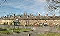
 Bletchingdon OldRedLion.JPG 3,000 × 1,800; 2.3 MB
-
 Bletchingdon TerracedCottages.JPG 3,000 × 1,800; 2.37 MB
-
 Bloxham - geograph.org.uk - 238446.jpg 640 × 480; 54 KB
-
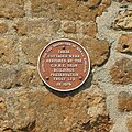
 Blue plaque on the wall - geograph.org.uk - 1388654.jpg 640 × 480; 92 KB
-
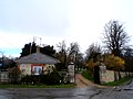 Lodge house, Brightwell Baldwin (geograph 3905585).jpg 4,320 × 3,240; 5 MB
-
 Broad Street, Bampton - geograph.org.uk - 1561615.jpg 640 × 427; 58 KB
-
 Broughton Poggs Mill - geograph.org.uk - 304622.jpg 640 × 480; 103 KB
-
 Crossing cottage - geograph.org.uk - 1232288.jpg 640 × 427; 70 KB
-
 Bruern Grange farmhouse - geograph.org.uk - 1232021.jpg 640 × 427; 62 KB
-
 Lamb Inn Buckland Oxfordshire.jpg 640 × 480; 124 KB
-
 New Row viewed from Middleton Road. - geograph.org.uk - 1084095.jpg 640 × 480; 79 KB
-

-
 Crossroads in Burford - geograph.org.uk - 1564623.jpg 640 × 480; 87 KB
-
 High St., Burford. - geograph.org.uk - 1613699.jpg 640 × 480; 122 KB
-
 High Street, Burford. - geograph.org.uk - 1613711.jpg 640 × 480; 106 KB
-
 Burford TudorCottage.jpg 2,975 × 1,785; 2.07 MB
-
 Burford, Witney Street - geograph.org.uk - 1297354.jpg 640 × 427; 379 KB
-
 Burford, Witney Street - geograph.org.uk - 1297356.jpg 640 × 427; 382 KB
-
 Bus img 5229 (16145659058).jpg 2,757 × 2,068; 1.77 MB
-
 Carterton, Rock Farm Cottages - geograph.org.uk - 361104.jpg 640 × 471; 143 KB
-
 Road through Chadlington - geograph.org.uk - 1096350.jpg 640 × 427; 73 KB
-
 Chalgrove TheGreen 1–2.jpg 1,280 × 720; 507 KB
-
 Houses in Charlbury - geograph.org.uk - 1014265.jpg 640 × 426; 85 KB
-
 Market Street, Charlbury - geograph.org.uk - 1633553.jpg 640 × 480; 89 KB
-
 Old Cottage, Charlbury - geograph.org.uk - 1437389.jpg 640 × 438; 99 KB
-
 Optare Solo SR YJ14 BWH Charlbury ParkSt.jpg 1,280 × 721; 451 KB
-
 Optare Solo SR YJ14 BWN Charlbury ParkSt.jpg 1,280 × 718; 612 KB
-
 Village centre scene, Charlbury - geograph.org.uk - 1437368.jpg 640 × 440; 79 KB
-
 Charlbury (34038224286).jpg 4,000 × 3,000; 3.78 MB
-
 Charlbury, near the Post Office - geograph.org.uk - 596007.jpg 640 × 477; 185 KB
-
 Hill Farm - geograph.org.uk - 1627892.jpg 640 × 480; 62 KB
-
 Cheapside, Bampton - geograph.org.uk - 1720549.jpg 1,024 × 776; 241 KB
-
 Cottages in Chilson - geograph.org.uk - 989435.jpg 640 × 426; 84 KB
-
 Cottages in Chilson - geograph.org.uk - 989687.jpg 640 × 426; 83 KB
-
 Chilson - geograph.org.uk - 1096593.jpg 640 × 427; 87 KB
-
-
 Chipping Norton-New Street - geograph.org.uk - 1354513.jpg 640 × 480; 80 KB
-
 Church Green, Witney - geograph.org.uk - 869104.jpg 640 × 480; 96 KB
-
 Hand and Shears, Church Hanborough - geograph.org.uk - 147024.jpg 640 × 480; 64 KB
-
 St Peter and St Paul, Church Hanborough - geograph.org.uk - 336896.jpg 640 × 480; 119 KB
-
 ChurchEnstone TheThatch.JPG 3,000 × 1,800; 786 KB
-
 ChurchHanborough ChurchView HartsCottage Hand&Shears.jpg 1,280 × 645; 387 KB
-
 ChurchHanborough ShepherdsWell WalnutCottage.jpg 1,280 × 705; 456 KB
-
 Cottages Cleveley Oxfordshire - geograph.org.uk - 231231.jpg 480 × 640; 90 KB
-
 Duke of Cumberland's Head Public House - geograph.org.uk - 23191.jpg 640 × 480; 97 KB
-
 St Annes Residential Home Clifton - geograph.org.uk - 23190.jpg 640 × 480; 98 KB
-
 The Cock Inn at Combe - geograph.org.uk - 1478287.jpg 640 × 427; 64 KB
-
 Juniper Hill - geograph.org.uk - 344125.jpg 640 × 480; 136 KB
-
 Juniper Hill - geograph.org.uk - 344132.jpg 640 × 480; 121 KB
-
 Row of cottages in Beauchamp Lane - geograph.org.uk - 1254930.jpg 640 × 427; 84 KB
-

-

-
 CurbridgeFarmCottages.jpg 1,280 × 719; 569 KB
-
 A slightly smaller Centrepoint - geograph.org.uk - 973399.jpg 640 × 480; 100 KB
-
 Arujo in Hudson Street - geograph.org.uk - 973380.jpg 480 × 640; 77 KB
-
 Cottages in The Tchure - geograph.org.uk - 643066.jpg 640 × 480; 78 KB
-

-
-
 Paper Mill Cottages - geograph.org.uk - 447803.jpg 640 × 531; 100 KB
-
 Scania AlexanderDennis Enviro300 YM15 FPT Deddington right.jpg 1,280 × 634; 332 KB
-
 Shops in Deddington High Street - geograph.org.uk - 973339.jpg 640 × 480; 82 KB
-
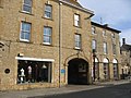
 Deddington BullRing ThreeHorseShoes.jpg 1,280 × 913; 691 KB
-
 Deddington CastleSt LokeCottage Jandor Wakehurst.jpg 1,280 × 1,280; 842 KB
-
 Deddington ChapelSq CentrePoint.jpg 1,280 × 606; 437 KB
-
 Deddington ChurchSt almshouses.jpg 1,280 × 688; 587 KB
-
 Deddington FeathertonHouse west.jpg 1,024 × 1,280; 586 KB
-
 Deddington HighSt 7–10.jpg 1,280 × 595; 411 KB
-
 Deddington HighSt GroveCottages.jpg 1,280 × 636; 516 KB
-
 Deddington HighSt MaundsFarmhouse.jpg 1,280 × 597; 502 KB
-
 Deddington HighSt OsborneCottage OsborneHouse CornerHouse.jpg 1,280 × 604; 473 KB
-
 Deddington MarketPlace NorthBlock.jpg 1,280 × 624; 439 KB
-
 Deddington MarketPlace NortheastTerrace.jpg 1,280 × 608; 458 KB
-
 Deddington MarketPlace NorthwestTerrace.jpg 1,280 × 607; 405 KB
-
 Deddington NewSt AfricHouse Treholford west.jpg 1,129 × 1,280; 717 KB
-
 Deddington NewSt AfricHouse Treholford.jpg 1,280 × 636; 515 KB
-
 Deddington NewSt BerwickHouse IlburyHouse.jpg 1,280 × 580; 416 KB
-
 Deddington NewSt Crown&Tuns.jpg 1,280 × 658; 527 KB
-
 Deddington NewSt OldPostHouse inscription.jpg 854 × 1,280; 767 KB
-
 Deddington NewSt OldPostHouse.jpg 1,280 × 586; 515 KB
-
 Deddington NewSt TheSteps PloughHouse Mallards.jpg 1,280 × 720; 590 KB
-
 Deddington SSPeter&Paul CWGC 5.jpg 1,280 × 913; 814 KB
-
 Deddington, Market Place.jpg 2,048 × 1,536; 1.14 MB
-
 Deddington, New Street - geograph.org.uk - 2209117.jpg 1,024 × 532; 353 KB
-
 Ivy Cottage, Drayton - geograph.org.uk - 1018742.jpg 640 × 480; 117 KB
-
 Duns Tew - general view - geograph.org.uk - 386111.jpg 640 × 425; 186 KB
-
 Duns Tew village1.jpg 640 × 480; 129 KB
-
 EastHendred StMary southwest.jpg 1,280 × 961; 648 KB
-
 EastHendred StMary west.jpg 1,280 × 720; 459 KB
-
 Elsfield HomeFarm house.JPG 2,620 × 1,965; 876 KB
-
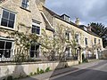
 Wisteria covered house, Church Enstone - geograph.org.uk - 1323946.jpg 640 × 480; 121 KB
-
 Epwell village green - geograph.org.uk - 449031.jpg 640 × 477; 148 KB
-
 The Chandlers Arms, Epwell - geograph.org.uk - 168129.jpg 480 × 640; 107 KB
-
 Mill Street, Eynsham - geograph.org.uk - 1439897.jpg 640 × 480; 67 KB
-
 Scania AlexanderDennis Enviro400 OU10 BHD Eynsham.jpg 1,280 × 613; 372 KB
-
 Eynsham, Acre End Street - geograph.org.uk - 120001.jpg 640 × 480; 108 KB
-
 Flora's Cottage - geograph.org.uk - 309083.jpg 640 × 480; 90 KB
-
 Fifield village.jpg 640 × 480; 120 KB
-
 "The Gassons" , Filkins - geograph.org.uk - 1116058.jpg 640 × 427; 77 KB
-
 Approaching Filkins from Langford - geograph.org.uk - 620209.jpg 640 × 427; 73 KB
-
 Formerly The Lamb, Filkins - geograph.org.uk - 1072443.jpg 640 × 427; 57 KB
-
 New house grafted on to old pub - geograph.org.uk - 304582.jpg 640 × 480; 81 KB
-
 Road junction in Filkins. - geograph.org.uk - 1093472.jpg 640 × 427; 63 KB
-
 Road through Filkins - geograph.org.uk - 1625726.jpg 640 × 480; 123 KB
-
 The old Post Office in Finstock - geograph.org.uk - 1237450.jpg 640 × 427; 80 KB
-

-
 Woodpecker Cottage in Finstock - geograph.org.uk - 1252315.jpg 640 × 427; 80 KB
-
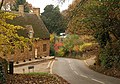
 Traffic lights at the bridge - geograph.org.uk - 1550063.jpg 640 × 427; 57 KB
-
 Gable and Vine Cottages, South Green, Kirtlington, Oxfordshire.jpg 2,968 × 1,781; 2.03 MB
-
 Gagingwell Cross and Wadham House.jpg 2,940 × 1,960; 2.56 MB
-
 Cottages in Garford - geograph.org.uk - 113757.jpg 640 × 481; 53 KB
-
 Gateway onto Church Green, Witney - geograph.org.uk - 868967.jpg 640 × 480; 77 KB
-
 Great Bourton from the Church yard - geograph.org.uk - 1138884.jpg 640 × 480; 94 KB
-
 Box Tree Cottage, Great Coxwell - geograph.org.uk - 307446.jpg 640 × 480; 100 KB
-
 Cottages Great Coxwell Geograph-2298175-by-Gareth-James.jpg 2,816 × 2,112; 1.76 MB
-
 The Bell Inn, Great Milton - geograph.org.uk - 247010.jpg 640 × 412; 58 KB
-
 GreatMilton BellLaneCottage.jpg 998 × 713; 572 KB
-
 GreatTew GabledThatchedCottage.JPG 2,500 × 2,000; 826 KB
-
 Cottages at Hampton Gay - geograph.org.uk - 357868.jpg 640 × 481; 111 KB
-
 House in Hampton Gay - geograph.org.uk - 966425.jpg 640 × 480; 72 KB
-
 Manor Farm, Hampton Gay - geograph.org.uk - 357866.jpg 640 × 480; 88 KB
-
 HamptonPoyle ChurchFarm house south.jpg 1,221 × 1,280; 869 KB
-
 HamptonPoyle OldManorHouse north.jpg 1,280 × 1,280; 1.09 MB
-
 HamptonPoyle OldRectory north.jpg 1,280 × 718; 446 KB
-
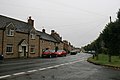
 Hanwell - Main Street - geograph.org.uk - 1138872.jpg 640 × 480; 85 KB
-
 Hempton Thatches CPREplaque.JPG 1,000 × 1,000; 491 KB
-
 Hempton Thatches&StJohnE.JPG 2,950 × 1,770; 1.99 MB
-
 Hempton Thatches.JPG 2,975 × 1,785; 646 KB
-
 Hethe scene, viewing West - geograph.org.uk - 1416407.jpg 640 × 480; 86 KB
-
 High Lodge Cottage - geograph.org.uk - 309093.jpg 640 × 480; 66 KB
-
 High Street in Burford.jpg 2,560 × 1,920; 2 MB
-
 House by road junction - geograph.org.uk - 334519.jpg 640 × 480; 103 KB
-
 House, Church Green, Witney - geograph.org.uk - 868735.jpg 500 × 640; 132 KB
-
 Houses on Church Green, Witney - geograph.org.uk - 868631.jpg 640 × 480; 104 KB
-
 Houses on Church Green, Witney - geograph.org.uk - 868981.jpg 640 × 599; 123 KB
-
 Houses on Church Green, Witney - geograph.org.uk - 869107.jpg 640 × 517; 122 KB
-
 Islip MonksCottage rear.jpg 2,955 × 1,970; 2.12 MB
-
 Ivy covered cottage, Hethe - geograph.org.uk - 1416399.jpg 640 × 480; 106 KB
-
 House near Kelmscott Manor - geograph.org.uk - 309864.jpg 640 × 480; 92 KB
-
 Buildings on Banbury Road, Kidlington - geograph.org.uk - 988195.jpg 640 × 395; 59 KB
-
 Kidlington old village.jpg 640 × 480; 175 KB
-
 Kidlington ChurchStreet 52.jpg 1,280 × 717; 578 KB
-
 Kidlington ChurchStreet 74–78.jpg 1,280 × 718; 539 KB
-
 Kidlington MillLane 108.jpg 1,280 × 719; 543 KB
-
 Kidlington MillLane 117–119.jpg 1,280 × 642; 449 KB
-
 Kidlington MillLane 127–135.jpg 1,280 × 609; 425 KB
-
 Cottage in Kingham - geograph.org.uk - 899392.jpg 640 × 426; 85 KB
-
 Cottage in Kingham - geograph.org.uk - 902339.jpg 640 × 426; 69 KB
-
 Cottages in Kingham - geograph.org.uk - 899665.jpg 640 × 426; 90 KB
-
 Stone cottage and phonebox in Kingham - geograph.org.uk - 290728.jpg 640 × 427; 79 KB
-
 Typical Cotswold cottages, Kingham - geograph.org.uk - 280076.jpg 640 × 427; 98 KB
-
 Kingham ChurchStreet cottages.jpg 1,280 × 720; 590 KB
-
 Property near Kingston Lisle church - geograph.org.uk - 667270.jpg 640 × 480; 320 KB
-

-
 Cottages in Kirtlingtom - geograph.org.uk - 785694.jpg 640 × 512; 104 KB
-
 Dairy Cottage, Kirtlington - geograph.org.uk - 1473509.jpg 640 × 480; 95 KB
-
 Main through road, Kirtlington - geograph.org.uk - 1416345.jpg 640 × 442; 64 KB
-

-
 Thatch Cottage Kirtlington - geograph.org.uk - 785703.jpg 640 × 475; 99 KB
-
 Kirtlington Manor corbel.JPG 1,940 × 2,910; 2.08 MB
-
 Kirtlington OldBakehouse southwest.jpg 1,280 × 663; 522 KB
-
 Kirtlington.jpg 3,456 × 2,304; 506 KB
-
-
 Manor Cottage, Little Milton - geograph.org.uk - 844688.jpg 640 × 480; 82 KB
-
 Cottage in Littlemore - geograph.org.uk - 1254981.jpg 640 × 427; 95 KB
-
 Road junction in Longworth - geograph.org.uk - 1004885.jpg 640 × 427; 71 KB
-
 Rose Cottage, Tuck's Lane, Longworth - geograph.org.uk - 1439316.jpg 640 × 480; 89 KB
-
 Squirrel Cottage, Longworth - geograph.org.uk - 1439215.jpg 640 × 480; 78 KB
-
 Houses in Lower Heyford.JPG 2,048 × 1,536; 1.34 MB
-
 Street in Lower Heyford - geograph.org.uk - 417948.jpg 640 × 480; 126 KB
-
 LowerHeyford FreeholdSt 105.jpg 1,191 × 1,280; 830 KB
-
 LowerHeyford FreeholdSt 93.jpg 1,190 × 1,280; 748 KB
-
 LowerHeyford FreeholdSt LintonCottage.jpg 1,280 × 1,280; 972 KB
-
 Mill Lane - geograph.org.uk - 1085595.jpg 640 × 480; 68 KB
-
 Holliers House, Middle Barton - geograph.org.uk - 767405.jpg 640 × 480; 53 KB
-
 Milton under Wychwood - geograph.org.uk - 232784.jpg 640 × 480; 64 KB
-
 Milton Cottages - geograph.org.uk - 238489.jpg 640 × 480; 86 KB
-
 Former Chartist bungalow - geograph.org.uk - 1549956.jpg 640 × 426; 48 KB
-


.jpg)


.jpg)


.jpg)


