Category:Stone walls in Oxfordshire
Ceremonial counties of England: Berkshire · Buckinghamshire · Cambridgeshire · Cheshire · Cornwall · Cumbria · Derbyshire · Devon · Dorset · Durham · East Sussex · Essex · Gloucestershire · Greater London · Hampshire · Herefordshire · Kent · Lancashire · Leicestershire · Lincolnshire · Merseyside · Norfolk · North Yorkshire · Northamptonshire · Northumberland · Nottinghamshire · Oxfordshire · Rutland · Shropshire · Somerset · South Yorkshire · Staffordshire · Surrey · West Sussex · West Yorkshire · Wiltshire · Worcestershire
City-counties:
Former historic counties:
Other former counties:
City-counties:
Former historic counties:
Other former counties:
Subcategories
This category has the following 2 subcategories, out of 2 total.
- Dry stone walls in Oxfordshire (44 F)
O
- Oxford city walls (19 F)
Media in category "Stone walls in Oxfordshire"
The following 160 files are in this category, out of 160 total.
-
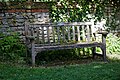 Brightwell Baldwin street bench Oxfordshire England.jpg 5,973 × 3,982; 30.28 MB
-
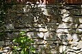 Brightwell Baldwin stone wall Oxfordshire England 01.jpg 6,240 × 4,160; 32.96 MB
-
 Brightwell Baldwin stone wall Oxfordshire England 02.jpg 6,240 × 4,160; 32.71 MB
-
 Brightwell Baldwin stone wall Oxfordshire England 03.jpg 6,240 × 4,160; 32.3 MB
-
 St Bartholomew's Church Brightwell Baldwin Oxfordshire England 01 less contrast.jpg 6,024 × 4,017; 33.45 MB
-
 St Bartholomew's Church Brightwell Baldwin Oxfordshire England 01 more contrast.jpg 6,024 × 4,017; 36.34 MB
-
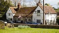 The Lord Nelson Inn Brightwell Baldwin Oxfordshire England 02.jpg 6,241 × 3,511; 32.34 MB
-
 The Lord Nelson Inn Brightwell Baldwin Oxfordshire England 03.jpg 6,194 × 3,486; 30.02 MB
-
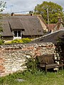 Cuxham from Holy Rood church with memorial bench Oxfordshire England.jpg 4,160 × 5,547; 30.59 MB
-
 Abingdon Long Alley Almshouses SSE.jpg 994 × 1,280; 773 KB
-
 Abingdon OckStreet 35 east.jpg 1,267 × 1,280; 847 KB
-
 Abingdon OurLady&StEdmund SE.jpg 1,280 × 913; 725 KB
-
 Alcove in the wall - geograph.org.uk - 1103479.jpg 640 × 480; 97 KB
-
 Trees in Alkerton - geograph.org.uk - 1566951.jpg 502 × 640; 139 KB
-
 St Peter and St Paul, Appleford - geograph.org.uk - 1540692.jpg 495 × 640; 73 KB
-
 Tower on the church - geograph.org.uk - 1597478.jpg 426 × 640; 75 KB
-
 War Memorial, Ardington - geograph.org.uk - 267702.jpg 480 × 640; 114 KB
-
 Aston&Cote SchoolSE.jpg 1,280 × 719; 467 KB
-
 Benson church.jpg 640 × 427; 260 KB
-
 Bicester LondonRd villas+tree.jpg 1,024 × 512; 303 KB
-
 Bicester LondonRd villas.jpg 768 × 960; 418 KB
-
 Black Bourton, The Old Inn.jpg 640 × 480; 82 KB
-
 Blenheim Park walls.jpg 3,456 × 2,304; 4.52 MB
-
 St Michael's Church in Blewbury-geograph-1664544-by-Steve-Daniels.jpg 1,500 × 1,000; 267 KB
-
 Blewbury OrchardDeneCottage SSE.jpg 1,090 × 1,280; 650 KB
-
 Bodicote StJohnB ChancelEast.jpg 852 × 1,280; 827 KB
-
 Botley NorthHinkseyLane 13–15 WSW.jpg 1,280 × 854; 722 KB
-
 Boundary Wall Of Manor House 01.jpg 4,000 × 3,000; 6.11 MB
-
 Boundary Wall Of Manor House 02.jpg 4,000 × 3,000; 6.15 MB
-
 Boundary Wall Of Number 56 Fronting The Croft.jpg 3,000 × 4,000; 5.35 MB
-
 Brasenose Lane Oxford 2008-07-15 14-25.jpg 3,264 × 2,448; 5.26 MB
-
 Broadwell's Golden Jubilee bench - geograph.org.uk - 1479380.jpg 640 × 480; 106 KB
-
 Bucknell ManorFarm.jpg 1,280 × 719; 649 KB
-
 Optare Solo KX56 TXP Burford.jpg 1,280 × 720; 654 KB
-
 Burford Priory old Chapel - geograph.org.uk - 1519589.jpg 480 × 640; 77 KB
-
 Cat in The Croft, Old Headington - geograph.org.uk - 306767.jpg 640 × 431; 114 KB
-
 CharneyBassett StPeter SSE.jpg 1,024 × 614; 403 KB
-
 Chastleton church.jpg 5,472 × 3,648; 8.86 MB
-
 Chilson - geograph.org.uk - 1096593.jpg 640 × 427; 87 KB
-
 Church Walk looking west, Oxford.JPG 4,288 × 3,216; 3.69 MB
-
 Juniper Hill - geograph.org.uk - 344132.jpg 640 × 480; 121 KB
-

-
 Cropredy Constone north.jpg 1,280 × 720; 552 KB
-
 Curbridge Village Hall - geograph.org.uk - 3077834.jpg 3,680 × 2,200; 1.22 MB
-
 Deddington Tchure EastSign.jpg 1,280 × 720; 548 KB
-
 St Peter's Church, Drayton - geograph.org.uk - 832466.jpg 640 × 480; 108 KB
-
 St Mary Magdalene Church, Duns Tew - geograph.org.uk - 114162.jpg 640 × 481; 61 KB
-
 Duxford Farm - geograph.org.uk - 91575.jpg 640 × 481; 68 KB
-
 East End - geograph.org.uk - 92026.jpg 640 × 481; 64 KB
-
 EastHendred StAugustine south.jpg 1,280 × 1,280; 1.01 MB
-
 EastHendred StAugustine west.jpg 1,026 × 1,280; 601 KB
-
 EastHendred StMary NaveWest.jpg 960 × 1,280; 655 KB
-
 EastHendred StMary southwest.jpg 1,280 × 961; 648 KB
-
 EastHendred StMary west.jpg 1,280 × 720; 459 KB
-
 ENG Oxford Rose Lane 03.jpg 4,016 × 3,012; 2.12 MB
-
 A view to the north from Faringdon - geograph.org.uk - 893973.jpg 640 × 480; 109 KB
-
 Roadside Statue - geograph.org.uk - 1704830.jpg 1,024 × 768; 250 KB
-
 Crossroads in Fifield - geograph.org.uk - 1216120.jpg 640 × 427; 63 KB
-
 St. John the Baptist, Fifield - geograph.org.uk - 1218245.jpg 640 × 427; 82 KB
-
 ForestHill StNicholas ESE.jpg 1,024 × 1,280; 830 KB
-
 Garford MillettsFarmCottages.jpg 1,024 × 683; 458 KB
-
 Goosey AllSaints cross east.jpg 960 × 768; 452 KB
-
 Grain Lorries This Way.jpg 1,200 × 900; 468 KB
-
 GreatCoxwell Danes.jpg 1,280 × 718; 673 KB
-
 Tower at Greys Court - geograph.org.uk - 556705.jpg 477 × 640; 122 KB
-
 Greys Court, Henley-on-Thames (6227589999).jpg 2,848 × 4,272; 8.64 MB
-
 Greys Court, Henley-on-Thames (6227706271).jpg 2,848 × 4,272; 10.28 MB
-
 Greys Court, Henley-on-Thames (6228152528).jpg 2,848 × 4,272; 7.49 MB
-
 Greys Court, Henley-on-Thames (6228387258).jpg 4,272 × 2,848; 11.24 MB
-
 St Margaret's, Harpsden - geograph.org.uk - 86951.jpg 597 × 400; 90 KB
-
 Holy Trinity church, Hatford - geograph.org.uk - 307353.jpg 480 × 640; 112 KB
-
 Wright StreetDeck OX68 OBU Headington.jpg 1,280 × 640; 645 KB
-
 HeadingtonHill wallbox GeorgeVI.jpg 1,880 × 2,820; 2.53 MB
-
 West Street, Henley - geograph.org.uk - 626702.jpg 640 × 480; 172 KB
-
 Methodist chapel, Hornton - geograph.org.uk - 1568025.jpg 640 × 429; 71 KB
-
 Iffley MillLa 2.jpg 1,280 × 719; 519 KB
-
 Iffley MillLane 2.jpg 1,280 × 720; 549 KB
-
 Iffley Rectory east.jpg 1,024 × 683; 391 KB
-
 Thatched cottage - geograph.org.uk - 471786.jpg 640 × 480; 77 KB
-
 AlexanderDennis Enviro400 HW63 FHE Islip.jpg 1,280 × 1,023; 675 KB
-
 Kidlington ChurchStreet 52.jpg 1,280 × 717; 578 KB
-
 Kidlington ChurchStreet 74–78.jpg 1,280 × 718; 539 KB
-
 Kidlington MillLane 108.jpg 1,280 × 719; 543 KB
-
 Kidlington MillLane 117–119.jpg 1,280 × 642; 449 KB
-
 Kirtlington Manor SSW.jpg 1,111 × 1,280; 660 KB
-
 Knibb BluePlaque Claydon.jpg 1,280 × 1,280; 1.03 MB
-

-

-

-
 Longworth Manor Gazebo.jpg 1,280 × 719; 583 KB
-
 MAN AlexanderDennis Enviro300 OU09 BZR Oxford NewRd.jpg 1,280 × 852; 664 KB
-
 Manor Farm, Nether Warton - geograph.org.uk - 236946.jpg 640 × 480; 70 KB
-
 Nuffield EnglishFarm EastRange SSW.jpg 1,280 × 641; 357 KB
-
 Nuffield HolyTrinity NorthAisle NorthWall detail.jpg 720 × 1,280; 890 KB
-
 Old Painted Gate - geograph.org.uk - 1658129.jpg 480 × 640; 117 KB
-
 Optare Solo OU10GFG Bodicote.jpg 1,280 × 851; 620 KB
-
 Optare Solo YJ10MBO Oxford2.jpg 839 × 558; 346 KB
-
 Oxford Botanic Garden wall nr entrance.JPG 4,000 × 3,000; 3.75 MB
-
 Mound from the road - geograph.org.uk - 1392706.jpg 640 × 480; 95 KB
-
 The outer walls - geograph.org.uk - 1408242.jpg 450 × 600; 43 KB
-
 Oxford StAndrew west.jpg 1,280 × 719; 537 KB
-
 Oxford StMatthew SW tree.jpg 1,024 × 1,280; 854 KB
-
 Oxford StMatthew SW2.jpg 1,024 × 1,280; 900 KB
-
 Oxford StMatthew west.jpg 1,280 × 849; 802 KB
-
 Longwall Street, Oxford, looking north.jpg 3,648 × 2,736; 4.07 MB
-

-
 OxfordCastle StGeorgesTower WestWindows.jpg 845 × 1,280; 820 KB
-
 Prescote Manor - geograph.org.uk - 936341.jpg 640 × 480; 98 KB
-
 RotherfieldPeppard AllSaints West1.jpg 1,021 × 1,280; 672 KB
-
 Sarsden Cross - geograph.org.uk - 267700.jpg 480 × 640; 96 KB
-
 Sarsden Cross - geograph.org.uk - 309020.jpg 640 × 480; 121 KB
-

-
 Shellingford TimberYardCottages StFaith SE.jpg 1,024 × 512; 222 KB
-
 Outbuildings of Shotover House - geograph.org.uk - 192057.jpg 640 × 480; 146 KB
-
 Entrance to Milestone House, Longcot Road - geograph.org.uk - 3708755.jpg 1,024 × 683; 260 KB
-
 The Manor House, Sibford Gower - geograph.org.uk - 273646.jpg 640 × 480; 55 KB
-
 St. Andrew's Church, South Stoke - geograph.org.uk - 36221.jpg 640 × 481; 65 KB
-
 Stanford itV StDenys MassDial.jpg 1,280 × 1,280; 1.45 MB
-
 Bench at the Hillcroft Millennium Green - geograph.org.uk - 1709358.jpg 1,500 × 972; 314 KB
-

-
 Thatched barn on Pound Lane - geograph.org.uk - 1709366.jpg 1,500 × 1,000; 165 KB
-

-

-
 Steventon StMichael&AllAngels SE.jpg 2,910 × 1,940; 2.27 MB
-
 Priory Cottages, Steventon, Berkshire - geograph-3725708.jpg 1,500 × 999; 254 KB
-
 Steventon Oxon Geograph-2613231-by-Bill-Nicholls.jpg 1,024 × 683; 162 KB
-
 St Peter, Stoke Lyne, Oxon - geograph.org.uk - 1634643.jpg 640 × 481; 95 KB
-
 SuttonCourtenay HighSt 76.jpg 1,280 × 1,256; 842 KB
-
 SuttonCourtenay HighSt LongBarn.jpg 1,280 × 1,280; 712 KB
-
 SuttonCourtenay SouthfieldFarmhouse NE.jpg 1,280 × 719; 618 KB
-
 Old Milestone by the A418, North Street, Thame (geograph 6035874).jpg 2,016 × 1,512; 844 KB
-
 The Prebendal in Priest End - geograph.org.uk - 1414308.jpg 640 × 410; 75 KB
-
 The Prebendal, Thame - geograph.org.uk - 161687.jpg 640 × 480; 118 KB
-
 UpperHeyford BarleyMow northwest.jpg 1,280 × 694; 487 KB
-
 UpperHeyford SchoolHouse east.jpg 3,008 × 2,000; 3.09 MB
-
 UpperHeyford SchoolHouse.JPG 2,974 × 1,948; 2.8 MB
-
 Wall at Blenheim Park - geograph.org.uk - 3374648.jpg 640 × 427; 227 KB
-
 Wall by the church - geograph.org.uk - 1308759.jpg 640 × 426; 80 KB
-
 Wall Plants.jpg 4,200 × 2,800; 14.04 MB
-
 Vent pipe on the wall - geograph.org.uk - 920426.jpg 426 × 640; 94 KB
-
 Well worn headstop - geograph.org.uk - 938872.jpg 640 × 426; 68 KB
-
 Wardington Pettifers sundial.jpg 1,280 × 626; 516 KB
-
 Wardington Pettifers.jpg 1,280 × 1,280; 657 KB
-
 Wardington School inscription.jpg 959 × 1,280; 1.01 MB
-
 WaterEaton ManorHouse east gates.jpg 1,280 × 1,242; 623 KB
-
 WaterEaton ManorHouse gates.jpg 1,280 × 1,265; 649 KB
-
 St Leonard's Church in Waterstock - geograph.org.uk - 1724846.jpg 1,500 × 1,000; 217 KB
-
 StLeonardsWaterstock.jpg 3,456 × 2,304; 816 KB
-
 The Old Village Lock-up at Wheatley - geograph.org.uk - 361680.jpg 640 × 480; 82 KB
-
 WigginsVA Bodicote StJohnB.jpg 1,279 × 1,280; 1.13 MB
-
 Witney OurLady&StHugh SSW tree.jpg 1,280 × 719; 577 KB
-
 Wolvercote StPeter southwest.jpg 1,024 × 683; 408 KB
-
 Stone wall protected by tarpaulins - geograph.org.uk - 353012.jpg 640 × 480; 116 KB
-
 Woodeaton HolyRood north-west.JPG 2,590 × 1,850; 1.58 MB
-
 Woodeaton HolyRood north.JPG 2,375 × 1,900; 1.48 MB
-
 St Peter's Church in Wootton - geograph.org.uk - 1372840.jpg 640 × 427; 76 KB
-
 Wotton StPeter East1.jpg 2,600 × 1,950; 2.2 MB
-
 North Arms, Wroxton - geograph.org.uk - 418934.jpg 640 × 480; 127 KB
-
 Wytham 22.jpg 3,008 × 2,000; 2.5 MB
-
 Yarnton OldSchool.JPG 2,610 × 1,740; 2.12 MB


.jpg)
.jpg)
.jpg)
.jpg)


.jpg)


