Category:Stowting
village and civil parish in Kent, United Kingdom  | |||||
| Upload media | |||||
| Instance of | |||||
|---|---|---|---|---|---|
| Location | Folkestone and Hythe, Kent, South East England, England | ||||
| Said to be the same as | Stowting (Wikimedia duplicated page, civil parish) | ||||
 | |||||
Subcategories
This category has the following 4 subcategories, out of 4 total.
Media in category "Stowting"
The following 94 files are in this category, out of 94 total.
-
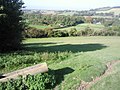
 A rural idyll - geograph.org.uk - 340850.jpg 640 × 480; 203 KB
-
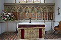 Altar and reredos, St Mary's church - geograph.org.uk - 3558343.jpg 3,696 × 2,448; 2.19 MB
-
 Approaching staggered junction, on B2068 - geograph.org.uk - 3388683.jpg 2,256 × 1,504; 3.56 MB
-
 B2068 Stone Street - geograph.org.uk - 1956144.jpg 1,024 × 768; 179 KB
-
 B2068 Stone Street - geograph.org.uk - 3388756.jpg 2,015 × 1,255; 2.82 MB
-
 Bend on Brabourne Lane - geograph.org.uk - 1767295.jpg 3,072 × 2,304; 2.98 MB
-
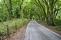
 Brabourne Lane - geograph.org.uk - 1767276.jpg 2,304 × 3,072; 2.72 MB
-
 Brabourne Lane - geograph.org.uk - 3550551.jpg 3,696 × 2,448; 2.32 MB
-
 Brabourne Lane - geograph.org.uk - 5562970.jpg 640 × 480; 205 KB
-
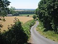
 Bright Green Field in Pett Valley - geograph.org.uk - 1767217.jpg 3,072 × 2,304; 1.61 MB
-
 Church Lane - geograph.org.uk - 1956120.jpg 1,024 × 768; 223 KB
-
 Cobb's Hill, Stowting - geograph.org.uk - 5562956.jpg 640 × 480; 181 KB
-
 Cottage on Scot's Lane - geograph.org.uk - 2079740.jpg 3,072 × 2,304; 2.17 MB
-
 Crossroads at Mockbeggar - geograph.org.uk - 330397.jpg 632 × 446; 250 KB
-
 Cutting the Grass - geograph.org.uk - 1956114.jpg 1,024 × 683; 239 KB
-
 Entrance to Stowting Common Farmhouse - geograph.org.uk - 3550532.jpg 3,492 × 2,056; 5.72 MB
-
 Farm building in field off Church Lane - geograph.org.uk - 398913.jpg 640 × 480; 118 KB
-
 Farm track on Brabourne Lane - geograph.org.uk - 1767289.jpg 3,072 × 2,304; 1.84 MB
-
 Farmland by Scot's Lane - geograph.org.uk - 4032139.jpg 640 × 430; 45 KB
-
 Field of Sheep of Brabourne Lane - geograph.org.uk - 1956109.jpg 1,024 × 768; 267 KB
-
 Field of Sheep off Brabourne Lane - geograph.org.uk - 1957131.jpg 1,024 × 768; 187 KB
-
 Gonepteryx rhamni - geograph.org.uk - 1450356.jpg 640 × 480; 408 KB
-
 Junction of Scots Lane and Fiddling Lane - geograph.org.uk - 1385391.jpg 640 × 480; 111 KB
-
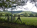
 Kissing Gate on Brabourne Lane - geograph.org.uk - 1767269.jpg 3,072 × 2,304; 1.73 MB
-

-
 Lane junction on North Downs Way in Stowting - geograph.org.uk - 2079713.jpg 3,072 × 2,304; 2.74 MB
-
 Lane to Stowting Common - geograph.org.uk - 1767212.jpg 3,072 × 2,304; 2.4 MB
-
 Moose Crossing, Stowting - geograph.org.uk - 1414695.jpg 480 × 640; 296 KB
-
 North Downs Way heads to Cobb's Hill - geograph.org.uk - 2171681.jpg 3,072 × 2,304; 1.71 MB
-
 North Downs Way heads towards Stowting - geograph.org.uk - 2080431.jpg 3,072 × 2,304; 1.87 MB
-
 North Downs Way on Scot's Lane - geograph.org.uk - 2079723.jpg 3,072 × 2,304; 2.48 MB
-
 North Downs Way on Scot's Lane and Fiddling Lane junction - geograph.org.uk - 2080414.jpg 3,072 × 2,304; 1.81 MB
-
 North Downs Way to Farthing Common - geograph.org.uk - 2171699.jpg 3,072 × 2,304; 1.96 MB
-
 Organ, St Mary's church, Stowting - geograph.org.uk - 3558340.jpg 2,448 × 3,696; 2.27 MB
-
 Paddocks by Scot's Lane - geograph.org.uk - 4032135.jpg 640 × 430; 50 KB
-
 Park Farm - geograph.org.uk - 1767235.jpg 3,072 × 2,304; 2.34 MB
-
 Pett Bottom Farm - geograph.org.uk - 5563294.jpg 640 × 480; 141 KB
-
 Scot's Lane - geograph.org.uk - 4032133.jpg 640 × 430; 92 KB
-
 Scot's Lane, Fiddling Lane junction - geograph.org.uk - 4032141.jpg 640 × 430; 73 KB
-
 Scot's Lane, Stowting - geograph.org.uk - 5562953.jpg 640 × 480; 170 KB
-
 St Mary's church, Stowting - geograph.org.uk - 3551123.jpg 3,696 × 2,448; 2.27 MB
-
 Stile on Cobb's Hill - geograph.org.uk - 2171683.jpg 3,072 × 2,304; 2.23 MB
-
 Stiles near Cobb's Hill - geograph.org.uk - 2171687.jpg 3,072 × 2,304; 1.68 MB
-
 Stiles on the North Downs Way on Cobb's Hill - geograph.org.uk - 2114795.jpg 1,280 × 960; 624 KB
-
 Stone Street towards Canterbury - geograph.org.uk - 5835595.jpg 1,024 × 684; 279 KB
-
 Thatched Barn near Park Farm - geograph.org.uk - 1767249.jpg 2,304 × 3,072; 2.21 MB
-
 Stowting church and new school - geograph.org.uk - 340851.jpg 640 × 480; 135 KB
-
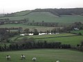
 Stowting from Cobb's Hill - geograph.org.uk - 1414709.jpg 640 × 477; 233 KB
-
 Stowting Hill - geograph.org.uk - 5562962.jpg 640 × 480; 196 KB
-
 Stream by the North Downs Way in Stowting - geograph.org.uk - 4923328.jpg 4,608 × 3,456; 5 MB
-
 The Black Horse, Broad Street - geograph.org.uk - 1385385.jpg 640 × 427; 78 KB
-
 The North Downs Way ascending Cobb's Hill - geograph.org.uk - 2114788.jpg 1,280 × 960; 610 KB
-
 The North Downs Way near Whiteway - geograph.org.uk - 4923329.jpg 4,608 × 3,456; 5.07 MB
-
 The Tiger Inn - geograph.org.uk - 3550541.jpg 3,352 × 2,272; 3.44 MB
-
 The Tiger Inn at Stowting - geograph.org.uk - 1099003.jpg 640 × 427; 73 KB
-
 The Tiger Inn, Stowting - geograph.org.uk - 1414688.jpg 480 × 640; 213 KB
-
 Tiger Inn, Stowting - geograph.org.uk - 3291788.jpg 3,264 × 2,448; 1.73 MB
-
 Trout Lake - geograph.org.uk - 2171696.jpg 3,072 × 2,304; 2.29 MB
-
 Tumulus Farm - geograph.org.uk - 1956133.jpg 1,024 × 768; 221 KB
-
 View from the North Downs Way towards Stowting - geograph.org.uk - 2114808.jpg 1,280 × 960; 622 KB
-
 View of Stowting - geograph.org.uk - 2171693.jpg 3,072 × 1,728; 1.21 MB
-
 View to Stowting from Cobb's Hill - geograph.org.uk - 4290671.jpg 1,024 × 768; 134 KB
-
 West Wood - geograph.org.uk - 1956138.jpg 1,024 × 768; 407 KB
-
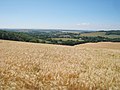 Wheat Field off Stone Street - geograph.org.uk - 1956129.jpg 1,024 × 768; 249 KB
-
 Edge of Sibton Wood - geograph.org.uk - 441219.jpg 640 × 428; 324 KB
-
 Farm buildings at Horton Court - geograph.org.uk - 340890.jpg 640 × 480; 123 KB
-
 Gate to field - geograph.org.uk - 340882.jpg 640 × 480; 178 KB
-
 Horses in paddock and track near Sixmile - geograph.org.uk - 340403.jpg 640 × 480; 259 KB
-
 Horton Court and church amongst the trees - geograph.org.uk - 340885.jpg 640 × 460; 136 KB
-
-
 Houses on Scots Lane - geograph.org.uk - 340860.jpg 640 × 480; 152 KB
-
 Jacksons Fencing, near Lymbridge Green - geograph.org.uk - 340822.jpg 640 × 480; 133 KB
-
 Joining the Stone Street - geograph.org.uk - 340905.jpg 640 × 480; 169 KB
-
 Junction of Scots Lane and Fiddling Lane - geograph.org.uk - 340415.jpg 640 × 480; 245 KB
-
 Looking SE from Church Lane - geograph.org.uk - 340877.jpg 640 × 480; 184 KB
-

-
 Looking SW towards Lymbridge Green - geograph.org.uk - 340816.jpg 640 × 480; 145 KB
-
 Looking SW towards Stowting Court - geograph.org.uk - 340857.jpg 640 × 428; 144 KB
-
 Mill Farm, Stowting - geograph.org.uk - 340856.jpg 640 × 480; 196 KB
-
-
 Old grain storage barn - geograph.org.uk - 340847.jpg 640 × 480; 115 KB
-
 Old telephone box at Stowting - geograph.org.uk - 398880.jpg 640 × 480; 98 KB
-
 Pond and the old Gate Inn - geograph.org.uk - 330388.jpg 640 × 480; 282 KB
-
 Riding in Woodland Road - geograph.org.uk - 441190.jpg 428 × 640; 362 KB
-
 Road near Sixmile - geograph.org.uk - 340911.jpg 640 × 480; 194 KB
-
 Small lake at Horton Court - geograph.org.uk - 340887.jpg 640 × 480; 157 KB
-
 Stone Street - geograph.org.uk - 400384.jpg 640 × 480; 69 KB
-
 Stowting Hill, looking NE - geograph.org.uk - 340841.jpg 640 × 480; 146 KB
-
 Stowting Hill, looking NW - geograph.org.uk - 340409.jpg 640 × 480; 302 KB
-
 Stowting school - geograph.org.uk - 340412.jpg 640 × 480; 310 KB
-
 The old part of Stowting school - geograph.org.uk - 340853.jpg 640 × 480; 188 KB
-
 View along Church Lane - geograph.org.uk - 340880.jpg 640 × 480; 118 KB
-

-
 View from Church Lane - geograph.org.uk - 340873.jpg 640 × 480; 142 KB


