Category:Strathbungo Parish Church
| Object location | | View all coordinates using: OpenStreetMap |
|---|
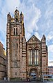
church building in Glasgow, Scotland, UK  | |||||
| Upload media | |||||
| Instance of | |||||
|---|---|---|---|---|---|
| Location |
| ||||
| Heritage designation |
| ||||
 | |||||
Media in category "Strathbungo Parish Church"
The following 17 files are in this category, out of 17 total.
-
 05477 Former Strathbungo Churches of Scotland, Strathbungo 001.jpg 4,830 × 6,440; 4.35 MB
-
 05477 Former Strathbungo Churches of Scotland, Strathbungo 002.jpg 4,830 × 6,440; 5.12 MB
-
 05477 Former Strathbungo Churches of Scotland, Strathbungo 003.jpg 4,830 × 6,440; 4.53 MB
-
 05477 Former Strathbungo Churches of Scotland, Strathbungo 004.jpg 5,152 × 3,864; 7.39 MB
-
 05477 Former Strathbungo Churches of Scotland, Strathbungo 005.jpg 5,152 × 3,864; 7.37 MB
-
 05477 Former Strathbungo Churches of Scotland, Strathbungo 006.jpg 4,830 × 6,440; 4.47 MB
-
 05477 Former Strathbungo Churches of Scotland, Strathbungo 007.jpg 5,152 × 3,864; 3.76 MB
-
 05477 Former Strathbungo Churches of Scotland, Strathbungo 008.jpg 5,152 × 3,864; 2.03 MB
-
 05477 Former Strathbungo Churches of Scotland, Strathbungo 009.jpg 5,152 × 3,864; 4.66 MB
-
 605 Pollokshaws Road, Strathbungo Parish Church.jpg 2,268 × 4,032; 3.23 MB
-
 Demolition site (geograph 7597829).jpg 1,600 × 1,200; 448 KB
-
 Former Strathbungo Parish Church (geograph 7598151).jpg 1,270 × 1,600; 264 KB
-
 Glasgow City - Strathbungo Parish Church - 20141229161053.jpg 2,448 × 3,264; 1.5 MB
-
 Glasgow City - Strathbungo Parish Church - 20141229161248.jpg 2,448 × 3,264; 2.61 MB
-
 Glasgow City - Strathbungo Parish Church - 20141229161642.jpg 2,448 × 3,264; 2.21 MB
-
 Strathbungo Parish Church, 605 Pollokshaws Road, Glasgow.jpg 3,024 × 4,032; 4.61 MB
-
 Strathbungo Parish Church, Glasgow, Scotland.jpg 2,066 × 3,212; 4.17 MB


.jpg)
.jpg)


