Category:Stratigraphy of Japan
Subcategories
This category has the following 18 subcategories, out of 18 total.
*
F
- Folds in Japan (15 F)
G
- Gandate (5 F)
H
I
K
- Kioroshi Kaiso (6 F)
L
- Lava beds in Japan (1 F)
M
O
T
U
- Unconformities in Japan (1 F)
V
Media in category "Stratigraphy of Japan"
The following 34 files are in this category, out of 34 total.
-
 140913 Sannai-Maruyama site Aomori Japan08s.jpg 6,000 × 4,000; 10.49 MB
-
 8,000 years ago shell midden of 2-H-North part of Higashimyo Site.jpg 4,400 × 3,300; 4.85 MB
-
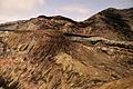
 Amidadake, Winter 2012.jpg 1,024 × 768; 207 KB
-
 Excavation in Omori Shell Mounds Garden - Omori, Tokyo, Japan - DSC05668.jpg 5,472 × 3,648; 12 MB
-
 Funayama Kofun (Yawatacho, Toyokawa), danmen zentai-1.jpg 6,016 × 4,000; 9.74 MB
-
 Funayama Kofun (Yawatacho, Toyokawa), danmen zentai-2.jpg 6,016 × 4,000; 8.68 MB
-
 Funayama Kofun (Yawatacho, Toyokawa), danmen-1.jpg 6,002 × 3,978; 10.92 MB
-
 Funayama Kofun (Yawatacho, Toyokawa), danmen-2.jpg 6,002 × 3,978; 11.25 MB
-
 Funayama Kofun (Yawatacho, Toyokawa), danmen-3.jpg 6,010 × 3,990; 9.79 MB
-
 Funayama Kofun (Yawatacho, Toyokawa), danmen-4.jpg 5,990 × 3,960; 12.09 MB
-
 Funayama Kofun (Yawatacho, Toyokawa), danmen-5.jpg 6,016 × 4,000; 10.92 MB
-
 Funayama Kofun 1a, Toyokawa.jpg 2,448 × 3,264; 4.3 MB
-
 Kasori midden preserve north.jpg 2,048 × 1,536; 751 KB
-
 Mount Mamahaha and Mount Haku from Okunoin 2010-08-27.jpg 1,920 × 1,280; 850 KB
-
 Mt. Aso - The Volcano - panoramio (1).jpg 1,504 × 1,000; 758 KB
-
 Mt. Aso - The Volcano - panoramio.jpg 1,504 × 1,000; 708 KB
-
 Omori Shell Mound, danmen.jpg 5,496 × 3,600; 9.1 MB
-
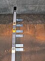
 Shell layers of Okadaira Shell Mounds, Ibaraki 01.jpg 2,277 × 2,592; 2.42 MB
-
 Shijimizuka Ruins (shell mound No.1).jpg 1,024 × 768; 376 KB
-
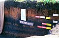
 Strata of Uenohara.JPG 1,920 × 2,560; 2.23 MB
-
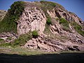
 Tedorikyou.jpg 4,000 × 3,000; 8.18 MB
-
 Uenohara Jomon Village a120.jpg 1,535 × 1,011; 1.55 MB
-
 Yoshigo Shell mound-04.jpg 900 × 1,200; 440 KB
-
 上高津貝塚遺跡-貝塚跡 - panoramio.jpg 2,736 × 1,824; 3.77 MB
-
 入江貝塚 05.jpg 3,648 × 2,736; 4.04 MB
-
 入江貝塚 06.jpg 3,648 × 2,736; 4.32 MB
-
 剣崎 - panoramio (2).jpg 3,648 × 2,736; 3.72 MB
-
 剣崎 - panoramio.jpg 3,648 × 2,736; 3.84 MB
-
 富士頂上瀑2.JPG 1,396 × 1,396; 538 KB
-
 峰の茶屋から朝日岳へ抜ける登山道の中間辺り(ズームで) - panoramio.jpg 4,176 × 2,784; 4.75 MB
-
 武蔵府中熊野神社古墳 盛土.JPG 5,591 × 3,202; 7.1 MB
-
 蔵王山五色岳 Peak Goshiki, Mt. Zao - panoramio - Tomofumi Sato.jpg 1,600 × 1,071; 844 KB
-
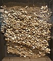
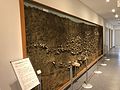 貝塚断面の剥ぎ取り展示.jpg 3,264 × 2,448; 1.71 MB
-
 青塚古墳 (犬山市) 内部土層.JPG 5,773 × 3,893; 11.5 MB


,_danmen_zentai-1.jpg)
,_danmen_zentai-2.jpg)
,_danmen-1.jpg)
,_danmen-2.jpg)
,_danmen-3.jpg)
,_danmen-4.jpg)
,_danmen-5.jpg)


.jpg)


.jpg)


.jpg)


_%E5%86%85%E9%83%A8%E5%9C%9F%E5%B1%A4.JPG)