Category:Stratton St Michael
village in Norfolk, United Kingdom | |||||
| Upload media | |||||
| Instance of |
| ||||
|---|---|---|---|---|---|
| Location | Long Stratton, South Norfolk, Norfolk, East of England, England | ||||
 | |||||
Subcategories
This category has only the following subcategory.
M
Media in category "Stratton St Michael"
The following 21 files are in this category, out of 21 total.
-
 A field of ripening barley - geograph.org.uk - 1362315.jpg 640 × 480; 103 KB
-
 A large wheat field - geograph.org.uk - 1362293.jpg 480 × 640; 98 KB
-

-
 Boudica's Way - to Stratton St Michael - geograph.org.uk - 1362297.jpg 640 × 480; 111 KB
-
 Boudica's Way - to Stratton St Michael - geograph.org.uk - 1362302.jpg 640 × 480; 101 KB
-
 Boudica's Way - to the B1527 - geograph.org.uk - 1362296.jpg 640 × 480; 96 KB
-
 Boudica's Way - to the B1527 - geograph.org.uk - 1362305.jpg 480 × 640; 118 KB
-
 Boudica's Way, Stratton St. Michael - geograph.org.uk - 355450.jpg 640 × 480; 99 KB
-

-
 Gate on footpath - geograph.org.uk - 1362319.jpg 480 × 640; 128 KB
-

-
 Junction of B1527 and Brick Kiln Lane - geograph.org.uk - 357805.jpg 640 × 480; 85 KB
-
 North on Boudica's Way - geograph.org.uk - 1362312.jpg 640 × 480; 107 KB
-
 Oak growing on field boundary - geograph.org.uk - 1362308.jpg 640 × 480; 107 KB
-
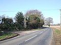
 Road Junction at Stratton St. Michael - geograph.org.uk - 357250.jpg 640 × 480; 97 KB
-
 St Michael's church - geograph.org.uk - 1362337.jpg 640 × 480; 108 KB
-
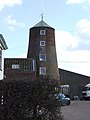
 St Michael's Mill - geograph.org.uk - 1356474.jpg 579 × 620; 92 KB
-
 St Michael's Mill - geograph.org.uk - 1356480.jpg 480 × 640; 87 KB
-
 St Michael's Mill - geograph.org.uk - 1356483.jpg 640 × 465; 82 KB
-
 Stratton St Michael - Boudica's Way - geograph.org.uk - 1362288.jpg 640 × 480; 89 KB
-
 Stratton St Michael, Leeder's Mill.jpg 480 × 640; 65 KB


