Category:Streams in County Kerry
Media in category "Streams in County Kerry"
The following 127 files are in this category, out of 127 total.
-
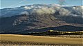
 Beenoskee-1371, Dingle Peninsula, Co. Kerry, Ireland.jpg 5,184 × 3,888; 3.27 MB
-
 Beenoskee-3263, Dingle Peninsula, Co. Kerry, Ireland.jpg 5,184 × 3,888; 2.66 MB
-
 Beenoskee-3265, Dingle Peninsula, Co. Kerry, Ireland.jpg 5,184 × 3,888; 2.59 MB
-
 Beenoskee-4519, Dingle Peninsula, Co. Kerry, Ireland.jpg 1,920 × 1,080; 531 KB
-
 Beenoskee-5057, Dingle Peninsula, Co. Kerry, Ireland.jpg 1,920 × 1,080; 277 KB
-
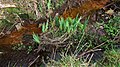 Bog Iris-1110, Dingle Peninsula, Co. Kerry, Ireland.jpg 1,920 × 1,080; 1.02 MB
-
 Bog Iris-5457, Dingle Peninsula, Co. Kerry, Ireland.jpg 1,920 × 1,080; 1.12 MB
-
 Boulders-5592, Tralee Bay, Co. Kerry, Ireland.jpg 1,920 × 1,080; 522 KB
-
 Boulders-9622, Tralee Bay, Co. Kerry, Ireland.jpg 1,920 × 1,080; 487 KB
-
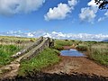
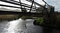
 Bridge-1118, Dingle Peninsula, Co. Kerry, Ireland.jpg 1,920 × 1,080; 613 KB
-
 Bridge-4658, Dingle Peninsula, Co. Kerry, Ireland.jpg 1,920 × 1,080; 532 KB
-
 Caher Bridge-5059, Dingle Peninsula, Co. Kerry, Ireland.jpg 1,920 × 1,080; 338 KB
-
 Caher Estuary-5638, Tralee Bay, Co. Kerry, Ireland.jpg 1,920 × 1,080; 475 KB
-
 Caher Estuary-5907, Dingle Peninsula, Co. Kerry, Ireland.jpg 1,920 × 1,080; 372 KB
-
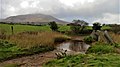
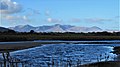 Caher River-4509, Dingle Peninsula, Co. Kerry, Ireland.jpg 1,920 × 1,080; 412 KB
-
 Country Lane-7836, Dingle Peninsula, Co. Kerry, Ireland.jpg 5,184 × 3,888; 3.85 MB
-
 Country Road-3617, Dingle Peninsula, Co. Kerry, Ireland.jpg 5,184 × 3,888; 3.96 MB
-
 Cummeenaloughaun valley and outlet stream - geograph.org.uk - 466854.jpg 640 × 427; 143 KB
-
 Curlew-6844, Dingle Peninsula, Co. Kerry, Ireland.jpg 1,920 × 1,080; 543 KB
-
 Curlew-6853, Dingle Peninsula, Co. Kerry, Ireland.jpg 1,920 × 1,080; 605 KB
-
 Dingle Way-3303, Co. Kerry, Ireland.jpg 5,184 × 3,888; 4.67 MB
-
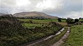 Dirt Road-7134, Dingle Peninsula, Co. Kerry, Ireland.jpg 1,920 × 1,080; 511 KB
-
 Dunes-9316, Dingle Peninsula, Co. Kerry, Ireland.jpg 1,920 × 1,080; 431 KB
-
 End of the Gearhanagour Stream valley - geograph.org.uk - 451015.jpg 640 × 427; 130 KB
-
 Erosion patterns, Glaninchiquin - geograph.org.uk - 467053.jpg 640 × 435; 180 KB
-
 Estuary-5927, Dingle Peninsula, Co. Kerry, Ireland.jpg 1,920 × 1,080; 514 KB
-
 Estuary-6262, Tralee Bay, Co. Kerry, Ireland.jpg 1,920 × 1,080; 526 KB
-
 Estuary-6271, Tralee Bay, Co. Kerry, Ireland.jpg 1,920 × 1,080; 486 KB
-
 Estuary-6401, Tralee Bay, Co. Kerry, Ireland.jpg 1,920 × 1,080; 568 KB
-
 Estuary-7647, Tralee Bay, Co. Kerry, Ireland.jpg 1,920 × 1,080; 550 KB
-
 Estuary-7657, Tralee Bay, Co. Kerry, Ireland.jpg 1,920 × 1,080; 592 KB
-
 Estuary-8743, Tralee Bay, Co. Kerry, Ireland.jpg 1,920 × 1,080; 569 KB
-
 Estuary-8779, Tralee Bay, Co. Kerry, Ireland.jpg 1,920 × 1,080; 520 KB
-
 Estuary-8783, Tralee Bay, Co. Kerry, Ireland.jpg 1,920 × 1,080; 535 KB
-
 Estuary-8785, Tralee Bay, Co. Kerry, Ireland.jpg 1,920 × 1,080; 484 KB
-
 Fishing-0707, Tralee Bay, Co. Kerry, Ireland.jpg 1,920 × 1,080; 377 KB
-
 Flooding-5636, Dingle Peninsula, Co. Kerry, Ireland.jpg 1,920 × 1,080; 251 KB
-
 Flooding-5640, Dingle Peninsula, Co. Kerry, Ireland.jpg 1,920 × 1,080; 326 KB
-
 Flooding-5794, Dingle Peninsula, Co. Kerry, Ireland.jpg 1,920 × 1,080; 504 KB
-
 Flooding-5797, Dingle Peninsula, Co. Kerry, Ireland.jpg 1,920 × 1,080; 318 KB
-
 Flooding-5802, Dingle Peninsula, Co. Kerry, Ireland.jpg 1,920 × 1,080; 328 KB
-
 Footbridge-0210, Dingle Peninsula, Co. Kerry, Ireland.jpg 1,920 × 1,080; 564 KB
-
 Footbridge-0218, Dingle Peninsula, Co. Kerry, Ireland.jpg 1,920 × 1,080; 412 KB
-
 Footbridge-0720, Dingle Peninsula, Co. Kerry, Ireland.jpg 5,184 × 3,888; 4.26 MB
-
 Footbridge-2929, Dingle Peninsula, Co. Kerry, Ireland.jpg 5,184 × 3,888; 3.57 MB
-
 Footbridge-2936, Dingle Peninsula, Co. Kerry, Ireland.jpg 5,184 × 3,888; 5.47 MB
-
 Ford & Footbridge-3148, Dingle Peninsula, Co. Kerry, Ireland.jpg 5,184 × 3,888; 3.88 MB
-
 Ford-5486, Dingle Peninsula, Co. Kerry, Ireland.jpg 1,920 × 1,080; 759 KB
-
 Ford-7143, Dingle Peninsula, Co. Kerry, Ireland.jpg 1,920 × 1,080; 546 KB
-
 Gearhanagour Stream - geograph.org.uk - 450895.jpg 640 × 427; 142 KB
-
 Gearhanagour Stream - geograph.org.uk - 451035.jpg 640 × 427; 135 KB
-
 Gearhanagour Stream, with Caher behind - geograph.org.uk - 450196.jpg 640 × 427; 130 KB
-
 Gleensk River tributary - geograph.org.uk - 775791.jpg 425 × 637; 86 KB
-
 High Tide-5649, Dingle Peninsula, Co. Kerry, Ireland.jpg 1,920 × 1,080; 384 KB
-
 High Tide-5657, Dingle Peninsula, Co. Kerry, Ireland.jpg 1,920 × 1,080; 337 KB
-
 High Tide-5688, Dingle Peninsula, Co. Kerry, Ireland.jpg 1,920 × 1,080; 326 KB
-
 High Tide-5754, Dingle Peninsula, Co. Kerry, Ireland.jpg 1,920 × 1,080; 355 KB
-
 High Tide-5856, Tralee Bay, Co. Kerry, Ireland.jpg 1,920 × 1,080; 379 KB
-
 High Tide-8555, Tralee Bay, Co. Kerry, Ireland.jpg 1,920 × 1,080; 467 KB
-
 High Tide-8563, Tralee Bay, Co. Kerry, Ireland.jpg 1,920 × 1,080; 361 KB
-
 High Tide-8568, Dingle Peninsula, Co. Kerry, Ireland.jpg 1,920 × 1,080; 619 KB
-
 High Tide-8584, Dingle Peninsula, Co. Kerry, Ireland.jpg 1,920 × 1,080; 490 KB
-
 High Tide-8597, Dingle Peninsula, Co. Kerry, Ireland.jpg 1,920 × 1,080; 517 KB
-
 Little Egret-8861, Dingle Peninsula, Co. Kerry, Ireland.jpg 1,920 × 1,080; 426 KB
-
 Little Egret-8866, Dingle Peninsula, Co. Kerry, Ireland.jpg 1,920 × 1,080; 481 KB
-
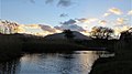
 Low Tide-2594, Tralee Bay, Co. Kerry, Ireland.jpg 5,184 × 3,888; 2.92 MB
-
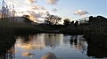
 Low Tide-2595, Tralee Bay, Co. Kerry, Ireland.jpg 5,184 × 3,888; 3.37 MB
-
 Marsh Road-8754, Dingle Peninsula, Co. Kerry, Ireland.jpg 1,920 × 1,080; 443 KB
-
 Marsh-3601, Dingle Peninsula, Co. Kerry, Ireland.jpg 5,184 × 3,888; 3.43 MB
-
 Marsh-3801, Dingle Peninsula, Co. Kerry, Ireland.jpg 1,920 × 1,080; 291 KB
-
 Marsh-9308, Dingle Peninsula, Co. Kerry, Ireland.jpg 1,920 × 1,080; 480 KB
-
 Marsh-9414, Dingle Peninsula, Co. Kerry, Ireland.jpg 1,920 × 1,080; 594 KB
-
 Mountain Stream - geograph.org.uk - 530609.jpg 640 × 480; 120 KB
-
 Mountain Stream - geograph.org.uk - 845218.jpg 426 × 640; 115 KB
-
 Mountain Stream - geograph.org.uk - 845226.jpg 640 × 426; 72 KB
-
 Nice place for lunch - geograph.org.uk - 776019.jpg 637 × 425; 95 KB
-
 NW head of Cummeenaloughaun - geograph.org.uk - 466816.jpg 640 × 427; 149 KB
-

-
 Outlet stream from Lough Cummernamuck - geograph.org.uk - 457137.jpg 433 × 640; 135 KB
-
 Overgrown Stream - geograph.org.uk - 914742.jpg 640 × 480; 138 KB
-
 Owennalacken Stream - geograph.org.uk - 449418.jpg 463 × 640; 130 KB
-
 Paddler-5757, Dingle Peninsula, Co. Kerry, Ireland.jpg 1,920 × 1,080; 341 KB
-
 Rainbow-5728, Dingle Peninsula, Co. Kerry, Ireland.jpg 1,920 × 1,080; 345 KB
-
 Rapids on Brandon Creek - geograph.org.uk - 465719.jpg 427 × 640; 142 KB
-
 Reedbeds-0231, Dingle Peninsula, Co. Kerry, Ireland.jpg 1,920 × 1,080; 636 KB
-
 Reeds-0206, Dingle Peninsula, Co. Kerry, Ireland.jpg 1,920 × 1,080; 627 KB
-
 Riding-1413, Tralee Bay, Co. Kerry, Ireland.jpg 1,920 × 1,080; 467 KB
-
 River Estuary-5943, Dingle Peninsula, Co. Kerry, Ireland.jpg 5,184 × 3,456; 2.03 MB
-
 Ruins-9035, Dingle Peninsula, Co. Kerry, Ireland.jpg 1,920 × 1,080; 396 KB
-
 Rushes-9619, Dingle Peninsula, Co. Kerry, Ireland.jpg 1,920 × 1,080; 730 KB
-
 Seabirds-8144, Tralee Bay, Co. Kerry, Ireland.jpg 1,920 × 1,080; 459 KB
-
 Seabirds-8155, Tralee Bay, Co. Kerry, Ireland.jpg 1,906 × 1,066; 1.82 MB
-
 Seabirds-8160, Tralee Bay, Co. Kerry, Ireland.jpg 1,920 × 1,080; 610 KB
-
 Shadow-7361, Dingle Peninsula, Co. Kerry, Ireland.jpg 1,920 × 1,080; 932 KB
-
 Shadows-7387, Dingle Peninsula, Co. Kerry, Ireland.jpg 1,920 × 1,080; 1,001 KB
-
 Slieve Mish Mountains-9075, Dingle Peninsula, Co. Kerry, Ireland.jpg 5,184 × 3,888; 3.28 MB
-
 Slieve Mish Mountains-9087, Dingle Peninsula, Co. Kerry, Ireland.jpg 5,184 × 3,888; 4.04 MB
-
 Slieve Mish Mountains-9092, Dingle Peninsula, Co. Kerry, Ireland.jpg 5,184 × 3,888; 3.46 MB
-
 Slieve Mish Mountains-9110, Dingle Peninsula, Co. Kerry, Ireland.jpg 5,184 × 3,888; 5.04 MB
-
 Slieve Mish-6427, Dingle Peninsula, Co. Kerry, Ireland.jpg 1,920 × 1,080; 396 KB
-

-
 Stepping Stones-2842, Tralee Bay, Co. Kerry, Ireland.jpg 5,184 × 3,888; 2.91 MB
-
 Stream entering Upper Lake - geograph.org.uk - 781115.jpg 637 × 425; 123 KB
-
 Stream from the mountains - geograph.org.uk - 913148.jpg 640 × 480; 149 KB
-
 Stream near Faill a'tSruthan - geograph.org.uk - 447660.jpg 444 × 640; 145 KB
-
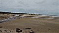
 Stream on Brandon Strand - geograph.org.uk - 4659846.jpg 640 × 480; 77 KB
-
 Stream on Mangerton Mountain - geograph.org.uk - 458002.jpg 427 × 640; 124 KB
-
 Sunlight-6119, Dingle Peninsula, Co. Kerry, Ireland.jpg 1,920 × 1,080; 573 KB
-
 Sunlight-6124, Dingle Peninsula, Co. Kerry, Ireland.jpg 1,920 × 1,080; 596 KB
-
 Sunset-3543, Dingle Peninsula, Co. Kerry, Ireland.jpg 1,920 × 1,080; 475 KB
-
 Sunset-3695, Dingle Peninsula, Co. Kerry, Ireland.jpg 1,920 × 1,080; 504 KB
-
 Sunset-3715, Dingle Peninsula, Co. Kerry, Ireland.jpg 1,920 × 1,080; 442 KB
-
 Sunset-3724, Dingle Peninsula, Co. Kerry, Ireland.jpg 1,920 × 1,080; 486 KB
-
 Sunset-6478, Dingle Peninsula, Co. Kerry, Ireland.jpg 1,920 × 1,080; 540 KB
-
 Tidal Estuary-3614, Tralee Bay, Co. Kerry, Ireland.jpg 5,184 × 3,888; 3.02 MB
-
 Tidal Estuary-3616, Tralee Bay, Co. Kerry, Ireland.jpg 5,184 × 3,888; 3.43 MB
-
 Tidal River-6893, Dingle Peninsula, Co. Kerry, Ireland.jpg 1,920 × 1,080; 741 KB
-
 Tracks-4048, Dingle Peninsula, Co. Kerry, Ireland.jpg 1,920 × 1,080; 733 KB
-
 Tracks-4061, Dingle Peninsula, Co. Kerry, Ireland.jpg 1,920 × 1,080; 688 KB
-
 Trees-5607, Dingle Peninsula, Co. Kerry, Ireland.jpg 1,920 × 1,080; 521 KB
-
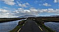
 Viaduct-2219, Dingle Peninsula, Co. Kerry, Ireland.jpg 1,920 × 1,080; 549 KB
-
 Village-3130, Dingle Peninsula, Co. Kerry, Ireland.jpg 5,184 × 3,888; 5.55 MB
-
 Village-3436, Dingle Peninsula, Co. Kerry, Ireland.jpg 4,713 × 3,808; 5.26 MB
-
 Walker-5769, Dingle Peninsula, Co. Kerry, Ireland.jpg 1,920 × 1,080; 406 KB
-
 Wild Geese-2781, Dingle Peninsula, Co. Kerry, Ireland.jpg 5,184 × 3,888; 3.05 MB
-
 Wild Geese-8242, Tralee Bay, Co. Kerry, Ireland.jpg 1,920 × 1,080; 409 KB
-
 Wild Geese-8384, Tralee Bay, Co. Kerry, Ireland.jpg 1,920 × 1,080; 340 KB


