Category:Street signs in the London Borough of Barnet

Media in category "Street signs in the London Borough of Barnet"
The following 76 files are in this category, out of 76 total.
-
 3 Oceans Bar and Restaurant, North Finchley, N12 (5970697181).jpg 3,708 × 2,472; 3.32 MB
-
 A407, Cricklewood Lane - geograph.org.uk - 1386115.jpg 427 × 640; 142 KB
-
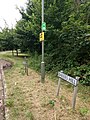 Bakers Hill and London Loop sign.jpg 3,456 × 4,608; 5.16 MB
-
 Birkbeck Road - geograph.org.uk - 1750528.jpg 1,600 × 1,059; 667 KB
-
 Bittacy Close, London NW7 - geograph.org.uk - 2734039.jpg 4,320 × 3,240; 4.33 MB
-
 Briar Close - geograph.org.uk - 614659.jpg 640 × 427; 140 KB
-
 Brunswick Boyz - geograph.org.uk - 1332851.jpg 640 × 427; 177 KB
-
 Brunswick Park Gardens, London N11 - geograph.org.uk - 931216.jpg 640 × 426; 134 KB
-
 Byng Road sign - geograph.org.uk - 5023339.jpg 640 × 520; 118 KB
-
 Cat Hill sign, East Barnet.JPG 4,000 × 3,000; 4.07 MB
-
 Cinderella Path.jpg 3,264 × 2,448; 2.72 MB
-
 Corner Shop, Alston Road - geograph.org.uk - 1577810.jpg 640 × 405; 153 KB
-
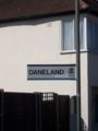 Daneland.jpg 1,932 × 2,576; 496 KB
-
 Dollis Brook - geograph.org.uk - 218921.jpg 640 × 480; 151 KB
-
 Downway or Summers Lane - geograph.org.uk - 217378.jpg 640 × 480; 89 KB
-
 Etchingham Park Road, London N3 - geograph.org.uk - 1151709.jpg 640 × 480; 103 KB
-
 Gallants Farm Road - geograph.org.uk - 1728657.jpg 1,600 × 1,093; 600 KB
-
 George Crescent, Colney Hatch - geograph.org.uk - 910192.jpg 640 × 480; 63 KB
-
 Golders Green.jpg 2,997 × 2,448; 1.05 MB
-
 Great North Road sign.jpg 3,264 × 2,448; 2.83 MB
-
 Gruneisen Road, Finchley.jpg 4,608 × 3,456; 2.8 MB
-
 Heatherton Terrace and Squires Lane - geograph.org.uk - 580657.jpg 640 × 480; 101 KB
-
 Heathgate street sign, London NW11.jpg 3,264 × 2,448; 1.7 MB
-
 Hoop Lane sign on Golders Green Road, London NW11.jpg 3,264 × 2,448; 768 KB
-
 Interesting old street name sign for Knoll Drive - geograph.org.uk - 3670006.jpg 1,600 × 1,200; 683 KB
-
 Interesting old street name sign for Knoll Drive - geograph.org.uk - 3670009.jpg 1,600 × 1,200; 664 KB
-
 Kenwood Close - geograph.org.uk - 1005679.jpg 640 × 427; 161 KB
-
 Kitchener road sign - geograph.org.uk - 228346.jpg 640 × 480; 105 KB
-
 Kitchener Road sign old style - geograph.org.uk - 5883279.jpg 640 × 309; 66 KB
-
 Kitchener Road signs new style - geograph.org.uk - 5883280.jpg 640 × 537; 84 KB
-
 Lawrence Campe Almshouses 07.JPG 4,000 × 3,000; 4.32 MB
-
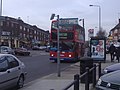 London Buses route 32 Colindale.jpg 1,600 × 1,200; 558 KB
-
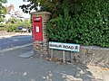 Manor Road, Chipping Barnet.jpg 4,000 × 3,000; 5.44 MB
-
 New Barnet, New Southgate, Enfield sign in East Barnet.JPG 3,000 × 4,000; 4.08 MB
-
 Oak Lane - geograph.org.uk - 193282.jpg 480 × 640; 127 KB
-
 Old sign for Hampden Square shop numbers - geograph.org.uk - 3673408.jpg 1,709 × 1,280; 703 KB
-
 Old sign for Midland Terrace, NW2 - geograph.org.uk - 2577166.jpg 640 × 480; 83 KB
-
 Old wooden road name - geograph.org.uk - 4495968.jpg 2,304 × 1,728; 932 KB
-
 One Man and His Dog - geograph.org.uk - 973807.jpg 640 × 494; 184 KB
-
 Richmond Road, Lyonsdown 01.JPG 4,000 × 3,000; 4.38 MB
-
 Road sign for Hampden Way - geograph.org.uk - 3669476.jpg 1,709 × 1,280; 827 KB
-
 Ruskin Close, Hampstead Garden Suburb.jpg 3,264 × 2,448; 4.49 MB
-
 Sign for Brent View Road, NW4 - geograph.org.uk - 2786136.jpg 640 × 480; 35 KB
-
 Sign for Elliot Road, NW4 - geograph.org.uk - 2786040.jpg 640 × 480; 97 KB
-
 Sign for Friars Walk, including house numbers - geograph.org.uk - 3669846.jpg 1,600 × 1,200; 640 KB
-
 Sign for Friars Walk, including house numbers - geograph.org.uk - 3669851.jpg 1,550 × 1,130; 724 KB
-
 Sign for Glebe Crescent, NW4 - geograph.org.uk - 2778332.jpg 640 × 480; 72 KB
-
 Sign for Hampden Square - geograph.org.uk - 3669480.jpg 2,560 × 1,920; 1.13 MB
-
 Sign for Herbert Road, NW4 - geograph.org.uk - 2786152.jpg 640 × 480; 92 KB
-
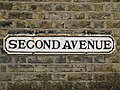 Sign for Second Avenue, NW4 - geograph.org.uk - 2778300.jpg 640 × 480; 107 KB
-
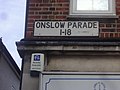 Sign for shop number directions on Onslow Parade - geograph.org.uk - 3673409.jpg 1,600 × 1,200; 515 KB
-
 Signs Galore - geograph.org.uk - 441369.jpg 480 × 640; 187 KB
-
 South end of Nesbitts Alley, Chipping Barnet.JPG 4,000 × 3,000; 4.36 MB
-
 Stanley Road - geograph.org.uk - 855715.jpg 640 × 427; 210 KB
-
 Station Road, Edgware - geograph.org.uk - 251415.jpg 640 × 480; 104 KB
-
 Street Furniture on The High Road - geograph.org.uk - 1090799.jpg 427 × 640; 173 KB
-
 Street name with numbers on Oak Way, Southgate - geograph.org.uk - 3673406.jpg 1,530 × 1,100; 761 KB
-
 Street name with numbers on Oak Way, Southgate - geograph.org.uk - 3673407.jpg 1,548 × 1,128; 871 KB
-
 Street sign - North Crescent - geograph.org.uk - 3926355.jpg 1,250 × 642; 628 KB
-
 Street sign, Brownlow Road N3 - geograph.org.uk - 2076568.jpg 640 × 480; 78 KB
-
 Street sign, Coleridge Road N12 - geograph.org.uk - 2081335.jpg 640 × 480; 56 KB
-
 Street sign, College Terrace N3 - geograph.org.uk - 2039006.jpg 640 × 480; 77 KB
-
 Street sign, Crewys Road NW2 - geograph.org.uk - 2081970.jpg 640 × 480; 52 KB
-
 Street sign, Derby Avenue N12 - geograph.org.uk - 2081345.jpg 640 × 480; 69 KB
-
 Street sign, Falkland Avenue N3 - geograph.org.uk - 2076467.jpg 640 × 480; 82 KB
-
 Street sign, Hillcourt Avenue N12 - geograph.org.uk - 2081094.jpg 640 × 480; 91 KB
-
 Street sign, Maurice Walk NW11 - geograph.org.uk - 2705315.jpg 640 × 480; 130 KB
-
 Street sign, Seymour Road N3 - geograph.org.uk - 2076535.jpg 640 × 480; 85 KB
-
 Street sign, Woodberry Grove N12 - geograph.org.uk - 2081367.jpg 640 × 480; 70 KB
-

-
 Trinity Church, Nether Street - geograph.org.uk - 992978.jpg 640 × 444; 128 KB
-
 Trinity Road N2 - geograph.org.uk - 158006.jpg 640 × 480; 77 KB
-
 Tudor Road, Barnet - geograph.org.uk - 1659603.jpg 640 × 480; 120 KB
-
 Victoria Avenue, New Barnet (1).jpg 4,000 × 3,000; 2.12 MB
-
 Well Approach sign with Barnet Physic Well.jpg 4,032 × 3,024; 1.75 MB
-
 Ye olde Warwick - panoramio.jpg 5,074 × 3,382; 10.54 MB
.jpg)


.jpg)

