Category:Streets in Esperance, Western Australia
English: Streets, roads and other thoroughfares in Esperance, Western Australia
Subcategories
This category has the following 3 subcategories, out of 3 total.
Media in category "Streets in Esperance, Western Australia"
The following 14 files are in this category, out of 14 total.
-
 Bandy Creek - Daw Dr looking W with crossing sign.jpg 3,264 × 2,448; 3.05 MB
-
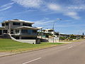 Castletown - Houses on Quays 2.jpg 3,264 × 2,448; 1.83 MB
-
 Castletown E - Castletown Quays looking W from end.jpg 3,264 × 2,448; 2.11 MB
-
 Castletown E - Chaplin Street looking N.jpg 3,264 × 2,448; 1.92 MB
-
 Castletown E - Chaplin Street looking S.jpg 3,264 × 2,448; 2.27 MB
-
 Castletown S - Goldfields Road looking N near YHA 1.jpg 3,264 × 2,448; 2.8 MB
-
 Castletown S - Goldfields Road looking N near YHA 2.jpg 3,264 × 2,448; 2.06 MB
-
 Esperance W - Harbour Road looking S.jpg 3,264 × 2,448; 2.47 MB
-
 Esperance W - Pink Lake Road curves.jpg 3,264 × 2,448; 2.44 MB
-
 Norseman Rd Chadwick near Shelden.jpg 3,264 × 2,448; 1.91 MB
-
 Norseman Rd N past Jetty Arts Centre.jpg 3,264 × 2,448; 1.84 MB
-
 Nulsen - Sims Street entering suburb from N.jpg 3,264 × 2,448; 2.54 MB
-
 Sinclair - entry at Freeman St.jpg 3,264 × 2,448; 2.41 MB
-
 Sinclair - Johns Street.jpg 3,264 × 2,448; 2.59 MB


