Category:Streets in Falkirk council area
Subcategories
This category has the following 2 subcategories, out of 2 total.
F
O
- Ochil View (3 F)
Media in category "Streets in Falkirk council area"
The following 43 files are in this category, out of 43 total.
-
 Airth Mercat Cross.jpg 640 × 480; 240 KB
-
 All in line - geograph.org.uk - 1223530.jpg 640 × 447; 96 KB
-
 Bin day, Polmont - geograph.org.uk - 85187.jpg 640 × 480; 67 KB
-
 Blackness Village - geograph.org.uk - 1185373.jpg 569 × 640; 75 KB
-
 California Über Alles. - geograph.org.uk - 85325.jpg 640 × 480; 61 KB
-
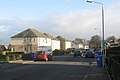
 Campbell Drive in Larbert - geograph.org.uk - 1261796.jpg 640 × 480; 66 KB
-
 Canal Street - geograph.org.uk - 633946.jpg 640 × 424; 57 KB
-
 Carronshore Road - geograph.org.uk - 199215.jpg 640 × 480; 93 KB
-
 Castlehill - geograph.org.uk - 1475736.jpg 640 × 480; 96 KB
-
 Castlehill - geograph.org.uk - 1475757.jpg 640 × 480; 98 KB
-
 Centre of Blackness - geograph.org.uk - 1122518.jpg 640 × 480; 65 KB
-
 Church Road, California - geograph.org.uk - 245826.jpg 640 × 480; 66 KB
-
 Church Street, Stenhousemuir - geograph.org.uk - 129749.jpg 640 × 480; 92 KB
-
-
 Falkirk bus on Merville Crescent, California - geograph.org.uk - 3081895.jpg 3,264 × 2,448; 3.74 MB
-
 FalkirkCentre.jpg 640 × 480; 304 KB
-
 Glen Village - geograph.org.uk - 1462162.jpg 640 × 480; 79 KB
-
 Grangepans area - geograph.org.uk - 551855.jpg 640 × 480; 54 KB
-
 High St, Slamannan - geograph.org.uk - 985394.jpg 640 × 480; 39 KB
-
 La Porte Precinct - geograph.org.uk - 542536.jpg 640 × 480; 84 KB
-
 Larbert Broomage.JPG 3,072 × 2,304; 2.19 MB
-
 LarbertMainStreet.jpg 640 × 480; 278 KB
-
 Laurieston - geograph.org.uk - 112186.jpg 640 × 428; 47 KB
-

-
 Main Street Bo'ness - geograph.org.uk - 903476.jpg 640 × 480; 89 KB
-
 Main Street Skinflats - geograph.org.uk - 697095.jpg 640 × 480; 60 KB
-
 Mamre Drive, California - geograph.org.uk - 1040561.jpg 640 × 480; 60 KB
-
 Mamre Drive, California - geograph.org.uk - 245821.jpg 640 × 480; 61 KB
-
 Merville Crescent, California - geograph.org.uk - 1040521.jpg 640 × 480; 80 KB
-
 Merville Crescent, California - geograph.org.uk - 1040527.jpg 640 × 480; 73 KB
-
 Merville Terrace, California - geograph.org.uk - 1040565.jpg 640 × 480; 61 KB
-
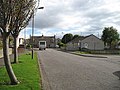
 Montford Close - geograph.org.uk - 1464420.jpg 640 × 475; 122 KB
-
 Princes Street, California - geograph.org.uk - 245811.jpg 640 × 480; 63 KB
-
 Queens Drive California - geograph.org.uk - 1040473.jpg 640 × 480; 65 KB
-
 Queens Drive, California - geograph.org.uk - 245818.jpg 640 × 480; 70 KB
-
 Register Street - geograph.org.uk - 551835.jpg 640 × 497; 53 KB
-

-
 Skinflats - geograph.org.uk - 199490.jpg 640 × 480; 63 KB
-
 Slamannan - geograph.org.uk - 138655.jpg 640 × 480; 189 KB
-
 Snowy brae - geograph.org.uk - 1634744.jpg 640 × 427; 62 KB
-
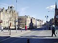
 Union Street - geograph.org.uk - 904496.jpg 640 × 415; 75 KB
-
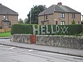
 Wellpark Terrace, Bonnybridge - geograph.org.uk - 986797.jpg 640 × 480; 65 KB
-
 Worn Stone at Gibson's Wynd - geograph.org.uk - 530324.jpg 480 × 640; 94 KB


