Category:Streets in Shadwell, West Yorkshire
Subcategories
This category has the following 7 subcategories, out of 7 total.
Media in category "Streets in Shadwell, West Yorkshire"
The following 38 files are in this category, out of 38 total.
-
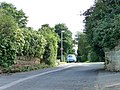
 A58 Wetherby Road at The Wellington public house - geograph.org.uk - 6174980.jpg 1,024 × 770; 150 KB
-
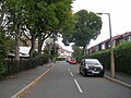
 Allerton Avenue - Street Lane - geograph.org.uk - 1446864.jpg 640 × 499; 242 KB
-
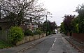
 Ayresome Terrace - East Moor Road - geograph.org.uk - 1446615.jpg 640 × 480; 243 KB
-
 Ayresome Terrace - Street Lane - geograph.org.uk - 1446597.jpg 640 × 480; 223 KB
-
 Bentcliffe Avenue - Bentcliffe Lane - geograph.org.uk - 1446870.jpg 640 × 480; 324 KB
-
 Bideford Avenue - Kedleston Road - geograph.org.uk - 1446587.jpg 640 × 480; 216 KB
-
 Brandon Close - Ring Road, Shadwell - geograph.org.uk - 3984369.jpg 640 × 480; 72 KB
-
 Colliers Lane, Shadwell - geograph.org.uk - 2579878.jpg 640 × 426; 75 KB
-
 Crofton Rise, Shadwell - geograph.org.uk - 3046054.jpg 1,024 × 768; 127 KB
-

-
 Dawlish Row - Skelton Terrace - geograph.org.uk - 1238312.jpg 640 × 480; 226 KB
-
 Dawlish Street - York Road - geograph.org.uk - 683792.jpg 640 × 434; 53 KB
-
 Dawlish Terrace - Ivy Avenue - geograph.org.uk - 1238443.jpg 640 × 454; 169 KB
-
 Emville Avenue - Shadwell Lane - geograph.org.uk - 791293.jpg 640 × 448; 48 KB
-
 Gateland Lane - geograph.org.uk - 2579883.jpg 640 × 443; 67 KB
-
 Gateland Lane, Shadwell - geograph.org.uk - 3047008.jpg 1,024 × 768; 173 KB
-
 Old Brandon Lane, Shadwell - geograph.org.uk - 3047016.jpg 998 × 749; 115 KB
-
 St Alban Road - geograph.org.uk - 563178.jpg 640 × 396; 32 KB
-
 Templenewsam Road - geograph.org.uk - 569171.jpg 640 × 378; 23 KB
-
 Whinmoor Lane - geograph.org.uk - 3047020.jpg 1,024 × 768; 201 KB
-
 Bentcliffe Drive - Street Lane - geograph.org.uk - 1446795.jpg 640 × 480; 300 KB
-
 Bentcliffe Gardens - Talbot Avenue - geograph.org.uk - 1446789.jpg 640 × 480; 223 KB
-
 Bentcliffe Grove - Bentcliffe Avenue - geograph.org.uk - 1446876.jpg 640 × 480; 289 KB
-
 Bentcliffe Grove - Lidgett Lane - geograph.org.uk - 1447457.jpg 640 × 480; 284 KB
-
 Bentcliffe Lane - Lidgett Lane - geograph.org.uk - 1447465.jpg 640 × 480; 305 KB
-
 Bentcliffe Lane - Street Lane - geograph.org.uk - 1446859.jpg 640 × 480; 270 KB
-
 Bentcliffe Mount - Bentcliffe Avenue - geograph.org.uk - 1447447.jpg 640 × 480; 270 KB
-
 Bideford Avenue - Street Lane - geograph.org.uk - 1446590.jpg 640 × 480; 275 KB
-
 Church Gardens - Moor Town - geograph.org.uk - 586298.jpg 640 × 410; 41 KB
-
 Coal Road - geograph.org.uk - 140127.jpg 640 × 480; 94 KB
-
 Davies Avenue - Old Park Road - geograph.org.uk - 1439938.jpg 640 × 480; 272 KB
-
 Fieldhouse Drive - geograph.org.uk - 609631.jpg 640 × 436; 28 KB
-
 Halton Moor Avenue - geograph.org.uk - 569191.jpg 640 × 389; 30 KB
-
 Holywell Lane, Shadwell. - geograph.org.uk - 217464.jpg 640 × 480; 77 KB
-
 Lyme Chase - geograph.org.uk - 563145.jpg 640 × 428; 69 KB
-
 Oak Crescent - geograph.org.uk - 569170.jpg 640 × 379; 21 KB
-
 Selby Avenue - geograph.org.uk - 569203.jpg 640 × 358; 22 KB
-
 Temple Court - geograph.org.uk - 569166.jpg 640 × 424; 24 KB


