Category:Streets in the London Borough of Harrow

Wikimedia category | |||||
| Upload media | |||||
| Instance of | |||||
|---|---|---|---|---|---|
| Category combines topics | |||||
| |||||
Subcategories
This category has the following 17 subcategories, out of 17 total.
B
- Burnt Oak Broadway (29 F)
C
E
- Edgware High Street (9 F)
G
H
- Harrow on the Hill High Street (37 F)
K
- Kenton Road (14 F)
L
P
R
S
- Sudbury Hill (street) (3 F)
U
W
- Watford Road, Wembley (13 F)
Media in category "Streets in the London Borough of Harrow"
The following 200 files are in this category, out of 427 total.
(previous page) (next page)-
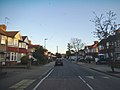
 340 bus stopped on Stanmore Broadway - geograph.org.uk - 3151538.jpg 2,048 × 1,536; 1.46 MB
-
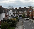
 A410 Uxbridge Road - geograph.org.uk - 5673495.jpg 640 × 480; 156 KB
-
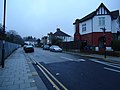
 Acacia Close, Harrow Weald - geograph.org.uk - 2279408.jpg 1,600 × 1,200; 1.36 MB
-
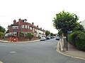
 Acacia Close, Harrow Weald - geograph.org.uk - 2279411.jpg 1,600 × 1,200; 766 KB
-
 Albury Drive, Pinner - geograph.org.uk - 2209667.jpg 1,600 × 1,200; 540 KB
-
 Albury Drive, Pinner - geograph.org.uk - 2209669.jpg 1,600 × 1,200; 572 KB
-
 Alexandra Avenue - geograph.org.uk - 2228744.jpg 640 × 439; 89 KB
-
 Alexandra Avenue from corner of Rayner's Lane - geograph.org.uk - 2212824.jpg 1,600 × 1,200; 556 KB
-
 Alexandra Avenue from corner of Rayner's Lane - geograph.org.uk - 2212828.jpg 1,600 × 1,200; 712 KB
-
 Alexandra Avenue, South Harrow - geograph.org.uk - 2280795.jpg 1,600 × 1,200; 678 KB
-
 Alexandra Avenue, South Harrow - geograph.org.uk - 2453818.jpg 4,320 × 3,240; 4.01 MB
-
 Alicia Avenue, Kenton - geograph.org.uk - 3179755.jpg 4,320 × 3,240; 3.82 MB
-
 Alma Row, Harrow Weald - geograph.org.uk - 3808016.jpg 2,304 × 1,728; 851 KB
-
 Almond Way, Harrow Weald - geograph.org.uk - 4223055.jpg 2,304 × 1,728; 851 KB
-
 Along Canons Drive - geograph.org.uk - 6015286.jpg 1,024 × 683; 498 KB
-
 Along Pangbourne Drive - geograph.org.uk - 6015293.jpg 1,024 × 683; 510 KB
-
 Anmersh Grove, Little Stanmore - geograph.org.uk - 4740807.jpg 2,304 × 1,728; 802 KB
-
 Artillery Place, Harrow Weald - geograph.org.uk - 3807902.jpg 2,304 × 1,728; 787 KB
-
 Avenue of trees on Stilwell Drive, Stanmore - geograph.org.uk - 4151148.jpg 2,206 × 1,588; 1.2 MB
-
 Beaufort Avenue, Wealdstone - geograph.org.uk - 3177622.jpg 4,320 × 3,240; 4.04 MB
-
 Bellfield Avenue, Harrow Weald - geograph.org.uk - 3807932.jpg 2,304 × 1,728; 824 KB
-
 Belmont Lane, Stanmore - geograph.org.uk - 4002093.jpg 2,304 × 1,728; 831 KB
-
 Belmont Lane, Stanmore - geograph.org.uk - 4002094.jpg 2,304 × 1,728; 824 KB
-
 Bend on Belmont Lane, Stanmore - geograph.org.uk - 4001839.jpg 2,304 × 1,728; 2.38 MB
-
 Blenheim Road, Harrow - geograph.org.uk - 4201261.jpg 2,304 × 1,728; 858 KB
-
 Blenheim Road, North Harrow - geograph.org.uk - 4223259.jpg 2,304 × 1,728; 1.16 MB
-
 Blenheim Road, North Harrow - geograph.org.uk - 4648219.jpg 640 × 480; 87 KB
-
 Blenheim Road, West Harrow - geograph.org.uk - 2880852.jpg 640 × 480; 149 KB
-
 Bouverie Rd - geograph.org.uk - 5435588.jpg 640 × 553; 73 KB
-
 Bouverie Road, West Harrow - geograph.org.uk - 2213693.jpg 640 × 480; 51 KB
-
 Bowls Close, Stanmore - geograph.org.uk - 4151081.jpg 2,304 × 1,728; 849 KB
-
 Boxtree Road, Harrow Weald - geograph.org.uk - 3177831.jpg 4,320 × 3,240; 4.83 MB
-
 Boxtree Road, Harrow Weald - geograph.org.uk - 3868325.jpg 640 × 360; 75 KB
-
 Bradenham Road, Kenton - geograph.org.uk - 3094456.jpg 1,594 × 1,156; 426 KB
-
 Bramble Close, Canons Park - geograph.org.uk - 4170028.jpg 640 × 465; 69 KB
-
 Brancker Road, Kenton - geograph.org.uk - 4773675.jpg 2,304 × 1,728; 937 KB
-
 Brancker Road, Kenton - geograph.org.uk - 4773676.jpg 2,304 × 1,728; 826 KB
-
 Bridge Street - geograph.org.uk - 3406520.jpg 2,592 × 1,728; 1.26 MB
-
 Bridge Street, Pinner - geograph.org.uk - 3179687.jpg 4,320 × 3,240; 3.92 MB
-
 Bridge Street, Pinner - geograph.org.uk - 3179689.jpg 4,320 × 3,240; 3.92 MB
-
 Bridge Street, Pinner - geograph.org.uk - 3406531.jpg 2,592 × 1,728; 1.39 MB
-
 Brightwen Grove, Stanmore - geograph.org.uk - 5527824.jpg 2,304 × 1,728; 819 KB
-
 Brightwen Grove, Stanmore - geograph.org.uk - 5527826.jpg 2,304 × 1,728; 1.3 MB
-
 Brooke Avenue - geograph.org.uk - 1141535.jpg 640 × 480; 55 KB
-
 Brooke Avenue, South Harrow - geograph.org.uk - 4250126.jpg 2,268 × 1,680; 1.16 MB
-
 Brooke Avenue, South Harrow - geograph.org.uk - 4250131.jpg 2,194 × 1,568; 989 KB
-
 Buckingham Road, Canons Park - geograph.org.uk - 3868350.jpg 640 × 360; 62 KB
-
 Buckingham Road, Little Stanmore - geograph.org.uk - 4421392.jpg 2,304 × 1,728; 829 KB
-
 Butler Road, Harrow - geograph.org.uk - 4648272.jpg 640 × 480; 75 KB
-
 Camrose Avenue, Little Stanmore - geograph.org.uk - 4815757.jpg 2,228 × 1,622; 1.05 MB
-
 Canons Drive, Edgware - geograph.org.uk - 2244673.jpg 1,600 × 1,200; 556 KB
-
 Canons Park - Cornbury Road - geograph.org.uk - 2880721.jpg 640 × 480; 168 KB
-

-
 Canons Park - Whitchurch Lane - geograph.org.uk - 2880709.jpg 640 × 480; 184 KB
-
 Canons Park, Whitchurch Lane - geograph.org.uk - 92431.jpg 640 × 425; 85 KB
-
 Caulfield Gardens, Pinner Green - geograph.org.uk - 4757512.jpg 2,304 × 1,728; 957 KB
-
 Charmian Avenue, Little Stanmore - geograph.org.uk - 4748952.jpg 2,304 × 1,728; 848 KB
-
 Chenduit Way, Stanmore - geograph.org.uk - 3177796.jpg 4,320 × 3,240; 4.04 MB
-
 Cheyneys Avenue, Stanmore - geograph.org.uk - 5210388.jpg 1,280 × 960; 661 KB
-
 Cheyneys Avenue, Stanmore - geograph.org.uk - 5210421.jpg 1,280 × 960; 590 KB
-
 Chicheley Road, Harrow Weald - geograph.org.uk - 3808143.jpg 2,304 × 1,728; 814 KB
-
 Christchurch Avenue - geograph.org.uk - 4782054.jpg 640 × 480; 140 KB
-
 Christchurch Avenue, Harrow - geograph.org.uk - 5285181.jpg 3,264 × 2,448; 1.89 MB
-
 Christchurch Avenue, Harrow - geograph.org.uk - 5285183.jpg 3,170 × 2,318; 2.21 MB
-
 Christchurch Avenue, Kenton - geograph.org.uk - 3094472.jpg 1,600 × 1,200; 686 KB
-
 Christchurch Avenue, Wealdstone - geograph.org.uk - 3177586.jpg 4,320 × 3,240; 3.97 MB
-
 Christchurch Avenue, Wealdstone - geograph.org.uk - 3177589.jpg 4,320 × 3,240; 4.15 MB
-
 Christchurch Avenue, Wealdstone - geograph.org.uk - 3177593.jpg 4,320 × 3,240; 4.04 MB
-
 Christchurch Gardens, Wealdstone - geograph.org.uk - 3177590.jpg 4,320 × 3,240; 4.26 MB
-
 Church Hill passing through Harrow School - geograph.org.uk - 5707146.jpg 1,600 × 1,064; 471 KB
-
 Church Lane - geograph.org.uk - 3405240.jpg 1,728 × 2,592; 1.25 MB
-
 Clamp Hill, Stanmore - geograph.org.uk - 2272264.jpg 1,600 × 1,200; 561 KB
-
 Clamp Hill, Stanmore - geograph.org.uk - 2272266.jpg 1,600 × 1,200; 562 KB
-
 Colchester Drive - geograph.org.uk - 4856808.jpg 1,024 × 768; 117 KB
-
 College Hill Road, Harrow Weald - geograph.org.uk - 2228423.jpg 1,600 × 1,200; 652 KB
-
 College Road - geograph.org.uk - 2226674.jpg 640 × 433; 86 KB
-
 College Road, Harrow - geograph.org.uk - 2284252.jpg 4,320 × 3,240; 3.81 MB
-
 Corbins Lane, South Harrow - geograph.org.uk - 2453791.jpg 4,320 × 3,240; 4.24 MB
-
 Cornwall Road, Hatch End - geograph.org.uk - 371642.jpg 640 × 479; 94 KB
-
 Cotman Gardens, Edgware - geograph.org.uk - 1304910.jpg 640 × 480; 78 KB
-
 Courtenay Avenue - geograph.org.uk - 2881160.jpg 640 × 480; 168 KB
-
 Courtenay Avenue - geograph.org.uk - 5673281.jpg 640 × 480; 124 KB
-
 Courtenay Avenue - geograph.org.uk - 5673291.jpg 640 × 480; 120 KB
-
 Courtenay Avenue at Langton Road - geograph.org.uk - 2881161.jpg 640 × 480; 162 KB
-
 Courtenay Avenue, Harrow Weald - geograph.org.uk - 3808134.jpg 2,304 × 1,728; 809 KB
-
 Crowshott Avenue, Little Stanmore - geograph.org.uk - 4748959.jpg 1,684 × 2,272; 1.59 MB
-
 Culver Grove, Little Stanmore - geograph.org.uk - 4001920.jpg 2,196 × 1,572; 1.28 MB
-
 Culver Grove, Little Stanmore - geograph.org.uk - 4743746.jpg 2,304 × 1,728; 880 KB
-
 Cypress Road, Harrow Weald - geograph.org.uk - 3807622.jpg 2,304 × 1,728; 825 KB
-
 Darcy Drive, Kenton - geograph.org.uk - 4773230.jpg 2,304 × 1,728; 834 KB
-
 Devonshire Road, Hatch End - geograph.org.uk - 371650.jpg 640 × 479; 101 KB
-
 Devonshire Road, Hatch End - geograph.org.uk - 371656.jpg 640 × 455; 84 KB
-
 Devonshire Road, Hatch End - geograph.org.uk - 4757514.jpg 2,304 × 1,728; 835 KB
-
 Donnefield Avenue, Canons Park - geograph.org.uk - 4169996.jpg 640 × 473; 60 KB
-
 Dorchester Avenue, Harrow - geograph.org.uk - 4648227.jpg 640 × 480; 70 KB
-
 Dorchester Avenue, North Harrow - geograph.org.uk - 4223243.jpg 2,304 × 1,728; 856 KB
-
 Drury Road, West Harrow - geograph.org.uk - 2213701.jpg 4,320 × 3,240; 4.07 MB
-
 Eastcote Lane - geograph.org.uk - 2226566.jpg 640 × 427; 68 KB
-
 Eastcote Lane, South Harrow - geograph.org.uk - 3751157.jpg 2,304 × 1,728; 822 KB
-
 Eastcote Lane, South Harrow - geograph.org.uk - 99125.jpg 640 × 480; 86 KB
-
 Eastcote Road, Pinner - geograph.org.uk - 5981597.jpg 4,555 × 3,207; 2.18 MB
-
 Edgware, Camrose Avenue - geograph.org.uk - 92428.jpg 640 × 425; 77 KB
-

-
 Edgware, Mollison Way - geograph.org.uk - 92441.jpg 640 × 425; 112 KB
-
 Edgware, Whitchurch Lane - geograph.org.uk - 1819939.jpg 640 × 480; 76 KB
-
 Elliott Road, Stanmore - geograph.org.uk - 3177817.jpg 4,320 × 3,240; 4.73 MB
-
 Elliott Road, Stanmore - geograph.org.uk - 4424815.jpg 1,600 × 1,067; 795 KB
-
 Elm Hatch, Hatch End - geograph.org.uk - 2210880.jpg 1,600 × 1,200; 476 KB
-
 Elm Park Road - geograph.org.uk - 1489780.jpg 640 × 421; 236 KB
-
 Elm Park, Stanmore - geograph.org.uk - 4658079.jpg 640 × 480; 54 KB
-
 Elmwood Avenue, Kenton - geograph.org.uk - 2246058.jpg 1,600 × 1,200; 531 KB
-
 Embry Way, Stanmore - geograph.org.uk - 2241796.jpg 1,600 × 1,200; 737 KB
-
 Embry Way, Stanmore - geograph.org.uk - 2241803.jpg 1,600 × 1,200; 571 KB
-
 Entering Stanmore, Marsh Lane - geograph.org.uk - 4170067.jpg 640 × 480; 97 KB
-
 Evelyn Drive, Pinner - geograph.org.uk - 2209681.jpg 1,600 × 1,200; 473 KB
-
 Felden Close in Spring - geograph.org.uk - 92853.jpg 640 × 480; 120 KB
-
 Football Road, Harrow School - geograph.org.uk - 3649396.jpg 1,200 × 1,600; 884 KB
-

-
 George Gange Way (A409) at night.jpg 6,086 × 3,423; 5.23 MB
-
 George V Avenue, North Harrow - geograph.org.uk - 5961156.jpg 1,280 × 960; 443 KB
-
 George V Avenue.jpg 1,600 × 1,200; 588 KB
-
 Glanleam Road, Stanmore - geograph.org.uk - 2244678.jpg 1,600 × 1,200; 554 KB
-
 Glebe Avenue, Kenton - geograph.org.uk - 4773227.jpg 2,238 × 1,636; 1.29 MB
-
 Glebe Lane, Kenton - geograph.org.uk - 4773225.jpg 2,304 × 1,728; 918 KB
-
 Glenalmond Road, Kenton - geograph.org.uk - 4773226.jpg 2,200 × 1,580; 986 KB
-
 Gordon Avenue, Stanmore - geograph.org.uk - 2228276.jpg 1,600 × 1,200; 578 KB
-
 Gordon Avenue, Stanmore - geograph.org.uk - 2228285.jpg 1,600 × 1,200; 577 KB
-
 Granville Place, Pinner - geograph.org.uk - 3178511.jpg 4,320 × 3,240; 4.24 MB
-
 Green Lane, Stanmore - geograph.org.uk - 2457036.jpg 3,968 × 2,232; 1.21 MB
-
 Green Lane, Stanmore - geograph.org.uk - 4151089.jpg 2,300 × 1,722; 1.76 MB
-
 Green Lane, Stanmore - geograph.org.uk - 4151090.jpg 2,304 × 1,728; 824 KB
-
 Greenford Road, Sudbury Hill - geograph.org.uk - 2447471.jpg 4,320 × 3,240; 4.01 MB
-
 Greenhill Way, Harrow - geograph.org.uk - 1936337.jpg 959 × 1,280; 165 KB
-
 Greystoke Avenue, North Harrow - geograph.org.uk - 5967449.jpg 1,280 × 960; 534 KB
-
 Grosvenor Avenue, Harrow - geograph.org.uk - 2880848.jpg 640 × 480; 189 KB
-
 Grosvenor Avenue, Harrow - geograph.org.uk - 4648229.jpg 640 × 480; 87 KB
-
 Grosvenor Avenue, North Harrow - geograph.org.uk - 4223248.jpg 2,304 × 1,728; 856 KB
-
 Grove Hill, Harrow on the Hill - geograph.org.uk - 2667240.jpg 960 × 1,280; 235 KB
-
 Gyles Park, Stanmore - geograph.org.uk - 4658068.jpg 640 × 480; 62 KB
-
 Hamel Close, Kenton - geograph.org.uk - 4773679.jpg 2,304 × 1,728; 872 KB
-
 Hampden Road, Harrow Weald - geograph.org.uk - 3808266.jpg 2,304 × 1,728; 832 KB
-
 Hanselin Close, Stanmore - geograph.org.uk - 3177805.jpg 4,320 × 3,240; 4.75 MB
-
 Harrow - College Road (north side) - geograph.org.uk - 2880888.jpg 640 × 480; 179 KB
-
 Harrow - College Road (south side) - geograph.org.uk - 2880899.jpg 640 × 480; 145 KB
-
 Harrow on the Hill, The Old Etonian - geograph.org.uk - 103788.jpg 640 × 446; 142 KB
-
 Harrow on the Hill. Middlesex - geograph.org.uk - 363769.jpg 640 × 494; 116 KB
-
 Harrow School buildings - geograph.org.uk - 3396677.jpg 2,592 × 1,728; 1.28 MB
-
 Harrow School, Peterborough Road - geograph.org.uk - 3649438.jpg 1,600 × 1,200; 509 KB
-
 Harrow View, Harrow - geograph.org.uk - 2229809.jpg 1,600 × 1,200; 642 KB
-
 Harrow View, Wealdstone - geograph.org.uk - 2229864.jpg 1,600 × 1,200; 561 KB
-
 Harrow Weald High Street - geograph.org.uk - 1291377.jpg 640 × 478; 89 KB
-
 Harrow Weald High Street - geograph.org.uk - 2273990.jpg 1,600 × 1,200; 574 KB
-
 Harrow Weald, Boxtree Road - geograph.org.uk - 104626.jpg 640 × 480; 107 KB
-
 Harrow Weald, Boxtree Road - geograph.org.uk - 1163380.jpg 640 × 480; 88 KB
-
 Harrow Weald, Courtenay Avenue - geograph.org.uk - 77029.jpg 640 × 480; 90 KB
-
 Harrow Weald, Kenton Lane - geograph.org.uk - 104622.jpg 640 × 480; 120 KB
-
 Harrow Weald, The Green Way - geograph.org.uk - 77039.jpg 640 × 480; 86 KB
-
 Hatch End - Westfield Park - geograph.org.uk - 2881165.jpg 640 × 480; 181 KB
-
 Hatch End Broadway, Uxbridge Road - geograph.org.uk - 2210876.jpg 1,600 × 1,200; 507 KB
-
 Hatch End Broadway, Uxbridge Road - geograph.org.uk - 2210877.jpg 1,600 × 1,200; 602 KB
-
 Hatch End, Royston Park Road - geograph.org.uk - 77442.jpg 640 × 480; 149 KB
-
 Hatch End, The Avenue - geograph.org.uk - 103785.jpg 640 × 480; 149 KB
-
 Hawthorne Avenue - geograph.org.uk - 1704213.jpg 1,600 × 1,200; 625 KB
-
 Hawthorne Avenue, Kenton - geograph.org.uk - 2246066.jpg 1,600 × 1,200; 641 KB
-
 Headstone Lane - geograph.org.uk - 2881158.jpg 640 × 480; 162 KB
-
 Headstone Lane - geograph.org.uk - 3178089.jpg 4,320 × 3,240; 4.56 MB
-
 Headstone Lane - geograph.org.uk - 5626819.jpg 4,000 × 3,000; 4.93 MB
-
 Headstone Lane - geograph.org.uk - 5673196.jpg 640 × 480; 103 KB
-
 Headstone Lane, North Harrow - geograph.org.uk - 4223324.jpg 2,304 × 1,728; 1.4 MB
-
 Headstone, Harrow, Chantry Place - geograph.org.uk - 103783.jpg 640 × 480; 93 KB
-
 High Road, Harrow Weald - geograph.org.uk - 3177825.jpg 4,320 × 3,240; 3.8 MB
-
 High Road, Harrow Weald - geograph.org.uk - 3177826.jpg 4,320 × 3,240; 3.66 MB
-
 High Road, Harrow Weald - geograph.org.uk - 3178057.jpg 4,320 × 3,240; 3.56 MB
-
 High Road, Harrow Weald - geograph.org.uk - 3178058.jpg 4,320 × 3,240; 4.1 MB
-
 High Road, Harrow Weald - geograph.org.uk - 3808173.jpg 2,304 × 1,728; 814 KB
-
 High Street, Wealdstone (2) - geograph.org.uk - 234453.jpg 640 × 480; 108 KB
-
 High Street, Wealdstone - geograph.org.uk - 234286.jpg 640 × 480; 110 KB
-
 High Street, Wealdstone - geograph.org.uk - 3177582.jpg 4,320 × 3,240; 3.97 MB
-
 High Street, Wealdstone - geograph.org.uk - 3919248.jpg 1,600 × 1,056; 402 KB
-
 High Worple - geograph.org.uk - 3631315.jpg 4,608 × 3,456; 6.76 MB
-
 Honeypot Lane, Queensbury - geograph.org.uk - 99158.jpg 640 × 480; 114 KB
-
 Honeypot Lane, Stanmore - geograph.org.uk - 2241771.jpg 1,600 × 1,200; 588 KB
-
 Honeypot Lane, Stanmore - geograph.org.uk - 2272421.jpg 1,600 × 1,200; 535 KB
-
 Honister Gardens, Belmont - geograph.org.uk - 5285173.jpg 3,264 × 2,448; 2.77 MB
-
 Honister Place, Belmont - geograph.org.uk - 5285175.jpg 3,264 × 2,448; 2.1 MB
-
 Houses in Kenmore Road - geograph.org.uk - 936937.jpg 640 × 497; 102 KB
-
 Houses on Binyon Crescent, Stanmore - geograph.org.uk - 4151144.jpg 2,304 × 1,728; 828 KB
-
 Houses on Masefield Avenue, Stanmore - geograph.org.uk - 4151065.jpg 2,304 × 1,728; 845 KB
-
 Howard Road, Canons Park - geograph.org.uk - 4170041.jpg 640 × 478; 49 KB
-
 Howard Road, Canons Park - geograph.org.uk - 6070112.jpg 1,878 × 1,216; 1.22 MB
-
 Howard Road, Canons Park - geograph.org.uk - 6070114.jpg 1,920 × 1,280; 957 KB
-
 Imperial Close - geograph.org.uk - 3005394.jpg 640 × 480; 85 KB
-
 Imperial Drive, North Harrow - geograph.org.uk - 4223253.jpg 2,228 × 1,584; 1.09 MB
-
 Imperial Drive, North Harrow - geograph.org.uk - 4648212.jpg 640 × 480; 112 KB
-
 Irvine Avenue, Wealdstone - geograph.org.uk - 3177629.jpg 4,320 × 3,240; 4 MB
-
 Jellicoe Gardens, Stanmore - geograph.org.uk - 4424820.jpg 1,600 × 1,067; 460 KB
-
 Kenmore Avenue, Wealdstone - geograph.org.uk - 3177626.jpg 4,320 × 3,240; 3.83 MB
-
 Kenmore Road - geograph.org.uk - 936931.jpg 640 × 480; 88 KB
-
 Kenmore Road - Waghorn Road - geograph.org.uk - 936925.jpg 640 × 427; 80 KB
-
 Kenmore Road, Kenton - geograph.org.uk - 4773667.jpg 2,304 × 1,728; 853 KB


_at_night.jpg)


_-_geograph.org.uk_-_2880888.jpg)
_-_geograph.org.uk_-_2880899.jpg)


_-_geograph.org.uk_-_234453.jpg)


