Category:Strickland Ketel
civil parish in Cumbria, England, UK | |||||
| Upload media | |||||
| Instance of | |||||
|---|---|---|---|---|---|
| Location | South Lakeland, Cumbria, North West England, England | ||||
 | |||||
Subcategories
This category has the following 4 subcategories, out of 4 total.
B
- Bonning Gate (4 F)
- Bowston (9 F)
E
Media in category "Strickland Ketel"
The following 190 files are in this category, out of 190 total.
-
 A field of buttercups near Bowston - geograph.org.uk - 3516470.jpg 3,872 × 2,592; 4.46 MB
-
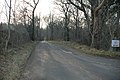
 A591 - geograph.org.uk - 1983487.jpg 640 × 427; 272 KB
-
 A591, Windermere Road - geograph.org.uk - 3384734.jpg 640 × 480; 421 KB
-
 A591-A5284 Junction - geograph.org.uk - 3384751.jpg 640 × 480; 424 KB
-
 An imposing gateway on Hollins Lane - geograph.org.uk - 2593259.jpg 4,592 × 3,056; 7.58 MB
-
 Approaching Bowston Farm - geograph.org.uk - 4902507.jpg 1,600 × 1,067; 612 KB
-
 Ashes Lane - Rather Heath - geograph.org.uk - 3409867.jpg 1,350 × 898; 253 KB
-
 Ashes Lane in the Woods on Rather Heath - geograph.org.uk - 4902480.jpg 1,600 × 1,067; 731 KB
-
 Bank End - geograph.org.uk - 2482421.jpg 640 × 480; 109 KB
-
 Bank End and the Kentmere fells - geograph.org.uk - 5155157.jpg 600 × 800; 128 KB
-

-
 Barn, Ellergreen Park - geograph.org.uk - 5110277.jpg 640 × 480; 453 KB
-
 Bowstone Weir - geograph.org.uk - 5110271.jpg 640 × 480; 545 KB
-
 Buildings by Bowston Bridge - geograph.org.uk - 2980187.jpg 4,320 × 3,240; 4.75 MB
-
 Burneside Cricket Club - geograph.org.uk - 5415538.jpg 1,600 × 988; 263 KB
-
 Burneside Football Club - geograph.org.uk - 3516569.jpg 3,872 × 2,592; 3.9 MB
-
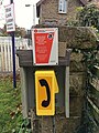 Burneside level crossing phone - geograph.org.uk - 5985512.jpg 3,024 × 4,032; 912 KB
-
 Burneside Mills, Burneside, Cupola - geograph.org.uk - 2164039.jpg 480 × 640; 51 KB
-

-
 Burneside railway station - geograph.org.uk - 5817677.jpg 1,024 × 790; 172 KB
-
 Burneside railway station, Cumbria - geograph.org.uk - 3268520.jpg 1,024 × 768; 186 KB
-
 Burneside Road - geograph.org.uk - 4902537.jpg 1,600 × 1,067; 685 KB
-
 Burneside station level crossing - geograph.org.uk - 5985515.jpg 650 × 434; 180 KB
-

-
 Burneside, Jolly Anglers - geograph.org.uk - 3549199.jpg 640 × 481; 454 KB
-
 Burneside, St Oswald's Church - geograph.org.uk - 3549197.jpg 640 × 481; 485 KB
-
 Burnside Mill Weir - geograph.org.uk - 2474696.jpg 1,600 × 1,063; 406 KB
-
 Business units at Plumgarth Farm Shop - geograph.org.uk - 5943640.jpg 4,000 × 3,000; 2.5 MB
-
 Capplerigg Lane - geograph.org.uk - 3377729.jpg 2,048 × 1,536; 526 KB
-
 Chewing the cud, near Burneside - geograph.org.uk - 5817706.jpg 1,024 × 763; 204 KB
-
 Cow in a field of buttercups by Toadpool Farm - geograph.org.uk - 3516655.jpg 3,872 × 2,592; 4.61 MB
-
 Cowan Head - geograph.org.uk - 91935.jpg 640 × 480; 119 KB
-
 Cowan Head Mill - geograph.org.uk - 5110273.jpg 640 × 480; 556 KB
-
 Cowan Head Wastewater Pumping Station - geograph.org.uk - 3516482.jpg 3,872 × 2,592; 6.58 MB
-
 Cows feeding at Low Brundrigg - geograph.org.uk - 2482425.jpg 640 × 480; 134 KB
-
 Cows in the grounds of Tolson Hall - geograph.org.uk - 3516585.jpg 3,872 × 2,592; 4.55 MB
-
 Departing Burnside station - geograph.org.uk - 4856532.jpg 1,800 × 1,189; 1.86 MB
-
 Dog in the water - geograph.org.uk - 5130112.jpg 640 × 480; 110 KB
-
 Ellergreen Park - geograph.org.uk - 3516572.jpg 3,872 × 2,592; 4.06 MB
-
 Excavations by the River Kent at Burneside - geograph.org.uk - 3516500.jpg 3,872 × 2,592; 4.02 MB
-
 Fallen tree on the Dales Way - geograph.org.uk - 5130124.jpg 480 × 640; 113 KB
-
 Farmland Near Bowston - geograph.org.uk - 5749524.jpg 640 × 408; 74 KB
-
 Field barn near Sharps Lane - geograph.org.uk - 4869046.jpg 640 × 480; 393 KB
-
 Fields by Windermere Road - geograph.org.uk - 3519797.jpg 3,872 × 2,592; 4.11 MB
-
 Fields in front of Capple Rigg - geograph.org.uk - 2825485.jpg 640 × 507; 57 KB
-
 Fields off Sharps Lane - geograph.org.uk - 4238832.jpg 1,350 × 673; 126 KB
-
 Footpath along line of disused railway - geograph.org.uk - 2474711.jpg 1,600 × 1,063; 776 KB
-
 Footpath crossing Ashes Lane - geograph.org.uk - 3234607.jpg 640 × 480; 118 KB
-
 Footpath heading North towards Burneside - geograph.org.uk - 4902530.jpg 1,600 × 1,067; 705 KB
-
 Green Lane heading for Bowston Farm - geograph.org.uk - 4902494.jpg 1,600 × 1,067; 408 KB
-
 Helsfell Nab - geograph.org.uk - 4152775.jpg 640 × 480; 71 KB
-
 Hollins Lane near Burneside - geograph.org.uk - 3516619.jpg 3,872 × 2,592; 5.76 MB
-
 Holme Houses - geograph.org.uk - 5749518.jpg 640 × 389; 57 KB
-
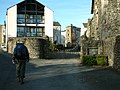
 Houses around a green in Bowston - geograph.org.uk - 4238836.jpg 1,350 × 760; 244 KB
-
 Houses on Winter Lane - geograph.org.uk - 5749526.jpg 640 × 378; 57 KB
-
 Houses on Winter Lane - geograph.org.uk - 5817714.jpg 1,024 × 750; 177 KB
-
 Housing estate at the south of Burneside - geograph.org.uk - 5817696.jpg 1,024 × 824; 180 KB
-
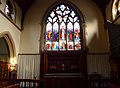
 Inside St Oswald, Burneside (a) - geograph.org.uk - 4363538.jpg 640 × 480; 60 KB
-
 Inside St Oswald, Burneside (b) - geograph.org.uk - 4363539.jpg 640 × 480; 59 KB
-
 Inside St Oswald, Burneside (c) - geograph.org.uk - 4363540.jpg 640 × 480; 62 KB
-
 Inside St Oswald, Burneside (d) - geograph.org.uk - 4363542.jpg 640 × 480; 68 KB
-
 James Cropper ^ Sons Ltd. - geograph.org.uk - 5110284.jpg 640 × 480; 470 KB
-

-
 Lane to Cragg Farm - geograph.org.uk - 2035729.jpg 640 × 469; 78 KB
-
 Level crossing in Burneside - geograph.org.uk - 5045184.jpg 1,024 × 682; 948 KB
-
 Looking towards Kendal from Carus Green - geograph.org.uk - 4902746.jpg 1,600 × 1,067; 294 KB
-
 Lovingly Artisan Bakery - geograph.org.uk - 5943636.jpg 4,000 × 3,000; 2.5 MB
-
 Low Brundrigg Farm on Crook Road - geograph.org.uk - 3127284.jpg 800 × 600; 214 KB
-
 Low-lying clouds in Cumbria - geograph.org.uk - 5964508.jpg 1,024 × 768; 74 KB
-
 Manmade pond near Bank End - geograph.org.uk - 5110235.jpg 640 × 480; 488 KB
-
 On Kendal Fell - geograph.org.uk - 4316938.jpg 640 × 480; 81 KB
-
 Path near Plumgarths - geograph.org.uk - 2484275.jpg 640 × 480; 52 KB
-
 Path through the woodland at Rather Heath - geograph.org.uk - 3377747.jpg 2,048 × 1,536; 524 KB
-
 Pink Bales - geograph.org.uk - 5110265.jpg 640 × 480; 394 KB
-
 Playing field, Burneside - geograph.org.uk - 5857270.jpg 5,376 × 3,024; 4.31 MB
-
 Railway at Burnside - geograph.org.uk - 1381827.jpg 1,000 × 669; 297 KB
-
 Railway north of the level crossing at Burneside - geograph.org.uk - 5415535.jpg 1,600 × 1,112; 413 KB
-
 Rather Heath Tarn ^ Boathouse - geograph.org.uk - 1956853.jpg 3,264 × 2,448; 1.35 MB
-
 River Kent - geograph.org.uk - 2164038.jpg 640 × 480; 168 KB
-
 Road passing St Oswald, Burneside - geograph.org.uk - 4362861.jpg 640 × 480; 80 KB
-
 Road to Cragg Farm - geograph.org.uk - 4338578.jpg 640 × 433; 65 KB
-
 Road to Cragg Farm - geograph.org.uk - 4338582.jpg 640 × 480; 77 KB
-
 Rush hour in Bowston - geograph.org.uk - 5130100.jpg 640 × 480; 82 KB
-
 Scream Point - geograph.org.uk - 5110248.jpg 640 × 480; 456 KB
-
 Sharps Lane - geograph.org.uk - 4238829.jpg 1,350 × 806; 170 KB
-

-
 Sheep in the grounds of Tolson Hall - geograph.org.uk - 3516598.jpg 3,872 × 2,592; 5.53 MB
-
 Sheep pasture, Rather Heath - geograph.org.uk - 2490353.jpg 640 × 480; 75 KB
-
 Slab bridge on the footpath to Fell Gate - geograph.org.uk - 2482429.jpg 640 × 480; 122 KB
-
 Snow covered lane near Ratherheath - geograph.org.uk - 2761969.jpg 1,464 × 976; 511 KB
-
 Southbound A591 - geograph.org.uk - 3384729.jpg 640 × 480; 442 KB
-
 Southbound A591 - geograph.org.uk - 3384753.jpg 640 × 480; 186 KB
-
 Spring south east of Fell Gate - geograph.org.uk - 5153724.jpg 640 × 480; 171 KB
-
 St Oswald's Church, Burneside - geograph.org.uk - 2164018.jpg 616 × 460; 104 KB
-
 St Oswald's Church, Burneside - geograph.org.uk - 3227484.jpg 640 × 480; 130 KB
-
 St Oswald's Church, Burneside - geograph.org.uk - 3516537.jpg 3,872 × 2,592; 4.44 MB
-
 St Oswald's Church, Burneside, Doorway - geograph.org.uk - 2164023.jpg 480 × 640; 118 KB
-
 St Oswald's Church, Burneside, Graveyard - geograph.org.uk - 2164025.jpg 640 × 480; 174 KB
-
 St Oswald's Church, Burneside, Graveyard - geograph.org.uk - 2164028.jpg 640 × 480; 174 KB
-
 St Oswald's Church, Burneside, Tower - geograph.org.uk - 2164030.jpg 480 × 640; 71 KB
-

-
 St Oswald's Church, Burnside, Lych gate - geograph.org.uk - 2164024.jpg 640 × 480; 151 KB
-
 St Oswald, Burneside, churchyard (1) - geograph.org.uk - 4362856.jpg 640 × 480; 82 KB
-
 St Oswald, Burneside, churchyard (2) - geograph.org.uk - 4362862.jpg 640 × 480; 92 KB
-
 St Oswald, Burneside, churchyard (3) - geograph.org.uk - 4362864.jpg 640 × 480; 106 KB
-
 St Oswald, Burneside, churchyard (4) - geograph.org.uk - 4363522.jpg 640 × 480; 96 KB
-
 St Oswald, Burneside, churchyard (5) - geograph.org.uk - 4363525.jpg 640 × 456; 102 KB
-
 St Oswald, Burneside, churchyard (6) - geograph.org.uk - 4363529.jpg 640 × 458; 97 KB
-
 St Oswald, Burneside, churchyard (7) - geograph.org.uk - 4363531.jpg 640 × 480; 129 KB
-
 St Oswald, Burneside, churchyard (8) - geograph.org.uk - 4363532.jpg 640 × 480; 98 KB
-
 St Oswald, Burneside, font - geograph.org.uk - 4363521.jpg 640 × 465; 41 KB
-
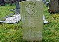
 St Oswald, Burneside, memorial (i) - geograph.org.uk - 4363560.jpg 640 × 480; 65 KB
-
 St Oswald, Burneside, memorial (ii) - geograph.org.uk - 4363561.jpg 640 × 480; 69 KB
-
 St Oswald, Burneside, memorial (iii) - geograph.org.uk - 4363565.jpg 640 × 480; 82 KB
-
 St Oswald, Burneside, memorial (iv) - geograph.org.uk - 4363569.jpg 640 × 480; 81 KB
-
 St Oswald, Burneside, pulpit - geograph.org.uk - 4363567.jpg 640 × 473; 71 KB
-

-

-

-
-

-
 St Oswald, Burneside-lectern - geograph.org.uk - 4363533.jpg 640 × 480; 73 KB
-

-
 St. Oswald's Church Tower, Burneside - geograph.org.uk - 4902515.jpg 1,600 × 1,067; 641 KB
-
 Stile on Cunswick Scar - geograph.org.uk - 946399.jpg 640 × 480; 106 KB
-
 Strickland Ketel , A591 - geograph.org.uk - 6307767.jpg 6,000 × 4,000; 4.11 MB
-
 Strickland Ketel , A591 - geograph.org.uk - 6307769.jpg 6,000 × 4,000; 5.59 MB
-
 Strickland Ketel , A591 - geograph.org.uk - 6353118.jpg 6,000 × 4,000; 4.84 MB
-
 Strickland Ketel , A591 - geograph.org.uk - 6353119.jpg 6,000 × 4,000; 5.74 MB
-
 Strickland Ketel , Countryside Scenery - geograph.org.uk - 6307768.jpg 6,000 × 4,000; 4.27 MB
-
 Strickland Ketel , Elba Monument - geograph.org.uk - 6353126.jpg 6,000 × 4,000; 4.47 MB
-
 Strickland Ketel , Grassy Field - geograph.org.uk - 6307765.jpg 6,000 × 4,000; 6.61 MB
-
 Strickland Ketel , Grassy Field - geograph.org.uk - 6307766.jpg 6,000 × 4,000; 5.13 MB
-
 Strickland Ketel , Hollins Lane - geograph.org.uk - 6353124.jpg 6,000 × 4,000; 7.87 MB
-
 Strickland Ketel , Rose Bank - geograph.org.uk - 6353132.jpg 6,000 × 4,000; 4.93 MB
-
 Strickland Ketel , Sharps Lane - geograph.org.uk - 6353121.jpg 6,000 × 4,000; 5.97 MB
-
 Strickland Ketel , Track - geograph.org.uk - 6353117.jpg 6,000 × 4,000; 6.43 MB
-
 Strickland Ketel , Windermere Road - geograph.org.uk - 6353135.jpg 6,000 × 4,000; 5.23 MB
-
 Strickland Ketel , Windermere Road A5284 - geograph.org.uk - 6307764.jpg 6,000 × 4,000; 5.9 MB
-
 Strickland Ketel , Windermere Road A5284 - geograph.org.uk - 6353139.jpg 6,000 × 4,000; 6.25 MB
-
 The 2 Sisters - geograph.org.uk - 5943638.jpg 4,000 × 3,000; 2.41 MB
-

-
 The bridge at Bowston - geograph.org.uk - 3542672.jpg 1,000 × 750; 605 KB
-
 The Dales Way - geograph.org.uk - 3200701.jpg 800 × 600; 157 KB
-
 The Dales Way - geograph.org.uk - 3200709.jpg 800 × 600; 166 KB
-
 The Dales Way - geograph.org.uk - 3200714.jpg 800 × 600; 189 KB
-
 The Dales Way - geograph.org.uk - 3200718.jpg 800 × 600; 134 KB
-
 The Dales Way - geograph.org.uk - 3200723.jpg 600 × 800; 142 KB
-
 The Dales Way - geograph.org.uk - 3200739.jpg 800 × 600; 123 KB
-
 The Dales Way - geograph.org.uk - 3200746.jpg 800 × 600; 208 KB
-
 The Dales Way - geograph.org.uk - 3200750.jpg 800 × 600; 136 KB
-
 The Dales Way - geograph.org.uk - 3200751.jpg 800 × 600; 194 KB
-
 The Dales Way - geograph.org.uk - 3200760.jpg 800 × 600; 161 KB
-
 The Dales Way - geograph.org.uk - 3200762.jpg 800 × 600; 122 KB
-
 The Dales Way - geograph.org.uk - 3200768.jpg 800 × 600; 110 KB
-
 The Dales Way - geograph.org.uk - 3200773.jpg 800 × 600; 115 KB
-
 The Dales Way - geograph.org.uk - 3200803.jpg 800 × 600; 123 KB
-
 The edge of Kendal - geograph.org.uk - 3519834.jpg 3,872 × 2,592; 4.68 MB
-
 The Gateway Inn near Plumgarths - geograph.org.uk - 3127268.jpg 800 × 600; 344 KB
-
 The Handsome Brewery, Bowston - geograph.org.uk - 5331657.jpg 640 × 480; 73 KB
-
 The Jolly Anglers, Burneside - geograph.org.uk - 3516515.jpg 3,872 × 2,592; 4.03 MB
-
 The Lakelander at Burneside north level crossing - geograph.org.uk - 5832161.jpg 1,024 × 683; 747 KB
-
 The Lakelander heads for Windermere - geograph.org.uk - 5832170.jpg 1,024 × 763; 935 KB
-
 The Lakelander leaving Burneside for Windermere - geograph.org.uk - 5832167.jpg 1,024 × 683; 894 KB
-
 The Railway at Bowston Farm - geograph.org.uk - 4902501.jpg 1,600 × 1,067; 594 KB
-
 The River Kent at Bowston - geograph.org.uk - 3227502.jpg 640 × 480; 145 KB
-
 The River Kent at Bowston - geograph.org.uk - 3542673.jpg 1,000 × 750; 789 KB
-
 The River Kent near Bowston - geograph.org.uk - 3516447.jpg 3,872 × 2,592; 4.66 MB
-
 The way to Halhead Hall from Crook Road - geograph.org.uk - 3127278.jpg 800 × 600; 372 KB
-
 The weir at Bowston - geograph.org.uk - 5444735.jpg 1,024 × 768; 325 KB
-
 The Windermere railway at Plantation Bridge - geograph.org.uk - 1382116.jpg 1,000 × 669; 390 KB
-
 Toadpool Farm - geograph.org.uk - 3516643.jpg 3,872 × 2,592; 3.9 MB
-
 Tolson Hall - geograph.org.uk - 3516608.jpg 3,872 × 2,592; 4.2 MB
-
 Track Through Rather Heath Woods - geograph.org.uk - 1956851.jpg 3,264 × 2,448; 1.37 MB
-
 Tree near Sharps Lane - geograph.org.uk - 4238826.jpg 680 × 784; 109 KB
-
 Trees in field north of Sharp's Lane - geograph.org.uk - 6293347.jpg 1,024 × 685; 995 KB
-
 Victorian postbox, Bowston - geograph.org.uk - 5329427.jpg 480 × 640; 121 KB
-
 View from a lay-by on Windermere Road - geograph.org.uk - 3516666.jpg 3,872 × 2,592; 4.93 MB
-
 Waiting. Level crossing at Burneside - geograph.org.uk - 1749501.jpg 2,848 × 2,136; 1.56 MB
-
 Wall on Kendal Fell, 1990 - geograph.org.uk - 3416657.jpg 640 × 447; 62 KB
-
 Water draw off for paper mill - geograph.org.uk - 5110289.jpg 640 × 480; 493 KB
-
 Weir on the Kent at Bowston - geograph.org.uk - 5334638.jpg 720 × 540; 161 KB
-
 Welcome to St Oswald, Burneside - geograph.org.uk - 4362866.jpg 640 × 480; 76 KB
-
 Western end of Rather Heath Lane - geograph.org.uk - 5045186.jpg 1,024 × 682; 1.07 MB
-
 Wetland area north of Ratherheath Lane - geograph.org.uk - 3377738.jpg 2,048 × 1,536; 677 KB
-
 Windermere Road (A591) - geograph.org.uk - 3384739.jpg 640 × 480; 534 KB
-
 Windermere Road (A591) - geograph.org.uk - 3384747.jpg 640 × 480; 499 KB
-
 Windermere Road, the A5284 - geograph.org.uk - 3519819.jpg 3,872 × 2,592; 4.37 MB
-
 Winstanley Place, Bowston - geograph.org.uk - 5130104.jpg 640 × 480; 70 KB
-
 Winter Lane - geograph.org.uk - 2035651.jpg 640 × 411; 74 KB


_-_geograph.org.uk_-_4363538.jpg)
_-_geograph.org.uk_-_4363539.jpg)
_-_geograph.org.uk_-_4363540.jpg)
_-_geograph.org.uk_-_4363542.jpg)


_-_geograph.org.uk_-_4362856.jpg)
_-_geograph.org.uk_-_4362862.jpg)
_-_geograph.org.uk_-_4362864.jpg)
_-_geograph.org.uk_-_4363522.jpg)
_-_geograph.org.uk_-_4363525.jpg)
_-_geograph.org.uk_-_4363529.jpg)
_-_geograph.org.uk_-_4363531.jpg)
_-_geograph.org.uk_-_4363532.jpg)

_-_geograph.org.uk_-_4363560.jpg)
_-_geograph.org.uk_-_4363561.jpg)
_-_geograph.org.uk_-_4363565.jpg)
_-_geograph.org.uk_-_4363569.jpg)

_-_geograph.org.uk_-_4363571.jpg)
_-_geograph.org.uk_-_4363572.jpg)
_-_geograph.org.uk_-_4363573.jpg)
_-_geograph.org.uk_-_4363576.jpg)
_-_geograph.org.uk_-_4363577.jpg)


_-_geograph.org.uk_-_3384739.jpg)
_-_geograph.org.uk_-_3384747.jpg)


