Category:Survey of Palestine overlaid with OpenStreetMap
Media in category "Survey of Palestine overlaid with OpenStreetMap"
The following 9 files are in this category, out of 9 total.
-
 Agamon HaHula fields on OpenStreetMap.jpg 749 × 752; 62 KB
-
 Agamon HaHula fields on OpenStreetMap.png 749 × 752; 86 KB
-
 Ashkelon 2020 street map overlaid on Survey of Palestine map from 1942.png 619 × 738; 1.13 MB
-

-
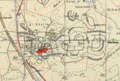
 El'ad 2020 street map overlaid on Survey of Palestine map from 1941.gif 677 × 492; 611 KB
-
 El'ad 2020 street map overlaid on Survey of Palestine map from 1941.png 727 × 493; 698 KB
-
 Nesher 2018 street map overlaid on Survey of Palestine map from 1932.png 1,116 × 682; 1.77 MB
-

-
 Safed 2020 street map overlaid on Survey of Palestine map from 1942.png 1,090 × 785; 1.9 MB


.png)


.png)
