Category:Swainswick
English: Swainswick is a small village and civil parish, north east of Bath, on the A46 in the Bath and North East Somerset unitary authority, Somerset, England. The parish has a population of 284.
village and civil parish in Somerset, England, UK  | |||||
| Upload media | |||||
| Instance of | |||||
|---|---|---|---|---|---|
| Location | Bath and North East Somerset, Somerset, South West England, England | ||||
| Population |
| ||||
 | |||||
Subcategories
This category has the following 2 subcategories, out of 2 total.
M
R
- RAF Charmy Down (16 F)
Media in category "Swainswick"
The following 102 files are in this category, out of 102 total.
-
 A double bridge - geograph.org.uk - 6507675.jpg 2,472 × 3,296; 1.77 MB
-
 A field with horns - geograph.org.uk - 4649849.jpg 1,704 × 2,304; 1.53 MB
-
 A footpath in a garden - geograph.org.uk - 6507669.jpg 3,296 × 2,472; 1.86 MB
-
 A surprising wall at Bathview Park - geograph.org.uk - 5237789.jpg 1,600 × 1,199; 808 KB
-
 A46 approaching A4 junction - geograph.org.uk - 4137354.jpg 1,600 × 977; 400 KB
-
 A46 descends towards Bath - geograph.org.uk - 4123998.jpg 1,600 × 1,047; 454 KB
-
 A46 towards Bath - geograph.org.uk - 4137344.jpg 2,587 × 1,744; 2.9 MB
-
 A46 underpass at Lower Swainswick - geograph.org.uk - 5237797.jpg 1,600 × 1,600; 723 KB
-
 Across the Lam Brook valley - geograph.org.uk - 6342380.jpg 3,310 × 1,902; 944 KB
-
 Across the Lam Brook valley - geograph.org.uk - 6342381.jpg 2,933 × 1,719; 771 KB
-
 Across the Lam Brook valley - geograph.org.uk - 6342511.jpg 3,371 × 2,339; 1.33 MB
-
 Across the Lam Brook valley - geograph.org.uk - 6342517.jpg 3,360 × 2,110; 1.32 MB
-
 Anchor Post - geograph.org.uk - 5109141.jpg 1,704 × 2,304; 1.99 MB
-
 Bear right for Swainswick Lane - geograph.org.uk - 6508234.jpg 3,296 × 2,472; 1.83 MB
-
 Benchmark on a garage - geograph.org.uk - 6507053.jpg 3,296 × 2,472; 1.93 MB
-
 Benchmark on the old Tollhouse - geograph.org.uk - 5109159.jpg 2,304 × 1,704; 1.53 MB
-
 Bend in the Road above Ashcombe Wood - geograph.org.uk - 6407190.jpg 2,054 × 1,023; 842 KB
-
 Bend on A46 near Bathview Park - geograph.org.uk - 4123739.jpg 1,600 × 1,064; 509 KB
-
 Bends on the A46 - geograph.org.uk - 4123721.jpg 1,600 × 1,070; 427 KB
-
 Beware of the Grumpy bunch^ - geograph.org.uk - 6507666.jpg 2,472 × 3,296; 1.74 MB
-
 Blacksmith Lane entrance on to A46 - geograph.org.uk - 5533844.jpg 640 × 496; 71 KB
-
 Countryside around Ashcombe - geograph.org.uk - 6342893.jpg 2,257 × 1,515; 393 KB
-
 Deadmill Lane - geograph.org.uk - 6508224.jpg 3,296 × 2,472; 1.87 MB
-
 Direction Sign - Signpost near Ashcombe Farm, Swainswick - geograph.org.uk - 6056517.jpg 1,789 × 1,162; 168 KB
-
 Drystone wall near St Catherine - geograph.org.uk - 479029.jpg 640 × 480; 128 KB
-
 Field by Tadwick Lane - geograph.org.uk - 6342472.jpg 4,288 × 2,848; 2 MB
-
 Former mill on Deadmill Lane - geograph.org.uk - 5229891.jpg 6,000 × 4,000; 4.73 MB
-
 From the A46 near Charmy Down - geograph.org.uk - 1037388.jpg 640 × 467; 218 KB
-

-
 Gloucester Road at Treetops - geograph.org.uk - 5534210.jpg 640 × 405; 60 KB
-
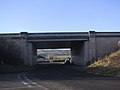
 Gloucester Road joins the A46 Swainswick bypass - geograph.org.uk - 1828792.jpg 1,600 × 1,200; 440 KB
-
 Gloucester Road through West Wood - geograph.org.uk - 5534206.jpg 640 × 508; 72 KB
-
 House near Down Farm - geograph.org.uk - 6407188.jpg 2,511 × 1,237; 940 KB
-
 Junction for Swainswick from A46 - geograph.org.uk - 5533753.jpg 640 × 453; 55 KB
-
 Junction, Ashcombe Farm - geograph.org.uk - 6342736.jpg 3,477 × 2,445; 966 KB
-
 Lam Brook valley - geograph.org.uk - 6342446.jpg 3,634 × 2,059; 1.43 MB
-
 Lam Brook valley - geograph.org.uk - 6342481.jpg 4,165 × 2,241; 1.45 MB
-
 Lam Brook valley near Ashcombe - geograph.org.uk - 6342695.jpg 3,264 × 2,176; 1.14 MB
-
 Lam Brook valley north of Woolley - geograph.org.uk - 6342507.jpg 2,918 × 1,925; 851 KB
-
 Layby off the A46 - geograph.org.uk - 6407180.jpg 1,863 × 960; 657 KB
-
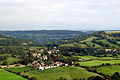
 Lower Swainswick - geograph.org.uk - 2421407.jpg 2,048 × 1,536; 1.02 MB
-
 Manor Farm - geograph.org.uk - 2483783.jpg 640 × 480; 93 KB
-
 Manor Farm, Tadwick - geograph.org.uk - 2618551.jpg 3,648 × 2,736; 2.18 MB
-
 Manor Farm, Tadwick.jpg 4,000 × 3,000; 4.83 MB
-
 Manor Farm, Woolley - geograph.org.uk - 550852.jpg 640 × 511; 133 KB
-
 Manor House Barn , Swainswick, Bath - geograph.org.uk - 1813679.jpg 1,600 × 1,197; 844 KB
-
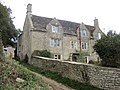
 Manor House, Swainswick, Bath - geograph.org.uk - 1813659.jpg 2,288 × 1,712; 892 KB
-
 Pasture across the Lam Brook valley - geograph.org.uk - 6342700.jpg 2,125 × 2,969; 1.08 MB
-
 Popping out the bales - geograph.org.uk - 6508225.jpg 3,296 × 2,472; 1.83 MB
-
 Postbox, Ashcombe Farm - geograph.org.uk - 6342739.jpg 3,595 × 2,613; 1.41 MB
-
 Pull with vigour, Upper Swainswick - geograph.org.uk - 3616861.jpg 3,264 × 2,448; 1.72 MB
-
 Road junction at Upper Swainswick - geograph.org.uk - 4434333.jpg 741 × 544; 80 KB
-
 Slowing for Lower Swainswick - geograph.org.uk - 5109154.jpg 2,304 × 1,704; 1.76 MB
-
 St Mary the Virgin, Swainswick - geograph.org.uk - 6508772.jpg 3,296 × 2,472; 1.93 MB
-
 St Mary's conservation area - geograph.org.uk - 6506787.jpg 3,296 × 2,472; 1.82 MB
-
 Start of fencing along A46 - geograph.org.uk - 5533768.jpg 640 × 430; 61 KB
-
 Subway under the A46 at Swainswick - geograph.org.uk - 6508228.jpg 3,296 × 2,472; 1.77 MB
-
 Swainswick Church School - geograph.org.uk - 6509158.jpg 3,296 × 2,472; 1.76 MB
-
 Swainswick Primary School - geograph.org.uk - 1811333.jpg 1,600 × 1,237; 736 KB
-
 Swainswick seat - geograph.org.uk - 6509150.jpg 3,296 × 2,472; 1.83 MB
-
 Swainswick spring - geograph.org.uk - 6509157.jpg 3,296 × 2,472; 1.9 MB
-
 Tadwick - geograph.org.uk - 6342910.jpg 3,002 × 1,710; 649 KB
-
 Tadwick - geograph.org.uk - 6342967.jpg 3,137 × 1,987; 1,001 KB
-
 Tadwick - geograph.org.uk - 719600.jpg 640 × 427; 123 KB
-
 Tadwick Lane - geograph.org.uk - 6342475.jpg 4,015 × 2,591; 2.1 MB
-
 Tadwick Lane - geograph.org.uk - 6342477.jpg 2,116 × 2,403; 991 KB
-
 Tadwick Lane - geograph.org.uk - 6342501.jpg 4,120 × 2,585; 2.12 MB
-
 Tadwick Lane - geograph.org.uk - 6342542.jpg 4,042 × 2,059; 1.55 MB
-
 Tadwick Lane, Upper Swainswick - geograph.org.uk - 6507056.jpg 3,296 × 2,472; 1.9 MB
-

-
 The A46 at Lower Swainswick - geograph.org.uk - 6407160.jpg 1,702 × 742; 370 KB
-
 The junction for Swainswick Lane - geograph.org.uk - 6407156.jpg 2,658 × 1,163; 939 KB
-
 The path goes under the road - geograph.org.uk - 6508231.jpg 3,296 × 2,472; 1.88 MB
-
 Track to Hartley Farm - geograph.org.uk - 6313109.jpg 2,930 × 1,445; 1.66 MB
-
 Turnpike Cottage, Gloucester Road - geograph.org.uk - 1828746.jpg 1,600 × 1,200; 353 KB
-
 Two time on St Mary - geograph.org.uk - 6508776.jpg 3,296 × 2,472; 1.82 MB
-
 Upper Swainswick (2) - geograph.org.uk - 905040.jpg 640 × 467; 104 KB
-
 Upper Swainswick - geograph.org.uk - 6342309.jpg 4,288 × 2,848; 2.12 MB
-
 Upper Swainswick - geograph.org.uk - 905008.jpg 640 × 448; 65 KB
-
 Upper Swainswick.jpg 640 × 427; 80 KB
-
 Valley at Ashcombe - geograph.org.uk - 6564770.jpg 4,145 × 2,059; 1.26 MB
-
 Valley near Ashcombe - geograph.org.uk - 6342818.jpg 2,297 × 1,533; 544 KB
-
 Valley pasture south of Tadwick - geograph.org.uk - 2618072.jpg 3,648 × 2,736; 1.48 MB
-
 Valley south of Tadwick - geograph.org.uk - 6342898.jpg 3,685 × 1,911; 1.15 MB
-
 View from the A46, Gloucester Road - geograph.org.uk - 755375.jpg 640 × 427; 65 KB
-
 Wingfield Farm - geograph.org.uk - 756981.jpg 640 × 437; 63 KB
-
 Won't get a bus through here - geograph.org.uk - 6509148.jpg 3,296 × 2,472; 1.79 MB
-
 A46 overbridge - geograph.org.uk - 1065977.jpg 640 × 480; 45 KB
-
 A46 passing Charmy Down - geograph.org.uk - 1037375.jpg 640 × 486; 183 KB
-
 Air Force camp site - geograph.org.uk - 756989.jpg 640 × 427; 77 KB
-
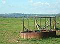 Cattle feeder on Charmy Down - geograph.org.uk - 756966.jpg 640 × 470; 85 KB
-
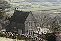 Cottage at Upper Langridge - geograph.org.uk - 715705.jpg 640 × 430; 128 KB
-
 Cottage on Langridge Lane - geograph.org.uk - 718045.jpg 640 × 474; 129 KB
-
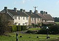 Cottages near Lansdown Racecourse - geograph.org.uk - 598474.jpg 640 × 454; 91 KB
-
 Down Farm from Tadwick Lane - geograph.org.uk - 470351.jpg 480 × 640; 80 KB
-
 Farm entrance at Upper Langridge - geograph.org.uk - 717955.jpg 640 × 426; 137 KB
-
 Geese, near Langridge - geograph.org.uk - 713595.jpg 640 × 473; 148 KB
-
 Holts Down - geograph.org.uk - 755430.jpg 640 × 449; 134 KB
-
 Langridge Lane - geograph.org.uk - 717961.jpg 640 × 507; 196 KB
-
 Langridge Lane looking east - geograph.org.uk - 718008.jpg 640 × 465; 138 KB
-
 Lansdown Park and Ride, Bath - geograph.org.uk - 717137.jpg 640 × 479; 132 KB
-
 Lansdown Park and Ride, Bath - geograph.org.uk - 717138.jpg 640 × 480; 148 KB


_-_geograph.org.uk_-_905040.jpg)


