Category:Swallowcliffe
village and civil parish in Wiltshire, United Kingdom  | |||||
| Upload media | |||||
| Instance of | |||||
|---|---|---|---|---|---|
| Location | Wiltshire, South West England, England | ||||
| official website | |||||
 | |||||
English: Swallowcliffe is a small village located approximately 13 miles west of Salisbury, Wiltshire, England. Its centre is one mile north of the A30 and it has a population of about 180.
Nederlands: Swallowcliffe is een dorp (village) en civil parish in de unitary authority Wiltshire, in het Engelse graafschap Wiltshire. De civil parish telt
Subcategories
This category has the following 3 subcategories, out of 3 total.
Media in category "Swallowcliffe"
The following 123 files are in this category, out of 123 total.
-
 A30 approaching Swallowcliffe garage - geograph.org.uk - 4046478.jpg 640 × 441; 68 KB
-
 A30 past Swallowcliffe - geograph.org.uk - 353463.jpg 430 × 640; 89 KB
-
 A30 road works, Swallowcliffe - geograph.org.uk - 5805469.jpg 1,024 × 684; 284 KB
-

-
 Bench Mark, Swallowcliffe Manor - geograph.org.uk - 1825352.jpg 480 × 640; 215 KB
-
 Bridleway, Swallowcliffe Down - geograph.org.uk - 1334408.jpg 640 × 482; 155 KB
-
 Chalk pit near Fovant - geograph.org.uk - 1476603.jpg 640 × 480; 141 KB
-
 Cock Pheasant - geograph.org.uk - 360750.jpg 640 × 480; 138 KB
-
 Dead or alive - Swallowcliffe - geograph.org.uk - 890715.jpg 640 × 480; 78 KB
-
 Downside Garage by A30 - geograph.org.uk - 3550845.jpg 1,024 × 768; 89 KB
-
 Drive to Apshill House, Chicksgrove - geograph.org.uk - 737543.jpg 640 × 480; 115 KB
-

-
 Edge of Swallowcliffe Wood - geograph.org.uk - 384337.jpg 640 × 430; 135 KB
-
 End of A30 road works, Swallowcliffe - geograph.org.uk - 5805510.jpg 1,024 × 684; 154 KB
-
 Entrance, Swallowcliffe Manor (geograph 1825360).jpg 640 × 494; 178 KB
-

-
 Farmland by Swallowcliffe - geograph.org.uk - 353444.jpg 640 × 430; 127 KB
-
 Flush Bracket 10053, Barber's Farm - geograph.org.uk - 1848876.jpg 480 × 640; 196 KB
-
 Footpath across rape field - geograph.org.uk - 384330.jpg 430 × 640; 134 KB
-
 Footpath, Cannon Hill Wood - geograph.org.uk - 738534.jpg 640 × 458; 123 KB
-
 Footpath, Sutton Mandeville Mill - geograph.org.uk - 737619.jpg 640 × 480; 106 KB
-
 Grazing sheep near Swallowcliffe - geograph.org.uk - 2655144.jpg 640 × 481; 68 KB
-
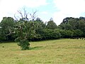
 Lone tree, Swallowcliffe - geograph.org.uk - 2806680.jpg 640 × 441; 85 KB
-
 Meripilus giganteus - geograph.org.uk - 738542.jpg 480 × 640; 84 KB
-
 Motor works beside A30 - geograph.org.uk - 3555475.jpg 1,024 × 768; 84 KB
-
 Oilseed rape near Swallowcliffe - geograph.org.uk - 2877873.jpg 640 × 481; 66 KB
-
 Old Milestone by the A30, Swallowcliffe Parish - geograph.org.uk - 6043287.jpg 1,687 × 1,247; 439 KB
-

-

-
 Rosebank, Swallowcliffe - geograph.org.uk - 890713.jpg 640 × 480; 105 KB
-
 Sheds at the Compasses Inn, Chicksgrove - geograph.org.uk - 310714.jpg 640 × 480; 126 KB
-
 Sheep grazing by A30 - geograph.org.uk - 335740.jpg 640 × 430; 128 KB
-
 Spoilt for Choice - geograph.org.uk - 2877870.jpg 640 × 481; 72 KB
-
 Stone Cottages in Swallowcliffe - geograph.org.uk - 326499.jpg 640 × 480; 109 KB
-
 Swallowcliffe Down - geograph.org.uk - 729265.jpg 640 × 434; 75 KB
-

-
 Swallowcliffe Wiltshire UK.jpg 600 × 450; 66 KB
-
 Village Street, Swallowcliffe - geograph.org.uk - 319480.jpg 640 × 480; 117 KB
-
 Wall beside the A30, Barber's Farm - geograph.org.uk - 1848856.jpg 640 × 480; 167 KB
-
 Weather vane, Barber's Farm - geograph.org.uk - 1848908.jpg 640 × 480; 68 KB
-
 Winter Feed on Swallowcliffe Down - geograph.org.uk - 607255.jpg 640 × 480; 66 KB
-
 Across bottom by Middle Down - geograph.org.uk - 382302.jpg 640 × 430; 97 KB
-

-
 Bank and ditch around Castle Ditches Fort - geograph.org.uk - 384282.jpg 640 × 430; 184 KB
-
 Bank around Castle Fort Ditches - geograph.org.uk - 384303.jpg 640 × 430; 179 KB
-
 Bottom by Middle Down - geograph.org.uk - 382299.jpg 640 × 430; 102 KB
-
 Bridleway down Buxbury Hollow - geograph.org.uk - 437833.jpg 640 × 480; 148 KB
-
 Bridleway to Halstead - geograph.org.uk - 437838.jpg 640 × 640; 210 KB
-
 Buxbury Hill - geograph.org.uk - 360046.jpg 640 × 430; 98 KB
-
 Buxbury Hill from Buxbury Hollow - geograph.org.uk - 437834.jpg 640 × 480; 80 KB
-

-
 Byway meets bridleway, Buxbury Hill - geograph.org.uk - 437829.jpg 640 × 480; 89 KB
-
 Cottage near Swallowcliffe - geograph.org.uk - 360770.jpg 640 × 480; 113 KB
-
 Dilapidated Stainers building - geograph.org.uk - 353464.jpg 640 × 430; 123 KB
-
 Dog show preparation, Chicksgrove - geograph.org.uk - 1434015.jpg 640 × 480; 98 KB
-
 Downhill towards A30 - geograph.org.uk - 382289.jpg 640 × 430; 106 KB
-
 Edge of Ebbesborne Down - geograph.org.uk - 382486.jpg 640 × 430; 106 KB
-
 Farm building by lane to Swallowcliffe - geograph.org.uk - 335744.jpg 640 × 430; 138 KB
-

-

-
 Farmland by Jobbers Lane - geograph.org.uk - 289080.jpg 640 × 480; 64 KB
-

-
 Five oak trees near Chicksgrove - geograph.org.uk - 737566.jpg 640 × 439; 66 KB
-
 Flooding on Old Shaftsbury Drove - geograph.org.uk - 360808.jpg 430 × 640; 118 KB
-
 Footpath along edge of Swallowcliffe Wood - geograph.org.uk - 384763.jpg 430 × 640; 180 KB
-
 Footpath into the woods - geograph.org.uk - 353452.jpg 640 × 430; 197 KB
-
 Footpath to Quarry Farm from Sutton Row - geograph.org.uk - 338612.jpg 640 × 480; 133 KB
-

-
 Footpath towards Sutton Row - geograph.org.uk - 738543.jpg 640 × 480; 123 KB
-
 Fovant Hut - geograph.org.uk - 437791.jpg 640 × 480; 96 KB
-
 Gates to Apshill House, Chicksgrove - geograph.org.uk - 737556.jpg 640 × 413; 60 KB
-
 Good Hat - geograph.org.uk - 310710.jpg 640 × 480; 126 KB
-
 Head of Bottom next to Prescombe Down - geograph.org.uk - 363729.jpg 640 × 430; 104 KB
-
 Heading towards Fovant - geograph.org.uk - 619465.jpg 640 × 480; 102 KB
-
 Hut Lane, Sutton Row - geograph.org.uk - 338622.jpg 640 × 480; 181 KB
-
 Jobbers Lane by Wallmead Farm - geograph.org.uk - 289071.jpg 480 × 640; 76 KB
-
 Junction of Yule Hill and High Street - geograph.org.uk - 289087.jpg 640 × 480; 124 KB
-
 Junction to Swallowcliffe - geograph.org.uk - 335543.jpg 640 × 430; 180 KB
-
 Lane in Swallowcliffe - geograph.org.uk - 335539.jpg 430 × 640; 133 KB
-
 Lane to Swallowcliffe - geograph.org.uk - 353445.jpg 430 × 640; 121 KB
-
 Lane to Totterdale Farm - geograph.org.uk - 289075.jpg 640 × 480; 95 KB
-
 Long barrow south of Buxbury Hill - geograph.org.uk - 437803.jpg 640 × 480; 84 KB
-
 Looking down into the bottom - geograph.org.uk - 382484.jpg 640 × 430; 129 KB
-
 Looking down on South Farm - geograph.org.uk - 382291.jpg 640 × 430; 117 KB
-
 Memorial Seat at Swallowcliffe - geograph.org.uk - 319458.jpg 640 × 480; 170 KB
-
 Middle Down - geograph.org.uk - 360799.jpg 640 × 430; 83 KB
-
 Moss Covered wall and gate, Swallowcliffe - geograph.org.uk - 319485.jpg 640 × 480; 156 KB
-

-
 Old Shaftsbury Drove - geograph.org.uk - 382292.jpg 430 × 640; 160 KB
-

-

-
 Old stone house in Swallowcliffe - geograph.org.uk - 353453.jpg 640 × 430; 171 KB
-

-

-
 Reservoir by Old Shaftsbury Drove - geograph.org.uk - 382304.jpg 640 × 430; 151 KB
-
 Reservoir by Whitmarsh Wood - geograph.org.uk - 384323.jpg 640 × 430; 123 KB
-
 Reservoir on Middle Down - geograph.org.uk - 382303.jpg 640 × 430; 141 KB
-
 Roadside Colour - Swallowcliffe - geograph.org.uk - 509541.jpg 640 × 480; 116 KB
-
 Sheep grazing, west of Sutton Row - geograph.org.uk - 437839.jpg 640 × 480; 94 KB
-
 Sign for the Compasses Inn, Chicksgrove - geograph.org.uk - 310706.jpg 480 × 640; 121 KB
-
 Signpost on Jobbers Lane - geograph.org.uk - 289088.jpg 480 × 640; 88 KB
-
 Slopes of Sutton Down - geograph.org.uk - 360851.jpg 640 × 430; 111 KB
-
 Small footbridge - geograph.org.uk - 335546.jpg 640 × 430; 166 KB
-
 Stainers building on A30 - geograph.org.uk - 335536.jpg 640 × 430; 122 KB
-
 Stream in Swallowcliffe - geograph.org.uk - 326501.jpg 480 × 640; 172 KB
-

-
 Swallowcliffe Down - geograph.org.uk - 360033.jpg 640 × 430; 103 KB
-
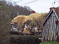
 Thatched house beside A30 - geograph.org.uk - 353456.jpg 640 × 430; 164 KB
-
 The Compasses Inn - geograph.org.uk - 310704.jpg 640 × 480; 77 KB
-
 The steep and winding road - geograph.org.uk - 382284.jpg 640 × 430; 130 KB
-

-
 Top of bottom by Middle Down - geograph.org.uk - 382297.jpg 640 × 430; 88 KB
-
 Track across rape field - geograph.org.uk - 384285.jpg 430 × 640; 104 KB
-
 Track along edge of Sutton Down - geograph.org.uk - 360864.jpg 430 × 640; 104 KB
-
 Track between downs - geograph.org.uk - 360830.jpg 430 × 640; 168 KB
-
 Track to North Hill Farm - geograph.org.uk - 360819.jpg 430 × 640; 160 KB
-
 Triangulation pillar on Sutton Down - geograph.org.uk - 437809.jpg 480 × 640; 112 KB
-
 Trig Point above Sutton Down - geograph.org.uk - 360042.jpg 640 × 430; 108 KB
-
 Trig Point on Sutton Down - geograph.org.uk - 360846.jpg 430 × 640; 146 KB
-
 View across Castle Fort Ditches - geograph.org.uk - 384295.jpg 640 × 430; 100 KB
-
 View across Swallowcliffe Down - geograph.org.uk - 360796.jpg 640 × 430; 104 KB
-
 Wallmead Farm - geograph.org.uk - 289073.jpg 640 × 480; 80 KB
-
 Yew Tree, Swallowcliffe - geograph.org.uk - 319463.jpg 640 × 480; 156 KB


.jpg)


