Category:Sykehouse
village in the United Kingdom | |||||
| Upload media | |||||
| Instance of | |||||
|---|---|---|---|---|---|
| Location | Doncaster, South Yorkshire, Yorkshire and the Humber, England | ||||
 | |||||
Subcategories
This category has the following 2 subcategories, out of 2 total.
S
- Sykehouse Lock (4 F)
T
Media in category "Sykehouse"
The following 200 files are in this category, out of 305 total.
(previous page) (next page)-
 A small enclosure by the footpath - geograph.org.uk - 6474643.jpg 1,024 × 768; 260 KB
-
 Anglers' platforms, New Junction Canal - geograph.org.uk - 3922390.jpg 1,024 × 768; 130 KB
-
 Anglian Water building next to Bank House - geograph.org.uk - 6491179.jpg 5,456 × 3,632; 3.26 MB
-
 Approaching Eskholme - geograph.org.uk - 2255562.jpg 480 × 640; 89 KB
-
 Approaching Eskholme from the east - geograph.org.uk - 4328245.jpg 1,600 × 1,200; 568 KB
-
 Approaching Plaice Hills Farm - geograph.org.uk - 4327830.jpg 1,600 × 1,200; 964 KB
-
 Approaching the Went Aqueduct - geograph.org.uk - 4327825.jpg 1,600 × 1,200; 512 KB
-
 Are you looking at me. - geograph.org.uk - 1691196.jpg 640 × 480; 69 KB
-
 Bank House - geograph.org.uk - 1255877.jpg 640 × 480; 30 KB
-
 Bank House - geograph.org.uk - 2765862.jpg 1,024 × 768; 196 KB
-
 Bank House Farm - geograph.org.uk - 4327761.jpg 1,600 × 1,200; 346 KB
-
 Banks Farm from across the River Don - geograph.org.uk - 2768486.jpg 1,024 × 768; 166 KB
-
 Barge Sobriety approaching Kirk Lane swingbridge - geograph.org.uk - 3922274.jpg 1,024 × 614; 132 KB
-

-
 Barn at Turpin Farm, Sykehouse - geograph.org.uk - 3106257.jpg 1,024 × 768; 232 KB
-
 Bate Lane Windmill - geograph.org.uk - 1255682.jpg 640 × 480; 88 KB
-
 Benchmark on Topham Ferry Bridge - geograph.org.uk - 2855511.jpg 3,264 × 2,448; 1.61 MB
-
 Black Syke Lane towards Fosterhouses - geograph.org.uk - 6116249.jpg 1,600 × 1,065; 489 KB
-
 Blackshaw Dike and Tideworth Hague Gorse - geograph.org.uk - 2768592.jpg 1,024 × 768; 230 KB
-
 Blackshaw Lane - geograph.org.uk - 2768443.jpg 1,024 × 768; 171 KB
-
 Blackshaw Lane - geograph.org.uk - 4327637.jpg 1,600 × 1,200; 588 KB
-

-
 Bridge over former railway line - geograph.org.uk - 4231570.jpg 1,024 × 768; 91 KB
-
 Bridge over the New junction canal - geograph.org.uk - 1701869.jpg 480 × 640; 42 KB
-
 Broad Lane heading east - geograph.org.uk - 2593536.jpg 1,600 × 1,200; 532 KB
-
 Broad Lane in Sykehouse - geograph.org.uk - 5495514.jpg 3,264 × 2,448; 2.47 MB
-
 Broad Lane postbox and bus stop - geograph.org.uk - 1184280.jpg 640 × 480; 91 KB
-
 Broad Lane, Sykehouse - geograph.org.uk - 2593532.jpg 1,600 × 1,200; 397 KB
-
 Buildings at White Cock Hall Farm - geograph.org.uk - 4826917.jpg 1,600 × 1,200; 545 KB
-
 Bunfold Shaw - geograph.org.uk - 2855433.jpg 3,264 × 2,448; 2.85 MB
-
 Bungalow at Pincheon Green - geograph.org.uk - 5638644.jpg 4,975 × 3,604; 4.35 MB
-
 Bungalow Farm - geograph.org.uk - 1332887.jpg 640 × 480; 59 KB
-
 Bungalow Farm - geograph.org.uk - 4520695.jpg 800 × 533; 74 KB
-
 Bungalow Farm - geograph.org.uk - 4826923.jpg 1,600 × 1,200; 789 KB
-
 Bungalow Farm, Sykehouse - geograph.org.uk - 3103199.jpg 1,024 × 768; 203 KB
-
 Bus Stops and Dwellings at Pincheon Green - geograph.org.uk - 5504315.jpg 3,211 × 2,385; 2.34 MB
-
 Busby Lane towards Tideworth Hague Lane - geograph.org.uk - 6116905.jpg 1,600 × 1,065; 961 KB
-
 Busby Lane towards Tideworth Hague Lane - geograph.org.uk - 6116911.jpg 1,600 × 1,065; 884 KB
-
 Bushy Lane - geograph.org.uk - 2765316.jpg 1,024 × 768; 250 KB
-
 By the New Junction Canal - geograph.org.uk - 2768564.jpg 1,024 × 768; 135 KB
-
 By the River Don - geograph.org.uk - 2768481.jpg 1,024 × 768; 174 KB
-
 Carr landscape - geograph.org.uk - 2765305.jpg 1,024 × 768; 162 KB
-
 Cat's cradle - geograph.org.uk - 3103221.jpg 768 × 1,024; 181 KB
-
 Chapel Lane in Sykehouse - geograph.org.uk - 5495512.jpg 3,264 × 2,448; 2.65 MB
-
 Chapel Lane, Sykehouse - geograph.org.uk - 3105686.jpg 1,024 × 768; 142 KB
-
 Chapel Row, Sykehouse - geograph.org.uk - 3103151.jpg 1,024 × 768; 138 KB
-
 Checking the wig-wags - geograph.org.uk - 4521687.jpg 800 × 533; 100 KB
-
 Clay Bridge near Sykehouse Lock - geograph.org.uk - 4761569.jpg 4,608 × 3,456; 3.49 MB
-
 Claybridge Farm, near Sykehouse Lock - geograph.org.uk - 5294412.jpg 1,600 × 1,200; 1,004 KB
-
 Claybridge near Sykehouse Lock - geograph.org.uk - 3105279.jpg 1,024 × 768; 174 KB
-
 Coming into land - geograph.org.uk - 2768450.jpg 1,024 × 768; 84 KB
-
 Converted windmill near Topham - geograph.org.uk - 4328251.jpg 1,600 × 1,200; 783 KB
-
 Cowick Road - geograph.org.uk - 2768472.jpg 1,024 × 768; 95 KB
-
 Cowick Road leading to Ivy House Farm - geograph.org.uk - 5638636.jpg 4,996 × 3,800; 3.98 MB
-
 Deeply rutted track - geograph.org.uk - 2768605.jpg 1,024 × 768; 305 KB
-

-
 Dismantled Railway looking north - geograph.org.uk - 2855422.jpg 3,264 × 2,448; 3.01 MB
-
 Disused cottage on Wormley Hill Lane - geograph.org.uk - 6491666.jpg 5,456 × 3,632; 2.19 MB
-
 Disused Public House, Sykehouse - geograph.org.uk - 288941.jpg 640 × 479; 77 KB
-
 Ditch and Meadow near Sykehouse - geograph.org.uk - 4762922.jpg 4,608 × 3,456; 4.2 MB
-
 Drain on the south bank of the River Went - geograph.org.uk - 3921347.jpg 1,024 × 768; 171 KB
-
 Dumped BT phone directories - geograph.org.uk - 6116920.jpg 1,600 × 1,065; 875 KB
-
 Dumped BT phone directories - geograph.org.uk - 6116932.jpg 1,600 × 1,065; 1 MB
-
 Dusk at New Ings - geograph.org.uk - 2768500.jpg 1,024 × 768; 217 KB
-
 Empty house by Wormley Hill Lane - geograph.org.uk - 5638614.jpg 5,009 × 3,706; 4.43 MB
-
 Entering Sykehouse on Oak Lane - geograph.org.uk - 6491166.jpg 5,079 × 3,501; 2.2 MB
-
 Eskholme to the River Went - geograph.org.uk - 2856395.jpg 3,264 × 2,448; 2.04 MB
-
 Exits from Topham Ferry Bridge - geograph.org.uk - 3105691.jpg 1,024 × 768; 236 KB
-
 Farm track - geograph.org.uk - 1255916.jpg 640 × 480; 38 KB
-
 Farm track near Sykehouse - geograph.org.uk - 3105010.jpg 1,024 × 768; 331 KB
-
 Farm track opposite Chapel Row, Sykehouse - geograph.org.uk - 3106287.jpg 1,024 × 768; 235 KB
-
 Farm track towards Flashley Carr Lane - geograph.org.uk - 6117125.jpg 1,600 × 1,065; 915 KB
-
 Farm track towards Riddings Farm - geograph.org.uk - 3922586.jpg 1,600 × 1,064; 605 KB
-
 Farmland and Aspen Trees near Bank Farm - geograph.org.uk - 5504313.jpg 3,264 × 2,448; 3.58 MB
-
 Farmland near Fenwick Grange - geograph.org.uk - 2593519.jpg 1,600 × 1,200; 304 KB
-
 Farmland near Pincheon Green - geograph.org.uk - 2765818.jpg 1,024 × 768; 162 KB
-
 Farmland near Tideworth Hague Gorse - geograph.org.uk - 2429266.jpg 1,600 × 1,200; 412 KB
-
 Farmland off Fowdall Lane - geograph.org.uk - 2429237.jpg 1,600 × 1,200; 495 KB
-
 Farmland off West Lane - geograph.org.uk - 2593525.jpg 1,600 × 1,200; 437 KB
-
 Farmland, east bank, New Junction Canal - geograph.org.uk - 3922229.jpg 1,024 × 614; 95 KB
-
 Farmland, New Ings - geograph.org.uk - 2593558.jpg 1,600 × 1,200; 381 KB
-
 Field Adjoining Tideworth Hague Gorse - geograph.org.uk - 5515155.jpg 3,264 × 2,448; 2.46 MB
-
 Field boundary, east of Plaice Hills Farm - geograph.org.uk - 3922236.jpg 1,024 × 614; 101 KB
-
 Filling station, Sykehouse - geograph.org.uk - 3106282.jpg 1,024 × 768; 128 KB
-
 Flashley Carr Lane towards Sykehouse - geograph.org.uk - 2593520.jpg 1,600 × 1,200; 426 KB
-
 Floating timber on the River Don - geograph.org.uk - 2768467.jpg 1,024 × 768; 139 KB
-
 Flood Bank and the River Don - geograph.org.uk - 2765864.jpg 1,024 × 768; 197 KB
-
 Flooding in the Went valley - geograph.org.uk - 3921332.jpg 1,024 × 768; 162 KB
-
 Fly-tipping on Fowdall Lane - geograph.org.uk - 2768542.jpg 1,024 × 768; 339 KB
-

-
 Footpath along a bank at Sykehouse - geograph.org.uk - 3106234.jpg 1,024 × 768; 303 KB
-
 Footpath along Barrier Bank - geograph.org.uk - 3105106.jpg 1,024 × 768; 313 KB
-
 Footpath at Tideworth Hague Gorse - geograph.org.uk - 5294450.jpg 1,600 × 1,200; 1.08 MB
-
 Footpath east of Sykehouse Lock - geograph.org.uk - 5294432.jpg 1,600 × 1,200; 1.07 MB
-
 Footpath off Oak Lane, Sykehouse - geograph.org.uk - 6491167.jpg 5,456 × 3,632; 2.2 MB
-
 Footpath on an embankment - geograph.org.uk - 2765841.jpg 1,024 × 768; 217 KB
-
 Footpath on an embankment - geograph.org.uk - 2765850.jpg 1,024 × 768; 184 KB
-
 Footpath through Tideworth Hague Gorse - geograph.org.uk - 2856484.jpg 3,264 × 2,448; 3.57 MB
-
 Footpath to Fosterhouses - geograph.org.uk - 2765309.jpg 1,024 × 768; 334 KB
-
 Footpath to Four Lane Ends - geograph.org.uk - 6474648.jpg 1,024 × 768; 320 KB
-
 Footpath to Sykehouse Lock - geograph.org.uk - 6474697.jpg 1,024 × 768; 253 KB
-
 Footpath towards Peartree Corner - geograph.org.uk - 5294436.jpg 1,600 × 1,200; 1,010 KB
-
 Former Primitive Methodist Chapel - geograph.org.uk - 4520714.jpg 800 × 533; 111 KB
-
 Former railway line - geograph.org.uk - 3105042.jpg 1,024 × 768; 281 KB
-
 Former telephone exchange - geograph.org.uk - 3105694.jpg 1,024 × 768; 269 KB
-
 Fowdall Lane - geograph.org.uk - 2768536.jpg 1,024 × 768; 358 KB
-
 Fowdall Lane towards Kirk Lane - geograph.org.uk - 6116915.jpg 1,600 × 1,065; 972 KB
-

-
 Harrier Hawk in Sykehouse Lock - geograph.org.uk - 4521694.jpg 800 × 533; 114 KB
-
-
-
 Hedge cutting near Sykehouse - geograph.org.uk - 3104999.jpg 1,024 × 768; 309 KB
-
 High Grove, Chapel Lane, Sykehouse - geograph.org.uk - 3106255.jpg 1,024 × 768; 221 KB
-
 Holy Trinity Church - geograph.org.uk - 4520711.jpg 800 × 533; 132 KB
-
 Holy Trinity Church, Sykehouse - geograph.org.uk - 6474700.jpg 1,024 × 768; 130 KB
-
 Horses being grazed on Black Syke Lane - geograph.org.uk - 2765300.jpg 1,024 × 768; 249 KB
-
 House at Sykehouse Lock, New Junction Canal - geograph.org.uk - 3922369.jpg 1,023 × 768; 132 KB
-
 House besides Kirk Lane Swingbridge - geograph.org.uk - 3922270.jpg 1,024 × 614; 118 KB
-
 Houses west of Sykehouse Road Bridge - geograph.org.uk - 3922245.jpg 1,024 × 768; 194 KB
-

-
 Isolated Dwelling on Wormley Hill Lane - geograph.org.uk - 5504307.jpg 3,264 × 2,448; 2.55 MB
-
 Isolated trees - geograph.org.uk - 2765295.jpg 1,024 × 768; 208 KB
-
 Ivy Cottage - geograph.org.uk - 1255785.jpg 640 × 480; 42 KB
-
 Ivy House - geograph.org.uk - 2768477.jpg 1,024 × 768; 137 KB
-
 Ivy House farm - geograph.org.uk - 4327757.jpg 1,600 × 1,200; 406 KB
-
 Ivy House Farm - geograph.org.uk - 6179017.jpg 1,024 × 768; 177 KB
-
 Ivy House Farm and the River Don - geograph.org.uk - 2429326.jpg 1,600 × 1,200; 352 KB
-
 Kirk lane - geograph.org.uk - 1255714.jpg 640 × 480; 90 KB
-
 Kirk Lane bridge - geograph.org.uk - 1255577.jpg 640 × 480; 48 KB
-
 Kirk Lane Bridge swinging open - geograph.org.uk - 3922268.jpg 1,024 × 768; 130 KB
-
 Kirk Lane bridge swinging shut - geograph.org.uk - 3922325.jpg 1,024 × 615; 119 KB
-
 Kirk Lane Swing Bridge - geograph.org.uk - 2768528.jpg 1,024 × 768; 114 KB
-
 Kirk Lane Swingbridge closed to boats - geograph.org.uk - 3922266.jpg 1,024 × 614; 105 KB
-
 Kirk Lane Swingbridge open for boats - geograph.org.uk - 3922318.jpg 1,024 × 615; 106 KB
-
 Kirklane Bridge (swing) - geograph.org.uk - 2856441.jpg 3,264 × 2,448; 1.53 MB
-
 Lane towards Topham - geograph.org.uk - 2593570.jpg 1,600 × 1,200; 545 KB
-
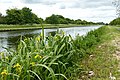 Lilies beside the New Junction Canal - geograph.org.uk - 4521683.jpg 800 × 533; 160 KB
-
 Livestock at Sykehouse - geograph.org.uk - 4762297.jpg 4,149 × 3,030; 3.25 MB
-
 Lock gates, Sykehouse Lock - geograph.org.uk - 2429225.jpg 1,600 × 1,200; 466 KB
-
 Low Ings Lane Joins Blackshaw Lane - geograph.org.uk - 6116246.jpg 1,600 × 1,065; 417 KB
-
 Manor Farm - geograph.org.uk - 4520699.jpg 800 × 533; 118 KB
-
 Manor Farm Lane - geograph.org.uk - 1255661.jpg 640 × 480; 63 KB
-
 Manor Farm Lane Junction - geograph.org.uk - 1255668.jpg 640 × 480; 61 KB
-
 Manor Farm, Sykehouse - geograph.org.uk - 4826920.jpg 1,600 × 1,200; 547 KB
-
 Mawson Green Lane - geograph.org.uk - 2856453.jpg 3,264 × 2,448; 1.79 MB
-
 Meadow View on West Lane - geograph.org.uk - 3922572.jpg 1,600 × 991; 679 KB
-
 Meadow view. - geograph.org.uk - 4365112.jpg 640 × 480; 51 KB
-

-
 Millennium Stone at Roadside - geograph.org.uk - 2855427.jpg 3,264 × 2,448; 2.49 MB
-
 Millstone in a wall, Chapel Lane, Sykehouse - geograph.org.uk - 3106240.jpg 1,024 × 768; 309 KB
-
 Moor House Farm - geograph.org.uk - 2856380.jpg 3,264 × 2,448; 2.74 MB
-
 Moor House Farm - geograph.org.uk - 4328248.jpg 1,600 × 1,200; 665 KB
-
 New Ings - geograph.org.uk - 2768494.jpg 1,024 × 768; 214 KB
-
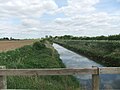
 New Ings Drain - geograph.org.uk - 2593557.jpg 1,600 × 1,200; 698 KB
-
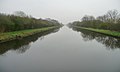
 New Junction Canal - geograph.org.uk - 2593542.jpg 1,600 × 1,200; 414 KB
-
 New Junction Canal - geograph.org.uk - 2593545.jpg 1,600 × 1,200; 474 KB
-
 New Junction Canal - geograph.org.uk - 5515133.jpg 3,198 × 2,363; 3 MB
-
 New Junction Canal - geograph.org.uk - 978788.jpg 640 × 618; 112 KB
-

-
 New Junction Canal at Sykehouse Lock - geograph.org.uk - 6116982.jpg 1,600 × 1,065; 542 KB
-
 New Junction Canal from Sykehouse Lock - geograph.org.uk - 6116990.jpg 1,600 × 1,065; 508 KB
-
 New Junction Canal towpath, Sykehouse - geograph.org.uk - 3922343.jpg 1,024 × 768; 136 KB
-
 New Junction Canal Viewed from Sykehouse Road Bridge - geograph.org.uk - 5504316.jpg 3,264 × 2,448; 2.64 MB
-
 New Junction Canal, aerial 2014 - geograph.org.uk - 3878843.jpg 683 × 1,024; 115 KB
-

-

-

-
-
 North Lane (Track) from Eskholme Lane - geograph.org.uk - 2856407.jpg 3,264 × 2,448; 4 MB
-
 North Lane and Eskholme Drain - geograph.org.uk - 2856414.jpg 3,264 × 2,448; 3.38 MB
-

-
 Overgrown track (Fowdall Lane) - geograph.org.uk - 2429235.jpg 1,600 × 1,200; 864 KB
-

-
 Path leading to Tideworth Hague Gorse - geograph.org.uk - 6116252.jpg 1,600 × 1,065; 749 KB
-
 Path leading to Tideworth Hague Gorse - geograph.org.uk - 6116281.jpg 1,600 × 1,065; 592 KB
-
 Path leading towards Westfield Farm - geograph.org.uk - 6117111.jpg 1,600 × 1,065; 1.06 MB
-
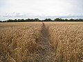 Path through a wheatfield - geograph.org.uk - 3105288.jpg 1,024 × 768; 233 KB
-
 Peeping over Topham Ferry bridge - geograph.org.uk - 2255557.jpg 480 × 640; 62 KB
-
 Pens beside the path at New Ings - geograph.org.uk - 4327822.jpg 1,600 × 1,200; 674 KB
-
 Pincheon Green - geograph.org.uk - 1255738.jpg 640 × 480; 47 KB
-
 Pincheon Green Farm, from the west - geograph.org.uk - 6266651.jpg 1,600 × 1,200; 652 KB
-
 Pincheon Green Lane Junction - geograph.org.uk - 1255862.jpg 640 × 480; 54 KB
-
 Pincheon Green Lane, Pincheon Green, looking west - geograph.org.uk - 6266640.jpg 1,600 × 1,200; 484 KB
-
 Private hut on Bate Lane Sykehouse - geograph.org.uk - 4231569.jpg 1,024 × 768; 170 KB
-
 Public Bridleway near West End - geograph.org.uk - 1332885.jpg 640 × 480; 129 KB
-
 Quiet country lane to Bank House - geograph.org.uk - 6179012.jpg 1,024 × 768; 127 KB
-
 Ready for an emergency - geograph.org.uk - 2768475.jpg 1,024 × 768; 217 KB
-
 Ready for the next planting, Pincheon Green - geograph.org.uk - 6266644.jpg 1,600 × 1,201; 637 KB
-
 Remains of Sykehouse station - geograph.org.uk - 3105315.jpg 1,024 × 768; 224 KB
-
 Residential property by Rudgate Lane - geograph.org.uk - 5638640.jpg 4,848 × 3,531; 3.61 MB
-
 River Don at Blackshaw Dike - geograph.org.uk - 4327751.jpg 1,600 × 1,200; 417 KB
-
 River Don east of Wormley Hill - geograph.org.uk - 4327755.jpg 1,600 × 1,200; 352 KB
-
 River Don flood bank looking towards Ivy House - geograph.org.uk - 2765869.jpg 1,024 × 768; 201 KB
-
 River Went - geograph.org.uk - 2593573.jpg 1,600 × 1,200; 376 KB
-
 River Went - geograph.org.uk - 434688.jpg 480 × 640; 110 KB
-
 River Went - geograph.org.uk - 6474630.jpg 1,024 × 768; 147 KB
-
 River Went in flood at Topham Ferry Bridge - geograph.org.uk - 5706973.jpg 1,600 × 1,065; 604 KB
-
 River Went southwest of Went Bridge - geograph.org.uk - 4327818.jpg 1,600 × 1,200; 556 KB
-
 Road sign on Pincheon Green Lane - geograph.org.uk - 6491181.jpg 5,456 × 3,632; 3.9 MB
-
 Rudgate Lane at Wormley Hill Farm - geograph.org.uk - 6491241.jpg 4,892 × 3,424; 1.76 MB


_-_geograph.org.uk_-_2856441.jpg)


_from_Eskholme_Lane_-_geograph.org.uk_-_2856407.jpg)


_-_geograph.org.uk_-_2429235.jpg)


