Category:Tümpel am Bornholz
| Object location | | View all coordinates using: OpenStreetMap |
|---|
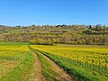
natural monument area in Wetterzeube Municipality, Saxony-Anhalt, Germany  | |||||
| Upload media | |||||
| Instance of | |||||
|---|---|---|---|---|---|
| Part of |
| ||||
| Location | Wetterzeube, Droyßiger-Zeitzer Forst, Burgenlandkreis, Saxony-Anhalt, Germany | ||||
| Heritage designation | |||||
| Inception |
| ||||
 | |||||
Media in category "Tümpel am Bornholz"
The following 6 files are in this category, out of 6 total.
-
 Blick auf das Elstertal - Tümpel am Bornholz und Hang bei Obersiedel.jpg 4,032 × 3,024; 6.88 MB
-
 Elsteraue am Bornholz-Tümpel 01.jpg 4,032 × 3,024; 9.2 MB
-
 Elsteraue am Bornholz-Tümpel 02.jpg 4,032 × 3,024; 8.58 MB
-
 Tümpel am Bornholz - Detailansicht 01.jpg 4,032 × 3,024; 10.73 MB
-
 Tümpel am Bornholz - Detailansicht 02.jpg 4,032 × 3,024; 9.99 MB
-
 Tümpel am Bornholz in der Elsteraue.jpg 4,032 × 3,024; 9.12 MB


