Category:TIF versions of Sanborn maps of Manhattan published in 1913
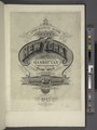
Maps from: Insurance Maps of the City of New York Borough of Manhattan. Volume Twelve. (New York: Sanborn Map Company, 1913), comprising 83 plates (maps), plus street index, title page, and volume index (the last one missing from this category).
Online at The New York Public Library Digital Collections website, Atlas 129. Vol. 12, 1913.
Media in category "TIF versions of Sanborn maps of Manhattan published in 1913"
The following 85 files are in this category, out of 85 total.
-
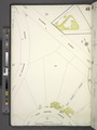
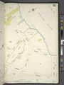
 Index NYPL1997978.tiff 5,349 × 7,131, 2 pages; 109.19 MB
-
-
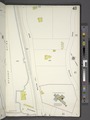
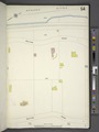
 Manhattan, V. 12, Plate No. 1 (Map bounded by Hudson River, Haven Ave.) NYPL1997980.tiff 5,349 × 7,131, 2 pages; 109.19 MB
-
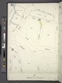
 Manhattan, V. 12, Plate No. 2 (Map bounded by Hudson River, Haven Ave.) NYPL1997981.tiff 5,349 × 7,131, 2 pages; 109.19 MB
-
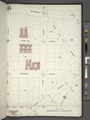
 Manhattan, V. 12, Plate No. 3 (Map bounded by W. 175th St., Fort Washington Ave., W. 170th St., Haven Ave.) NYPL1997982.tiff 5,349 × 7,131, 2 pages; 109.19 MB
-
 Manhattan, V. 12, Plate No. 4 (Map bounded by W. 179th St., Fort Washington Ave., W. 175th St., Haven Ave.) NYPL1997983.tiff 5,349 × 7,131, 2 pages; 109.19 MB
-
 Manhattan, V. 12, Plate No. 5 (Map bounded by Fort Washington Ave., W. 173rd St., St. Nicholas Ave., W. 170th St.) NYPL1997984.tiff 5,349 × 7,131, 2 pages; 109.19 MB
-
 Manhattan, V. 12, Plate No. 6 (Map bounded by Fort Washington Ave., W. 176th St., St. Nicholas Ave., W. 173rd St.) NYPL1997985.tiff 5,349 × 7,131, 2 pages; 109.19 MB
-
 Manhattan, V. 12, Plate No. 7 (Map bounded by St. Nicholas Ave., W. 173rd St., Amsterdam Ave., W. 170th St.) NYPL1997986.tiff 5,349 × 7,131, 2 pages; 109.19 MB
-
 Manhattan, V. 12, Plate No. 8 (Map bounded by St. Nicholas Ave., W. 176th St., Amsterdam Ave., W. 173rd St.) NYPL1997987.tiff 5,349 × 7,131, 2 pages; 109.19 MB
-
 Manhattan, V. 12, Plate No. 9 (Map bounded by Fort Washington Ave., W. 179th St., St. Nicholas Ave., W. 176th St.) NYPL1997988.tiff 5,349 × 7,131, 2 pages; 109.19 MB
-
 Manhattan, V. 12, Plate No. 10 (Map bounded by St. Nicholas Ave., W. 179th St., Amsterdam Ave.,, W. 176th St.) NYPL1997989.tiff 5,349 × 7,131, 2 pages; 109.19 MB
-
 Manhattan, V. 12, Plate No. 11 (Map bounded by Hudson River, Riverside Drive) NYPL1997990.tiff 5,349 × 7,131, 2 pages; 109.19 MB
-
 Manhattan, V. 12, Plate No. 12 (Map bounded by Hudson River, Riverside Drive) NYPL1997991.tiff 5,349 × 7,131, 2 pages; 109.19 MB
-
 Manhattan, V. 12, Plate No. 13 (Map bounded by W. 181st St., Northern Ave., W. 177th St., Riverside Drive) NYPL1997992.tiff 5,349 × 7,131, 2 pages; 109.19 MB
-
 Manhattan, V. 12, Plate No. 14 (Map bounded by Northern Ave., W. 181st St., Broadway, W. 179th St.) NYPL1997993.tiff 5,349 × 7,131, 2 pages; 109.19 MB
-
 Manhattan, V. 12, Plate No. 15 (Map bounded by Hudson River, Northern Ave., W. 181st St.) NYPL1997994.tiff 5,359 × 7,145, 2 pages; 109.61 MB
-
 Manhattan, V. 12, Plate No. 16 (Map bounded by Northern Ave., Fort Washington Ave., W. 181st St.) NYPL1997995.tiff 5,349 × 7,131, 2 pages; 109.19 MB
-
 Manhattan, V. 12, Plate No. 17 (Map bounded by W. 186th St., Broadway, W. 181st St., Fort Washington Ave.) NYPL1997996.tiff 5,380 × 7,173, 2 pages; 110.47 MB
-
 Manhattan, V. 12, Plate No. 18 (Map bounded by W. 183rd St., St. Nicholas Ave., W. 179th St., Broadway) NYPL1997997.tiff 5,380 × 7,173, 2 pages; 110.47 MB
-
 Manhattan, V. 12, Plate No. 19 (Map bounded by St. Nicholas Ave., W. 182nd St., Amsterdam Ave., W. 179th St.) NYPL1997998.tiff 5,380 × 7,173, 2 pages; 110.47 MB
-
 Manhattan, V. 12, Plate No. 20 (Map bounded by St. Nicholas Ave., W. 185th St., Laurel Hill Terrace, W. 182nd St.) NYPL1997999.tiff 5,380 × 7,173, 2 pages; 110.47 MB
-
 Manhattan, V. 12, Plate No. 21 (Map bounded by Hudson River, Fort Washington Ave.) NYPL1998000.tiff 5,346 × 7,128, 2 pages; 109.08 MB
-
 Manhattan, V. 12, Plate No. 22 (Map bounded by Fort Wasshington Ave., W. 188th St., Broadway, W. 186th St.) NYPL1998001.tiff 5,380 × 7,173, 2 pages; 110.47 MB
-
 Manhattan, V. 12, Plate No. 23 (Map bounded by W. 187th St., St. Nicholas Ave., W. 183rd St., Broadway) NYPL1998002.tiff 5,401 × 7,201, 2 pages; 111.33 MB
-
 Manhattan, V. 12, Plate No. 24 (Map bounded by Broadway, W. 190th St., St. Nicholas Ave., W. 187th St.) NYPL1998003.tiff 5,382 × 7,176, 2 pages; 110.56 MB
-
 Manhattan, V. 12, Plate No. 25 (Map bounded by St. Nicholas Ave., W. 188th St., Laurel Hill Terrace, W. 185th St.) NYPL1998004.tiff 5,349 × 7,132, 2 pages; 109.21 MB
-
 Manhattan, V. 12, Plate No. 26 (Map bounded by St. Nicholas Ave., W. 191st St., Amsterdam Ave., W. 188th St.) NYPL1998005.tiff 5,368 × 7,158, 2 pages; 109.99 MB
-
 Manhattan, V. 12, Plate No. 27 (Map bounded by Hudson River, Riverside Drive) NYPL1998006.tiff 5,368 × 7,158, 2 pages; 109.99 MB
-
 Manhattan, V. 12, Plate No. 28 (Map bounded by Riverside Drive, Fort Washington Ave.) NYPL1998007.tiff 5,400 × 7,200, 2 pages; 111.3 MB
-
 Manhattan, V. 12, Plate No. 29 (Map bounded by Overlook Terr., Broadway, W. 188th St., Fort Washington Ave.) NYPL1998008.tiff 5,400 × 7,200, 2 pages; 111.3 MB
-
 Manhattan, V. 12, Plate No. 30 (Map bounded by Broadway, W. 193rd St., St. Nicholas Ave.) NYPL1998009.tiff 5,294 × 7,059, 2 pages; 106.98 MB
-
 Manhattan, V. 12, Plate No. 31 (Map bounded by St. Nicholas Ave., Amsterdam Ave.) NYPL1998010.tiff 5,389 × 7,185, 2 pages; 110.84 MB
-
 Manhattan, V. 12, Plate No. 32 (Map bounded by St. Nicholas Ave., Amsterdam Ave.) NYPL1998011.tiff 5,411 × 7,215, 2 pages; 111.76 MB
-
 Manhattan, V. 12, Plate No. 33 (Map bounded by Hudson River, Riverside Drive) NYPL1998012.tiff 5,397 × 7,196, 2 pages; 111.17 MB
-
 Manhattan, V. 12, Plate No. 34 (Map bounded by Hudson River, Riverside Drive) NYPL1998013.tiff 5,411 × 7,215, 2 pages; 111.76 MB
-
 Manhattan, V. 12, Plate No. 35 (Map bounded by Riverside Drive, Broadway) NYPL1998014.tiff 5,382 × 7,176, 2 pages; 110.56 MB
-
 Manhattan, V. 12, Plate No. 36 (Map bounded by Riverside Drive, Broadway) NYPL1998015.tiff 5,411 × 7,215, 2 pages; 111.76 MB
-
 Manhattan, V. 12, Plate No. 37 (Map bounded by Ellwood St., Nagle Ave., Broadway) NYPL1998016.tiff 5,405 × 7,206, 2 pages; 111.49 MB
-
 Manhattan, V. 12, Plate No. 38 (Map bounded by Ellwood St., W. 193rd St., Broadway) NYPL1998017.tiff 5,411 × 7,215, 2 pages; 111.76 MB
-
 Manhattan, V. 12, Plate No. 39 (Map bounded by Dyckman St., Riverside Drive, Hudson River) NYPL1998018.tiff 5,405 × 7,206, 2 pages; 111.49 MB
-
 Manhattan, V. 12, Plate No. 40 (Map bounded by Bolton Rd., Dyckman St.) NYPL1998019.tiff 5,411 × 7,215, 2 pages; 111.76 MB
-
 Manhattan, V. 12, Plate No. 41 (Map bounded by Riverside Drive, Broadway, Corbin Place) NYPL1998020.tiff 5,394 × 7,191, 2 pages; 111.04 MB
-
 Manhattan, V. 12, Plate No. 42 (Map bounded by D. St., Dyckman St., Riverside Drive) NYPL1998021.tiff 5,411 × 7,215, 2 pages; 111.76 MB
-
 Manhattan, V. 12, Plate No. 43 (Map bounded by Bolton Rd., Prescott Ave., Dyckman St.) NYPL1998022.tiff 5,412 × 7,216, 2 pages; 111.79 MB
-
 Manhattan, V. 12, Plate No. 44 (Map bounded by Prescott Ave., Academy St., Vermilyea Ave., Dyckman St.) NYPL1998023.tiff 5,394 × 7,193, 2 pages; 111.07 MB
-
 Manhattan, V. 12, Plate No. 45 (Map bounded by Dyckman St., Sherman Ave., Broadway) NYPL1998024.tiff 5,394 × 7,193, 2 pages; 111.07 MB
-
 Manhattan, V. 12, Plate No. 46 (Map bounded by Dyckman St., Nagle Ave., Ellwood St., Sherman Ave.) NYPL1998025.tiff 5,394 × 7,193, 2 pages; 111.07 MB
-
 Manhattan, V. 12, Plate No. 47 (Map bounded by Dyckman St., St. Nicholas Ave., Ellwood St., Nagle Ave.) NYPL1998026.tiff 5,403 × 7,205, 2 pages; 111.44 MB
-
 Manhattan, V. 12, Plate No. 48 (Map bounded by Dyckman St., Fort George Ave.) NYPL1998027.tiff 5,399 × 7,199, 2 pages; 111.26 MB
-
 Manhattan, V. 12, Plate No. 49 (Map bounded by Vermilyea Ave., Academy St., Nagle Ave., Dyckman St.) NYPL1998028.tiff 5,403 × 7,205, 2 pages; 111.44 MB
-
 Manhattan, V. 12, Plate No. 50 (Map bounded by 10th Ave., Dyckman St., Nagle Ave.) NYPL1998029.tiff 5,403 × 7,205, 2 pages; 111.44 MB
-
 Manhattan, V. 12, Plate No. 51 (Map bounded by Dyckman St., W. 201st St., Harlem River) NYPL1998030.tiff 5,409 × 7,212, 2 pages; 111.67 MB
-
 Manhattan, V. 12, Plate No. 52 (Map bounded by 10th Ave., W. 204th St., Harlem River, W. 201st St.) NYPL1998031.tiff 5,411 × 7,215, 2 pages; 111.76 MB
-
 Manhattan, V. 12, Plate No. 53 (Map bounded by Hudson River, Bolton Rd.) NYPL1998032.tiff 5,370 × 7,160, 2 pages; 110.07 MB
-
 Manhattan, V. 12, Plate No. 54 (Map bounded by Hudson River, Bolton Rd.) NYPL1998033.tiff 5,382 × 7,176, 2 pages; 110.56 MB
-
 Manhattan, V. 12, Plate No. 55 (Map bounded by Bolton Rd., Nicholas Place) NYPL1998034.tiff 5,395 × 7,193, 2 pages; 111.09 MB
-
 Manhattan, V. 12, Plate No. 56 (Map bounded by Emerson Pl., Seaman Ave., Nicholas Place) NYPL1998035.tiff 5,395 × 7,193, 2 pages; 111.09 MB
-
 Manhattan, V. 12, Plate No. 57 (Map bounded by W. 207th St., Broadway, Academy St., Seaman Ave.) NYPL1998036.tiff 5,395 × 7,193, 2 pages; 111.09 MB
-
 Manhattan, V. 12, Plate No. 58 (Map bounded by W. 207th St., Sherman Ave., Academy St., Broadway) NYPL1998037.tiff 5,395 × 7,193, 2 pages; 111.09 MB
-
 Manhattan, V. 12, Plate No. 59 (Map bounded by W. 207th St., Nagle Ave., Academy St., Sherman Ave.) NYPL1998038.tiff 5,395 × 7,193, 2 pages; 111.09 MB
-
 Manhattan, V. 12, Plate No. 60 (Map bounded by 10th Ave., W. 207th St., Harlem River, W. 204th St.) NYPL1998039.tiff 5,383 × 7,177, 2 pages; 110.59 MB
-
 Manhattan, V. 12, Plate No. 61 (Map bounded by 10th Ave., W. 210th St., Harlem River, W. 207th St.) NYPL1998040.tiff 5,399 × 7,199, 2 pages; 111.26 MB
-
 Manhattan, V. 12, Plate No. 62 (Map bounded by 10th Ave., W. 213th St., Harlem River, W. 210th St.) NYPL1998041.tiff 5,383 × 7,177, 2 pages; 110.59 MB
-
 Manhattan, V. 12, Plate No. 63 (Map bounded by Cold Spring Rd., Crosby Place) NYPL1998042.tiff 5,381 × 7,174, 2 pages; 110.51 MB
-
 Manhattan, V. 12, Plate No. 64 (Map bounded by W. 214th St., Broadway, W. 207th St., Seaman Ave.) NYPL1998043.tiff 5,383 × 7,177, 2 pages; 110.59 MB
-
 Manhattan, V. 12, Plate No. 65 (Map bounded by Broadway, W. 211th St., 10th Ave., Post Ave., W. 207th St.) NYPL1998044.tiff 5,390 × 7,187, 2 pages; 110.89 MB
-
 Manhattan, V. 12, Plate No. 66 (Map bounded by W. 215th St., 10th Ave., W. 211th St., Broadway) NYPL1998045.tiff 5,390 × 7,187, 2 pages; 110.89 MB
-
 Manhattan, V. 12, Plate No. 67 (Map bounded by 10th Ave., W. 216th St., Harlem River, W. 213th St.) NYPL1998046.tiff 5,390 × 7,187, 2 pages; 110.89 MB
-
 Manhattan, V. 12, Plate No. 68 (Map bounded by 10th Ave., Broadway, W. 219th St., Harlem River, W. 216th St.) NYPL1998047.tiff 5,400 × 7,201, 2 pages; 111.31 MB
-
 Manhattan, V. 12, Plate No. 69 (Map bounded by Harlem River, Bolton Rd., Hudson River) NYPL1998048.tiff 5,408 × 7,210, 2 pages; 111.62 MB
-
 Manhattan, V. 12, Plate No. 70 (Map bounded by Harlem River, Prescott Ave.) NYPL1998049.tiff 5,333 × 7,110, 2 pages; 108.54 MB
-
 Manhattan, V. 12, Plate No. 71 (Map bounded by Cold Spring Rd., Harlem River) NYPL1998050.tiff 5,400 × 7,201, 2 pages; 111.31 MB
-
 Manhattan, V. 12, Plate No. 72 (Map bounded by Harlem River, Seaman Ave., W. 218th St.) NYPL1998051.tiff 5,340 × 7,119, 2 pages; 108.82 MB
-
 Manhattan, V. 12, Plate No. 73 (Map bounded by Bolton Rd., Cold Spring Rd., Crosby Place) NYPL1998052.tiff 5,375 × 7,166, 2 pages; 110.26 MB
-
 Manhattan, V. 12, Plate No. 74 (Map bounded by Harlem River, W. 218th St., Seaman Ave., W. 213th St.) NYPL1998053.tiff 5,340 × 7,119, 2 pages; 108.82 MB
-
 Manhattan, V. 12, Plate No. 75 (Map bounded by Seaman Ave., W. 217th St., Broadway, W. 214th St.) NYPL1998054.tiff 5,340 × 7,119, 2 pages; 108.82 MB
-
 Manhattan, V. 12, Plate No. 76 (Map bounded by Seaman Ave., W. 219th St., Broadway) NYPL1998055.tiff 5,340 × 7,119, 2 pages; 108.82 MB
-
 Manhattan, V. 12, Plate No. 77 (Map bounded by Seaman Ave., Harlem River, Broadway, W. 219th St.) NYPL1998056.tiff 5,340 × 7,119, 2 pages; 108.82 MB
-
 Manhattan, V. 12, Plate No. 78 (Map bounded by Broadway, Harlem River, W. 219th St.) NYPL1998057.tiff 5,340 × 7,119, 2 pages; 108.82 MB
-
 Manhattan, V. 12, Plate No. 79 (Map bounded by W. 227th St., Jacobus Place., Harlem River, Teunissen Ave.) NYPL1998058.tiff 5,371 × 7,161, 2 pages; 110.1 MB
-
 Manhattan, V. 12, Plate No. 80 (Map bounded byW. 227th St., Broadway, W. 225th St., Van Corlears Place) NYPL1998059.tiff 5,371 × 7,161, 2 pages; 110.1 MB
-
 Manhattan, V. 12, Plate No. 81 (Map bounded by Broadway, W. 225th St., Harlem River) NYPL1998060.tiff 5,371 × 7,161, 2 pages; 110.1 MB
-
 Manhattan, V. 12, Plate No. 82 (Map bounded by W. 230th St., Broadway, W. 227th St.) NYPL1998061.tiff 5,371 × 7,161, 2 pages; 110.1 MB
-
 Manhattan, V. 12, Plate No. 83 (Map bounded by Harlem River, Amsterdam Ave.) NYPL1998062.tiff 5,371 × 7,161, 2 pages; 110.1 MB