Category:Taihaku-dōri

Map of Taihaku Dōri, 大博通りの地図

Subcategories
This category has the following 8 subcategories, out of 8 total.
Media in category "Taihaku-dōri"
The following 55 files are in this category, out of 55 total.
-
 Chikkōhonmachi Fukkuoka-City 01.jpg 3,840 × 2,160; 2.18 MB
-

-

-
 Fukuoka BRT Bus near Gofukumachi Station.jpg 3,960 × 2,970; 3.3 MB
-
 Fukuoka City - Taihaku-dori Avenue - 01.JPG 1,936 × 2,896; 3.06 MB
-
 Fukuoka Open Top Bus passing through Taihaku Dōri near Hotel Cabinas Fukuoka 20230907.jpg 2,688 × 2,688; 2.44 MB
-
 Gofuku-machi 20220405.jpg 4,000 × 2,000; 2.89 MB
-
 Hakata Taihaku Street 2011.jpg 1,067 × 1,600; 505 KB
-
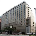 Hotel Nikkou Fukuoka 2011.jpg 1,600 × 1,600; 530 KB
-
 JRHAKATACITYAMUPRAZA observationdeck NIGHT.JPG 2,304 × 1,728; 986 KB
-
 Kamiyamachi view south from Chikkōhonmachi Intersection Hakata-ku Fukuoka City 20230420.jpg 3,840 × 2,160; 2.16 MB
-
 Nishinihon city bank Headquarters annex 2011.jpg 1,600 × 1,600; 613 KB
-
 Passageway for Gion Station the exterior view of the P-4th Exit on Taihaku Dōri 20230907.jpg 4,000 × 1,680; 2.82 MB
-

-
 Passageway for Gion Station the exterior view of the P-4th Exit on Taihaku Dōri 20240408.jpg 4,000 × 2,256; 2.95 MB
-

-
 Sekijoumachi Fukuoka-City 01.jpg 3,840 × 2,160; 2.18 MB
-
 Shimo-gofukumachi view N from the S corner of Kuramoto INT Hakata-ku Fukuoka 20230420.jpg 4,000 × 1,680; 1.67 MB
-

-
-
 Taihaku Dōri NW from Gionmachi INT Reisenmachi Gokushomachi Hakata-ku Fukuoka 20230720.jpg 3,984 × 1,664; 1.64 MB
-

-

-

-

-

-
 Taihaku Dōri SE from Gionmachi INT Gokushomachi Gionmachi Hakata-ku Fukuoka 20230720.jpg 3,984 × 2,240; 2.61 MB
-

-

-

-

-
-

-

-
 Taihaku street 2010 A.jpg 2,000 × 1,333; 952 KB
-
 Taihaku street 2010 B.jpg 2,000 × 1,545; 497 KB
-
 Taihaku street2010A.jpg 2,000 × 1,334; 1.99 MB
-
 Taihaku-dori Avenue Gofukumach 20220408.jpg 4,000 × 2,000; 2.39 MB
-
 Taihaku-dori Avenue Gofukumachi 20220407.jpg 4,000 × 2,000; 2.56 MB
-
 Taihaku-dori Road from Hakata Station.JPG 3,264 × 2,448; 2.21 MB
-
 Taihaku-dori St. - panoramio.jpg 2,272 × 1,704; 1.05 MB
-
 Taihaku-dori Street at dusk 20150327-1.jpg 3,264 × 2,448; 2.18 MB
-
 Taihaku-dori Street at dusk 20150327-2.jpg 3,264 × 2,448; 2.08 MB
-
 Taihaku-dori Street from northern end.jpg 3,264 × 2,448; 2.63 MB
-
 Taihaku-dori Street near Hakata Station.jpg 3,925 × 2,944; 3.38 MB
-

-

-

-

-
 Taihakumachi view E from Chikkōhonmachi Intersection Hakata-ku Fukuoka 20230420.jpg 4,000 × 2,256; 2.56 MB
-
 Taihakumachi view N from Kamiyamachi Intersection Hakata-ku Fukuoka 20230420.jpg 4,000 × 2,256; 2.31 MB
-
 Tenyamachi view south from Gofukumachi Intersection Hakata-ku Fukuoka City 20230420.jpg 4,000 × 2,256; 2.18 MB
-
 Tsunabamachi 20220412.jpg 4,000 × 2,000; 2.24 MB
-
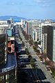
 View from top of Hakata Station (northwest).jpg 3,958 × 2,969; 2.75 MB
-
 博多駅前 - panoramio (1).jpg 3,456 × 2,592; 1.24 MB


.jpg)
.jpg)