Category:Tama Hills
日本語: 多摩丘陵の画像。
English: Images of Tamakyuryo (Hills of Tama)
expanse of hills stretching along the southwestern flank of Tokyo  | |||||
| Upload media | |||||
| Instance of |
| ||||
|---|---|---|---|---|---|
| Named after |
| ||||
| Located in protected area |
| ||||
| Location | |||||
| Area |
| ||||
| Elevation above sea level |
| ||||
 | |||||
Subcategories
This category has the following 14 subcategories, out of 14 total.
H
- Higashitakane Shinrinkoen (143 F)
I
J
K
- Kodomo Shizen Kōen (35 F)
M
- Maioka Park (5 F)
- Mount Masugata (38 F)
O
- Oyamadairi Park (8 F)
- Ōzenji Furusato Park (39 F)
S
- Shikinomori Park (33 F)
T
Y
Media in category "Tama Hills"
The following 28 files are in this category, out of 28 total.
-
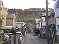
 Inagi Sakahama 05a5085v.jpg 640 × 480; 122 KB
-
 Inagi satoyama 06b5799s.jpg 400 × 300; 78 KB
-
 Inagi satoyama 06b5841s.jpg 480 × 360; 95 KB
-
 Inagiminamiyamaview.jpg 2,241 × 1,642; 2.01 MB
-
 KashinokiyamaNaturePark-Kamakurakodo.jpg 720 × 480; 253 KB
-
 Kawasakiw-end.jpg 2,560 × 1,920; 1.93 MB
-
 MachidaHills.jpg 970 × 966; 552 KB
-
 Maioka furusato t01.JPG 1,067 × 800; 837 KB
-
 Maioka park t01.JPG 1,195 × 800; 1.39 MB
-
 Minamiyama6.JPG 2,592 × 3,872; 5.12 MB
-
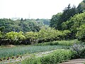
 Naganuma Park.jpg 1,900 × 1,267; 2.62 MB
-
 Nanakuniyama summit.jpg 1,600 × 1,200; 1.1 MB
-
 Nanakuniyama.jpg 1,600 × 1,200; 1.13 MB
-
 Nanzan1.JPG 3,648 × 2,736; 3.83 MB
-
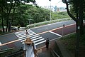
 Oiwake2013.jpg 960 × 720; 252 KB
-
 Oto-ryokuchi.jpg 640 × 480; 156 KB
-
 Shimizuyado.jpg 2,460 × 1,668; 1.1 MB
-
 TadaoPark3.jpg 640 × 480; 179 KB
-
 Yokoyanma.jpg 2,239 × 1,632; 2.23 MB
-
 おっ越し山ふれあいの森 - panoramio.jpg 800 × 600; 303 KB
-
 多摩丘陵.jpg 2,560 × 1,920; 1.08 MB
-
 多摩丘陵、小田急多摩線黒川駅付近 - 画像 187.jpg 2,560 × 1,920; 812 KB
-
 多摩市 いろは坂 中腹.jpg 1,900 × 1,267; 2.25 MB
-
 多摩市「いろは坂」の階段130806.jpg 2,592 × 1,728; 976 KB
-
 平山城址公園からの風景.JPG 3,648 × 2,736; 4.42 MB
-
 梨子ノ木特別緑地保全地区 - panoramio.jpg 1,024 × 768; 207 KB
-
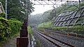 清水谷戸トンネル.JPG 1,920 × 1,080; 608 KB
-
 黒川 - panoramio (7).jpg 2,640 × 1,760; 5.01 MB


.jpg)