Category:Tamlaght, County Fermanagh
English: Tamlaght is is a townland (of 185 acres) and village in County Fermanagh, Northern Ireland, 4.5km south-east of Enniskillen.
village in County Fermanagh, Northern Ireland, UK  | |||||
| Upload media | |||||
| Instance of | |||||
|---|---|---|---|---|---|
| Location | Northern Ireland | ||||
 | |||||
Media in category "Tamlaght, County Fermanagh"
The following 16 files are in this category, out of 16 total.
-

-
 Approaching Tamlaght on the A4 (Belfast Road) - geograph.org.uk - 3165497.jpg 1,024 × 767; 156 KB
-
 At Tamlaght Bay - geograph.org.uk - 4084689.jpg 640 × 480; 156 KB
-
 Bend in the A4 west of Tamlaght - geograph.org.uk - 3165503.jpg 1,024 × 768; 108 KB
-
 Church of Ireland Hall, Tamlaght - geograph.org.uk - 1043855.jpg 640 × 479; 51 KB
-
 Church of Ireland, Tamlaght - geograph.org.uk - 3212209.jpg 640 × 480; 62 KB
-
 Deserted farmhouse at Cleenish - geograph.org.uk - 1044449.jpg 640 × 479; 52 KB
-
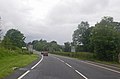
 Heading for Tamlaght on the Belfast Road (A4) - geograph.org.uk - 3225173.jpg 1,024 × 768; 132 KB
-
 Housing estate on Enniskillen Road, Tamlaght - geograph.org.uk - 3165501.jpg 1,024 × 572; 98 KB
-
-
 Shankill One - geograph.org.uk - 940630.jpg 640 × 479; 54 KB
-
 Trees, Tamlaght Bay - geograph.org.uk - 4084690.jpg 640 × 480; 164 KB
-
 Ardtonnagh Townland - geograph.org.uk - 1043922.jpg 640 × 479; 55 KB
-
 Ardtonnagh Townland - geograph.org.uk - 1043925.jpg 640 × 479; 54 KB
-
 Nothing biting^ - geograph.org.uk - 586154.jpg 640 × 480; 111 KB
-
 The Ring road - geograph.org.uk - 567183.jpg 640 × 480; 150 KB

_-_geograph.org.uk_-_3165497.jpg)


_-_geograph.org.uk_-_3225173.jpg)


