Category:Taplow
Deutsch: Taplow ist ein Dorf in der Grafschaft Buckinghamshire in England. Es liegt am Ufer der Themse gegenüber von Maidenhead, rund 35 km westlich von London. Der Name ist ursprünglich angelsächsisch und bedeutet 'Tæppa's hill' (Tæppas Hügel).
English: Taplow is a village and civil parish within South Bucks district in Buckinghamshire, England. It sits on the east bank of the River Thames facing Maidenhead on the opposite bank. Taplow railway station is situated near the A4 south of the village.
Norsk bokmål: Taplow er en landsby i Buckinghamshire, England, i nærheten av Maidenhead. Landsbyen er et verdslig sogn.
village and civil parish in Buckinghamshire, England  | |||||
| Upload media | |||||
| Instance of | |||||
|---|---|---|---|---|---|
| Location | Buckinghamshire, South East England, England | ||||
| Located in or next to body of water | |||||
| Population |
| ||||
| Area |
| ||||
 | |||||
Subcategories
This category has the following 15 subcategories, out of 15 total.
B
- Boulter's Lock (35 F)
- Bray Lock (8 F)
C
D
- Dorney Bridge, Taplow (6 F)
H
- Hedsor House (8 F)
N
P
R
S
- South Lodge Pit (7 F)
T
Media in category "Taplow"
The following 200 files are in this category, out of 402 total.
(previous page) (next page)-

-
 A corner of the village green, Taplow - geograph.org.uk - 3818953.jpg 1,024 × 803; 230 KB
-
 A narrow boat departing Bray Lock - geograph.org.uk - 2495877.jpg 640 × 480; 70 KB
-
 A plaque beside the River Thames in Maidenhead - geograph.org.uk - 3442492.jpg 2,592 × 1,944; 1.96 MB
-
 A walk in the woods by Sheepcote Lane - geograph.org.uk - 3458656.jpg 800 × 600; 223 KB
-
 A4 Bath Road at Maidenhead boundary - geograph.org.uk - 4862406.jpg 640 × 480; 85 KB
-
 A4 Bridge over the River Thames - geograph.org.uk - 5375133.jpg 640 × 273; 35 KB
-
 A4 Bridge, Jubilee River - geograph.org.uk - 6680447.jpg 1,024 × 684; 167 KB
-
 A4, approaching railway bridge - geograph.org.uk - 3560483.jpg 640 × 430; 49 KB
-
 A4, Dorney turning - geograph.org.uk - 3560487.jpg 640 × 430; 50 KB
-
 A4, eastbound - geograph.org.uk - 3560481.jpg 640 × 430; 61 KB
-
 A4094 - geograph.org.uk - 3561493.jpg 640 × 430; 102 KB
-

-
 Along the driveway - geograph.org.uk - 3877362.jpg 640 × 480; 131 KB
-
 Amerden Lane, Taplow geograph-6680452-by-N-Chadwick.jpg 1,024 × 684; 233 KB
-
 Approaching Bray Weir - geograph.org.uk - 3415373.jpg 640 × 480; 94 KB
-
 At Boulters Lock - geograph.org.uk - 4116385.jpg 4,000 × 3,000; 3.02 MB
-
 Autumnal colours on the Beeches Way - geograph.org.uk - 2684637.jpg 3,968 × 2,976; 2.94 MB
-
 Baglady near Maidenhead - geograph.org.uk - 2546820.jpg 1,024 × 680; 219 KB
-
 Balcony on the pavilion - geograph.org.uk - 5618135.jpg 1,024 × 683; 110 KB
-
 Barge Farm - geograph.org.uk - 2877481.jpg 4,288 × 3,216; 3.55 MB
-
 Barge passing Boulters weir - geograph.org.uk - 5314587.jpg 5,202 × 3,465; 3.22 MB
-
 Bath Rd, A4 - geograph.org.uk - 6680443.jpg 1,024 × 645; 158 KB
-
 Bath Rd, A4 - geograph.org.uk - 6680445.jpg 1,024 × 684; 234 KB
-
 Bath Road, Taplow - geograph.org.uk - 2812105.jpg 1,600 × 1,200; 551 KB
-
 Beeches Way (18) - geograph.org.uk - 3473784.jpg 800 × 600; 201 KB
-
 Beeches Way (19) - geograph.org.uk - 3473790.jpg 800 × 600; 181 KB
-
 Beeches Way (20) - geograph.org.uk - 3473798.jpg 800 × 600; 116 KB
-
 Beeches Way (21) - geograph.org.uk - 3473801.jpg 800 × 600; 198 KB
-
 Beeches Way - geograph.org.uk - 3301730.jpg 640 × 480; 80 KB
-
 Berry Hill - geograph.org.uk - 6680449.jpg 1,024 × 684; 221 KB
-
 Beside the Thames - geograph.org.uk - 3878650.jpg 640 × 480; 160 KB
-
 Boat House, Cliveden - geograph.org.uk - 5379064.jpg 1,600 × 1,200; 527 KB
-
 Boat in the Shed - geograph.org.uk - 5614139.jpg 1,024 × 683; 144 KB
-
 Boat on River Thames - geograph.org.uk - 5378906.jpg 1,600 × 1,200; 606 KB
-
 Boats Moored Above Maidenhead Bridge - geograph.org.uk - 2878604.jpg 4,288 × 3,216; 3.27 MB
-
 Boulter Lock - geograph.org.uk - 3561438.jpg 640 × 430; 109 KB
-
 Boulter's Gardens - geograph.org.uk - 3561496.jpg 640 × 430; 98 KB
-
 Boulter's Lock - geograph.org.uk - 4177481.jpg 640 × 430; 98 KB
-
 Boulter's Weir - geograph.org.uk - 4177512.jpg 640 × 430; 117 KB
-
 Boulter's Weir - geograph.org.uk - 4177514.jpg 640 × 430; 79 KB
-
 Boulters Lock - geograph.org.uk - 5314590.jpg 5,202 × 3,465; 3.92 MB
-
 Boulters Lock Maidenhead - geograph.org.uk - 2214190.jpg 2,560 × 1,920; 3.68 MB
-
 Boulters Lock, Maidenhead - geograph.org.uk - 5378893.jpg 1,513 × 1,600; 665 KB
-
 Boulters Weir - geograph.org.uk - 4116401.jpg 4,000 × 3,000; 2.55 MB
-
 Bourn End Road - geograph.org.uk - 6828823.jpg 4,032 × 2,268; 1.03 MB
-
 Bray Lock - geograph.org.uk - 2546855.jpg 1,024 × 680; 214 KB
-
 Bray Lock - geograph.org.uk - 2877459.jpg 4,288 × 3,216; 3.36 MB
-
 Bray Lock - geograph.org.uk - 5109896.jpg 5,184 × 3,456; 6.83 MB
-
 Bridges over the River Jubilee - geograph.org.uk - 6828662.jpg 6,016 × 3,384; 2.32 MB
-
 Bridleway, Hitcham - geograph.org.uk - 2171707.jpg 640 × 469; 143 KB
-
 Bridleway, Hitcham - geograph.org.uk - 2171710.jpg 640 × 480; 125 KB
-
 Buckinghamshire, South Bucks District - geograph.org.uk - 2878627.jpg 4,288 × 3,216; 3.46 MB
-
 Cafe at Boulters Lock - geograph.org.uk - 3415384.jpg 640 × 480; 141 KB
-
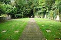
 Canadian Military Cemetery, Cliveden - geograph.org.uk - 4188161.jpg 4,920 × 1,957; 2.74 MB
-
 Canning Oak Information - geograph.org.uk - 5618128.jpg 533 × 800; 100 KB
-
 Cherry Tree ^ Weir - geograph.org.uk - 4116395.jpg 4,000 × 3,000; 3.66 MB
-
 Clivden garden wall - geograph.org.uk - 6828809.jpg 6,016 × 3,384; 2.87 MB
-
 Cliveden - Narrowboat - geograph.org.uk - 4214471.jpg 2,560 × 1,920; 2.68 MB
-
 Cliveden Deep - geograph.org.uk - 3878568.jpg 640 × 480; 151 KB
-
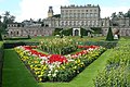
 Cliveden House from the end of the Terrace - geograph.org.uk - 2856091.jpg 7,077 × 2,226; 3.66 MB
-
 Cliveden House from the Parterre - geograph.org.uk - 2604946.jpg 2,845 × 837; 209 KB
-
 Cliveden House from the Statue - geograph.org.uk - 2604955.jpg 2,848 × 2,134; 1.13 MB
-
 Cliveden Road close to Huntswood Lane - geograph.org.uk - 6828748.jpg 6,016 × 3,384; 2.8 MB
-
 Cliveden Road looking south - geograph.org.uk - 4862402.jpg 640 × 480; 112 KB
-
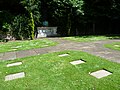 Cliveden War Cemetery - geograph.org.uk - 2456033.jpg 4,000 × 3,000; 4.03 MB
-
 Cliveden War Cemetery - geograph.org.uk - 2456053.jpg 4,000 × 3,000; 4.06 MB
-
 Cliveden War Memorial - geograph.org.uk - 5618240.jpg 1,024 × 683; 84 KB
-
 Cliveden woodlands car park entrance - geograph.org.uk - 6828742.jpg 6,016 × 3,384; 3.15 MB
-
 Cliveden, clock tower - geograph.org.uk - 2579525.jpg 480 × 640; 199 KB
-
 Cliveden, duel commemoration - geograph.org.uk - 2582275.jpg 640 × 461; 226 KB
-
 Cliveden, grounds - geograph.org.uk - 2582283.jpg 481 × 640; 260 KB
-
 Cliveden, part of the parterre - geograph.org.uk - 2579816.jpg 640 × 424; 235 KB
-
 Cliveden, the grounds - geograph.org.uk - 2579418.jpg 640 × 411; 248 KB
-
 Cliveden, the grounds - geograph.org.uk - 2579419.jpg 432 × 640; 240 KB
-
 Cliveden, view from the parterre - geograph.org.uk - 2579866.jpg 640 × 406; 167 KB
-
 Cliveden, view from the parterre - geograph.org.uk - 2579871.jpg 640 × 425; 220 KB
-
 Cliveden, war memorial garden - geograph.org.uk - 2579824.jpg 640 × 427; 237 KB
-
 Cliveden, water garden - geograph.org.uk - 2582289.jpg 640 × 392; 235 KB
-
 Cool under Yew in the Duke’s Garden at Cliveden - geograph.org.uk - 3537334.jpg 4,000 × 3,000; 5.39 MB
-
 Creative World in The Bishop Centre - geograph.org.uk - 2696411.jpg 1,500 × 998; 155 KB
-
 Crested Grebe - geograph.org.uk - 2877534.jpg 4,288 × 3,216; 2.19 MB
-
 Derek Rd - geograph.org.uk - 3561412.jpg 640 × 430; 115 KB
-
 Derelict looking house on Glen Island (geograph 4168868).jpg 640 × 430; 100 KB
-
 Direction signs on Broad Lane - geograph.org.uk - 4376267.jpg 2,560 × 1,920; 1.96 MB
-
 Downstream of Marsh Lane Weir - geograph.org.uk - 3781771.jpg 1,600 × 1,200; 519 KB
-
 Dragon Gate - geograph.org.uk - 189239.jpg 640 × 354; 82 KB
-
 Ducks and pond by Castleman's Farm (1) - geograph.org.uk - 3458822.jpg 800 × 600; 160 KB
-
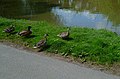 Ducks and pond by Castleman's Farm (2) - geograph.org.uk - 3458824.jpg 800 × 528; 138 KB
-
 Dumb Bell Garage, Taplow, about 1946 - geograph.org.uk - 2380672.jpg 511 × 361; 31 KB
-
 Dumb Bell Harvester, Taplow - geograph.org.uk - 383095.jpg 640 × 480; 70 KB
-
 Ellington Road - geograph.org.uk - 6828622.jpg 5,184 × 2,916; 1.85 MB
-

-
 Entrance to Shell garage on Bath Road, Taplow - geograph.org.uk - 2811998.jpg 1,600 × 1,200; 390 KB
-
 Evening cruising down the Thames - geograph.org.uk - 948349.jpg 640 × 427; 124 KB
-
 Evergreen Telephone Box - geograph.org.uk - 515658.jpg 480 × 640; 92 KB
-
 Eyot in the Jubilee River - geograph.org.uk - 2878962.jpg 4,288 × 3,216; 3.48 MB
-
 Farmland, seen from Boundary Road - geograph.org.uk - 3818960.jpg 1,024 × 768; 112 KB
-
 Field south of Green Common Lane - geograph.org.uk - 6885147.jpg 6,016 × 3,384; 3.07 MB
-
 Fields by the River Thames - geograph.org.uk - 3442394.jpg 2,592 × 1,944; 1.12 MB
-
 Fire Hose Cart (7958677318).jpg 3,811 × 2,740; 4.55 MB
-
 Fishery, Maidenhead - geograph.org.uk - 2877557.jpg 4,288 × 3,216; 3.67 MB
-

-
 Floral display - geograph.org.uk - 5618791.jpg 1,024 × 683; 253 KB
-
 Footbridge by Glebe Close - geograph.org.uk - 2878986.jpg 4,288 × 3,216; 3.73 MB
-
 Footbridge, Jubilee River - geograph.org.uk - 6680435.jpg 1,024 × 684; 267 KB
-
 Footbridge, Jubilee River - geograph.org.uk - 6680474.jpg 1,024 × 684; 250 KB
-
 Footbridge, Jubilee River - geograph.org.uk - 6684666.jpg 1,024 × 684; 196 KB
-
 Footpath along the Jubilee River - geograph.org.uk - 6680441.jpg 1,024 × 684; 258 KB
-
 Footpath signpost - geograph.org.uk - 6684710.jpg 1,024 × 684; 316 KB
-
 Footpath south of Taplow - geograph.org.uk - 6828639.jpg 6,016 × 3,384; 3.25 MB
-
 Footpath south of Taplow - geograph.org.uk - 6828647.jpg 6,016 × 3,384; 2.45 MB
-

-
 Ford Prefect in Rectory Close - geograph.org.uk - 1501538.jpg 640 × 480; 79 KB
-
 Fountain in the water garden - geograph.org.uk - 5618858.jpg 533 × 800; 136 KB
-
 Fountain on Ray Mill Island - geograph.org.uk - 4116667.jpg 3,000 × 4,000; 4.47 MB
-
 Frances Avenue - geograph.org.uk - 3561417.jpg 640 × 430; 122 KB
-
 Frances Drive - geograph.org.uk - 4168816.jpg 640 × 430; 104 KB
-
 Glen Island - geograph.org.uk - 3561422.jpg 640 × 430; 89 KB
-
 Glen Island, River Thames - geograph.org.uk - 3561435.jpg 640 × 430; 84 KB
-
 Golf ball mushroom - geograph.org.uk - 5618133.jpg 533 × 800; 90 KB
-
 Golf Course, Wooburn Common - geograph.org.uk - 5972822.jpg 5,184 × 3,456; 3.3 MB
-

-
 Green Common Lane, Wooburn Common - geograph.org.uk - 2149339.jpg 640 × 428; 147 KB
-
 Green Drive, Cliveden - geograph.org.uk - 3829837.jpg 734 × 1,024; 311 KB
-
 Green Drive, Cliveden - geograph.org.uk - 6531385.jpg 1,600 × 1,048; 915 KB
-
 Heathfield Road - geograph.org.uk - 162756.jpg 640 × 480; 504 KB
-
 Heathfield Road at Sheepcote Lane - geograph.org.uk - 4862396.jpg 640 × 480; 98 KB
-
 Heathfield Road north of Dropmore - geograph.org.uk - 4862393.jpg 640 × 481; 91 KB
-
 Heathfield Road opposite Hedsor Lane - geograph.org.uk - 4378003.jpg 2,560 × 1,920; 1.98 MB
-
 Heathfield Road, Dropmore - geograph.org.uk - 5666094.jpg 2,304 × 1,728; 872 KB
-
 Hedsor Equestrian Centre - geograph.org.uk - 3090306.jpg 640 × 480; 94 KB
-
 Hedsor Lane, Hedsor - geograph.org.uk - 4377755.jpg 2,560 × 1,920; 2 MB
-
 Hedsor Lane, Taplow. - panoramio.jpg 3,456 × 4,608; 5.96 MB
-

-
 Heron, Cliveden Ornamental Lake - geograph.org.uk - 4188071.jpg 2,230 × 1,008; 728 KB
-
 High Street, Taplow - geograph.org.uk - 331382.jpg 640 × 480; 121 KB
-
 Hitcham parish church, from the west - geograph.org.uk - 3831910.jpg 1,024 × 766; 162 KB
-
 Hitchambury Manor - geograph.org.uk - 1501234.jpg 640 × 480; 124 KB
-
 Horse paddock and stables - geograph.org.uk - 6885103.jpg 5,184 × 2,916; 2.77 MB
-
 House on Glen Island - geograph.org.uk - 3561424.jpg 640 × 430; 127 KB
-
 House on Ray Mead Rd - geograph.org.uk - 4168870.jpg 640 × 430; 89 KB
-
 House overlooking the Thames - geograph.org.uk - 2546832.jpg 1,024 × 680; 219 KB
-
 House, Ray Mill Rd East - geograph.org.uk - 3561495.jpg 640 × 430; 68 KB
-
 Houses alongside the Thames - geograph.org.uk - 3671787.jpg 4,000 × 3,000; 4.35 MB
-
 Houses alongside the Thames - geograph.org.uk - 3671809.jpg 4,000 × 3,000; 4.18 MB
-
 Houses by the Thames - geograph.org.uk - 2696513.jpg 1,500 × 999; 162 KB
-
 Houses in River Road, Maidenhead - geograph.org.uk - 3671242.jpg 4,000 × 3,000; 4.3 MB
-
 Houses on River Road - geograph.org.uk - 2696528.jpg 1,500 × 1,000; 198 KB
-
 How the Other Half Lives - geograph.org.uk - 2877514.jpg 4,288 × 3,216; 3.49 MB
-
 Hunt's Lane - geograph.org.uk - 1501241.jpg 640 × 480; 110 KB
-
 Hunt's Lane - geograph.org.uk - 1501248.jpg 640 × 480; 93 KB
-
 Huntswood Golf Course - geograph.org.uk - 6828732.jpg 6,016 × 3,384; 1.72 MB
-
 Island, Jubilee River - geograph.org.uk - 6680440.jpg 1,024 × 684; 241 KB
-
 Island, Jubilee River - geograph.org.uk - 6684659.jpg 1,024 × 684; 251 KB
-
 Japanese garden - geograph.org.uk - 3877282.jpg 640 × 480; 187 KB
-
 Jubilee Lane - geograph.org.uk - 6680423.jpg 1,024 × 684; 167 KB
-
 Jubilee Relief Channel - geograph.org.uk - 5922104.jpg 1,024 × 681; 154 KB
-
 Jubilee River (30605505861).jpg 3,776 × 2,520; 2.75 MB
-
 Jubilee River (36843083196).jpg 4,032 × 3,024; 4.56 MB
-
 Jubilee River (42905943130).jpg 4,032 × 3,024; 3.63 MB
-
 Jubilee River - geograph.org.uk - 2878837.jpg 4,288 × 3,216; 3.88 MB
-
 Jubilee River - geograph.org.uk - 2878871.jpg 4,288 × 3,216; 3.51 MB
-
 Jubilee River - geograph.org.uk - 3908862.jpg 640 × 386; 71 KB
-
 Jubilee River - geograph.org.uk - 3908865.jpg 640 × 430; 100 KB
-
 Jubilee River - geograph.org.uk - 5137305.jpg 640 × 373; 34 KB
-
 Jubilee River - geograph.org.uk - 6611736.jpg 1,024 × 684; 102 KB
-
 Jubilee River - geograph.org.uk - 6680429.jpg 1,024 × 684; 252 KB
-
 Jubilee River - geograph.org.uk - 6680434.jpg 1,024 × 684; 216 KB
-
 Jubilee River - geograph.org.uk - 6680436.jpg 1,024 × 684; 187 KB
-
 Jubilee River - geograph.org.uk - 6680442.jpg 1,024 × 684; 220 KB
-
 Jubilee River - geograph.org.uk - 6680475.jpg 1,024 × 684; 175 KB
-
 Jubilee River - geograph.org.uk - 6680495.jpg 1,024 × 684; 272 KB
-
 Jubilee River - geograph.org.uk - 6684663.jpg 1,024 × 684; 257 KB
-
 Jubilee River Above Marsh Lane Weir - geograph.org.uk - 2878940.jpg 4,288 × 3,216; 3.79 MB
-
 Jubilee River by Amerden Ponds - geograph.org.uk - 2878814.jpg 4,288 × 3,216; 3.59 MB
-
 Jubilee River by Marsh Lane - geograph.org.uk - 2878920.jpg 4,288 × 3,216; 3.6 MB
-
 Jubilee River Swimmers - geograph.org.uk - 6680469.jpg 1,024 × 684; 168 KB
-
 Jubilee River West of Marsh Lane - geograph.org.uk - 2878907.jpg 4,288 × 3,216; 3.57 MB
-
 Jubilee River, Amerden Lane bridge - geograph.org.uk - 278766.jpg 640 × 480; 96 KB
-
 Jubilee River, Maidenhead - geograph.org.uk - 71700.jpg 640 × 425; 74 KB
-
 Jubilee River, Marsh Lane Weir - geograph.org.uk - 71688.jpg 640 × 425; 100 KB
-
 Jubilee River, Taplow - geograph.org.uk - 2878739.jpg 4,288 × 3,216; 3.35 MB
-
 Lake at Amerden - geograph.org.uk - 2878755.jpg 4,288 × 3,216; 3.8 MB
-
 Lake by the railway line - geograph.org.uk - 3908852.jpg 640 × 430; 54 KB
-
 Larch by the Boat House - geograph.org.uk - 6694274.jpg 4,633 × 2,967; 3.43 MB
-
 Larch in Low Sunshine - geograph.org.uk - 6694268.jpg 4,737 × 3,120; 4.3 MB
-
 Large Riverside House - geograph.org.uk - 3561432.jpg 640 × 430; 59 KB
-
 Layby on Taplow Common Road - geograph.org.uk - 5663962.jpg 2,304 × 1,728; 845 KB
-
 Leafy suburbia - geograph.org.uk - 3561494.jpg 640 × 430; 116 KB
-
 Left side statues - geograph.org.uk - 5617982.jpg 533 × 800; 140 KB
-
 Lilies on the Cliveden Ornamental Lake - geograph.org.uk - 4188078.jpg 2,744 × 1,640; 1.36 MB
-
 Lock keepers House, Boulter's Lock - geograph.org.uk - 3561443.jpg 640 × 430; 130 KB
-
 Lock keepers House, Boulter's Lock - geograph.org.uk - 3561445.jpg 640 × 430; 96 KB
-
 Lock keepers House, Boulter's Lock - geograph.org.uk - 4177489.jpg 640 × 428; 84 KB
-
 Long drive - geograph.org.uk - 5617986.jpg 1,024 × 683; 140 KB
-
 Longworth Drive - geograph.org.uk - 3561429.jpg 640 × 430; 72 KB
-
 Low railway bridge, Taplow geograph-6680457-by-N-Chadwick.jpg 1,024 × 684; 289 KB
-
 Lower Cookham Rd - geograph.org.uk - 4177491.jpg 640 × 430; 76 KB
-
 Lower Cookham Rd - geograph.org.uk - 4177495.jpg 640 × 430; 91 KB


_-_geograph.org.uk_-_3473784.jpg)
_-_geograph.org.uk_-_3473790.jpg)
_-_geograph.org.uk_-_3473798.jpg)
_-_geograph.org.uk_-_3473801.jpg)


.jpg)


_-_geograph.org.uk_-_3458822.jpg)
_-_geograph.org.uk_-_3458824.jpg)


.jpg)


.jpg)
.jpg)
.jpg)


