Category:Tarring Neville
village and civil parish in the Lewes District of East Sussex, England  | |||||
| Upload media | |||||
| Instance of | |||||
|---|---|---|---|---|---|
| Location | Lewes, East Sussex, South East England, England | ||||
| Area |
| ||||
 | |||||
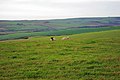
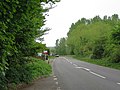
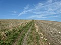
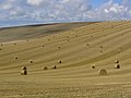
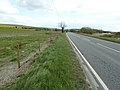
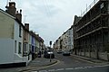
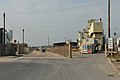
English: Tarring Neville is a village and civil parish in the Lewes District of East Sussex, England. The village is located five miles (8 km) south of Lewes, on the A26 road to Newhaven. The south west border of the parish runs along the River Ouse, the parish extending into the South Downs.
Subcategories
This category has only the following subcategory.
M
Media in category "Tarring Neville"
The following 129 files are in this category, out of 129 total.
-
 A black face, a white face - geograph.org.uk - 2716898.jpg 640 × 428; 91 KB
-
 A26 heading to Tarring Neville - geograph.org.uk - 2367765.jpg 640 × 381; 45 KB
-
 A26 near Tarring Neville - geograph.org.uk - 4431015.jpg 3,500 × 2,318; 3.55 MB
-
 A26 near Tarring Neville - geograph.org.uk - 4431018.jpg 3,402 × 2,181; 2.97 MB
-
 A26 towards Newhaven - geograph.org.uk - 4470453.jpg 1,600 × 1,200; 829 KB
-
 A26, Tarring Neville - geograph.org.uk - 3493269.jpg 640 × 430; 67 KB
-
 A26, Tarring Neville - geograph.org.uk - 4030847.jpg 640 × 456; 54 KB
-
 Asham Wharf - geograph.org.uk - 761276.jpg 640 × 479; 125 KB
-
 Asham Wharf - geograph.org.uk - 761294.jpg 640 × 479; 82 KB
-
 Barn, Durham Farm - geograph.org.uk - 3493275.jpg 640 × 413; 61 KB
-
 Barn, Durham Farm - geograph.org.uk - 4030855.jpg 640 × 430; 51 KB
-
 Barns at Court Farm - geograph.org.uk - 2111251.jpg 640 × 427; 85 KB
-
 Bend in the A26 near Tarring Neville - geograph.org.uk - 1835143.jpg 640 × 430; 62 KB
-
 Bridleway north to Radio Station masts on Beddingham Hill - geograph.org.uk - 2901927.jpg 4,000 × 3,000; 3.73 MB
-
 Bridleway to Beddingham Hill - geograph.org.uk - 1178782.jpg 480 × 640; 95 KB
-
 Bridleway to Beddingham Hill - geograph.org.uk - 2623808.jpg 640 × 480; 92 KB
-
 Bridleway to Beddingham Hill - geograph.org.uk - 2630816.jpg 640 × 480; 96 KB
-
 Brooks, Tarring Neville - geograph.org.uk - 2665516.jpg 640 × 480; 85 KB
-
 Brooks, Tarring Neville - geograph.org.uk - 2665618.jpg 640 × 480; 77 KB
-
 Cattle grazing in the Ouse Valley - geograph.org.uk - 4030850.jpg 640 × 430; 44 KB
-
 Chalk cliffs at Chalk pit at Tarring Neville - geograph.org.uk - 2907986.jpg 4,000 × 3,000; 3.37 MB
-
 Chalk quarry at Tarring Neville - geograph.org.uk - 2908044.jpg 4,000 × 3,000; 3.37 MB
-

-
 Church of St Mary's Tarring Neville - geograph.org.uk - 2907938.jpg 4,000 × 3,000; 3.64 MB
-
 Closer view of Durham Farm entrance - geograph.org.uk - 2906555.jpg 4,000 × 3,000; 3.72 MB
-
 Course of the dry valley towards South Heighton - geograph.org.uk - 2901915.jpg 4,000 × 3,000; 3.48 MB
-
 Court Farm - geograph.org.uk - 3493271.jpg 640 × 430; 58 KB
-
 Cow Wish Bottom - geograph.org.uk - 1178787.jpg 640 × 484; 81 KB
-
 Cow Wish Bottom - geograph.org.uk - 1178795.jpg 640 × 462; 58 KB
-
 Difficult entrance to Durham Farm - geograph.org.uk - 2906548.jpg 4,000 × 3,000; 3.42 MB
-
 Dry valleys converge - geograph.org.uk - 2901895.jpg 4,000 × 3,000; 3.37 MB
-
 Entering South Heighton on the A26 - geograph.org.uk - 1835160.jpg 640 × 380; 45 KB
-
 Entering South Heighton on the A26 - geograph.org.uk - 2367771.jpg 640 × 340; 38 KB
-
 Entering Tarring Neville - geograph.org.uk - 2367767.jpg 640 × 366; 35 KB
-
 Entering Tarring Neville on the A26 - geograph.org.uk - 1835149.jpg 640 × 398; 53 KB
-
 Farmland on South Downs - geograph.org.uk - 2630803.jpg 640 × 480; 94 KB
-
 Farmland on South Downs - geograph.org.uk - 2630806.jpg 640 × 480; 99 KB
-
 Field of horses, Tarring Neville - geograph.org.uk - 2778980.jpg 1,600 × 1,183; 384 KB
-
 Flood Defence Work, River Ouse - geograph.org.uk - 3114388.jpg 640 × 480; 53 KB
-
 Footpath to the River Ouse - geograph.org.uk - 2665484.jpg 480 × 640; 83 KB
-
 Fore Hill - geograph.org.uk - 1178776.jpg 640 × 480; 98 KB
-
 Fore Hill above South Heighton - geograph.org.uk - 1137814.jpg 640 × 304; 55 KB
-
 Fore Hill, Beddingham - geograph.org.uk - 1137592.jpg 640 × 352; 51 KB
-

-
-
 Hay bales on Fore Hill near Newhaven - geograph.org.uk - 3752797.jpg 768 × 1,024; 179 KB
-
 House at Tarring Neville - geograph.org.uk - 3493272.jpg 640 × 430; 60 KB
-
 Houses by Court Farm - geograph.org.uk - 2105006.jpg 640 × 320; 52 KB
-
 In the Ouse Valley - geograph.org.uk - 4030840.jpg 640 × 430; 38 KB
-
 Itford Bottom - geograph.org.uk - 4017321.jpg 640 × 430; 34 KB
-
 Lane at Tarring Neville, East Sussex - geograph.org.uk - 736121.jpg 640 × 506; 149 KB
-
 Looking south over the River Ouse valley - geograph.org.uk - 2908068.jpg 4,000 × 3,000; 3.41 MB
-
 Low tide on the River Ouse - geograph.org.uk - 2906519.jpg 4,000 × 3,000; 3.14 MB
-
 Near Tarring Neville.png 1,743 × 1,331; 922 KB
-
 New fencing by the A26 to Newhaven - geograph.org.uk - 2907885.jpg 4,000 × 3,000; 3.07 MB
-
 Newhaven Deep Sea Anglers Club - geograph.org.uk - 2665533.jpg 640 × 480; 55 KB
-
 North Quay, Newhaven - geograph.org.uk - 179869.jpg 640 × 479; 51 KB
-
 Oilseed rape by the A26 - geograph.org.uk - 1837138.jpg 640 × 430; 63 KB
-
 Old Course of River Ouse - geograph.org.uk - 2665478.jpg 640 × 480; 78 KB
-
 Old Course of River Ouse - geograph.org.uk - 2665488.jpg 480 × 640; 93 KB
-
 Old Course of River Ouse - geograph.org.uk - 2665623.jpg 640 × 480; 76 KB
-
 Old Course of River Ouse - geograph.org.uk - 2665641.jpg 640 × 480; 84 KB
-
 Overgrown sidings, Newhaven - geograph.org.uk - 123547.jpg 640 × 479; 185 KB
-

-
 Parallel ditches - geograph.org.uk - 4030835.jpg 640 × 430; 50 KB
-

-
 Path leading NW from Fore Hill, near Newhaven - geograph.org.uk - 3752799.jpg 768 × 1,024; 195 KB
-
 Piddinghoe Wharf - geograph.org.uk - 2716793.jpg 640 × 428; 92 KB
-
 Postbox at Tarrning Neville, East Sussex - geograph.org.uk - 736134.jpg 640 × 370; 111 KB
-
 Pylon in the Ouse Valley - geograph.org.uk - 4030853.jpg 640 × 430; 27 KB
-
 Rape seed crop by Tarring Court Farm - geograph.org.uk - 2907892.jpg 4,000 × 3,000; 3.7 MB
-
 River Ouse - geograph.org.uk - 156365.jpg 640 × 480; 95 KB
-
 River Ouse - geograph.org.uk - 2665481.jpg 463 × 640; 60 KB
-
 River Ouse - geograph.org.uk - 2665511.jpg 640 × 480; 55 KB
-
 River Ouse - geograph.org.uk - 2665537.jpg 640 × 480; 75 KB
-
 River Ouse - geograph.org.uk - 2665628.jpg 640 × 480; 86 KB
-
 River Ouse - geograph.org.uk - 2665633.jpg 640 × 480; 75 KB
-
 River Ouse - geograph.org.uk - 2975396.jpg 640 × 480; 68 KB
-
 River Ouse - geograph.org.uk - 3114427.jpg 640 × 480; 68 KB
-
 Riverbank stile - geograph.org.uk - 2716814.jpg 640 × 428; 88 KB
-
 Roadside cattle opposite Tarring Court Farm - geograph.org.uk - 2907930.jpg 4,000 × 3,000; 3.56 MB
-
 Roadside verge on the A26, Tarring Neville - geograph.org.uk - 4363308.jpg 1,522 × 1,086; 674 KB
-
 Shared bridleway on Fore Hill - geograph.org.uk - 2901968.jpg 4,000 × 3,000; 3.39 MB
-
 Sharp bend on the A26 - geograph.org.uk - 4431021.jpg 3,476 × 2,274; 4.59 MB
-
 Site of Former Brick and Tile Works - geograph.org.uk - 2665531.jpg 640 × 480; 89 KB
-
 St Mary, Tarring Neville - geograph.org.uk - 5913275.jpg 1,600 × 1,064; 468 KB
-
 Stock Brooks - geograph.org.uk - 2665487.jpg 640 × 480; 76 KB
-
 Stock Brooks - geograph.org.uk - 2665492.jpg 640 × 480; 93 KB
-
 Stock Cottages on the A26 - geograph.org.uk - 2906533.jpg 4,000 × 3,000; 3.48 MB
-
 Stock Marsh - geograph.org.uk - 2665505.jpg 640 × 480; 89 KB
-
 Tarring Court Farm - geograph.org.uk - 4017325.jpg 640 × 430; 62 KB
-
 Tarring Court farm, Tarring Neville - geograph.org.uk - 2599145.jpg 1,600 × 1,200; 502 KB
-
 Tarring Neville - geograph.org.uk - 123530.jpg 640 × 479; 199 KB
-
 Tarring Neville - geograph.org.uk - 1345820.jpg 640 × 480; 84 KB
-
 The Four Acres-The Three Acres - geograph.org.uk - 2665500.jpg 640 × 480; 78 KB
-

-
 Three Ponds Holiday Park and Fishery - geograph.org.uk - 2908077.jpg 4,000 × 3,000; 3.65 MB
-
 Trains passing near Southease - geograph.org.uk - 1268335.jpg 640 × 480; 45 KB
-
 Trig point with a view - geograph.org.uk - 2717019.jpg 640 × 428; 73 KB
-
 View across the Ouse - geograph.org.uk - 2716778.jpg 640 × 428; 108 KB
-

-
 View from the A26, Tarring Neville - geograph.org.uk - 4363339.jpg 1,068 × 940; 433 KB
-
 View over field to the village of Piddinghoe - geograph.org.uk - 2907914.jpg 4,000 × 3,000; 3.45 MB
-
 View towards Hill Farm Cottage - geograph.org.uk - 2716740.jpg 640 × 428; 94 KB
-
 Well Bottom from Fore Hill - geograph.org.uk - 1137707.jpg 640 × 480; 52 KB
-
 A26, Itford Farm - geograph.org.uk - 760816.jpg 640 × 479; 109 KB
-
 A26, Itford Farm - geograph.org.uk - 760823.jpg 479 × 640; 96 KB
-
 Asham Wharf - geograph.org.uk - 761284.jpg 640 × 479; 119 KB
-

-

-
 Denton Village - geograph.org.uk - 109259.jpg 640 × 480; 117 KB
-
 Drainage Ditch - geograph.org.uk - 761196.jpg 479 × 640; 88 KB
-
 Drainage Ditch - geograph.org.uk - 761718.jpg 479 × 640; 142 KB
-
 Farm Track - geograph.org.uk - 761198.jpg 479 × 640; 114 KB
-
 Flotsam and Jetsam, River Ouse - geograph.org.uk - 761336.jpg 479 × 640; 118 KB
-
 Footbridge, Glynde Reach - geograph.org.uk - 761356.jpg 640 × 479; 107 KB
-
 Footbridge, Glynde Reach - geograph.org.uk - 761359.jpg 640 × 479; 113 KB
-
 Former engine sheds, Newhaven - geograph.org.uk - 123551.jpg 640 × 479; 123 KB
-
 Gate, South Downs Way - geograph.org.uk - 760771.jpg 479 × 640; 82 KB
-
 Hoddern Farm trig - geograph.org.uk - 67770.jpg 640 × 427; 90 KB
-
 House Boat - geograph.org.uk - 7119.jpg 640 × 480; 79 KB
-

-
 Meeching Road, Newhaven - geograph.org.uk - 193338.jpg 640 × 425; 62 KB
-
 Modern Housing Estate at Newhaven - geograph.org.uk - 18329.jpg 640 × 480; 119 KB
-
 Newhaven Cemetery - geograph.org.uk - 156374.jpg 640 × 480; 57 KB
-
 North Quay Road Newhaven - geograph.org.uk - 494215.jpg 640 × 425; 81 KB
-
 Ouse Estuary Project - geograph.org.uk - 18314.jpg 640 × 480; 82 KB
-
 Poverty Bottom - geograph.org.uk - 109240.jpg 640 × 480; 115 KB
-
 River Ouse Estuary, Newhaven - geograph.org.uk - 179883.jpg 640 × 480; 28 KB


