Category:Tattingstone
English: Category for files related to the village of Tattingstone in Suffolk.
village in Suffolk, England, UK  | |||||
| Upload media | |||||
| Instance of | |||||
|---|---|---|---|---|---|
| Location | Babergh, Suffolk, East of England, England | ||||
| official website | |||||
 | |||||
Subcategories
This category has the following 9 subcategories, out of 9 total.
A
C
- Coxhall Road, Tattingstone (26 F)
L
- Lemons Hill, Tattingstone (22 F)
T
- St Mary, Tattingstone (50 F)
- Tattingstone Village Hall (7 F)
- Tattingstone Wonder (9 F)
V
- Tattingstone Village Sign (7 F)
Media in category "Tattingstone"
The following 200 files are in this category, out of 214 total.
(previous page) (next page)-
 A corner of Holbrook Park - geograph.org.uk - 5611305.jpg 640 × 480; 113 KB
-
 A field of vegetables - geograph.org.uk - 4153046.jpg 640 × 430; 101 KB
-
 A narrow Suffolk lane - geograph.org.uk - 4152965.jpg 640 × 415; 65 KB
-
 A narrow Suffolk lane - geograph.org.uk - 4152970.jpg 640 × 430; 63 KB
-
 A single tree - geograph.org.uk - 4153017.jpg 640 × 430; 88 KB
-
 A137 - geograph.org.uk - 4785223.jpg 640 × 311; 41 KB
-
 A137 looking towards Ipswich - geograph.org.uk - 3483346.jpg 3,072 × 2,304; 1.32 MB
-
 A137 looking towards Ipswich ^ footpaths - geograph.org.uk - 3515504.jpg 3,072 × 2,053; 1 MB
-
 A137 south of Hubbard Hall Farm - geograph.org.uk - 3580749.jpg 3,648 × 2,736; 1.35 MB
-
 A137 to Manningtree - geograph.org.uk - 3482480.jpg 3,072 × 2,304; 1.4 MB
-
 A137, The Heath, near Tattingstone - geograph.org.uk - 4123559.jpg 3,008 × 2,000; 5.77 MB
-
 Alton Water - geograph.org.uk - 5611254.jpg 640 × 480; 115 KB
-
 Alton Water reservoir near Tattingstone - geograph.org.uk - 5856283.jpg 1,024 × 768; 245 KB
-
 Approaching Larch Wood - geograph.org.uk - 4181566.jpg 640 × 430; 114 KB
-
 Approaching Lemons Hill Bridge - geograph.org.uk - 4168090.jpg 640 × 430; 92 KB
-
 Arable crops - geograph.org.uk - 4153057.jpg 640 × 430; 84 KB
-
 Autumn - geograph.org.uk - 3719630.jpg 768 × 1,024; 461 KB
-
 Ayre Lodge (geograph 6698277).jpg 1,024 × 684; 150 KB
-
 Ayre Lodge - geograph.org.uk - 4176163.jpg 640 × 430; 79 KB
-
 Back Lane off Church Rd - geograph.org.uk - 4176194.jpg 640 × 430; 103 KB
-
 Barley - geograph.org.uk - 4161152.jpg 640 × 430; 85 KB
-
 Barn, Pond Hall Farm (geograph 6698285).jpg 1,024 × 684; 293 KB
-
 Barn, Pond Hall Farm - geograph.org.uk - 4176199.jpg 640 × 430; 109 KB
-
 Bend, Coxhall Rd - geograph.org.uk - 4153055.jpg 640 × 430; 75 KB
-
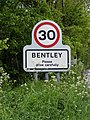 Bentley sign on Station Road - geograph.org.uk - 3483497.jpg 2,304 × 3,072; 1.64 MB
-
 Birds - geograph.org.uk - 3719659.jpg 1,024 × 768; 214 KB
-
 Bridleway off coxhall Rd - geograph.org.uk - 4153029.jpg 640 × 430; 71 KB
-
 Bridleway off Lemons Hill - geograph.org.uk - 4167960.jpg 640 × 430; 119 KB
-
 Bridleway to Alton Water - geograph.org.uk - 4153031.jpg 640 × 430; 106 KB
-
 Bridleway to Alton Water - geograph.org.uk - 4153043.jpg 640 × 430; 75 KB
-
 Bridleway to Coxhall Road - geograph.org.uk - 3482797.jpg 3,072 × 2,304; 1.48 MB
-

-
 Buxton Wood and pylon line from the railway - geograph.org.uk - 5612297.jpg 1,600 × 928; 214 KB
-
 By Church Rd - geograph.org.uk - 4176184.jpg 640 × 382; 93 KB
-
 Car park at Alton Water Visitor Centre - geograph.org.uk - 1956483.jpg 4,000 × 3,000; 2.95 MB
-
 Ceduna Cosy Nook - geograph.org.uk - 4161255.jpg 640 × 430; 100 KB
-
 Cereals in a field - geograph.org.uk - 4176221.jpg 640 × 430; 53 KB
-
 Chedworth Place - geograph.org.uk - 4168197.jpg 640 × 430; 74 KB
-
 Chedworth Place - geograph.org.uk - 4168227.jpg 640 × 430; 75 KB
-
 Church Rd - geograph.org.uk - 4176122.jpg 640 × 430; 108 KB
-
 Church Rd - geograph.org.uk - 4176124.jpg 640 × 430; 105 KB
-
 Church Rd - geograph.org.uk - 4176172.jpg 640 × 430; 117 KB
-
 Church Road ^ footpath to the A137 - geograph.org.uk - 3483290.jpg 3,072 × 1,997; 1.09 MB
-
 Church Road, Tattingstone - geograph.org.uk - 3482530.jpg 3,072 × 2,304; 1.23 MB
-
 Circus at Tattingstone - geograph.org.uk - 2510790.jpg 3,648 × 2,736; 2.43 MB
-

-
 Conservation Sign - geograph.org.uk - 3720766.jpg 1,024 × 768; 238 KB
-
 Cottage in Tattingstone - geograph.org.uk - 4176072.jpg 640 × 430; 112 KB
-
 Cottage on the bend - geograph.org.uk - 4176077.jpg 640 × 430; 105 KB
-
 Cottages, Tattingstone - geograph.org.uk - 589119.jpg 640 × 453; 109 KB
-
 Country Hall, Tatingstone - geograph.org.uk - 18317.jpg 640 × 480; 59 KB
-
 Country Road And Footpath Sign - geograph.org.uk - 3679825.jpg 768 × 1,024; 357 KB
-
 Coxhall Road - geograph.org.uk - 5611311.jpg 640 × 480; 166 KB
-
 Cycle track near Alton Water - geograph.org.uk - 2513838.jpg 3,648 × 2,736; 3.83 MB
-
 Cyclists Warning Sign - geograph.org.uk - 3719666.jpg 1,024 × 768; 447 KB
-
 Dead Tree - geograph.org.uk - 3719683.jpg 768 × 1,024; 285 KB
-
 Dead Tree - geograph.org.uk - 3719687.jpg 768 × 1,024; 142 KB
-
 Edge of Little Birch Wood - geograph.org.uk - 4152974.jpg 640 × 430; 50 KB
-
 End Of The Road - geograph.org.uk - 1469604.jpg 640 × 480; 109 KB
-
 Entering Bentley - geograph.org.uk - 3679805.jpg 1,024 × 768; 308 KB
-
 Entering Bentley on Station Road - geograph.org.uk - 3483464.jpg 3,072 × 2,304; 1.49 MB
-
 Entering Tattingstone on Station Road - geograph.org.uk - 3482457.jpg 3,072 × 2,304; 1.76 MB
-
 Entering Tattingstone on the A137 - geograph.org.uk - 3483433.jpg 3,072 × 2,304; 1.3 MB
-
 Entering Tattingstone on White Horse Hill - geograph.org.uk - 4621585.jpg 1,240 × 930; 358 KB
-
 Entrance to Cycle Route - geograph.org.uk - 2513839.jpg 3,648 × 2,736; 4.58 MB
-
 Farm Shop Signs - geograph.org.uk - 3720792.jpg 1,024 × 766; 214 KB
-
 Farmland by Coxhall Rd - geograph.org.uk - 4153011.jpg 640 × 430; 79 KB
-
 Farmland by Coxhall Rd - geograph.org.uk - 4153021.jpg 640 × 430; 68 KB
-
 Farmland by Coxhall Rd - geograph.org.uk - 4161144.jpg 640 × 430; 71 KB
-
 Field at Rookery Farm, Tattingstone - geograph.org.uk - 4123664.jpg 3,008 × 2,000; 7.26 MB
-
 Field of Barley - geograph.org.uk - 4161168.jpg 640 × 430; 72 KB
-
 Field of Barley - geograph.org.uk - 4161402.jpg 640 × 430; 82 KB
-
 Field of beet by Woodley Wood - geograph.org.uk - 5611338.jpg 640 × 480; 141 KB
-
 Fishing, Alton Water - geograph.org.uk - 5611269.jpg 640 × 480; 123 KB
-
 Footpath - geograph.org.uk - 3720768.jpg 1,024 × 768; 304 KB
-
 Footpath Entrance - geograph.org.uk - 2530559.jpg 3,648 × 2,280; 3.54 MB
-
 Footpath next to Abberton Reservoir Tattingstone - geograph.org.uk - 2340840.jpg 4,000 × 3,000; 2.87 MB
-
 Footpath off Church Rd - geograph.org.uk - 4176126.jpg 640 × 430; 88 KB
-
 Footpath through barley - geograph.org.uk - 4161184.jpg 640 × 430; 73 KB
-
 Footpath through barley - geograph.org.uk - 4161187.jpg 640 × 430; 85 KB
-
 Footpath to Alton Water - geograph.org.uk - 4176211.jpg 640 × 430; 91 KB
-
 Footpath to Brantham Bridge on the A137 - geograph.org.uk - 3482428.jpg 3,072 × 2,304; 1.63 MB
-
 Footpath to Brantham Bridge on the A137 - geograph.org.uk - 3482432.jpg 3,072 × 2,304; 1.38 MB
-
 Footpath to Cragpit Farm ^ A137 - geograph.org.uk - 3483322.jpg 3,072 × 2,304; 1.3 MB
-
 Footpath to the A137 - geograph.org.uk - 3483163.jpg 3,072 × 2,304; 1.46 MB
-
 Footpath to the A137 - geograph.org.uk - 3483294.jpg 2,304 × 3,072; 1.33 MB
-
 Footpath to White Horse Hill ^ Lemons Hill - geograph.org.uk - 3483081.jpg 1,600 × 1,200; 583 KB
-
 Footpath ^ entrance to Alton Water Reservoir - geograph.org.uk - 3483108.jpg 2,854 × 1,847; 1.06 MB
-
 Footpaths off the A137 - geograph.org.uk - 3515505.jpg 3,072 × 2,304; 1.18 MB
-

-
 Former Methodist chapel, Tattingstone - geograph.org.uk - 4169613.jpg 4,320 × 3,240; 4.84 MB
-
 Great Birch Wood - geograph.org.uk - 4153000.jpg 640 × 430; 87 KB
-
 Holbrook Park - geograph.org.uk - 4161159.jpg 640 × 430; 121 KB
-
 Holbrook Park - geograph.org.uk - 4161160.jpg 640 × 430; 90 KB
-
 Holbrook Park - geograph.org.uk - 4161163.jpg 640 × 430; 85 KB
-
 Holbrook Park - geograph.org.uk - 4161178.jpg 640 × 430; 97 KB
-
 Holbrook Park in Bluebell time - geograph.org.uk - 2107992.jpg 2,816 × 2,112; 2.41 MB
-
 House in Tattingstone - geograph.org.uk - 4161215.jpg 640 × 430; 65 KB
-
 House in Tattingstone - geograph.org.uk - 4176071.jpg 640 × 430; 100 KB
-
 House in Tattingstone - geograph.org.uk - 4176161.jpg 640 × 430; 83 KB
-
 Houses in Tattingstone - geograph.org.uk - 4176157.jpg 640 × 430; 109 KB
-
 Houses in Tattingstone - geograph.org.uk - 589121.jpg 640 × 514; 103 KB
-
 Houses off Lemons Hill - geograph.org.uk - 4168076.jpg 640 × 430; 85 KB
-
 Joining the A137 - geograph.org.uk - 4785220.jpg 640 × 309; 52 KB
-
 Lake - geograph.org.uk - 3679800.jpg 1,024 × 768; 310 KB
-
 Lane by Alton Water - geograph.org.uk - 4176213.jpg 640 × 430; 77 KB
-
 Lane by Alton Water - geograph.org.uk - 4176214.jpg 640 × 430; 77 KB
-
 Lane by Alton Water - geograph.org.uk - 4176216.jpg 640 × 430; 100 KB
-
 Lane by Alton Water - geograph.org.uk - 4176218.jpg 640 × 430; 76 KB
-
 Lane by Alton Water - geograph.org.uk - 4176229.jpg 640 × 430; 78 KB
-
 Lane by Alton Water - geograph.org.uk - 4176240.jpg 640 × 430; 91 KB
-
 Lane by Alton Water - geograph.org.uk - 4176242.jpg 640 × 430; 97 KB
-
 Lane south of Tattingstone - geograph.org.uk - 4176207.jpg 640 × 430; 103 KB
-

-
 Little Birch Wood - geograph.org.uk - 4152971.jpg 640 × 430; 127 KB
-
 Looking East from Lemons Hill Bridge - geograph.org.uk - 4877911.jpg 4,000 × 3,000; 4.64 MB
-

-
 Looking towards Tattingstone Heath - geograph.org.uk - 2530562.jpg 3,648 × 2,736; 2.89 MB
-
 Looking up White Horse Hill - geograph.org.uk - 2510805.jpg 3,648 × 2,736; 3 MB
-
 Map of Tattingstone, OS 1946.png 328 × 231; 138 KB
-
 North of Tatingstone - geograph.org.uk - 4161205.jpg 640 × 430; 77 KB
-
 Orchard Cottage - geograph.org.uk - 5969797.jpg 1,024 × 681; 180 KB
-
 Path near Alton Water - geograph.org.uk - 2510814.jpg 3,648 × 2,736; 4.1 MB
-
 Path near Alton Water - geograph.org.uk - 4181560.jpg 640 × 430; 105 KB
-
 Path near Alton Water - geograph.org.uk - 4181562.jpg 640 × 430; 103 KB
-
 Path near Alton Water - geograph.org.uk - 4181564.jpg 640 × 430; 110 KB
-
 Pond Hall Farm - geograph.org.uk - 4176201.jpg 640 × 430; 80 KB
-
 Pond Hall Farm - geograph.org.uk - 4176205.jpg 640 × 430; 71 KB
-
 Pond Hall Farm vegetable stall and farm house - geograph.org.uk - 2513657.jpg 3,648 × 2,736; 3.94 MB
-
 Pond Hall Farmhouse (geograph 6698283).jpg 1,024 × 684; 183 KB
-
 Pond Hall Farmhouse - geograph.org.uk - 4176197.jpg 640 × 430; 114 KB
-
 Pond Hall farmyard - geograph.org.uk - 2513655.jpg 3,648 × 2,736; 3.18 MB
-
 Pylon crossing Coxhall Rd - geograph.org.uk - 4153038.jpg 640 × 430; 72 KB
-
 Ripe barley - geograph.org.uk - 4161181.jpg 640 × 430; 87 KB
-
 Ripening wheat - geograph.org.uk - 4153041.jpg 640 × 430; 67 KB
-
 Road And Path - geograph.org.uk - 3720763.jpg 1,024 × 768; 304 KB
-
 Road to Tattingstone - geograph.org.uk - 4161208.jpg 640 × 430; 84 KB
-
 Road to Tattingstone - geograph.org.uk - 4161211.jpg 640 × 430; 84 KB
-
 Roadside vegetation - geograph.org.uk - 4176223.jpg 640 × 430; 111 KB
-
 Roadsigns on Church Road - geograph.org.uk - 3483339.jpg 3,072 × 2,304; 1.43 MB
-
 Roadsigns on the A137 - geograph.org.uk - 3482472.jpg 2,304 × 3,072; 1.39 MB
-
 Roadsigns on the A137 - geograph.org.uk - 3482474.jpg 3,072 × 2,304; 1.3 MB
-
 Roadsigns on the A137 - geograph.org.uk - 3483373.jpg 2,304 × 3,072; 1.56 MB
-
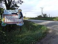 Rookery Farm Shop Sign - geograph.org.uk - 3720788.jpg 1,024 × 768; 226 KB
-

-
 School Rd - geograph.org.uk - 4161265.jpg 640 × 430; 78 KB
-
 School Road sign - geograph.org.uk - 3482996.jpg 3,072 × 2,304; 1.43 MB
-
 School Road ^ White Horse Postbox - geograph.org.uk - 3482831.jpg 3,072 × 2,172; 1.26 MB
-
 School Road, Tattingstone White Horse - geograph.org.uk - 3482985.jpg 3,072 × 2,304; 1.36 MB
-
 Seat With A View - geograph.org.uk - 3719695.jpg 768 × 1,024; 246 KB
-
 Semi-detached house, Lemons Hill - geograph.org.uk - 4168080.jpg 640 × 402; 81 KB
-
 Seventeenth century cottages, Tattingstone - geograph.org.uk - 4169500.jpg 4,320 × 3,240; 3.83 MB
-
 Shoreline, Alton Water - geograph.org.uk - 4168144.jpg 640 × 430; 65 KB
-
 Shrub Wood - geograph.org.uk - 4161156.jpg 640 × 430; 86 KB
-
 Signs - geograph.org.uk - 3719639.jpg 768 × 1,024; 305 KB
-
 St Mary's Hospital redevelopment - geograph.org.uk - 4168194.jpg 640 × 430; 74 KB
-
 Station Road ^ footpath to Brantham Bridge on the A137 - geograph.org.uk - 3482411.jpg 3,072 × 2,304; 1.45 MB
-
 Station Road, Tattingstone - geograph.org.uk - 3482466.jpg 2,965 × 2,227; 1.1 MB
-
 Station Road, Tattingstone - geograph.org.uk - 3483386.jpg 3,072 × 2,304; 1.28 MB
-
 Summer Baling - geograph.org.uk - 2541123.jpg 2,269 × 1,418; 618 KB
-
 Tattingstone - geograph.org.uk - 4168277.jpg 640 × 430; 73 KB
-
 Tattingstone church - geograph.org.uk - 5611279.jpg 640 × 480; 121 KB
-
 Tattingstone Hospital in 1990 - geograph.org.uk - 4142138.jpg 800 × 448; 69 KB
-
 Tattingstone Park - geograph.org.uk - 4176167.jpg 640 × 430; 98 KB
-
 Tattingstone Park - geograph.org.uk - 4176208.jpg 640 × 430; 104 KB
-
 Tattingstone Place - geograph.org.uk - 3720781.jpg 1,024 × 768; 240 KB
-
 Tattingstone Primary School - geograph.org.uk - 4176067.jpg 640 × 430; 84 KB
-
 Tattingstone Primary School - geograph.org.uk - 4176068.jpg 640 × 436; 81 KB
-
 Tattingstone Primary School - geograph.org.uk - 4176075.jpg 640 × 430; 71 KB
-
 Tattingstone Primary Sub-station - geograph.org.uk - 4153058.jpg 640 × 430; 85 KB
-
 Tattingstone Primary Sub-station - geograph.org.uk - 4153061.jpg 640 × 430; 85 KB
-
 Tattingstone Primary Sub-station - geograph.org.uk - 4153063.jpg 640 × 430; 92 KB
-
 Tattingstone Primary Substation - geograph.org.uk - 2510819.jpg 3,648 × 2,736; 3.14 MB
-
 Tattingstone sign - geograph.org.uk - 3482458.jpg 2,304 × 3,072; 1.58 MB
-

-

-

-
 Tattingstone village sign - geograph.org.uk - 4295629.jpg 480 × 640; 67 KB
-
 Tattingstone White Horse - geograph.org.uk - 4161224.jpg 640 × 430; 75 KB
-
 Tattingstone Wonder - front - geograph.org.uk - 5239239.jpg 5,184 × 2,920; 5.36 MB
-
 Tattingstone WW1 Memorial - geograph.org.uk - 4622553.jpg 1,782 × 2,383; 877 KB
-
 Telephone Box White Horse Postbox ^ Bus Shelter - geograph.org.uk - 3482854.jpg 3,072 × 2,304; 1.5 MB
-
 Telephone Box ^ White Horse Postbox - geograph.org.uk - 3482850.jpg 2,304 × 3,072; 1.55 MB
-
 Telephone Box ^ White Horse Postbox - geograph.org.uk - 3483002.jpg 2,037 × 2,956; 1.86 MB
-
 The Close - geograph.org.uk - 4168204.jpg 640 × 430; 105 KB
-
 The leaning shed of Tattingstone - panoramio.jpg 1,024 × 768; 281 KB
-
 The Old Rectory - geograph.org.uk - 4176158.jpg 640 × 430; 78 KB
-
 The Walk (geograph 6694387).jpg 1,024 × 684; 185 KB
-
 The Wheatsheaf pub, Tattingstone - geograph.org.uk - 4169624.jpg 4,320 × 3,240; 4.19 MB
-

-
 The White Horse, Tattingstone - geograph.org.uk - 5611300.jpg 640 × 428; 113 KB
-
 The WW2 Memorial at Tattingstone - geograph.org.uk - 4622558.jpg 1,482 × 2,052; 811 KB
-
 Track to Alton Water - geograph.org.uk - 4181559.jpg 640 × 430; 101 KB
-
 Track, Pond Hall Farm - geograph.org.uk - 4176210.jpg 640 × 430; 91 KB
-
 Vegetables in a field - geograph.org.uk - 4176220.jpg 640 × 430; 68 KB
-
 View down the valley at Bentley - geograph.org.uk - 5746511.jpg 1,600 × 1,200; 305 KB
-
 View up towards Folly Farm, from the railway - geograph.org.uk - 5612140.jpg 1,600 × 962; 227 KB
-
 Water pump, White Horse - geograph.org.uk - 4161254.jpg 430 × 640; 95 KB
-
 Wheat and woodland - geograph.org.uk - 4168184.jpg 640 × 430; 71 KB
-
 Wheat field - geograph.org.uk - 4153019.jpg 640 × 430; 84 KB


.jpg)


.jpg)


.jpg)


.jpg)


