Category:Teisterbant, Kerk-Avezaath
| Object location | | View all coordinates using: OpenStreetMap |
|---|
building in Buren, Netherlands  | |||||
| Upload media | |||||
| Instance of | |||||
|---|---|---|---|---|---|
| Location | Buren, Gelderland, Netherlands | ||||
| Street address |
| ||||
| Located on street |
| ||||
| Heritage designation |
| ||||
 | |||||
|
This is a category about rijksmonument number 11450
|
| Address |
|
Media in category "Teisterbant, Kerk-Avezaath"
The following 29 files are in this category, out of 29 total.
-
 't Kasteel Teisterbandt (nabij Kerk Avezaath) PK-T-AW-2952, PK-T-AW-2565.tif 9,120 × 6,684; 174.43 MB
-
 Achtergevel - Kerk-Avezaath - 20124455 - RCE.jpg 1,200 × 934; 302 KB
-
 Achtergevel - Kerk-Avezaath - 20124456 - RCE.jpg 1,200 × 934; 283 KB
-
 Exterieur OVERZICHT VOORGEVEL - Kerk-Avezaath - 20339446 - RCE.jpg 1,188 × 1,200; 434 KB
-
 Graaf Waldger van Teisterbant, Nicolaes de Kemp.jpg 3,457 × 4,825; 1.99 MB
-
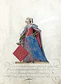 Gravin van Teisterbant, Nicolaes de Kemp (toegeschreven aan), ca. 1600 - ca. 1625 recht.jpg 3,591 × 4,952; 5.38 MB
-
 Interieur - Kerk-Avezaath - 20124458 - RCE.jpg 1,183 × 1,200; 340 KB
-
 Interieur - Kerk-Avezaath - 20124459 - RCE.jpg 1,195 × 1,200; 278 KB
-
 Interieur - Kerk-Avezaath - 20124460 - RCE.jpg 1,181 × 1,200; 215 KB
-
 Interieur - Kerk-Avezaath - 20124462 - RCE.jpg 1,180 × 1,200; 199 KB
-
 Interieur - Kerk-Avezaath - 20124463 - RCE.jpg 1,195 × 1,200; 224 KB
-
 Interieur - Kerk-Avezaath - 20124464 - RCE.jpg 1,188 × 1,200; 221 KB
-
 Interieur - Kerk-Avezaath - 20124465 - RCE.jpg 1,200 × 1,197; 204 KB
-
 Interieur, kap - Kerk-Avezaath - 20124466 - RCE.jpg 1,192 × 1,200; 322 KB
-
 Interieur, kap - Kerk-Avezaath - 20124467 - RCE.jpg 1,195 × 1,200; 300 KB
-
 Interieur, plafond - Kerk-Avezaath - 20124461 - RCE.jpg 1,185 × 1,200; 199 KB
-
 Kerk-Avezaath - Dorpsstraat 29 - "Huize Teisterbant"- brug.JPG 3,888 × 2,592; 4.63 MB
-
 Kerk-Avezaath - Dorpsstraat 29 - "Huize Teisterbant".JPG 4,674 × 2,056; 2.37 MB
-
 Kerk-Avezaath RM 11450 Teisterbant 01.jpg 3,264 × 2,448; 2.14 MB
-
 Kerk-Avezaath RM 11450 Teisterbant 03.jpg 3,264 × 2,448; 2.18 MB
-
 Kerk-Avezaath RM 11450 Teisterbant 05.jpg 2,448 × 3,264; 1.74 MB
-
 Kerk-Avezaath RM 11450 Teisterbant 06.jpg 3,264 × 2,448; 2.05 MB
-
 Kerk-Avezaath RM 11450 Teisterbant 07.jpg 3,264 × 2,448; 2.39 MB
-
 Klok - Kerk-Avezaath - 20124468 - RCE.jpg 1,190 × 1,200; 239 KB
-
 Teisterbant", voorgevel - Kerk-Avezaath - 20124526 - RCE.jpg 1,200 × 812; 255 KB
-
 Teisterbant", voorgevel - Kerk-Avezaath - 20124527 - RCE.jpg 1,200 × 949; 345 KB
-
 Voorgevel - Kerk-Avezaath - 20124453 - RCE.jpg 959 × 1,200; 306 KB
-
 Voorgevel - Kerk-Avezaath - 20124454 - RCE.jpg 1,200 × 955; 291 KB
-
 Zijgevel - Kerk-Avezaath - 20124457 - RCE.jpg 1,200 × 950; 290 KB


,_ca._1600_-_ca._1625_recht.jpg)


