Category:Templecombe
English: Templecombe is a village in Somerset, England, situated on the A357 road five miles south of Wincanton, twelve miles east of Yeovil, and 30 miles west of Salisbury. The village has a population of 1,510. Along with the hamlet of Combe Throop it forms the parish of Abbas and Templecombe.
日本語: アバス・コンブ(Abbas Combe)は、 イングランドのサマセットの西にある地域。テンプルコンブの隣に位置する。2002年現在の人口は1510人。ドゥームズデイ・ブックにコンブとして記録されている。
village in the United Kingdom  | |||||
| Upload media | |||||
| Instance of | |||||
|---|---|---|---|---|---|
| Location | Abbas and Templecombe, South Somerset, Somerset, South West England, England | ||||
 | |||||
Subcategories
This category has the following 2 subcategories, out of 2 total.
M
- St Mary's church, Templecombe (11 F)
T
Media in category "Templecombe"
The following 78 files are in this category, out of 78 total.
-
 "The Templars Retreat" at Templecombe - geograph.org.uk - 3153542.jpg 800 × 600; 121 KB
-
 2015 at Templecombe station - Wincanton Road bridge and church.JPG 1,024 × 1,366; 616 KB
-
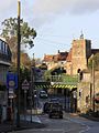
 A357 entering Templecombe - geograph.org.uk - 3418085.jpg 640 × 369; 81 KB
-
 A357 winding through Templecombe - geograph.org.uk - 3418090.jpg 640 × 405; 83 KB
-
 Approaching church at Templecombe - geograph.org.uk - 4045165.jpg 640 × 376; 44 KB
-
 Blackmore Vale Close, Templecombe - geograph.org.uk - 4475660.jpg 800 × 569; 102 KB
-
 Bridge fish ^ chips shop, Templecombe - geograph.org.uk - 4474796.jpg 800 × 542; 122 KB
-
 Church Hill houses, Templecombe - geograph.org.uk - 4475654.jpg 799 × 800; 193 KB
-
 Combe Farm,Templecombe - geograph.org.uk - 3668329.jpg 1,920 × 1,174; 331 KB
-
 Field and Sewage Works at Templecombe - geograph.org.uk - 93204.jpg 640 × 480; 77 KB
-
 Fields, Templecombe - geograph.org.uk - 3668353.jpg 3,466 × 2,356; 1.47 MB
-
 Gate near Templecombe - geograph.org.uk - 1565993.jpg 640 × 480; 134 KB
-

-

-
 Ivy Cottage, Templecombe - geograph.org.uk - 4475658.jpg 800 × 764; 200 KB
-

-

-
 Network Rail site, Templecombe - geograph.org.uk - 4474721.jpg 800 × 666; 149 KB
-

-
 Pimpernel Cottage, Templecombe - geograph.org.uk - 4474848.jpg 698 × 800; 117 KB
-

-
 Railbridge-01.jpg 448 × 299; 47 KB
-
 Railway line near Combe Throop - geograph.org.uk - 577947.jpg 640 × 430; 242 KB
-
 Railway lines near Stowell Wood - geograph.org.uk - 2714.jpg 640 × 173; 24 KB
-
 Renovated Finger Sign.jpg 1,024 × 768; 155 KB
-

-
 Sign at "The Templars Retreat" - geograph.org.uk - 3153540.jpg 800 × 600; 79 KB
-

-

-
 SPC International, Templecombe - geograph.org.uk - 4474624.jpg 800 × 621; 100 KB
-
 Station Road, Templecombe - geograph.org.uk - 4474599.jpg 800 × 722; 133 KB
-
 Sun and date plaque in Templecombe - geograph.org.uk - 3153551.jpg 800 × 600; 96 KB
-
 Templars Place, Templecombe - geograph.org.uk - 4474871.jpg 800 × 782; 143 KB
-
 Templecombe Friendly Society Brass 1.JPG 1,661 × 3,054; 1.46 MB
-
 Templecombe in 2008.jpg 640 × 480; 79 KB
-
 Templecombe primary school - geograph.org.uk - 4475648.jpg 800 × 643; 136 KB
-
 Templecombe Telephone Exchange - geograph.org.uk - 2745449.jpg 3,072 × 2,304; 1.76 MB
-
 Templecombe United Reformed Church - geograph.org.uk - 4412292.jpg 3,072 × 2,304; 2.37 MB
-
 Templecombe United Reformed Church - geograph.org.uk - 4475719.jpg 800 × 683; 132 KB
-
 The Hamlet, Templecombe - geograph.org.uk - 4475657.jpg 800 × 650; 111 KB
-
 The rail bridge at Templecombe - geograph.org.uk - 3153516.jpg 800 × 600; 129 KB
-
 The Templars Retreat - geograph.org.uk - 4217000.jpg 800 × 533; 147 KB
-
 The Templars Retreat, Templecombe - geograph.org.uk - 4474803.jpg 800 × 600; 111 KB
-
 Tip Top, Templecombe - geograph.org.uk - 4474820.jpg 800 × 756; 152 KB
-
 Water pillar, Slades Hill, Templecombe - geograph.org.uk - 4475689.jpg 800 × 779; 161 KB
-

-

-
 Yarnbarton, Templecombe - geograph.org.uk - 4474586.jpg 719 × 800; 125 KB
-
 A357 north to Yenston - geograph.org.uk - 550410.jpg 430 × 640; 290 KB
-
 Approaching Stowell Wood - geograph.org.uk - 2725.jpg 640 × 480; 33 KB
-
 Bow Brook - geograph.org.uk - 577939.jpg 430 × 640; 488 KB
-
 Bow Brook Bridge - geograph.org.uk - 577928.jpg 640 × 430; 369 KB
-
 Bridge over Bow Brook - geograph.org.uk - 398365.jpg 640 × 480; 188 KB
-
 Broadmead Lane (Track) - geograph.org.uk - 550242.jpg 640 × 430; 501 KB
-
 Burnt House Farm - geograph.org.uk - 459263.jpg 640 × 480; 105 KB
-
 Curves of Temple Lane - geograph.org.uk - 550393.jpg 640 × 430; 280 KB
-
 Derelict building on Park Lane - geograph.org.uk - 550338.jpg 640 × 430; 269 KB
-
 End of Throop Road - geograph.org.uk - 577952.jpg 430 × 640; 363 KB
-
 Field on Lois Farm - geograph.org.uk - 578122.jpg 640 × 430; 236 KB
-
 Fields of Mohuns Park - geograph.org.uk - 550231.jpg 640 × 430; 251 KB
-
 Hay bales on Common Lane farm - geograph.org.uk - 550342.jpg 640 × 430; 253 KB
-
 Horsington Marsh - geograph.org.uk - 306395.jpg 640 × 480; 95 KB
-
 Lois Farm - geograph.org.uk - 578130.jpg 640 × 430; 252 KB
-
 Maize field on the edge of Templecombe - geograph.org.uk - 459260.jpg 640 × 480; 121 KB
-
 Middle Throop Farmhouse Combe Throop - geograph.org.uk - 557791.jpg 640 × 480; 190 KB
-
 Mohuns Park - geograph.org.uk - 550229.jpg 640 × 430; 287 KB
-
 North Side Wood, Templecombe - geograph.org.uk - 2722.jpg 640 × 480; 46 KB
-
 Park Lane - geograph.org.uk - 550241.jpg 430 × 640; 380 KB
-
 Road to Mohuns Park - geograph.org.uk - 550227.jpg 430 × 640; 246 KB
-
 Route of dismtd rly - geograph.org.uk - 550354.jpg 430 × 640; 354 KB
-
 Scrub land by Temple Lane - geograph.org.uk - 550401.jpg 640 × 430; 298 KB
-
 Temple Lane and tree - geograph.org.uk - 550402.jpg 640 × 430; 335 KB
-
 Temple Lane towards Templecombe - geograph.org.uk - 550391.jpg 430 × 640; 277 KB
-
 The Royal Wessex, Templecombe - geograph.org.uk - 666914.jpg 640 × 480; 93 KB
-
 Throop Road (eastwards) - geograph.org.uk - 577954.jpg 430 × 640; 343 KB
-
 Throop Road (westwards) - geograph.org.uk - 577958.jpg 430 × 640; 402 KB
-
 Track on Lois Farm - geograph.org.uk - 578116.jpg 430 × 640; 263 KB
-
 Track towards Combe Throop - geograph.org.uk - 550398.jpg 430 × 640; 378 KB


_-_geograph.org.uk_-_550242.jpg)


_-_geograph.org.uk_-_577954.jpg)
_-_geograph.org.uk_-_577958.jpg)

