Category:Terraced houses in Bramley, Leeds
Media in category "Terraced houses in Bramley, Leeds"
The following 43 files are in this category, out of 43 total.
-
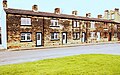
 Aston Road end of houses on Highfield Road - geograph.org.uk - 5899766.jpg 1,024 × 685; 152 KB
-
 Back Lane, Bramley, Leeds - geograph.org.uk - 4927334.jpg 1,280 × 805; 771 KB
-
 Back Melbourne Grove, Bramley, Leeds - geograph.org.uk - 5665934.jpg 1,280 × 853; 635 KB
-
 Back Melbourne Grove, Bramley, Leeds - geograph.org.uk - 5665935.jpg 1,280 × 719; 428 KB
-
 Back Raynville Terrace, Bramley - geograph.org.uk - 4970310.jpg 1,024 × 576; 153 KB
-
 Back, Melbourne Grove, Bramley, Leeds - geograph.org.uk - 5667633.jpg 1,280 × 762; 497 KB
-
 Back, Warrels Mount, Bramley, Leeds - geograph.org.uk - 5667594.jpg 1,280 × 669; 512 KB
-
 Backs of houses on Rossefield Grove, Bramley - geograph.org.uk - 4832391.jpg 1,024 × 768; 201 KB
-
 Backs of houses on Rossefield View, Bramley - geograph.org.uk - 4832394.jpg 1,024 × 768; 201 KB
-
 Bottom end of Raynville Crescent - geograph.org.uk - 4598805.jpg 1,024 × 768; 119 KB
-
 Bottom of Back Aston Road, Bramley - geograph.org.uk - 4598716.jpg 1,024 × 768; 116 KB
-
 Cottages, Back Lane, Bramley - geograph.org.uk - 6458851.jpg 1,024 × 768; 248 KB
-
 Elder Road, Bramley, Leeds - geograph.org.uk - 5674728.jpg 1,280 × 853; 678 KB
-
 Ferncliffe Terrace - Ferncliffe Road - geograph.org.uk - 1127408.jpg 640 × 442; 176 KB
-
 Ferncliffe Terrace, Bramley, Leeds - geograph.org.uk - 5667591.jpg 1,280 × 661; 439 KB
-
 Grosmont Place, Bramley, Leeds - geograph.org.uk - 5665901.jpg 1,280 × 853; 639 KB
-
 Grosmont Place, Bramley, Leeds - geograph.org.uk - 5665904.jpg 1,280 × 809; 569 KB
-
 Grosmont Road, Bramley, Leeds - geograph.org.uk - 5667610.jpg 1,280 × 672; 493 KB
-
 Grosmont Terrace, Bramley, Leeds - geograph.org.uk - 5665909.jpg 1,280 × 668; 528 KB
-
 Grosmont Terrace, Bramley, Leeds - geograph.org.uk - 5665912.jpg 1,280 × 668; 496 KB
-
 Highfield Road, Bramley, Leeds - geograph.org.uk - 5127043.jpg 1,182 × 738; 412 KB
-
 Highfield Road, Bramley, north end - geograph.org.uk - 4598610.jpg 1,024 × 768; 139 KB
-
 Houses for sale, Westover Road, Bramley - geograph.org.uk - 4619989.jpg 768 × 1,024; 153 KB
-
 Houses of Nansen Grove at Station Mount junction - geograph.org.uk - 5982545.jpg 1,024 × 663; 165 KB
-
 Houses of Nansen View at Station Mount junction - geograph.org.uk - 5982559.jpg 1,024 × 670; 174 KB
-

-

-
 Houses on Poplar Rise, Bramley (geograph 6445993).jpg 1,024 × 768; 220 KB
-
 Houses on Rosemont Street (geograph 6726104).jpg 1,024 × 768; 165 KB
-
 Landseer Terrace, Bramley - geograph.org.uk - 4598764.jpg 1,024 × 768; 121 KB
-
 Nansen Avenue - Bramley - geograph.org.uk - 1066052.jpg 640 × 480; 214 KB
-
 Nansen Grove - Bramley - geograph.org.uk - 1066051.jpg 640 × 480; 216 KB
-
 Nansen Mount - Bramley - geograph.org.uk - 1066050.jpg 640 × 480; 209 KB
-
 Nansen Terrace - Bramley - geograph.org.uk - 1066044.jpg 640 × 480; 236 KB
-
 Nansen Terrace, Bramley, Leeds - geograph.org.uk - 4887957.jpg 5,312 × 2,988; 6.81 MB
-
 Nansen View - Bramley - geograph.org.uk - 1066045.jpg 640 × 480; 230 KB
-
 Poplar Rise, Bramley, Leeds (geograph 4949443).jpg 1,280 × 853; 467 KB
-
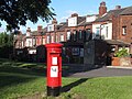 Postbox, Lower Town Street, Bramley - geograph.org.uk - 4598624.jpg 1,024 × 768; 231 KB
-
 Rosecliffe Mount - Ferncliffe Road - geograph.org.uk - 1127411.jpg 640 × 441; 172 KB
-

-
 Rosecliffe Terrace - Ferncliffe Road - geograph.org.uk - 1127409.jpg 640 × 445; 175 KB
-
 Warley Terrace, Rock Lane, Bramley - geograph.org.uk - 6447359.jpg 1,024 × 768; 248 KB
-
 Warrels Avenue, Bramley, Leeds - geograph.org.uk - 5667620.jpg 1,280 × 669; 438 KB


.jpg)
.jpg)


.jpg)


