Category:Territorial evolution of Brazil
Subcategories
This category has the following 2 subcategories, out of 2 total.
Media in category "Territorial evolution of Brazil"
The following 36 files are in this category, out of 36 total.
-
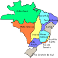
 Brazil states.gif 370 × 330; 28 KB
-
 América Portuguesa. Brasil Colônia.jpg 1,046 × 970; 152 KB
-
 Brasil - Colonizacion vèrs 1690.png 1,131 × 1,271; 247 KB
-
 Brasil - Evolucion territòriala.png 1,013 × 1,006; 240 KB
-
 Brasil - Periòde coloniau vèrs 1790.png 1,117 × 1,270; 254 KB
-
 Brasil 1720.jpg 606 × 599; 54 KB
-
 Brasil divisao politico administrativa 1943.PNG 388 × 331; 14 KB
-
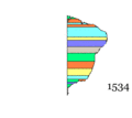
 Brazil in 1534.svg 2,008 × 1,985; 1,016 KB
-
 Brazil in 1572.svg 2,008 × 1,985; 913 KB
-
 Brazil in 1709.svg 2,008 × 1,985; 1.18 MB
-
 Brazil in 1750.svg 2,008 × 1,985; 1.29 MB
-
 Brazil in 1817.svg 2,008 × 1,985; 1.37 MB
-
 Brazil in 1822.svg 2,008 × 2,065; 1.45 MB
-
 Brazil in 1889.svg 2,008 × 1,986; 1.43 MB
-
 Brazil in 1943.svg 2,008 × 1,987; 1.5 MB
-
 Brazil provinces 1889.png 302 × 331; 7 KB
-
 Brazil Provinces 1889.svg 2,008 × 1,984; 1.13 MB
-
 Brazil states1534.png 302 × 305; 3 KB
-
 Brazil states1572.png 302 × 305; 8 KB
-
 Brazil states1709.png 302 × 305; 6 KB
-
 Brazil states1789 eo.svg 308 × 303; 79 KB
-
 Brazil states1789 rus.svg 308 × 303; 173 KB
-
 Brazil states1789.png 302 × 305; 7 KB
-
 Brazil states1823.png 302 × 352; 8 KB
-
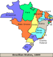 Brazil states1889.png 302 × 331; 8 KB
-
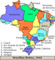 Brazil states1943.png 302 × 331; 9 KB
-
 Brazil states1990.png 302 × 331; 9 KB
-
 Estado do Brazil 1549.jpg 2,914 × 3,918; 1.33 MB
-
 Imperio do Brazil 1822.jpg 3,329 × 3,096; 1.77 MB
-

-
 Mapa-brasil-1824.png 2,339 × 2,184; 348 KB
-
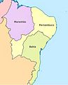 Nordeste brasileiro - 1709 (cropped).JPG 606 × 751; 96 KB
-
 Nordeste brasileiro - 1709 (cropped).svg 833 × 1,028; 430 KB
-
 Republica do Brasil 1889.jpg 3,362 × 3,084; 1.62 MB
-
 Sudamerica-rioplata 1864-1873.svg 1,873 × 2,000; 219 KB
-
 Vice-Reino do Brazil 1763.jpg 3,691 × 3,103; 1.41 MB


.jpg)

.JPG)
.svg)


