Category:Territorial evolution of France
process by which the territorial extent of metropolitan France came to be | |||||
| Upload media | |||||
| Instance of |
| ||||
|---|---|---|---|---|---|
| Facet of | |||||
| Location |
| ||||
| |||||
Pages in category "Territorial evolution of France"
This category contains only the following page.
Media in category "Territorial evolution of France"
The following 71 files are in this category, out of 71 total.
-
 Frontiere francaise 985 1947.gif 931 × 859; 2.02 MB
-
 Adquisicións territoriais de Luís XIV-gl.svg 1,717 × 1,662; 522 KB
-
 Agrandissements de la France aux XIVe et XVe siècles.jpeg 591 × 584; 105 KB
-
 Annexations of France North 1795-1811 -es.svg 932 × 832; 622 KB
-
 Annexations of France North 1795-1811 -nl.svg 957 × 838; 921 KB
-
 C. 1000 Europe and Byzantine Empire.jpg 1,349 × 1,055; 1.83 MB
-
 C. 1000 Western Europe.jpg 1,454 × 1,302; 2.1 MB
-
 C. 1097 Europe and Mediterranean Lands.jpg 1,752 × 1,375; 2.11 MB
-
 C. 1097 Western Europe and First Crusade Routes.jpg 1,068 × 1,299; 1.67 MB
-
 C. 1150 France, Lotharingia and Burgundy.jpg 2,979 × 3,931; 4.77 MB
-
 C. 1184 Eastern France, Champagne and Burgundy.jpg 1,840 × 1,119; 2.05 MB
-
 C. 1184 France and English Possesions.jpg 1,328 × 1,305; 2.25 MB
-
 C. 1190 Europe and Mediterranean Lands.jpg 1,514 × 1,173; 2.42 MB
-
 C. 1223 France.jpg 1,352 × 1,252; 977 KB
-
 C. 1279 France.jpg 2,979 × 3,931; 4.38 MB
-
 C. 1360 Europe and Western Asia.jpg 2,112 × 1,365; 2.11 MB
-
 C. 1360 Europe.jpg 4,045 × 3,000; 3.9 MB
-
 C. 1360 France and Holy Roman Empire.jpg 1,890 × 1,276; 1.52 MB
-
 C. 1429 France.jpg 3,890 × 3,010; 4.27 MB
-
 C. 1453 France.jpg 1,458 × 1,202; 1.55 MB
-
 C. 1490 France and England.jpg 811 × 1,252; 1.26 MB
-
 C. 1494 France.jpg 1,379 × 1,337; 1.24 MB
-
 C. 1519 Europe.jpg 4,212 × 3,212; 4.87 MB
-
 C. 1575 France (Northern).jpg 2,206 × 1,275; 3.11 MB
-
 C. 1575 France (Southern).jpg 1,980 × 1,381; 2.99 MB
-
 C. 768 Frankish Dominions (486-768).jpg 3,890 × 3,010; 3.66 MB
-
 C. 800 Carolingian Empire.jpg 2,204 × 1,880; 2.98 MB
-
 C. 814 Frankish Kingdoms.jpg 1,267 × 792; 721 KB
-
 C. 843 Division of Carolingian Empire.jpg 2,201 × 1,874; 3.08 MB
-
 C. 888 Europe.jpg 2,305 × 1,454; 1.73 MB
-
 C. 900 Frankish Dominions (768-900).jpg 3,879 × 3,031; 3.8 MB
-
 C. 962 Europe.jpg 4,066 × 3,010; 3.6 MB
-
 Conquetes Philippe Auguste.png 800 × 600; 101 KB
-
 Conquistas de Felipe Augusto ca.svg 10,072 × 7,059; 324 KB
-
 Conquistas de Felipe Augusto es.svg 9,442 × 6,618; 304 KB
-
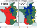 Conquiste territoriali Filippo Augusto.png 796 × 596; 75 KB
-
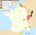
 Conquêtes de Louis XIV de 1648 à 1681.jpeg 591 × 635; 118 KB
-
 ES Francia 1552-1798.png 975 × 737; 118 KB
-
 EU20 88Louis.jpg 2,008 × 2,632; 4.44 MB
-
 France (1945-1949).png 1,920 × 1,615; 533 KB
-
 France 1552 to 1798-ca.png 2,000 × 1,390; 576 KB
-
 France 1552 to 1798-de.svg 2,584 × 1,796; 1.49 MB
-
 France 1552 to 1798-en.png 800 × 600; 40 KB
-
 France 1552 to 1798-es.svg 2,584 × 1,796; 696 KB
-
 France 1552 to 1798-fr.png 800 × 600; 32 KB
-
 France 1552 to 1798-fr.svg 2,584 × 1,796; 869 KB
-
 France 1643 to 1715-es.svg 1,832 × 1,773; 872 KB
-
 France 1643 to 1715-fr.svg 1,717 × 1,662; 513 KB
-
 France frontiers 1601 1766-es.svg 2,024 × 2,754; 2.7 MB
-
 France in 1789.svg 2,000 × 1,922; 1.08 MB
-
 France à la fin du Xe siècle.jpeg 534 × 616; 125 KB
-
 France, provinces in 1789 - de - colored.svg 1,925 × 1,920; 1.58 MB
-
 France, provinces in 1789 - en - colored.svg 1,925 × 1,920; 1.56 MB
-
 France, provinces in 1789 - es - colored.svg 1,925 × 1,920; 1.58 MB
-
 France, provinces in 1789 - fr - colored.svg 1,925 × 1,920; 1.56 MB
-
 Frankreich mit Eroberungen.png 800 × 600; 36 KB
-
 French borders from 985 to 1947.gif 466 × 430; 202 KB
-
 Frontiere francaise 985 1947 small.gif 466 × 430; 1.19 MB
-
 Henri Dron & Heymann, Plan de la Commune de Paris - Paris Musées.jpg 7,790 × 6,029; 29.14 MB
-
 Louis XIV Expansion.svg 423 × 518; 43 KB
-
 PazDeLosPirineos.svg 1,832 × 1,773; 643 KB
-
 Plan des anciennes enceintes de Paris (1180-1845) - Paris Musées.jpg 9,262 × 6,876; 40.55 MB
-

-
 Plan des anciennes enceintes et limites de Paris, Etabli par A. Grimault (02) - Paris Musées.jpg 8,463 × 6,108; 31.94 MB
-
 Plan des anciennes enceintes et limites de Paris, Etabli par A. Grimault (03) - Paris Musées.jpg 8,216 × 6,152; 32.71 MB
-
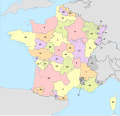 Provinces of France (numered).svg 2,000 × 1,922; 1.08 MB
-
 Provinces of France (numered-monochrome).svg 2,000 × 1,922; 1.08 MB
-
 Putz24.jpg 1,704 × 1,513; 274 KB
-
 Pyrenäenfriede.svg 916 × 883; 292 KB
-

-
 The city limits of Paris from the 4th century to 2015.svg 1,500 × 1,000; 24 KB


.jpg)
.jpg)
.jpg)


.jpg)


.png)


_-_Paris_Mus%C3%A9es.jpg)
_-_Paris_Mus%C3%A9es.jpg)
_-_Paris_Mus%C3%A9es.jpg)
_-_Paris_Mus%C3%A9es.jpg)
.svg)
.svg)


_(1945-1949).png)
