Category:Territorial evolution of the Philippines
Media in category "Territorial evolution of the Philippines"
The following 10 files are in this category, out of 10 total.
-
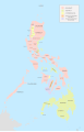 Administrative Divisions of the Philippines (1880).svg 512 × 792; 1.47 MB
-
 Administrative Divisions of the Philippines (1899).svg 512 × 792; 1.45 MB
-
 Administrative Divisions of the Philippines (1908).svg 512 × 792; 1.51 MB
-
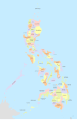
 Administrative Divisions of the Philippines (1918).svg 512 × 792; 1.53 MB
-
 Administrative Divisions of the Philippines (1935).svg 512 × 792; 1.52 MB
-
 Administrative Divisions of the Philippines (1942-1945).svg 512 × 792; 1.49 MB
-
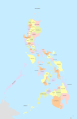
 Administrative Divisions of the Philippines (1986).svg 512 × 792; 1.86 MB
-
 Collier's 1921 Philippine Islands.jpg 1,830 × 2,212; 821 KB
-
 Philippine Islands - 1899 political map.jpg 5,092 × 6,036; 9.41 MB
-
 Philippine territorial map 1880.PNG 1,394 × 2,052; 4.75 MB
.svg)
.svg)
.svg)
.svg)
.svg)
.svg)
.svg)


