Category:Theodor-Heuss-Weg (Berlin-Gesundbrunnen)
| Object location | | View all coordinates using: OpenStreetMap |
|---|
street in Berlin-Gesundbrunnen, Germany  | |||||
| Upload media | |||||
| Instance of | |||||
|---|---|---|---|---|---|
| Named after | |||||
| Location | Gesundbrunnen, Mitte, Berlin, Germany | ||||
| Connects with | |||||
 | |||||
Subcategories
This category has the following 2 subcategories, out of 2 total.
E
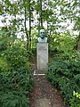
- Ernst-Reuter-Büste (5 F)
- Ernst-Reuter-Siedlung (12 F)
Media in category "Theodor-Heuss-Weg (Berlin-Gesundbrunnen)"
The following 24 files are in this category, out of 24 total.
-
 Bundesarchiv B 145 Bild-F002775-0009, Berlin, Theodor-Heuss-Weg.jpg 784 × 766; 61 KB
-
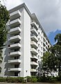 Ernst-Reuter-Siedlung (Berlin-Gesundbrunnen) Scheibenwohnhaus.JPG 1,824 × 2,488; 2.93 MB
-
 Gesundbrunnen Ernst-Reuter-Siedlung Ackerstraße.jpg 4,896 × 3,672; 6.92 MB
-
 Gesundbrunnen Ernst-Reuter-Siedlung Gärten.jpg 4,896 × 3,672; 6.85 MB
-
 Gesundbrunnen Ernst-Reuter-Siedlung Punkthochhaus-001.jpg 3,672 × 4,896; 6.71 MB
-
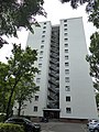 Gesundbrunnen Ernst-Reuter-Siedlung Punkthochhaus-002.jpg 3,672 × 4,896; 6.91 MB
-
 Gesundbrunnen Ernst-Reuter-Siedlung-001.jpg 4,896 × 3,672; 6.66 MB
-
 Gesundbrunnen Ernst-Reuter-Siedlung-002.jpg 3,672 × 4,896; 6.61 MB
-
 Gesundbrunnen Ernst-Reuter-Siedlung-005.jpg 3,672 × 4,896; 7.06 MB
-
 Gesundbrunnen Ernst-Reuter-Siedlung.jpg 3,672 × 4,896; 5.07 MB
-
 GesundbrunnenTheodorHeussWeg.jpg 2,448 × 3,264; 2.03 MB
-
 Straßenbrunnen Gesundbrunnen 93 Ackerstraße (1).jpg 3,194 × 2,631; 2.29 MB
-
 Straßenbrunnen Gesundbrunnen 93 Ackerstraße (2).jpg 4,288 × 3,216; 4.15 MB
-
 Straßenbrunnen Gesundbrunnen 93 Ackerstraße (3).jpg 4,288 × 3,216; 3.28 MB
-
 Straßenbrunnen Gesundbrunnen 93 Ackerstraße (4).jpg 4,286 × 3,216; 2.73 MB
-
 Straßenbrunnen Gesundbrunnen 93 Ackerstraße (5).jpg 3,165 × 2,485; 1.45 MB
-
 Straßenbrunnen Gesundbrunnen 93 Ackerstraße (6).jpg 3,216 × 4,288; 2.75 MB
-
 Straßenbrunnen XX Gesundbrunnen-Gartenstraße Theodor-Heuß-Weg (1).jpg 4,288 × 3,216; 2.6 MB
-
 Straßenbrunnen XX Gesundbrunnen-Gartenstraße Theodor-Heuß-Weg (2).jpg 3,482 × 3,109; 2.32 MB
-
 Straßenbrunnen XX Gesundbrunnen-Gartenstraße Theodor-Heuß-Weg (3).jpg 4,288 × 3,216; 7.04 MB
-
 Straßenbrunnen XX Gesundbrunnen-Gartenstraße Theodor-Heuß-Weg (4).jpg 4,288 × 3,216; 1.95 MB
-
 Straßenbrunnen XX Gesundbrunnen-Gartenstraße Theodor-Heuß-Weg (5).jpg 3,056 × 2,221; 1.07 MB
-
 Straßenbrunnen XX Gesundbrunnen-Gartenstraße Theodor-Heuß-Weg (6).jpg 4,011 × 2,728; 2.75 MB
-
 Straßenbrunnen XX Gesundbrunnen-Gartenstraße Theodor-Heuß-Weg (7).jpg 3,928 × 2,945; 2.13 MB

_Scheibenwohnhaus.JPG)


.jpg)
.jpg)
.jpg)
.jpg)
.jpg)
.jpg)
.jpg)
.jpg)
.jpg)
.jpg)
.jpg)
.jpg)
.jpg)