Category:Thimbleby, Lincolnshire
village and civil parish in East Lindsey, Lincolnshire, England  | |||||
| Upload media | |||||
| Instance of | |||||
|---|---|---|---|---|---|
| Location | East Lindsey, Lincolnshire, East Midlands, England | ||||
 | |||||
Subcategories
This category has the following 2 subcategories, out of 2 total.
S
W
- White Cottage, Thimbleby (3 F)
Media in category "Thimbleby, Lincolnshire"
The following 72 files are in this category, out of 72 total.
-
 30 year old Ramblers' Bridge, Poolham - geograph.org.uk - 4375291.jpg 640 × 427; 114 KB
-
 A corner of the churchyard - geograph.org.uk - 4018463.jpg 1,024 × 768; 330 KB
-

-
 A158 at Thimbleby Road junction - geograph.org.uk - 3525927.jpg 640 × 380; 93 KB
-

-
 B1190 heading east - geograph.org.uk - 3490168.jpg 640 × 480; 59 KB
-
 B1190 heading east out of Thimbleby - geograph.org.uk - 3490205.jpg 640 × 480; 81 KB
-
 B1190 into Thimbleby - geograph.org.uk - 3490181.jpg 640 × 480; 75 KB
-

-
 Barns at Hallgarth Farm - geograph.org.uk - 4018501.jpg 1,024 × 768; 230 KB
-
 Bridleway to the A158 - geograph.org.uk - 4390056.jpg 1,024 × 768; 172 KB
-

-
 Church Cottage, Thimbleby - geograph.org.uk - 4019621.jpg 1,024 × 768; 133 KB
-
 Crowders Nursery - geograph.org.uk - 4826239.jpg 4,726 × 2,735; 7.14 MB
-

-
 Edlington House from Shearman's Wath - geograph.org.uk - 4374795.jpg 1,024 × 683; 119 KB
-
 Entering Thimbleby, Lincolnshire - geograph.org.uk - 2577564.jpg 800 × 600; 267 KB
-
 Farmland near Thimbleby - geograph.org.uk - 4826257.jpg 4,858 × 2,741; 5.08 MB
-
 Farmland off the B1190 - geograph.org.uk - 3490160.jpg 640 × 480; 65 KB
-
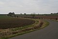
 Farmland west of Thimbleby - geograph.org.uk - 3490148.jpg 640 × 536; 49 KB
-
 Farmland, Thimbleby - geograph.org.uk - 3490198.jpg 640 × 480; 49 KB
-
 Farmland, Thimbleby - geograph.org.uk - 3490212.jpg 640 × 480; 52 KB
-

-
 Grazing, Horncastle - geograph.org.uk - 3490226.jpg 640 × 480; 67 KB
-
 Green Lane at Goose Lane - geograph.org.uk - 2577778.jpg 800 × 600; 218 KB
-

-

-
 Jemina Slurry-Duck in Elmhirst Lane - geograph.org.uk - 4034344.jpg 640 × 427; 115 KB
-
-
 Main Street - geograph.org.uk - 4099235.jpg 1,024 × 683; 174 KB
-
 Mill Lane, the road to Langton - geograph.org.uk - 4034413.jpg 640 × 427; 65 KB
-
-

-
 North Street, Thimbleby - geograph.org.uk - 4019598.jpg 1,024 × 768; 201 KB
-
 Old Chapel on Chapel Lane - geograph.org.uk - 2653952.jpg 1,280 × 960; 463 KB
-
 Old Manor House - geograph.org.uk - 709270.jpg 640 × 427; 51 KB
-
 Ordnance Survey Cut Mark - geograph.org.uk - 5481714.jpg 640 × 463; 114 KB
-
 Path to Edlington - geograph.org.uk - 4034428.jpg 640 × 427; 64 KB
-
 Ponds between Thimbleby and Langton, aerial 2014 - geograph.org.uk - 3891708.jpg 1,024 × 683; 147 KB
-
 Public Footpath and Footbridge, near Thimbleby - geograph.org.uk - 2653998.jpg 1,280 × 960; 450 KB
-
 Road to Poolham - geograph.org.uk - 4375274.jpg 640 × 427; 45 KB
-
 Shearman's Wath - the road to West Ashby - geograph.org.uk - 4830550.jpg 5,184 × 3,888; 4.7 MB
-
 Shearman's Wath looking north-east - geograph.org.uk - 3263224.jpg 2,256 × 1,504; 1.25 MB
-
 Shearman's Wath, West Ashby - geograph.org.uk - 4374792.jpg 1,024 × 683; 97 KB
-
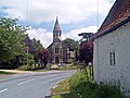 St Margaret's Church - geograph.org.uk - 2462603.jpg 3,264 × 2,448; 5.9 MB
-
 Thatched cottage, Thimbleby - geograph.org.uk - 3490175.jpg 640 × 480; 61 KB
-
 Thatched Cottages - geograph.org.uk - 2462645.jpg 3,264 × 2,448; 5.94 MB
-
 Thatched Roof at Thimbleby - geograph.org.uk - 642989.jpg 640 × 480; 81 KB
-
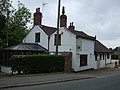
 The Durham Ox, Thimbleby - geograph.org.uk - 2577569.jpg 800 × 600; 297 KB
-
 The Durham Ox, Thimbleby - geograph.org.uk - 3490216.jpg 640 × 480; 70 KB
-
 The former school, Thimbleby - geograph.org.uk - 4018491.jpg 1,024 × 768; 167 KB
-
 The Old Manor, Thimbleby - geograph.org.uk - 4019610.jpg 1,024 × 768; 116 KB
-
 The Thimbleby Monster - geograph.org.uk - 5060951.jpg 3,600 × 2,400; 7.8 MB
-
 The village pump, Thimbleby - geograph.org.uk - 4018475.jpg 1,024 × 768; 253 KB
-
 Thimbleby Cottage - geograph.org.uk - 709247.jpg 640 × 427; 55 KB
-
 Thimbleby Mill - geograph.org.uk - 4034381.jpg 640 × 427; 100 KB
-
 Thimbleby water pump - geograph.org.uk - 457867.jpg 427 × 640; 102 KB
-
 Thimbleby, aerial 2014 - geograph.org.uk - 3891702.jpg 1,024 × 683; 159 KB
-
 Thimbleby, B1190 (Main Street) looking west - geograph.org.uk - 5060929.jpg 5,184 × 3,456; 7.01 MB
-
 Thimbleby, Llyndu Cottage - geograph.org.uk - 5060920.jpg 5,184 × 3,456; 5.98 MB
-
 Thimbleby, Parish Hall - geograph.org.uk - 5060925.jpg 5,184 × 3,456; 7.75 MB
-
 Thimbleby, The 'Durham Ox' - geograph.org.uk - 5060962.jpg 5,184 × 3,456; 7.54 MB
-
 Thimbleby, The 'Durham Ox' - geograph.org.uk - 5060968.jpg 5,184 × 3,456; 6.44 MB
-
 Thimbleby-l'Eglise^ - geograph.org.uk - 4034457.jpg 640 × 427; 66 KB
-
 Wesleyan Methodist Chapel - geograph.org.uk - 709274.jpg 640 × 427; 59 KB
-
 Who are ewe looking at ^ - geograph.org.uk - 709245.jpg 640 × 427; 100 KB
-
 Farm Buildings near Horncastle - geograph.org.uk - 215948.jpg 640 × 480; 65 KB
-
 Glebe Farm - geograph.org.uk - 215461.jpg 640 × 480; 82 KB
-
 Pasture off Langton Lane - geograph.org.uk - 707748.jpg 640 × 427; 115 KB
-
 The Durham Ox, Thimbleby - geograph.org.uk - 136741.jpg 640 × 427; 72 KB
-
 Thimbleby Main Street - geograph.org.uk - 294010.jpg 640 × 427; 93 KB
-
 Thimbleby Village Hall - geograph.org.uk - 457858.jpg 640 × 427; 78 KB


_looking_west_-_geograph.org.uk_-_5060929.jpg)


