Category:Thorner
village and civil parish in West Yorkshire, England  | |||||
| Upload media | |||||
| Instance of | |||||
|---|---|---|---|---|---|
| Location | Leeds, West Yorkshire, Yorkshire and the Humber, England | ||||
| Population |
| ||||
 | |||||
English: Thorner is a village and civil parish in the City of Leeds in West Yorkshire, England, located between Seacroft and Wetherby. It is situated not far away from the A1, A58 and A64 trunk roads. It is 8 miles (13 km) north-east of Leeds city centre and 7 miles (11 km) to the south-west of Wetherby, and has a population of 1,503.
Nederlands: Thorner is een dorp (village) en civil parish in het bestuurlijke gebied City of Leeds, in het Engelse graafschap West Yorkshire. De civil parish telt
Subcategories
This category has the following 5 subcategories, out of 5 total.
Media in category "Thorner"
The following 200 files are in this category, out of 232 total.
(previous page) (next page)-
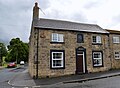 18th Century House, Main Street Thorner, Leeds - geograph.org.uk - 4868223.jpg 1,108 × 813; 384 KB
-
 4 Camp Square,Thorner - geograph.org.uk - 83968.jpg 480 × 640; 90 KB
-
 A footpath at Birkby Grange - geograph.org.uk - 2782214.jpg 800 × 600; 127 KB
-

-

-
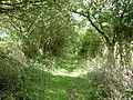
 A path leading to a disused railway line - geograph.org.uk - 2784620.jpg 800 × 600; 188 KB
-
 A path leading to Coal Road - geograph.org.uk - 2782262.jpg 800 × 600; 140 KB
-

-
 A path leading to Thorner - geograph.org.uk - 2784597.jpg 800 × 600; 201 KB
-
 A stile near Birkby Grange - geograph.org.uk - 2782209.jpg 800 × 600; 132 KB
-
 A walk from Oulton Church ^59 - geograph.org.uk - 2011416.jpg 800 × 600; 297 KB
-
 A walk from Oulton Church ^61 - geograph.org.uk - 2011444.jpg 800 × 600; 240 KB
-
 A walk from Oulton Church ^62 - geograph.org.uk - 2011459.jpg 800 × 600; 285 KB
-
 A walk from Oulton Church ^63 - geograph.org.uk - 2011473.jpg 800 × 600; 384 KB
-
 A walk from Oulton Church ^64 - geograph.org.uk - 2011498.jpg 800 × 600; 316 KB
-
 A waste of money - geograph.org.uk - 2784622.jpg 800 × 600; 132 KB
-
 A58 near Eltofts Farm - geograph.org.uk - 6174982.jpg 1,024 × 770; 169 KB
-
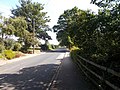
 A58 towards Wetherby - geograph.org.uk - 3797749.jpg 640 × 480; 110 KB
-
 A58 Wetherby Road at Coal Road junction - geograph.org.uk - 6174981.jpg 1,024 × 769; 165 KB
-
 Access to Eltofts House from Carr Lane - geograph.org.uk - 5809297.jpg 1,600 × 1,200; 829 KB
-
 Approaching Eltofts House - geograph.org.uk - 5809296.jpg 1,600 × 1,200; 431 KB
-
 Barnaby Cottage on Whinmoor Lane - geograph.org.uk - 3047022.jpg 1,024 × 768; 156 KB
-
 Barnaby Cottages, Winn Moor Lane - geograph.org.uk - 6268626.jpg 1,024 × 768; 104 KB
-
 Beck - Carr Lane - geograph.org.uk - 4617730.jpg 640 × 480; 131 KB
-
 Beck alongside the road, south of Thorner - geograph.org.uk - 3053454.jpg 1,024 × 768; 203 KB
-
 Birkby Hill Ordnance Survey Trig Pillar - geograph.org.uk - 3857681.jpg 800 × 600; 201 KB
-
-
-
 Bridge over Beck - Lower Sandhills - geograph.org.uk - 948748.jpg 640 × 461; 248 KB
-
 Bridge over dismantled railway - geograph.org.uk - 89668.jpg 640 × 480; 96 KB
-
 Bridleway - Kirk Hills - geograph.org.uk - 4617571.jpg 640 × 480; 88 KB
-
 Bridleway at Thorner - geograph.org.uk - 3025481.jpg 2,048 × 1,536; 508 KB
-
 Brookeside, Thorner - geograph.org.uk - 2786538.jpg 640 × 480; 56 KB
-
 BT Premises - Carr Lane - geograph.org.uk - 4617736.jpg 640 × 480; 74 KB
-

-
 Butts Garth - Stead Lane - geograph.org.uk - 4617741.jpg 640 × 480; 91 KB
-
 Butts Garth View - Butts Garth - geograph.org.uk - 4617775.jpg 640 × 480; 93 KB
-
 Camp Square - Main Street - geograph.org.uk - 4617838.jpg 480 × 640; 85 KB
-
 Carr House Farm - geograph.org.uk - 2782197.jpg 800 × 600; 166 KB
-
 Carr Lane - geograph.org.uk - 3045840.jpg 1,024 × 768; 168 KB
-
 Carr Lane - geograph.org.uk - 3045866.jpg 1,024 × 768; 173 KB
-
 Carr Lane - geograph.org.uk - 5345166.jpg 5,184 × 3,456; 6.11 MB
-
 Carr Lane - Main Street - geograph.org.uk - 4617728.jpg 640 × 480; 83 KB
-
 Carr Lane - viewed from Bay Horse Lane - geograph.org.uk - 3972854.jpg 640 × 480; 112 KB
-
 Carr Lane at the 102 metre spot height - geograph.org.uk - 3046008.jpg 1,024 × 768; 215 KB
-
 Church Farm - Church View - geograph.org.uk - 4617680.jpg 640 × 443; 85 KB
-
-

-

-

-
 Church View, Thorner - geograph.org.uk - 2784407.jpg 640 × 480; 45 KB
-
 Church View, Thorner - geograph.org.uk - 4810451.jpg 1,600 × 1,067; 553 KB
-
 Claypit Lane - Stead Lane - geograph.org.uk - 4617744.jpg 640 × 480; 99 KB
-
 Clover-filled field, north of Carr Lane - geograph.org.uk - 3053425.jpg 1,024 × 768; 125 KB
-
 Coal Road - viewed from Bay Horse Lane - geograph.org.uk - 3972859.jpg 640 × 480; 111 KB
-
 Cottage in Thorner - geograph.org.uk - 2545276.jpg 640 × 435; 71 KB
-

-
 Countryside around Carr Lane - geograph.org.uk - 5345162.jpg 5,184 × 3,456; 5.89 MB
-
 Cross Base and Shaft, Thorner.jpg 480 × 640; 104 KB
-
 Disused Railway approaching Thorner from the South - geograph.org.uk - 5345150.jpg 5,184 × 3,456; 5.8 MB
-

-
 Ellerker Lane - geograph.org.uk - 2546478.jpg 640 × 480; 99 KB
-
 Ellerker Lane - geograph.org.uk - 3025484.jpg 2,048 × 1,536; 551 KB
-
 Ellerker Lane - geograph.org.uk - 4810273.jpg 1,600 × 1,067; 607 KB
-
 Ellerker Lane towards Thorner - geograph.org.uk - 4032828.jpg 1,600 × 1,064; 624 KB
-
 Ellerker Lane, Thorner - geograph.org.uk - 140377.jpg 480 × 640; 94 KB
-
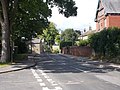
 Entering Thorner on Bramham Road - geograph.org.uk - 2784394.jpg 640 × 480; 87 KB
-
 Farm buildings off Carr Lane, Thorner - geograph.org.uk - 4033970.jpg 1,600 × 1,047; 567 KB
-
 Farmland near Thorner - geograph.org.uk - 2545239.jpg 640 × 480; 107 KB
-
 Farmland near Thorner - geograph.org.uk - 2784389.jpg 640 × 480; 71 KB
-
 Farmland off Bramham Road - geograph.org.uk - 2784362.jpg 640 × 480; 66 KB
-
 Farmland on the north side of Carr Lane - geograph.org.uk - 3046017.jpg 1,024 × 768; 211 KB
-
 Farmland south of Carr Lane - geograph.org.uk - 3053443.jpg 1,024 × 768; 101 KB
-
 Farmland, Miry Carr - geograph.org.uk - 2786545.jpg 640 × 480; 42 KB
-
 Farmland, Norwood House Farm - geograph.org.uk - 2784383.jpg 640 × 480; 110 KB
-
 Farmland, Nova Scotia - geograph.org.uk - 2784376.jpg 640 × 480; 89 KB
-
 Farmland, Sandhills - geograph.org.uk - 2786541.jpg 640 × 480; 85 KB
-
 Field bounded by hedges - geograph.org.uk - 3053434.jpg 1,024 × 768; 127 KB
-
 Fields, Birkby Hill - geograph.org.uk - 3797729.jpg 640 × 480; 67 KB
-
 Footpath - end of Butts Garth - geograph.org.uk - 4617795.jpg 640 × 480; 128 KB
-
 Footpath - Main Street - geograph.org.uk - 4617853.jpg 480 × 640; 99 KB
-
 Footpath - The Close - geograph.org.uk - 4617574.jpg 480 × 640; 72 KB
-
 Footpath - The Close - geograph.org.uk - 4617577.jpg 640 × 480; 137 KB
-
 Footpath south of Carr Farm - geograph.org.uk - 5809298.jpg 1,600 × 1,200; 790 KB
-
 Footpath stile by gated track - geograph.org.uk - 3053464.jpg 1,024 × 768; 178 KB
-
 Footpath towards West Field - geograph.org.uk - 5809299.jpg 1,600 × 1,200; 684 KB
-
 Ford at Thorner - geograph.org.uk - 5809300.jpg 1,600 × 1,200; 998 KB
-
 Gate beside Mangrill Lane - geograph.org.uk - 3291883.jpg 2,048 × 1,536; 545 KB
-
 Gate into grass field - geograph.org.uk - 3046011.jpg 1,024 × 768; 182 KB
-
 Gated field entrance, Carr Lane - geograph.org.uk - 3053420.jpg 1,024 × 768; 168 KB
-
 Grazing off the A58 - geograph.org.uk - 3797744.jpg 640 × 480; 109 KB
-
 Green Area - Main Street - geograph.org.uk - 4617727.jpg 640 × 480; 111 KB
-
 Half-hidden warning, Carr Lane - geograph.org.uk - 3053415.jpg 1,024 × 768; 194 KB
-
 Heathcote Avenue - Butts Garth - geograph.org.uk - 4617750.jpg 480 × 640; 100 KB
-
 Heathcote Avenue - Main Street - geograph.org.uk - 4617803.jpg 480 × 640; 69 KB
-

-
 Houses on Ellerker Road, Thoner - geograph.org.uk - 4032833.jpg 1,600 × 1,064; 404 KB
-
 Houses on Moat End, Thorner - geograph.org.uk - 4033894.jpg 1,600 × 1,064; 464 KB
-
 Intake Lane towards Intake Farm - geograph.org.uk - 2786543.jpg 640 × 480; 86 KB
-

-
-
 Kiddal Hall - geograph.org.uk - 140451.jpg 640 × 480; 103 KB
-

-
 Kirkby Garth - Main Street - geograph.org.uk - 4617698.jpg 640 × 459; 78 KB
-
 Kirkfield Lane - Church Hill, Thorner - geograph.org.uk - 948814.jpg 640 × 408; 174 KB
-
 Kirkfield Lane - Kirk Hills - geograph.org.uk - 4617563.jpg 640 × 480; 64 KB
-

-
 Kirkfield Lane, Thorner - geograph.org.uk - 2411390.jpg 800 × 600; 244 KB
-
 Kirkfield Lane, Thorner - geograph.org.uk - 4032835.jpg 1,600 × 1,064; 435 KB
-
 Kirklands, Carr Lane, Thorner - geograph.org.uk - 3045845.jpg 768 × 1,024; 543 KB
-
 Lane to Saw Wood House - geograph.org.uk - 5809662.jpg 1,600 × 1,200; 512 KB
-
 Leeds Country Way between Thorner and Scarcroft - geograph.org.uk - 4811344.jpg 1,600 × 1,067; 611 KB
-
 Leeds Country Way in Kiddal Wood (1) - geograph.org.uk - 5344452.jpg 5,184 × 3,456; 5.82 MB
-
 Leeds Country Way in Kiddal Wood (2) - geograph.org.uk - 5344456.jpg 5,184 × 3,456; 5.19 MB
-
 Leeds Country Way near Redhills Plantation - geograph.org.uk - 3025490.jpg 2,048 × 1,536; 571 KB
-
 Leeds Country Way outside Thorner - geograph.org.uk - 4810278.jpg 1,600 × 1,067; 615 KB
-
 Leeds Country Way towards Oaklands Manor - geograph.org.uk - 4033972.jpg 1,600 × 1,064; 884 KB
-
 Leeds Country Way towards Oaklands Manor - geograph.org.uk - 4033978.jpg 1,600 × 1,064; 835 KB
-
 Leeds Country Way, Kiddal Bridge - geograph.org.uk - 140450.jpg 480 × 640; 59 KB
-
 Littlemoor Lane - Butts Garth - geograph.org.uk - 4617779.jpg 640 × 480; 91 KB
-
 Littlemoor Lane, Thorner - geograph.org.uk - 2784764.jpg 800 × 600; 103 KB
-
 Looking down Milner Lane towards the centre of Thorner (7th December 2013).JPG 3,456 × 2,738; 1.75 MB
-

-
 Main Street, Thorner - geograph.org.uk - 4810776.jpg 1,600 × 1,067; 455 KB
-
 Mangrill Lane (track) - geograph.org.uk - 2784366.jpg 640 × 480; 121 KB
-
 Mangrill Lane - geograph.org.uk - 4810054.jpg 1,600 × 1,067; 741 KB
-
 Manor Gardens - Church Hill - geograph.org.uk - 4617561.jpg 640 × 480; 105 KB
-
 Meadowland in sunshine and shade - geograph.org.uk - 3046020.jpg 1,024 × 768; 207 KB
-
 Mexborough Court - Carr Lane - geograph.org.uk - 4617729.jpg 640 × 480; 88 KB
-
 Milestone, Thorner.jpg 485 × 661; 75 KB
-

-

-
 Moat End - Stead Lane - geograph.org.uk - 4617746.jpg 640 × 480; 75 KB
-
 Narrow field south of Thorner - geograph.org.uk - 3053455.jpg 1,024 × 768; 203 KB
-
 Ordnance Survey Cut Mark - geograph.org.uk - 4161043.jpg 4,000 × 3,000; 4.1 MB
-
 Pastures by Carr Farm - geograph.org.uk - 5345156.jpg 5,184 × 3,456; 6.82 MB
-
 Pear Tree Cottage - Lower Sandhills - geograph.org.uk - 948744.jpg 640 × 455; 205 KB
-
 Pond near Scarcroft Lodge - geograph.org.uk - 6141822.jpg 1,024 × 531; 158 KB
-
 Private lane towards Privet Plantation - geograph.org.uk - 3291862.jpg 2,048 × 1,536; 531 KB
-

-
 Rapeseed near Thorner - geograph.org.uk - 2546423.jpg 640 × 480; 103 KB
-
 Road to Sandhills - geograph.org.uk - 2545201.jpg 640 × 480; 83 KB
-
 Saw Wood - geograph.org.uk - 5345318.jpg 5,184 × 3,456; 6.06 MB
-
 Saw Wood, Leeds Country Way - geograph.org.uk - 140439.jpg 640 × 480; 115 KB
-
 Scotts Hill Court - Main Street - geograph.org.uk - 4617848.jpg 640 × 456; 78 KB
-
 Skippon Terrace - geograph.org.uk - 3045851.jpg 1,024 × 768; 150 KB
-
 St John's Avenue - Main Street - geograph.org.uk - 4617857.jpg 640 × 480; 71 KB
-
 St John's Avenue, Thorner - geograph.org.uk - 2784769.jpg 800 × 600; 196 KB
-
 St John's Avenue, Thorner - geograph.org.uk - 2784771.jpg 800 × 600; 135 KB
-
 St John's Court - St John's Avenue - geograph.org.uk - 4617860.jpg 640 × 480; 83 KB
-
 St Peter's Church, Thorner, Leeds - geograph.org.uk - 4868230.jpg 1,280 × 960; 729 KB
-

-
 Station Lane - Carr Lane - geograph.org.uk - 4617733.jpg 640 × 480; 86 KB
-
 Station Lane, Thorner - geograph.org.uk - 3025471.jpg 2,048 × 1,536; 513 KB
-
 Stead Lane - Main Street - geograph.org.uk - 4617738.jpg 640 × 480; 71 KB
-
 Stone built house dated 1759 Main Street Thorner - geograph.org.uk - 4590303.jpg 3,485 × 2,545; 2.89 MB
-
 Stoney Lane heading west - geograph.org.uk - 3797746.jpg 640 × 480; 74 KB
-
 Sunny south-western corner of a meadow - geograph.org.uk - 3046033.jpg 1,024 × 768; 203 KB
-
 Taking it easy after a hard night at work^ - geograph.org.uk - 4032667.jpg 1,600 × 1,064; 764 KB
-
 The Beehive @Thorner - geograph.org.uk - 2786534.jpg 640 × 480; 60 KB
-
 The bridge on Littlemoor Lane, Thorner - geograph.org.uk - 2784751.jpg 800 × 600; 164 KB
-
 The Close - St Peter's Garth - geograph.org.uk - 4617573.jpg 640 × 412; 51 KB
-
 The entrance to Carr Farm - geograph.org.uk - 3053438.jpg 1,024 × 768; 164 KB
-

-
 The footpath to the south of Carr Farm - geograph.org.uk - 2782192.jpg 800 × 600; 157 KB
-
 The Leeds Country Way in Kiddal Wood - geograph.org.uk - 4032777.jpg 1,600 × 1,064; 926 KB
-
 The Leeds Country Way in Kiddal Wood - geograph.org.uk - 4032780.jpg 1,600 × 1,064; 902 KB
-
 The Leeds Country Way towards Thorner - geograph.org.uk - 4032786.jpg 1,600 × 1,064; 791 KB
-
 The Leeds Country Way towards Thorner - geograph.org.uk - 4032790.jpg 1,600 × 1,064; 881 KB
-
 The Paddock - Butts Garth - geograph.org.uk - 4617793.jpg 640 × 480; 83 KB
-

-
 The path heading West from Carr Farm - geograph.org.uk - 2782186.jpg 800 × 600; 120 KB
-
 The path over Thorner ford - geograph.org.uk - 2784776.jpg 800 × 600; 174 KB
-
 The road to Lower Sandhills - geograph.org.uk - 3053450.jpg 1,024 × 768; 114 KB
-
 Thorner Bowling Club - Carr Lane - geograph.org.uk - 4617737.jpg 640 × 480; 84 KB
-
 Thorner Bowling Club on Carr Lane - geograph.org.uk - 4033898.jpg 1,600 × 1,064; 647 KB
-
 Thorner footpath - geograph.org.uk - 3045848.jpg 768 × 1,024; 602 KB
-
 Thorner Ford - geograph.org.uk - 3763277.jpg 3,872 × 2,592; 4.58 MB
-
 Thorner Lane heading south - geograph.org.uk - 2786547.jpg 640 × 480; 100 KB
-
 Thorner Moor - geograph.org.uk - 4810267.jpg 1,600 × 1,067; 529 KB
-
 Thorner Moor trig point looking east - geograph.org.uk - 3291909.jpg 2,048 × 1,536; 595 KB
-
 Thorner Moor trig point looking west - geograph.org.uk - 3291908.jpg 2,048 × 1,536; 554 KB
-
 Thorner railway station (site), Yorkshire (geograph 3459209).jpg 1,024 × 768; 207 KB
-
 Thorner welcomes careful drivers - geograph.org.uk - 3045842.jpg 1,024 × 768; 153 KB
-
 Track next to Whittle Car - geograph.org.uk - 801257.jpg 400 × 600; 274 KB
-
 Track to Norwood House Farm - geograph.org.uk - 2784384.jpg 640 × 480; 127 KB
-
 Track to Nova Scotia Farm - geograph.org.uk - 2784371.jpg 640 × 480; 74 KB
-
 Track towards Whittle Car - geograph.org.uk - 804609.jpg 600 × 400; 253 KB
-
 Tree on a field boundary - geograph.org.uk - 3045839.jpg 1,024 × 768; 121 KB
-
 Trees at the corner of a field - geograph.org.uk - 3046024.jpg 1,024 × 768; 193 KB
-
 Trig Point on Thorner Moor - geograph.org.uk - 4810149.jpg 1,600 × 1,067; 723 KB
-
 Trig Point ^S1896 near to Birkby Grange - geograph.org.uk - 2782259.jpg 800 × 600; 152 KB
-
 Victorian Post Box - Church Hill, Thorner - geograph.org.uk - 948810.jpg 352 × 640; 202 KB
-
 Victorian Post Box - Lower Sandhills - geograph.org.uk - 948739.jpg 371 × 640; 194 KB
-
 Victory Hall - Carr Lane - geograph.org.uk - 4617734.jpg 640 × 480; 75 KB
-
 View from the bench, south of Thorner - geograph.org.uk - 3053473.jpg 1,024 × 768; 157 KB
-
 VR Post Box - Church View - geograph.org.uk - 4617671.jpg 369 × 640; 76 KB
-
 Walkers only past this point - geograph.org.uk - 2784790.jpg 800 × 600; 146 KB
-
 Walking west at Carr Farm - geograph.org.uk - 2784835.jpg 800 × 600; 181 KB
-
 Walking west towards Carr Farm - geograph.org.uk - 2784794.jpg 800 × 600; 124 KB


_-_geograph.org.uk_-_5344452.jpg)
_-_geograph.org.uk_-_5344456.jpg)


.JPG)


_-_geograph.org.uk_-_2784366.jpg)


,_Yorkshire_(geograph_3459209).jpg)


