Category:Thornley-with-Wheatley
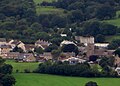
English: Thornley-with-Wheatley is a civil parish in the Borough of Ribble Valley, Lancashire, England. It is entirely rural, with no villages or other substantial settlements. Its population was 320 in 2011, a figure that has not changed much for over a century. (→Thornley-with-Wheatley)
civil parish in Lancashire, UK  | |||||
| Upload media | |||||
| Instance of | |||||
|---|---|---|---|---|---|
| Location | Ribble Valley, Lancashire, North West England, England | ||||
 | |||||
Subcategories
This category has the following 2 subcategories, out of 2 total.
L
- Longridge Fell (31 F)
- Longridge Golf Club (7 F)
Media in category "Thornley-with-Wheatley"
The following 200 files are in this category, out of 220 total.
(previous page) (next page)-
 "No public access for any reason" - geograph.org.uk - 4490246.jpg 4,592 × 3,056; 7.23 MB
-
 "Quiet Lane" near Longridge - geograph.org.uk - 4355223.jpg 800 × 533; 257 KB
-
 A Corner of Lyme House Farm - geograph.org.uk - 6125304.jpg 5,184 × 3,456; 7.6 MB
-
-
 A mounting block at Wheatley Farm - geograph.org.uk - 4506743.jpg 3,649 × 2,139; 6.82 MB
-
 A steep hill down to Brook House - geograph.org.uk - 4505597.jpg 4,592 × 3,056; 6.32 MB
-
 A tractor poses in front of Dusty Clough Wood - geograph.org.uk - 4521675.jpg 4,119 × 2,395; 7.64 MB
-
 A tree in a field - geograph.org.uk - 4524574.jpg 4,074 × 2,951; 7.75 MB
-
 A View North Westwards to Beacon Hill - geograph.org.uk - 6477191.jpg 5,184 × 3,456; 5.76 MB
-
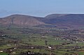
 A view of Longridge Fell - geograph.org.uk - 5163135.jpg 4,000 × 3,000; 5.06 MB
-

-
 Access Lane to Giles Farm - geograph.org.uk - 6125310.jpg 5,184 × 3,456; 5.96 MB
-
 Access road to Loud Carr Side - geograph.org.uk - 1976140.jpg 640 × 480; 81 KB
-
 An unusual bridge - geograph.org.uk - 4524619.jpg 4,394 × 2,292; 6.95 MB
-
 Back gate to Cardwell House - geograph.org.uk - 1868861.jpg 640 × 426; 242 KB
-
 Bailey Hippings - geograph.org.uk - 1976167.jpg 2,592 × 1,944; 1.64 MB
-
 Billingtons Farm - geograph.org.uk - 6477268.jpg 5,184 × 3,456; 7.5 MB
-
 Bradley Hall - geograph.org.uk - 4511861.jpg 4,457 × 2,966; 7.77 MB
-
 Bradleys Farm - geograph.org.uk - 6478574.jpg 5,184 × 3,456; 7.31 MB
-
 Brick barn at Bowland-with-Leagram, Lancashire.jpg 640 × 480; 231 KB
-
 Bridge over Higgin Brook at Moss Gate Farm - geograph.org.uk - 4273062.jpg 1,024 × 768; 208 KB
-
 Bridleway from Thornley Hall - geograph.org.uk - 1868868.jpg 640 × 426; 332 KB
-

-
 Cairn on Longridge Fell - geograph.org.uk - 3113071.jpg 640 × 480; 69 KB
-
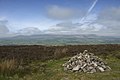 Cairn on Thornley Hall Fell - geograph.org.uk - 1868872.jpg 640 × 426; 215 KB
-
 Carr Side - geograph.org.uk - 4463944.jpg 3,398 × 3,440; 1.5 MB
-
 Carr Side Farm - geograph.org.uk - 1939013.jpg 1,024 × 768; 214 KB
-
 Cattle feeder above the Loud valley - geograph.org.uk - 3750401.jpg 3,454 × 2,302; 2.19 MB
-
 Chipping from Longridge Fell - geograph.org.uk - 5109857.jpg 3,802 × 2,714; 5.33 MB
-

-
 Clough Lane - geograph.org.uk - 4124282.jpg 640 × 480; 117 KB
-
 Concessionary Footpath From Jeffrey Hill - geograph.org.uk - 3300251.jpg 2,560 × 1,920; 2.41 MB
-
 Cottongrass On Moorland Above Longridge - geograph.org.uk - 3561701.jpg 2,560 × 1,920; 3.68 MB
-
 Country Lane heading towards Gill Bridge - geograph.org.uk - 6498758.jpg 5,184 × 3,456; 7.14 MB
-
 Country Lane outside Priest Hill Farm - geograph.org.uk - 6496375.jpg 5,184 × 3,456; 5.41 MB
-
 Country Road near Carr Side Farm - geograph.org.uk - 6123084.jpg 5,184 × 3,456; 5.94 MB
-
 Cowley Brook coming off Gannow Fell - geograph.org.uk - 3734302.jpg 3,683 × 2,455; 3 MB
-
 Damp farmland near Thornley - geograph.org.uk - 3752649.jpg 3,630 × 2,420; 2.19 MB
-
 Derby Arms - geograph.org.uk - 4459821.jpg 4,878 × 2,443; 1.64 MB
-
 Elm Brow at Arbour Farm - geograph.org.uk - 2846277.jpg 640 × 481; 58 KB
-
 Elm Brow at Woodhill - geograph.org.uk - 2846265.jpg 640 × 481; 65 KB
-
 Elm Brow lane junction - geograph.org.uk - 2846291.jpg 640 × 480; 36 KB
-
 Entrance to Cardwell House - geograph.org.uk - 3113102.jpg 640 × 480; 71 KB
-
 Fairway on Longridge Golf Course - geograph.org.uk - 6478585.jpg 5,184 × 3,456; 7.28 MB
-
 Farmland at Carr Side - geograph.org.uk - 1938999.jpg 1,024 × 768; 187 KB
-
 Farmland near Carr Side - geograph.org.uk - 6123059.jpg 5,156 × 3,375; 4.96 MB
-
 Farmland near Chipping - geograph.org.uk - 3491942.jpg 640 × 480; 505 KB
-
 Farmyard at Thornley Hall - geograph.org.uk - 6125514.jpg 5,184 × 3,456; 6.89 MB
-
 Fields at Carr Side - geograph.org.uk - 1938997.jpg 1,024 × 768; 166 KB
-
 Fields at Carr Side Farm - geograph.org.uk - 3750416.jpg 3,595 × 2,397; 2.23 MB
-
 Flood on the road by Mocking Brook Wood - geograph.org.uk - 3752638.jpg 3,617 × 2,411; 3.75 MB
-
 Flooded track near Thornley Hall - geograph.org.uk - 3752654.jpg 3,872 × 2,592; 6.4 MB
-
 Footbridge over River Loud - geograph.org.uk - 1868855.jpg 640 × 426; 252 KB
-
-
 Footpath by Mocking Brook - geograph.org.uk - 3752642.jpg 3,652 × 2,435; 3.03 MB
-

-
 Footpath heading North East from Higher Birks - geograph.org.uk - 6478380.jpg 5,184 × 3,456; 5.81 MB
-
 Footpath junction on Longridge Fell - geograph.org.uk - 1868875.jpg 640 × 426; 315 KB
-
 Footpath on Jeffrey Hill - geograph.org.uk - 3733037.jpg 3,451 × 2,301; 3.07 MB
-
 Footpath on the Edge of Mercer's Wood - geograph.org.uk - 6478581.jpg 5,184 × 3,456; 4.41 MB
-
 Footpath start near Brook farm - geograph.org.uk - 1868874.jpg 640 × 426; 257 KB
-
 Footpath towards Chipping - geograph.org.uk - 3750408.jpg 3,683 × 2,455; 3.2 MB
-
 Forty Acre Farm - geograph.org.uk - 1938885.jpg 1,024 × 768; 108 KB
-
 Forty Acre Farm - geograph.org.uk - 4505498.jpg 4,592 × 2,821; 7.81 MB
-
 Forty Acre Farm - geograph.org.uk - 6478587.jpg 5,184 × 3,456; 6.76 MB
-
 Forty Acre Lane - geograph.org.uk - 4464477.jpg 1,024 × 766; 677 KB
-
 Forty Acre Lane - geograph.org.uk - 4490322.jpg 4,592 × 3,056; 6.37 MB
-

-
 Forty Acre Lane Near Cardwell House - geograph.org.uk - 4638326.jpg 2,784 × 1,568; 2.17 MB
-
 Four Acre Lane - geograph.org.uk - 6125316.jpg 5,184 × 3,456; 4.28 MB
-
 Freshly Cut Field at Old Rhodes - geograph.org.uk - 6477266.jpg 5,184 × 3,456; 6.05 MB
-
 From Jeffrey Hill on a water colour morning - geograph.org.uk - 5602061.jpg 3,583 × 2,358; 4.19 MB
-
 From Longridge Fell to Chipping and Fells Beyond - geograph.org.uk - 4655608.jpg 2,784 × 1,568; 2.04 MB
-
 Fylde Water Board Bridge - geograph.org.uk - 3353396.jpg 2,560 × 1,920; 2.84 MB
-
 Gate entrance to Cardwell House - geograph.org.uk - 2010800.jpg 1,600 × 1,200; 502 KB
-
 Gibbon Bridge crossing the River Loud - geograph.org.uk - 2401282.jpg 1,024 × 766; 189 KB
-
 Gibbon Bridge Hotel and Restaurant - geograph.org.uk - 4530124.jpg 4,372 × 2,832; 7.03 MB
-
 Gibbon Bridge over the River Loud - geograph.org.uk - 4521701.jpg 4,592 × 2,791; 7.82 MB
-
 Gill Bridge - geograph.org.uk - 3584628.jpg 2,560 × 1,920; 3.14 MB
-
 Gill Bridge - geograph.org.uk - 4355327.jpg 800 × 533; 277 KB
-
 Gill Bridge - geograph.org.uk - 4507270.jpg 4,592 × 2,532; 6.71 MB
-
 Golf club house - geograph.org.uk - 1938880.jpg 1,024 × 768; 182 KB
-
 Gunpowder storage building - geograph.org.uk - 1364465.jpg 640 × 480; 121 KB
-
 Heather moorland, Longridge Fell - geograph.org.uk - 4124788.jpg 640 × 480; 119 KB
-
 Information Board on Jeffrey Hill - geograph.org.uk - 1868865.jpg 640 × 426; 236 KB
-
 Jeffrey Hill - geograph.org.uk - 1868863.jpg 640 × 426; 212 KB
-
 Jeffrey Hill - geograph.org.uk - 1938898.jpg 1,024 × 768; 96 KB
-
 Jeffrey Hill - view to the north - geograph.org.uk - 1168875.jpg 640 × 480; 83 KB
-

-
 Jeffrey Hill Sign - geograph.org.uk - 3277661.jpg 2,560 × 1,920; 3.07 MB
-
 Jeffrey Hill Start Of Concessionary Footpath - geograph.org.uk - 3300241.jpg 2,454 × 1,752; 2.09 MB
-

-
 Lea Barn - geograph.org.uk - 6407204.jpg 800 × 533; 111 KB
-
 Longridge Fell Access Land Information - geograph.org.uk - 1940395.jpg 1,024 × 768; 116 KB
-
 Longridge Fell from Hodder Valley - geograph.org.uk - 2436185.jpg 640 × 480; 91 KB
-
 Longridge Fell from North - geograph.org.uk - 2436133.jpg 640 × 480; 125 KB
-
 Longridge Fell Information Board - geograph.org.uk - 1938910.jpg 1,024 × 768; 162 KB
-
 Longridge Golf Course - geograph.org.uk - 3353501.jpg 2,560 × 1,827; 2.77 MB
-
 Longridge Road at Woodhill - geograph.org.uk - 4504548.jpg 4,592 × 3,056; 6.83 MB
-

-
 Looking east to Longridge Fell - geograph.org.uk - 2436166.jpg 640 × 480; 97 KB
-
 Looking to Whitewell ^ Dunsop Bridge from Longridge Fell - geograph.org.uk - 4657276.jpg 2,784 × 1,568; 2.16 MB
-
 Lord's Lane - geograph.org.uk - 6477273.jpg 5,184 × 3,456; 5.91 MB
-
 Loud Carr Side - geograph.org.uk - 6123106.jpg 5,184 × 3,456; 6.85 MB
-
 Loud Lower Bridge - geograph.org.uk - 4507232.jpg 3,908 × 2,477; 7.91 MB
-
 Massey Ferguson Tractor - geograph.org.uk - 6294794.jpg 3,742 × 2,685; 1.67 MB
-
 Mocking Brook Wood - geograph.org.uk - 4511845.jpg 4,592 × 2,748; 7.88 MB
-
 Moorland at Jeffrey Hill - geograph.org.uk - 5109789.jpg 4,000 × 3,000; 3.93 MB
-
 Moss gate Farm - geograph.org.uk - 6407548.jpg 800 × 533; 131 KB
-
 Old Clay Lane - geograph.org.uk - 4488420.jpg 4,547 × 3,026; 7.08 MB
-
 Old Farm Barn - geograph.org.uk - 3356717.jpg 2,560 × 1,920; 2.54 MB
-
 Old gatepost, Jeffrey Hill - geograph.org.uk - 4124302.jpg 800 × 600; 145 KB
-
 On Four Acre Lane - geograph.org.uk - 6125486.jpg 5,184 × 3,456; 6.39 MB
-
 On the Long Ridge of Longridge Fell - geograph.org.uk - 5704725.jpg 5,184 × 3,456; 7.39 MB
-
 Outbuilding at Dale House - geograph.org.uk - 6478579.jpg 5,184 × 3,456; 5.98 MB
-
 Outbuildings and Units attached to Lancaster Farm - geograph.org.uk - 6498736.jpg 5,184 × 3,456; 5.35 MB
-
 Outbuildings at Wood Top Farm - geograph.org.uk - 4655214.jpg 1,600 × 1,067; 634 KB
-
 Park Wood - geograph.org.uk - 6125507.jpg 5,164 × 3,422; 6.79 MB
-
 Path on Jeffrey Hill - geograph.org.uk - 1938979.jpg 1,024 × 768; 170 KB
-
 Photographing the small standing stone - geograph.org.uk - 4449522.jpg 3,072 × 2,304; 2.99 MB
-
 Priest Hill Farmhouse - geograph.org.uk - 6496383.jpg 5,184 × 3,456; 6.28 MB
-
 Quiet Lane on Longridge Fell - geograph.org.uk - 1938892.jpg 1,024 × 768; 184 KB
-
 Rainbow by Jeffrey Hill - geograph.org.uk - 3733000.jpg 3,696 × 2,464; 942 KB
-
 Recently-felled forestry plantation - geograph.org.uk - 5134335.jpg 3,264 × 2,448; 2.3 MB
-
 River Loud - geograph.org.uk - 4355324.jpg 800 × 533; 279 KB
-
 Road and forest edge, Jeffrey Hill - geograph.org.uk - 2010824.jpg 1,024 × 768; 156 KB
-
 Road bridge - geograph.org.uk - 509562.jpg 640 × 480; 146 KB
-
 Road Junction at Jeffrey Hill - geograph.org.uk - 4464476.jpg 1,024 × 613; 548 KB
-
 Road junction at Thornley - geograph.org.uk - 1868869.jpg 640 × 426; 212 KB
-
 Road junction just north of Carr Side Farm - geograph.org.uk - 1939007.jpg 1,024 × 768; 216 KB
-
 Road junction near Loud Myham Farm - geograph.org.uk - 4504221.jpg 2,000 × 1,503; 505 KB
-
 Road junction near Thornley Hall - geograph.org.uk - 3752658.jpg 3,617 × 2,411; 2.5 MB
-
 Road junction near Wheatley farm - geograph.org.uk - 1868859.jpg 640 × 426; 271 KB
-
 Road junction north of Carr Side Farm - geograph.org.uk - 2010854.jpg 1,600 × 1,200; 453 KB
-
 Road near Woodtop Wood - geograph.org.uk - 6407776.jpg 800 × 533; 111 KB
-
 Road to Carr Side Farm - geograph.org.uk - 2771165.jpg 640 × 480; 166 KB
-

-

-
 Rough pasture near Dale House - geograph.org.uk - 2436097.jpg 640 × 480; 102 KB
-
 Rural road by Bradley Hall - geograph.org.uk - 5053057.jpg 1,500 × 999; 158 KB
-
 Rural road by Brook House - geograph.org.uk - 5053069.jpg 1,500 × 999; 202 KB
-
 Rural road by Elliott House - geograph.org.uk - 5053014.jpg 1,500 × 999; 170 KB
-
 Rural road by Meadow Farm - geograph.org.uk - 5053081.jpg 1,500 × 999; 168 KB
-
 Rural road near Dusty Clough - geograph.org.uk - 5053010.jpg 1,500 × 999; 183 KB
-
 Rural road near Rams Clough - geograph.org.uk - 5053062.jpg 1,500 × 999; 145 KB
-
 Rural road to Hesketh Lane - geograph.org.uk - 5053075.jpg 1,500 × 999; 207 KB
-
 Scenic Car Park - geograph.org.uk - 1976101.jpg 640 × 480; 75 KB
-
 She tells me "It's cloud not rain" - geograph.org.uk - 4490299.jpg 4,592 × 3,056; 6.7 MB
-
 Sheep on Jeffrey Hill - geograph.org.uk - 1938986.jpg 1,024 × 768; 171 KB
-
 Small reservoir near Nook Fold - geograph.org.uk - 1938834.jpg 1,024 × 768; 198 KB
-
 Small tributary of the Loud - geograph.org.uk - 3751484.jpg 3,872 × 2,592; 4.78 MB
-
 Soil Improvers Awaiting Spreading - geograph.org.uk - 3906326.jpg 2,560 × 1,438; 2.85 MB
-
 St William of York Ch - geograph.org.uk - 74706.jpg 640 × 426; 141 KB
-

-
 Standing stone on Jeffrey Hill - geograph.org.uk - 3733033.jpg 3,622 × 2,414; 2.59 MB
-

-

-
 Stile on Longridge Fell - geograph.org.uk - 1868876.jpg 640 × 426; 200 KB
-
 Stile on Longridge Fell - geograph.org.uk - 3733049.jpg 3,674 × 2,450; 3.09 MB
-
 Stone Barn near Lancaster Farm - geograph.org.uk - 6498743.jpg 5,184 × 3,456; 5.2 MB
-
 Stone Croft - geograph.org.uk - 1938842.jpg 1,024 × 768; 162 KB
-
 Stone Stile and Gate by Park Wood - geograph.org.uk - 6125500.jpg 5,177 × 3,429; 6.96 MB
-
 Structure on Jeffrey Hill - geograph.org.uk - 700957.jpg 640 × 480; 67 KB
-
 Sun Catcher by Halima Cassell - geograph.org.uk - 4505745.jpg 640 × 500; 90 KB
-
 Sun Catcher Near Jeffrey Hill - geograph.org.uk - 4605842.jpg 2,560 × 1,920; 2.52 MB
-
 Telecoms Mast near Forty Acre farm - geograph.org.uk - 1539090.jpg 640 × 480; 47 KB
-
 The 'long ridge' of Longridge Fell - geograph.org.uk - 4125210.jpg 640 × 480; 84 KB
-
 The beginning of Rams Clough - geograph.org.uk - 3733024.jpg 3,784 × 2,523; 3.9 MB
-
 The Derby Arms - geograph.org.uk - 4355221.jpg 800 × 533; 201 KB
-
 The Derby Arms - geograph.org.uk - 4502027.jpg 4,366 × 1,982; 5.88 MB
-
 The Derby Arms on Longridge Road - geograph.org.uk - 4273056.jpg 1,600 × 1,200; 473 KB
-
 The Derby Arms, Longridge - geograph.org.uk - 3598964.jpg 2,401 × 1,331; 2.01 MB
-
 The Derby Arms, Longridge Road - geograph.org.uk - 2846248.jpg 640 × 480; 46 KB
-
 The Derby Arms, Thornley-with-Wheatley - geograph.org.uk - 2311061.jpg 640 × 426; 263 KB
-
 The entrance to Arbour Fold - geograph.org.uk - 4504700.jpg 4,581 × 2,491; 6.77 MB
-
 The entrance to Lee House - geograph.org.uk - 4504617.jpg 4,407 × 2,370; 7.56 MB
-
 The northwest slopes of Jeffrey Hill - geograph.org.uk - 1940370.jpg 1,024 × 768; 176 KB
-
 The River Loud - geograph.org.uk - 2965129.jpg 4,000 × 3,000; 7.21 MB
-
 The River Loud at Gill Bridge - geograph.org.uk - 4501944.jpg 4,116 × 3,056; 7.8 MB
-
 The River Loud is full - geograph.org.uk - 3752663.jpg 3,643 × 2,429; 3.57 MB
-
 The road down Jeffrey Hill - geograph.org.uk - 1713207.jpg 2,272 × 1,712; 1,014 KB
-
 The road to Hesketh Lane - geograph.org.uk - 5053077.jpg 1,500 × 999; 221 KB
-
 The steep hill down Gannow Fell - geograph.org.uk - 4505540.jpg 4,592 × 2,520; 7.32 MB
-
 The valley from Jeffrey Hill - geograph.org.uk - 4077034.jpg 4,000 × 2,807; 5.67 MB
-
 The view from Jeffrey Hill - geograph.org.uk - 1940380.jpg 1,024 × 768; 143 KB
-
 The view westwards from the car park - geograph.org.uk - 4505939.jpg 4,297 × 1,813; 4.4 MB
-
 Thorley School Now Disused - geograph.org.uk - 3356707.jpg 2,552 × 1,908; 2.21 MB
-
 Thornley Hall - geograph.org.uk - 4510955.jpg 4,345 × 2,311; 5 MB
-
 Thornley Hall Farm - geograph.org.uk - 3356677.jpg 2,560 × 1,920; 2.59 MB
-
 Thornley Hall.jpg 2,592 × 1,944; 1.34 MB
-
 Thornley old school - geograph.org.uk - 6407271.jpg 800 × 533; 127 KB
-
 Thornley School - geograph.org.uk - 1868853.jpg 640 × 426; 194 KB
-
 Thornley School being redeveloped - geograph.org.uk - 4526062.jpg 4,241 × 2,547; 6.34 MB
-
 Thornley with Wheatley boundary sign - geograph.org.uk - 2846222.jpg 640 × 481; 40 KB
-
 Towards the Radio Mast at Forty Acre Farm - geograph.org.uk - 6478591.jpg 5,184 × 3,456; 7.43 MB
-
 Track across Thornley Hall Fell - geograph.org.uk - 1868871.jpg 640 × 426; 245 KB
-
 Track leading towards Longridge Road - geograph.org.uk - 6477602.jpg 5,156 × 2,618; 4.3 MB
-

-
 Turnley's Farm - geograph.org.uk - 6478391.jpg 5,184 × 3,456; 6.62 MB
-
 Valley below Jeffrey Hill - geograph.org.uk - 4464474.jpg 1,024 × 768; 747 KB


