Category:Thorpe on the Hill, West Yorkshire
village in Leeds, West Yorkshire, UK Feb2006.jpg) | |||||
| Upload media | |||||
| Instance of | |||||
|---|---|---|---|---|---|
| Location | Leeds, West Yorkshire, Yorkshire and the Humber, England | ||||
 | |||||
Subcategories
This category has the following 3 subcategories, out of 3 total.
L
- Lofthouse Interchange (17 F)
Media in category "Thorpe on the Hill, West Yorkshire"
The following 41 files are in this category, out of 41 total.
-
 Apartments, Bluebell Road - geograph.org.uk - 2735070.jpg 640 × 477; 64 KB
-
 B6135 heading east - geograph.org.uk - 2741569.jpg 640 × 480; 51 KB
-
 Beck Way - viewed from Poppy Lane - geograph.org.uk - 3558350.jpg 640 × 480; 64 KB
-
-

-
 Bridleway - Stanhope Road - geograph.org.uk - 3204087.jpg 480 × 640; 119 KB
-
 Bridleway - Station Lane - geograph.org.uk - 3204333.jpg 480 × 640; 116 KB
-
 Bridleway to Belle Isle - geograph.org.uk - 2060606.jpg 1,024 × 681; 222 KB
-

-
 Community Centre - Stanhope Gardens - geograph.org.uk - 3558236.jpg 640 × 480; 61 KB
-

-
 Daisy Vale Terrace - Stanhope Road - geograph.org.uk - 3204092.jpg 533 × 640; 82 KB
-
 Farmland off the B6135 - geograph.org.uk - 2741568.jpg 640 × 480; 76 KB
-

-

-
 Leeds Country Way at East Ardsley - geograph.org.uk - 3917795.jpg 1,600 × 1,064; 642 KB
-
 Leeds Country Way enters Thorpe on the Hill - geograph.org.uk - 3917694.jpg 1,600 × 1,064; 454 KB
-
 Leeds Country Way enters Thorpe on the Hill - geograph.org.uk - 3917703.jpg 1,600 × 1,064; 747 KB
-
 Leeds Country Way towards Lingwell Gate Lane - geograph.org.uk - 3917851.jpg 1,600 × 1,064; 401 KB
-
 Lofthouse Interchange.jpg 640 × 426; 42 KB
-
 M62 at Thorpe - geograph.org.uk - 906172.jpg 640 × 480; 88 KB
-
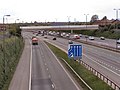 M62 At Thorpe on the Hill - geograph.org.uk - 1857610.jpg 2,000 × 1,500; 451 KB
-
 M62 eastbound at Thorpe on the Hill - geograph.org.uk - 3030839.jpg 640 × 480; 34 KB
-
 M62 near to M1 junction - geograph.org.uk - 906177.jpg 640 × 480; 79 KB
-
 M62 westbound - geograph.org.uk - 1324070.jpg 640 × 480; 32 KB
-

-
 Oakley Street - off Station Lane - geograph.org.uk - 3558210.jpg 640 × 480; 64 KB
-
 Oakley Street - Stanhope Road - geograph.org.uk - 3204101.jpg 640 × 480; 82 KB
-
 Owlett Hall Farm - Stanhope Road - geograph.org.uk - 3558320.jpg 640 × 450; 60 KB
-

-
 Owlett Mead - Stanhope Road - geograph.org.uk - 3204089.jpg 640 × 480; 75 KB
-
 Owlett Mead Close - Owlett Mead - geograph.org.uk - 3558304.jpg 640 × 480; 61 KB
-
 Railway Bridge - geograph.org.uk - 987631.jpg 640 × 486; 78 KB
-
 Rhubarb Field alongside the M62 - geograph.org.uk - 3917691.jpg 1,600 × 1,064; 487 KB
-
 Road and Rail - geograph.org.uk - 626531.jpg 640 × 480; 103 KB
-
 Sunday Delivery^ - geograph.org.uk - 987635.jpg 640 × 469; 65 KB
-
 The Nook - geograph.org.uk - 987627.jpg 640 × 456; 77 KB
-

-
 ThorpeOnTheHillLeeds(StevePartridge)Feb2006.jpg 640 × 480; 77 KB
-
 Tubular pylons at Thorpe on the Hill. - geograph.org.uk - 128482.jpg 640 × 480; 88 KB
-
 The M62-M1 Motorway (Lofthouse Interchange Diversion and Connecting Road) Scheme 1994 (UKSI 1994-1023).pdf 1,239 × 1,752, 3 pages; 126 KB


