Category:Three Crosses, Swansea
Cymraeg: Pentref a chymuned ar ben gogledd-ddwyreiniol Penrhyn Gŵyr, Abertawe yw Y Crwys (Saesneg: Three Crosses). Lleolir ar groesffordd y ffordd i ganol dinas Abertawe (10 km i ffwrdd), a'r ffordd i Benclawdd (5 km i ffwrdd). Datblygodd y pentref yn yr 19eg ganrif er mwyn gwasanaethu pyllau glo bas yr ardal. Bu cau'r pyllau glo erbyn dechrau'r 20fed ganrif, ac ers hynny mae'r pentref wedi dod yn bennaf yn gartref i gymudwyr sy'n gweithio yn Abertawe.
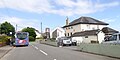
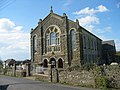
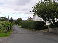
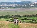
English: Three Crosses is a village and community at the north-eastern end of the Gower peninsula, Swansea, Wales. Situated at a crossroad on the road from Swansea city centre (10 km) to Penclawdd (5 km), it grew up in the early 19th century to serve small shallow collieries in the area. These collieries disappeared by the early years of the 20th century, and since then Three Crosses has developed as a large dormitory village for Swansea.
village and community in Swansea, Wales   | |||||
| Upload media | |||||
| Instance of | |||||
|---|---|---|---|---|---|
| Location | Swansea, Wales | ||||
 | |||||
Media in category "Three Crosses, Swansea"
The following 53 files are in this category, out of 53 total.
-
 2024 Wales Swansea Community Three Crosses map.svg 512 × 472; 651 KB
-
 Autumn morning leaving Three Crosses - geograph.org.uk - 1041309.jpg 640 × 427; 57 KB
-

-
 Barn at Rhean-fawr farm - geograph.org.uk - 5829237.jpg 1,600 × 1,201; 723 KB
-
 Bluebells - geograph.org.uk - 3985366.jpg 800 × 531; 238 KB
-
-
 Caer Eithin Engine House for Berthlwyd Colliery - geograph.org.uk - 3817182.jpg 1,280 × 960; 276 KB
-
 Caer Eithin Engine House for Berthlwyd Colliery - geograph.org.uk - 3817191.jpg 1,280 × 960; 290 KB
-

-
 Capel Carmel - geograph.org.uk - 5587506.jpg 1,600 × 1,200; 666 KB
-
 Capel y Crwys, Three Crosses (geograph 3844792).jpg 640 × 480; 89 KB
-
 Carmel Chapel - geograph.org.uk - 6152175.jpg 2,048 × 1,536; 1.18 MB
-
 Cattle grid, Tirmynydd Road - geograph.org.uk - 5829285.jpg 1,600 × 998; 656 KB
-
 Chapel y Crwys - geograph.org.uk - 5999009.jpg 3,264 × 2,448; 2.59 MB
-
 Coed Pen y Wern Wood - geograph.org.uk - 4322957.jpg 640 × 480; 143 KB
-
 Cottages at Wern-olau - geograph.org.uk - 558223.jpg 640 × 480; 98 KB
-
 Country Stores and Post Office (geograph 5587962).jpg 1,600 × 1,200; 349 KB
-
 Dunvant Road south of Killan Fawr Farm - geograph.org.uk - 3955652.jpg 3,126 × 2,581; 1.3 MB
-
 Entrance to the Lodge near Wern-olau - geograph.org.uk - 558232.jpg 640 × 480; 130 KB
-
 Faded road markings at the edge of Three Crosses - geograph.org.uk - 5829246.jpg 1,600 × 1,068; 703 KB
-
 Farmland near Wimblewood-ganol - geograph.org.uk - 3986008.jpg 1,024 × 680; 331 KB
-
 Field near Gelli Groes - geograph.org.uk - 5587489.jpg 1,600 × 1,200; 325 KB
-
 Footpath at Three Crosses - geograph.org.uk - 5999018.jpg 3,264 × 2,448; 3.91 MB
-
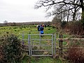
 Gate to the footpath to Dunvant - geograph.org.uk - 1041228.jpg 640 × 427; 125 KB
-
 Gelli Hir Farm - geograph.org.uk - 5999020.jpg 3,264 × 2,448; 3.64 MB
-
 Gower Golf Club 10th green - geograph.org.uk - 3955630.jpg 3,648 × 2,736; 2.91 MB
-
 Gower Golf Club 16th green and 14th tee - geograph.org.uk - 3955643.jpg 3,648 × 2,736; 2.52 MB
-
-
 Graig Cefn Golau - geograph.org.uk - 3100421.jpg 690 × 518; 176 KB
-
 Houses at Dukefield - geograph.org.uk - 5999013.jpg 3,264 × 2,448; 3.57 MB
-
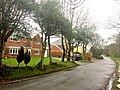
 Houses on the edge of Three Crosses - geograph.org.uk - 1041253.jpg 640 × 427; 135 KB
-

-
 Llwybr Crwys - Three Crosses Path - geograph.org.uk - 4322984.jpg 640 × 480; 104 KB
-
 Lone bush on Fairwood Common - geograph.org.uk - 5829291.jpg 1,600 × 961; 602 KB
-

-
 Open space in Three Crosses and Welsh Independent Chapel - geograph.org.uk - 5829280.jpg 1,600 × 1,200; 843 KB
-
 Ordnance Survey Cut Mark (Inverted) - geograph.org.uk - 4016420.jpg 480 × 640; 125 KB
-
 Ordnance Survey Cut Mark - geograph.org.uk - 4006836.jpg 480 × 640; 116 KB
-
 Ordnance Survey Cut Mark - geograph.org.uk - 4016415.jpg 480 × 640; 113 KB
-
 Ordnance Survey Flush Bracket (G3821) - geograph.org.uk - 4006234.jpg 480 × 640; 113 KB
-
 Pompren Crwys - Three Crosses Footbridge - geograph.org.uk - 4305857.jpg 640 × 480; 156 KB
-
 Road junction at Cilonnen - geograph.org.uk - 6152178.jpg 3,264 × 2,448; 2.88 MB
-
 Road near Wimblewood ganol - geograph.org.uk - 3986030.jpg 1,024 × 680; 274 KB
-
 Road west of Three Crosses - geograph.org.uk - 3985334.jpg 800 × 531; 141 KB
-
 Terrace of cottages - geograph.org.uk - 1041749.jpg 640 × 427; 67 KB
-
 The Gower Way - geograph.org.uk - 3985358.jpg 1,024 × 680; 356 KB
-
 The Gower Way - geograph.org.uk - 5587501.jpg 1,600 × 1,200; 644 KB
-
 The Poundffald at Three Crosses - geograph.org.uk - 5829257.jpg 1,600 × 1,066; 560 KB
-
 The Poundffald,Three Crosses - geograph.org.uk - 3984319.jpg 800 × 531; 118 KB
-
 Three Crosses Community Centre - geograph.org.uk - 3985328.jpg 1,024 × 680; 317 KB
-
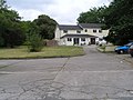
 Three Crosses, farmhouse by road junction - geograph.org.uk - 185081.jpg 640 × 427; 177 KB
-
 Three Crosses, footpath to Whitewalls - geograph.org.uk - 185083.jpg 640 × 427; 173 KB
-
 Three Crosses, The Poundffald - geograph.org.uk - 185080.jpg 640 × 427; 165 KB


.jpg)


.jpg)


_-_geograph.org.uk_-_4016420.jpg)


_-_geograph.org.uk_-_4006234.jpg)


