Category:Thrumpton
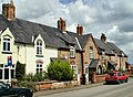
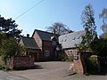
English: Thrumpton is a village and civil parish in Nottinghamshire, England. At the time of the 2001 census it had a population of 152 . It is located on the A453 road 6 miles south-west of West Bridgford. The 13th century village church of All Saints was restored in 1871. Many of the gabled brick houses in the village were built between 1700 and 1745 by John Emerton of Thrumpton Hall.
village in United Kingdom  | |||||
| Upload media | |||||
| Instance of | |||||
|---|---|---|---|---|---|
| Location | Rushcliffe, Nottinghamshire, East Midlands, England | ||||
| Population |
| ||||
 | |||||
Subcategories
This category has the following 2 subcategories, out of 2 total.
A
T
- Thrumpton Hall (9 F)
Media in category "Thrumpton"
The following 175 files are in this category, out of 175 total.
-
 9 Church Lane, Thrumpton - geograph.org.uk - 1812897.jpg 1,024 × 768; 130 KB
-

-
 A splash of late Autumn colour - geograph.org.uk - 6330172.jpg 480 × 640; 178 KB
-

-
 A453 - Manor Farm bridge - geograph.org.uk - 2952350.jpg 640 × 480; 67 KB
-
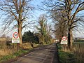
 A453 at the turning for Thrumpton - geograph.org.uk - 2952356.jpg 640 × 480; 44 KB
-
 A453 at Thrumpton - geograph.org.uk - 1888844.jpg 854 × 1,280; 272 KB
-
 A453 between Thrumpton and Barton - geograph.org.uk - 3344148.jpg 1,280 × 942; 245 KB
-
 A453 Green Street - geograph.org.uk - 4229445.jpg 640 × 480; 226 KB
-
 A453 near Barton - geograph.org.uk - 2952360.jpg 640 × 480; 51 KB
-
 A453 near Manor Farm - geograph.org.uk - 2952354.jpg 640 × 480; 55 KB
-
 A453 near Thrumpton - geograph.org.uk - 4229466.jpg 640 × 480; 226 KB
-
 A453 passing Thrumpton - geograph.org.uk - 3344143.jpg 1,280 × 960; 206 KB
-
 A453 passing Thrumpton - geograph.org.uk - 3344153.jpg 1,280 × 952; 349 KB
-
 A453 towards West Bridgford - geograph.org.uk - 5029957.jpg 640 × 480; 71 KB
-
 A453 widening near Thrumpton - geograph.org.uk - 4466632.jpg 1,024 × 768; 110 KB
-
 All Saints Church, Thrumpton - geograph.org.uk - 6594977.jpg 1,600 × 1,065; 798 KB
-
 All Saints Church, Thrumpton - geograph.org.uk - 6594982.jpg 1,600 × 1,065; 700 KB
-
 All Saints Church, Thrumpton - geograph.org.uk - 6594986.jpg 1,600 × 1,065; 799 KB
-
 All Saints' Church, Thrumpton - geograph.org.uk - 6408357.jpg 3,648 × 2,432; 4.21 MB
-
 Approaching Thrumpton - geograph.org.uk - 4800236.jpg 1,600 × 1,200; 1.03 MB
-
 At the end of Pasture Lane - geograph.org.uk - 1357278.jpg 479 × 640; 95 KB
-
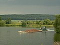 Barge transport, Attenborough Quarry - geograph.org.uk - 1357270.jpg 640 × 479; 60 KB
-
 Barn near Thrumpton - geograph.org.uk - 1888853.jpg 1,280 × 854; 263 KB
-
 Barton Lane from Church Lane, Thrumpton - geograph.org.uk - 6595068.jpg 1,600 × 1,065; 740 KB
-

-
 Barton Lane towards Barton in Fabis - geograph.org.uk - 6595079.jpg 1,600 × 1,102; 657 KB
-
 Barton Lane, Thrumpton - geograph.org.uk - 1812911.jpg 1,024 × 768; 109 KB
-
 Barton Lane, Thrumpton - geograph.org.uk - 1888820.jpg 1,280 × 854; 227 KB
-
 Barton Lane, Thrumpton - geograph.org.uk - 1888847.jpg 1,280 × 854; 233 KB
-
 Barton Lane, Thrumpton - geograph.org.uk - 5029969.jpg 640 × 480; 69 KB
-
 Barton Lane, Thrumpton - geograph.org.uk - 6594972.jpg 1,600 × 1,071; 917 KB
-
 Barton Lane-Green Street sign. - geograph.org.uk - 6622671.jpg 640 × 497; 97 KB
-
 Boundary fence - geograph.org.uk - 737743.jpg 480 × 640; 179 KB
-
 Bridge ramp - geograph.org.uk - 1888838.jpg 1,280 × 854; 312 KB
-
 Bridle path by the A453 - geograph.org.uk - 5824102.jpg 1,024 × 768; 930 KB
-
 Bridleway down Cottagers Hill - geograph.org.uk - 4473021.jpg 1,024 × 768; 157 KB
-
 Bridleway through Cottagers Hill Spinney - geograph.org.uk - 4473025.jpg 1,024 × 768; 343 KB
-
 Bridleway to Barton in Fabis - geograph.org.uk - 4800251.jpg 1,600 × 1,200; 704 KB
-
 Caravan park, Thrumpton - geograph.org.uk - 4466620.jpg 1,024 × 768; 126 KB
-
 Caravans by the Trent near Thrumpton - geograph.org.uk - 1090648.jpg 640 × 480; 166 KB
-
 Carved stone on New Buildings, Thrumpton - geograph.org.uk - 1888805.jpg 1,280 × 854; 307 KB
-
 Church Farm - geograph.org.uk - 1888786.jpg 1,280 × 854; 210 KB
-
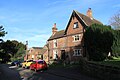 Church House, Thrumpton.jpg 3,648 × 2,432; 3.64 MB
-
 Church Lane, Thrumpton (1) - geograph.org.uk - 1812869.jpg 1,024 × 768; 129 KB
-
 Church Lane, Thrumpton (2) - geograph.org.uk - 1812873.jpg 1,024 × 768; 157 KB
-
 Church Lane, Thrumpton - geograph.org.uk - 1888816.jpg 1,280 × 854; 295 KB
-
 Church Lane, Thrumpton - geograph.org.uk - 6595061.jpg 1,600 × 1,103; 712 KB
-

-
 Cottage on the Trent - geograph.org.uk - 1090670.jpg 640 × 480; 169 KB
-
 Cottages on Church Lane, Thrumpton - geograph.org.uk - 4466630.jpg 1,024 × 768; 161 KB
-
 Cricket field, Thrumpton - geograph.org.uk - 1888765.jpg 1,280 × 854; 412 KB
-
 Dangerous corner, Barton Lane - geograph.org.uk - 1812923.jpg 1,024 × 768; 131 KB
-
 Down Gotham Hill - geograph.org.uk - 5824296.jpg 1,024 × 768; 972 KB
-
 Drive with a footpath, off Church Lane - geograph.org.uk - 1812880.jpg 1,024 × 768; 236 KB
-
 Elm Cottage, Thrumpton.jpg 3,648 × 2,432; 5.33 MB
-
 Entering Thumpton - geograph.org.uk - 5029964.jpg 640 × 480; 72 KB
-

-
 Farmland near Thumpton - geograph.org.uk - 5029954.jpg 640 × 480; 74 KB
-

-
 Field off Church Lane, Thrumpton - geograph.org.uk - 1812895.jpg 1,024 × 768; 125 KB
-
 Field track off Barton Lane - geograph.org.uk - 1812930.jpg 1,024 × 768; 155 KB
-
 Fields Farm, Thrumpton - geograph.org.uk - 5029961.jpg 640 × 480; 120 KB
-
 Footpath in Wright's Hill Plantation - geograph.org.uk - 4901773.jpg 1,280 × 960; 751 KB
-
 Footpath into Gotham Hill Wood - geograph.org.uk - 4801118.jpg 1,600 × 1,200; 1.19 MB
-
 Foxglove Cottage and the Old Post Office, Thrumpton.jpg 3,648 × 2,432; 4.2 MB
-
 Goodbye Thrumpton - geograph.org.uk - 1812918.jpg 1,024 × 768; 122 KB
-
 Gravel extraction - geograph.org.uk - 1357269.jpg 640 × 479; 68 KB
-
 Gravel pit off pasture Lane - geograph.org.uk - 1090448.jpg 640 × 480; 166 KB
-
 Gravel pit off pasture Lane - geograph.org.uk - 1090451.jpg 640 × 480; 152 KB
-
 Gravel pit off pasture Lane - geograph.org.uk - 1090667.jpg 640 × 480; 133 KB
-
 Gravel pit off Pasture Lane - geograph.org.uk - 1357343.jpg 479 × 640; 131 KB
-
 Gravel pits by Pasture Lane - geograph.org.uk - 1158356.jpg 640 × 480; 184 KB
-

-
 House on Church Lane, Thrumpton - geograph.org.uk - 6594983.jpg 1,600 × 1,065; 830 KB
-
 Houses at Thrumpton - geograph.org.uk - 14907.jpg 640 × 467; 152 KB
-
 In Cottagers Hill Spinney - geograph.org.uk - 6330713.jpg 1,744 × 3,648; 4.28 MB
-
 In the woods at Red Hill - geograph.org.uk - 1061775.jpg 640 × 480; 125 KB
-
 Inside Gotham Wood - geograph.org.uk - 1305745.jpg 480 × 640; 132 KB
-
 Laburnum Cottage, Thrumpton.jpg 3,648 × 2,432; 5.13 MB
-
 Leaving Cottagers Hill Spinney - geograph.org.uk - 6330716.jpg 3,648 × 1,744; 4.01 MB
-
 Line of tramway - geograph.org.uk - 1890705.jpg 854 × 1,280; 413 KB
-
 Loading point - geograph.org.uk - 1409571.jpg 640 × 426; 124 KB
-
 Long narrow field near Thrumpton - geograph.org.uk - 1812945.jpg 1,024 × 768; 183 KB
-
 Manor Farm, Thrumpton - geograph.org.uk - 1888833.jpg 1,280 × 854; 218 KB
-
 Manor Farm, Thrumpton - geograph.org.uk - 1888841.jpg 1,280 × 854; 139 KB
-
 Natural and industrial reflections - geograph.org.uk - 1090665.jpg 640 × 480; 156 KB
-
 Navigation sign - geograph.org.uk - 1357363.jpg 640 × 479; 78 KB
-
 New A53 Link Road Under Construction - geograph.org.uk - 4229428.jpg 480 × 640; 304 KB
-
 New Buildings, Church Lane - geograph.org.uk - 1888799.jpg 1,280 × 854; 221 KB
-
 New Buildings, Thrumpton - geograph.org.uk - 6408363.jpg 3,648 × 2,432; 3.99 MB
-
 New workings at the Gravel pit - geograph.org.uk - 1090467.jpg 640 × 480; 172 KB
-
 North Portal, Redhill Tunnel.jpg 1,024 × 776; 402 KB
-
 Odd cypresses - geograph.org.uk - 1357356.jpg 479 × 640; 81 KB
-
 Orchard House, Church Lane, Thrumpton - geograph.org.uk - 1812888.jpg 1,024 × 768; 144 KB
-
 Park House or Garden House - geograph.org.uk - 1888774.jpg 1,280 × 854; 296 KB
-
 Path to a Gravel Pit - geograph.org.uk - 1090651.jpg 640 × 480; 164 KB
-
 Paths by the Gravel Pits - geograph.org.uk - 1090445.jpg 640 × 480; 159 KB
-
 Pathway to Thrumpton - geograph.org.uk - 6408366.jpg 4,032 × 3,024; 4.42 MB
-

-
 Power lines near Thrumpton - geograph.org.uk - 4473000.jpg 1,024 × 768; 102 KB
-
 Power Station from A453 - geograph.org.uk - 1107090.jpg 640 × 480; 46 KB
-
 Pylon under threatening skies near Thrumpton - geograph.org.uk - 4472984.jpg 1,024 × 768; 81 KB
-
 Quarry loading point - geograph.org.uk - 1357392.jpg 640 × 479; 98 KB
-
 Ratcliffe on Soar - geograph.org.uk - 3001511.jpg 1,024 × 691; 682 KB
-
 Ratcliffe Power Station - geograph.org.uk - 2005367.jpg 1,280 × 854; 195 KB
-
 River Trent - geograph.org.uk - 3678989.jpg 640 × 480; 56 KB
-
 River Trent at Thrumpton (geograph 2005371).jpg 1,280 × 854; 308 KB
-
 River Trent at Thrumpton - geograph.org.uk - 14912.jpg 640 × 480; 129 KB
-

-
 River Trent path - geograph.org.uk - 1090642.jpg 640 × 480; 155 KB
-
 River Trent path - geograph.org.uk - 1090649.jpg 640 × 480; 165 KB
-
 Road leading to the lock - geograph.org.uk - 1090495.jpg 640 × 480; 189 KB
-
 Sealed Pillbox - geograph.org.uk - 6703478.jpg 1,024 × 780; 453 KB
-

-
 Site of plaster mill - geograph.org.uk - 2005383.jpg 1,280 × 854; 309 KB
-
 Site of Thrumpton Mine - geograph.org.uk - 1890726.jpg 1,280 × 854; 286 KB
-
 Snowfield above Thrumpton - geograph.org.uk - 1146441.jpg 640 × 372; 35 KB
-

-
 Sunlit pylons - geograph.org.uk - 1890715.jpg 1,280 × 851; 238 KB
-
 Sunset Over a Gravel Pit - geograph.org.uk - 886990.jpg 427 × 640; 238 KB
-
 The brow of Barton Lane - geograph.org.uk - 5366266.jpg 1,280 × 720; 322 KB
-
 The River Trent - geograph.org.uk - 6484524.jpg 4,032 × 3,024; 6.21 MB
-
 The Trent near Thrumpton - geograph.org.uk - 744729.jpg 640 × 480; 52 KB
-
 The unnavigable River Trent at Red Hill - geograph.org.uk - 6180928.jpg 1,703 × 1,278; 478 KB
-
 Thrumpton Accommodation Bridge - geograph.org.uk - 4229475.jpg 640 × 480; 255 KB
-
 Thrumpton C1SK5130 - geograph.org.uk - 2005363.jpg 1,280 × 854; 542 KB
-
 Thrumpton from Wright's Hill - geograph.org.uk - 739606.jpg 640 × 480; 68 KB
-
 Thrumpton Hill - geograph.org.uk - 1888809.jpg 1,280 × 854; 215 KB
-
 Thrumpton House - geograph.org.uk - 1888756.jpg 1,280 × 854; 319 KB
-
 Thrumpton House - geograph.org.uk - 1888759.jpg 1,280 × 854; 372 KB
-
 Thrumpton Lane End - geograph.org.uk - 1888822.jpg 1,280 × 854; 223 KB
-
 Thrumpton telephone - geograph.org.uk - 1888790.jpg 1,280 × 854; 227 KB
-
 Thrumpton Village - geograph.org.uk - 1305747.jpg 640 × 480; 93 KB
-
 Thrumpton Village - geograph.org.uk - 1305758.jpg 640 × 480; 85 KB
-
 Thrumpton Village - geograph.org.uk - 1305763.jpg 640 × 480; 94 KB
-
 Thrumpton Village cottage - geograph.org.uk - 1305770.jpg 640 × 480; 111 KB
-
 Thrumpton Village fields - geograph.org.uk - 1305753.jpg 640 × 480; 130 KB
-
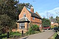
 Thrumpton Village Hall - geograph.org.uk - 1888780.jpg 1,280 × 854; 362 KB
-
 Thrumpton Village Hall - geograph.org.uk - 4466629.jpg 1,024 × 768; 226 KB
-
 Thrumpton Village Hall - geograph.org.uk - 4800239.jpg 1,600 × 1,200; 776 KB
-
 Thrumpton Village Hall - geograph.org.uk - 4901803.jpg 1,280 × 960; 551 KB
-
 Thrumpton Village Hall - geograph.org.uk - 6408359.jpg 3,648 × 2,432; 5.3 MB
-
 Towards Glebe Farm - geograph.org.uk - 5824269.jpg 1,024 × 768; 813 KB
-
 Towards the Trent Valley - geograph.org.uk - 5824288.jpg 1,024 × 768; 871 KB
-
 Track block - geograph.org.uk - 6330730.jpg 3,462 × 1,655; 871 KB
-
 Track by the Gravel Pit - geograph.org.uk - 1090455.jpg 640 × 480; 173 KB
-
 Track by the River Trent - geograph.org.uk - 6408343.jpg 4,032 × 3,024; 5.16 MB
-
 Track leading from Pasture Lane - geograph.org.uk - 1090454.jpg 640 × 480; 151 KB
-
 Track to the woods - geograph.org.uk - 1890718.jpg 837 × 1,280; 302 KB
-
 Tractor tracks - geograph.org.uk - 6408340.jpg 4,032 × 3,024; 5.58 MB
-
 Tramway House - geograph.org.uk - 1890701.jpg 1,280 × 855; 514 KB
-
 Trent valley flatlands - geograph.org.uk - 1812935.jpg 1,024 × 768; 215 KB
-
 Trent Valley from Gotham Hill - geograph.org.uk - 737845.jpg 640 × 441; 107 KB
-
 Trent Valley Way path at Thrumpton - geograph.org.uk - 1305779.jpg 640 × 480; 82 KB
-

-
 Trent Valley with hailstorm - geograph.org.uk - 737767.jpg 640 × 474; 115 KB
-
 Trent Valley without hailstorm - geograph.org.uk - 737771.jpg 640 × 481; 144 KB
-
 View towards Glebe Farm - geograph.org.uk - 6330733.jpg 3,648 × 1,744; 2.47 MB
-
 War Memorial at All Saints Church, Thrumpton - geograph.org.uk - 6595044.jpg 1,600 × 1,065; 656 KB
-
 Weekend homes - geograph.org.uk - 1357387.jpg 640 × 479; 133 KB
-
 Weir on the River Trent - geograph.org.uk - 3400592.jpg 4,000 × 3,000; 3.43 MB
-
 West Leake junction - 5 - geograph.org.uk - 3344141.jpg 1,280 × 960; 280 KB
-
 Wheatfield, woods and power station - geograph.org.uk - 5824276.jpg 1,024 × 768; 1.02 MB
-
 Wobbly tracks - geograph.org.uk - 1888811.jpg 1,280 × 854; 301 KB
-
 Woodland ride on Cottagers Hill (1) - geograph.org.uk - 737758.jpg 480 × 640; 300 KB
-
 Woodland ride on Cottagers Hill (1) - geograph.org.uk - 737763.jpg 479 × 640; 319 KB
-
 Woodland ride on Cottagers Hill (3) - geograph.org.uk - 737247.jpg 640 × 480; 290 KB
-
-
 Bridleway to Cottagers Hill - geograph.org.uk - 740513.jpg 640 × 480; 52 KB
-
 Entering the woods on Cottagers Hill - geograph.org.uk - 740532.jpg 640 × 480; 132 KB
-

-
 Glebe Farm - geograph.org.uk - 302345.jpg 640 × 480; 45 KB
-
 Gotham Bridleway No.1 - geograph.org.uk - 737824.jpg 640 × 480; 110 KB
-
 Pipe Smoking - geograph.org.uk - 594926.jpg 640 × 480; 42 KB


_-_geograph.org.uk_-_1812869.jpg)
_-_geograph.org.uk_-_1812873.jpg)


.jpg)


_-_geograph.org.uk_-_737758.jpg)
_-_geograph.org.uk_-_737763.jpg)
_-_geograph.org.uk_-_737247.jpg)


