Category:Thunderbolts Way
road in New South Wales  | |||||
| Upload media | |||||
| Instance of | |||||
|---|---|---|---|---|---|
| Location | New South Wales, AUS | ||||
| Length |
| ||||
| |||||
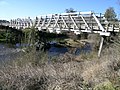
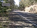
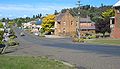
Thunderbolts Way is a scenic, sealed road in New South Wales linking Gloucester to Inverell. It is known by alternative names in or near the towns it passes through.
Media in category "Thunderbolts Way"
The following 19 files are in this category, out of 19 total.
-
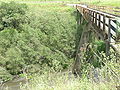 Barnard River.JPG 2,592 × 1,944; 2.16 MB
-
 Bundarra (1).JPG 2,592 × 1,944; 2.1 MB
-
 Carsons Lookout 2.JPG 1,944 × 2,592; 2.14 MB
-
 Carsons Lookout 3.JPG 2,592 × 1,944; 1.91 MB
-
 Dangar Lagoon.JPG 2,324 × 1,612; 1.16 MB
-
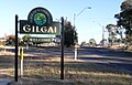 Gilgai.JPG 2,425 × 1,550; 927 KB
-
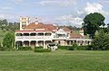
 House on ThunderBolts Way - panoramio.jpg 4,248 × 2,788; 2.67 MB
-
 Irish Town.JPG 3,200 × 1,642; 971 KB
-
 Langford.JPG 1,739 × 1,141; 826 KB
-
 Little Manning River.JPG 2,592 × 1,944; 2.14 MB
-
 Rocky River (1).JPG 2,592 × 1,944; 2.24 MB
-
 ThnderbltsWay-Gilgai.JPG 2,592 × 1,944; 2.25 MB
-
 ThndrboltsWay-Inverell.JPG 2,229 × 1,605; 1.97 MB
-
 Thunderbolt.JPG 1,699 × 1,537; 490 KB
-
 Thunderbolts Way (2).JPG 2,592 × 1,944; 2.15 MB
-
 Thunderbolts Way.JPG 2,592 × 1,944; 2.2 MB
-
 ThunderboltsWay-Inverell.JPG 2,592 × 1,944; 2.29 MB
-
 Walcha 2007.JPG 1,375 × 792; 360 KB
-
 Walchair - panoramio.jpg 2,736 × 3,648; 2.99 MB

.JPG)


.JPG)


.JPG)


