Category:Tibbermore (civil parish)
Scottish parish in Perth and Kinross, Scotland, UK | |||||
| Upload media | |||||
| Instance of | |||||
|---|---|---|---|---|---|
| Part of |
| ||||
| Named after | |||||
| Location |
| ||||
| Population |
| ||||
| Area |
| ||||
 | |||||
Subcategories
This category has the following 3 subcategories, out of 3 total.
Media in category "Tibbermore (civil parish)"
The following 200 files are in this category, out of 433 total.
(previous page) (next page)-
 "I love the lade", Tulloch - geograph.org.uk - 2050249.jpg 640 × 483; 102 KB
-
 A building with Clock Tower, Huntingtowerfield - geograph.org.uk - 4004662.jpg 4,608 × 3,456; 3.71 MB
-
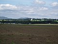
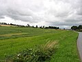
 A field and wood near Dupplin Loch - geograph.org.uk - 2696802.jpg 2,592 × 1,944; 1.38 MB
-
 A field and woodland near Dupplin Loch - geograph.org.uk - 2696803.jpg 2,592 × 1,944; 1.24 MB
-
 A mix of cereals at Easter Cultmalundie - geograph.org.uk - 5455116.jpg 1,024 × 682; 204 KB
-
 A Roman road, north of the modern A9 - geograph.org.uk - 2696800.jpg 2,592 × 1,944; 1.96 MB
-
 A85, Approaching Perth - geograph.org.uk - 2673829.jpg 640 × 480; 183 KB
-
 A85, Huntingtower - geograph.org.uk - 2673816.jpg 640 × 480; 187 KB
-
 A85, Huntingtower - geograph.org.uk - 3654922.jpg 640 × 480; 232 KB
-
 A9 approaching Perth - geograph.org.uk - 5330360.jpg 640 × 419; 45 KB
-
 A9 by Crossgates - geograph.org.uk - 2279196.jpg 800 × 562; 47 KB
-
 A9 by the A85 turning - geograph.org.uk - 2280247.jpg 1,024 × 727; 63 KB
-
 A9 Crossing River Almond - geograph.org.uk - 5906445.jpg 640 × 480; 401 KB
-
 A9 Perth bypass - geograph.org.uk - 4971260.jpg 800 × 600; 74 KB
-
 A9, Perth - geograph.org.uk - 5330379.jpg 640 × 440; 49 KB
-
 A9, Perth bypass - geograph.org.uk - 4395210.jpg 800 × 600; 372 KB
-
 A90 west of Perth - geograph.org.uk - 2853973.jpg 472 × 640; 83 KB
-
 Access road to A9 from A85, west of Perth - geograph.org.uk - 2652828.jpg 1,600 × 1,200; 479 KB
-
 Agricar Ltd - geograph.org.uk - 3654914.jpg 640 × 480; 261 KB
-

-
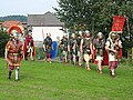 Antonine Guard re-enactment - geograph.org.uk - 2050257.jpg 640 × 480; 104 KB
-
 Approaching Inveralmond Roundabout - geograph.org.uk - 4231242.jpg 1,433 × 955; 271 KB
-
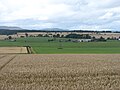
 Arable land near Huntingtower - geograph.org.uk - 2512492.jpg 640 × 452; 227 KB
-
 Arable land, Cultmalundie - geograph.org.uk - 3470739.jpg 640 × 360; 198 KB
-
 Arran Road, North Muirton Industrial Estate, Perth - geograph.org.uk - 3838297.jpg 1,600 × 1,200; 305 KB
-
 Audi dealership, Perth - geograph.org.uk - 4208023.jpg 800 × 480; 65 KB
-
 Automobile dealership off the A9 - geograph.org.uk - 3822588.jpg 2,592 × 1,936; 1.38 MB
-
 Autumn Colours - geograph.org.uk - 2379725.jpg 2,816 × 1,932; 2.4 MB
-
 Bank erosion, River Almond - geograph.org.uk - 5288656.jpg 1,600 × 1,067; 514 KB
-
 Beavers about^ - geograph.org.uk - 5288786.jpg 1,302 × 1,600; 487 KB
-
 Behind the Bike Sheds - geograph.org.uk - 2496378.jpg 640 × 427; 64 KB
-
 Big empty space east of McDiarmid Park, Perth - geograph.org.uk - 3934332.jpg 1,024 × 681; 139 KB
-
 Blackruthven, black cattle - geograph.org.uk - 3470747.jpg 640 × 360; 236 KB
-
 Blairbell Wood - geograph.org.uk - 3658524.jpg 640 × 360; 281 KB
-
 Bleachers Way - geograph.org.uk - 5892870.jpg 640 × 480; 220 KB
-
 Bleachers Way, Huntingtowerfield - geograph.org.uk - 4004641.jpg 4,608 × 3,456; 3 MB
-

-
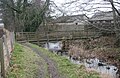
 Bridge over lade near Huntingtower - geograph.org.uk - 4083549.jpg 640 × 480; 98 KB
-
 Bridge over the A9 at Perth - geograph.org.uk - 3604357.jpg 1,024 × 681; 183 KB
-
 Cairn, Huntingtower - geograph.org.uk - 3654947.jpg 640 × 480; 273 KB
-
 Campbell's Isle - geograph.org.uk - 3656700.jpg 640 × 360; 277 KB
-
 Campsie Rd Letham - geograph.org.uk - 2611359.jpg 1,600 × 1,143; 552 KB
-
 Car dealership, Perth - geograph.org.uk - 2280255.jpg 640 × 501; 46 KB
-
-
 Car Park, Perth College - geograph.org.uk - 2702281.jpg 640 × 431; 26 KB
-
 Car park, Perth Crematorium - geograph.org.uk - 4819802.jpg 3,504 × 2,336; 5.28 MB
-
 Car park, Tulloch Road, Perth - geograph.org.uk - 2652803.jpg 1,600 × 1,200; 539 KB
-
-
 Castle view - geograph.org.uk - 2614405.jpg 1,600 × 1,143; 414 KB
-
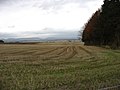
 Cereal 'tramlines' at Wester Cultmalundie - geograph.org.uk - 5455104.jpg 1,024 × 674; 187 KB
-
 Cereals above Greenhill - geograph.org.uk - 3470731.jpg 640 × 480; 237 KB
-
 Cleekum salmon fishing station - geograph.org.uk - 2369597.jpg 800 × 600; 106 KB
-
 Cormorants on a spit of land in the Tay - geograph.org.uk - 2194259.jpg 1,600 × 1,600; 413 KB
-
 Cottage at Greenhill - geograph.org.uk - 5575520.jpg 800 × 533; 91 KB
-
 Cottage at Tibbermore Crossroads - geograph.org.uk - 5455392.jpg 1,024 × 682; 175 KB
-
 Cottages, Powbridge - geograph.org.uk - 4870409.jpg 3,167 × 2,157; 2.39 MB
-
 Covered reservoir - geograph.org.uk - 3656690.jpg 640 × 480; 229 KB
-
 Covered reservoir - geograph.org.uk - 3812441.jpg 640 × 471; 38 KB
-
 Crieff Road (A85), Perth - geograph.org.uk - 2673868.jpg 640 × 480; 214 KB
-
 Crieff Road bridge over the A9 - geograph.org.uk - 5330376.jpg 640 × 393; 43 KB
-
 Crieff Road, Hillyland, Perth - geograph.org.uk - 2673849.jpg 640 × 480; 216 KB
-
 Crieff Road, Perth - geograph.org.uk - 2673838.jpg 640 × 480; 209 KB
-
 Crieff Road, Perth - geograph.org.uk - 5887417.jpg 1,024 × 796; 133 KB
-
 Crossroads, Tibbermore - geograph.org.uk - 2667355.jpg 1,600 × 1,200; 395 KB
-
 Cultmalundie Woods - geograph.org.uk - 3470629.jpg 640 × 360; 216 KB
-
 Cultmalundie Woods - geograph.org.uk - 3470634.jpg 640 × 360; 264 KB
-
 Cycle path towards Perth - geograph.org.uk - 2199640.jpg 640 × 480; 104 KB
-
 Dead centre of Perth - geograph.org.uk - 2611262.jpg 1,600 × 1,143; 422 KB
-
 Decorated ceiling in Huntingtower Castle - geograph.org.uk - 2658323.jpg 534 × 800; 267 KB
-

-
 Dobbies car park, Perth - geograph.org.uk - 1778662.jpg 800 × 532; 128 KB
-
 Dobbies Garden Centre - geograph.org.uk - 2788655.jpg 1,600 × 1,133; 195 KB
-
 Dobbies Garden Centre - geograph.org.uk - 4819818.jpg 3,387 × 2,170; 2.27 MB
-
 Dobbies Garden Centre - geograph.org.uk - 4819824.jpg 3,504 × 2,336; 3.73 MB
-
 Dobbies Garden Centre - geograph.org.uk - 4819829.jpg 3,504 × 2,336; 3.35 MB
-
 Door at Huntingtower Castle - geograph.org.uk - 5288977.jpg 1,036 × 1,600; 364 KB
-
 Drive, West Mains - geograph.org.uk - 5228015.jpg 800 × 531; 234 KB
-
 Duck pond at Gloagburn Farm - geograph.org.uk - 2591841.jpg 640 × 480; 105 KB
-

-
 Dunkeld Road (A912), Perth - geograph.org.uk - 5745524.jpg 640 × 480; 63 KB
-
 East Pow - geograph.org.uk - 3654988.jpg 640 × 360; 288 KB
-
 East Pow joins the Almond - geograph.org.uk - 2513841.jpg 640 × 480; 301 KB
-
 Easter Cultmalundie farm buildings - geograph.org.uk - 5455118.jpg 1,024 × 682; 192 KB
-
 Electricity sub station, Arran Road - geograph.org.uk - 3493048.jpg 640 × 480; 75 KB
-
 Entrance, Perth Auction Mart - geograph.org.uk - 3654882.jpg 640 × 480; 274 KB
-
 Entrance, Perth Auction Mart - geograph.org.uk - 3654898.jpg 640 × 480; 307 KB
-
 Facade of Huntingtower Hotel - geograph.org.uk - 4004751.jpg 4,372 × 3,185; 2.63 MB
-
 Fairies Road, Burghmuir, Perth - geograph.org.uk - 5897493.jpg 1,600 × 1,067; 571 KB
-
 Farm buildings, Ruthven Farm - geograph.org.uk - 4083550.jpg 640 × 480; 92 KB
-

-
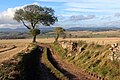
 Farm road, Tibbermore - geograph.org.uk - 3656645.jpg 640 × 360; 214 KB
-
 Farmland at Gloagburn - geograph.org.uk - 5359130.jpg 640 × 480; 71 KB
-
 Farmland at Mains of Cultmalundie - geograph.org.uk - 4698134.jpg 2,592 × 1,944; 1.27 MB
-
 Farmland at Tibbermore - geograph.org.uk - 3499903.jpg 640 × 480; 49 KB
-
 Farmland at Tibbermore - geograph.org.uk - 4084148.jpg 640 × 480; 54 KB
-
 Farmland near Merriness - geograph.org.uk - 4698141.jpg 2,592 × 1,944; 1.3 MB
-
 Field and Blairbell Wood - geograph.org.uk - 3470638.jpg 640 × 360; 245 KB
-
 Field at Duntanlich near Pow Bridge - geograph.org.uk - 4459174.jpg 640 × 480; 52 KB
-
 Field at Gloagburn Farm - geograph.org.uk - 5288996.jpg 1,600 × 1,067; 497 KB
-
 Field boundary near Parkneuk - geograph.org.uk - 2191394.jpg 640 × 500; 86 KB
-
 Field track at Tibbermore - geograph.org.uk - 5455126.jpg 1,024 × 682; 180 KB
-
 Field track at Wester Cultmalundie - geograph.org.uk - 5455102.jpg 1,024 × 682; 163 KB
-
 Field track at Wester Cultmalundie - geograph.org.uk - 5570525.jpg 1,024 × 682; 193 KB
-
 Field, North Blackruthven - geograph.org.uk - 5228144.jpg 800 × 531; 248 KB
-
 Fields at Merriness - geograph.org.uk - 2591174.jpg 640 × 480; 85 KB
-
 Fields at Tibbermore - geograph.org.uk - 5455394.jpg 1,024 × 682; 167 KB
-
 Fields beside the minor road to Methven - geograph.org.uk - 5818513.jpg 1,600 × 1,067; 500 KB
-
 Fields by the lane to Madderty - geograph.org.uk - 4698121.jpg 2,592 × 1,944; 1.31 MB
-
 Fields near Crossgates - geograph.org.uk - 2696799.jpg 2,592 × 1,944; 1.31 MB
-
 Fields of stubble at Westmuir - geograph.org.uk - 5570539.jpg 800 × 533; 137 KB
-
 Filling Station, Perth - geograph.org.uk - 4208019.jpg 800 × 600; 72 KB
-
 Flood defences, River Almond - geograph.org.uk - 2513840.jpg 640 × 480; 313 KB
-
 Footbridge over the Town Lade - geograph.org.uk - 5288854.jpg 1,600 × 1,035; 546 KB
-
 Footpath beside the Town Lade - geograph.org.uk - 5288859.jpg 1,600 × 1,067; 549 KB
-
 Footpath to Huntingtower - geograph.org.uk - 2182890.jpg 2,048 × 1,536; 431 KB
-
 Former track near Parkneuk, near Perth - geograph.org.uk - 3604333.jpg 1,024 × 682; 209 KB
-
 Front garden, Huntingtower Hotel - geograph.org.uk - 3999540.jpg 2,217 × 1,439; 1.03 MB
-
 Front section of Bleachwork, Huntingtowerfield - geograph.org.uk - 5288890.jpg 1,228 × 1,600; 365 KB
-
-
 Garden Centre from the Perth bypass - geograph.org.uk - 5336841.jpg 800 × 527; 252 KB
-
 Garth Avenue in Letham - geograph.org.uk - 2611335.jpg 640 × 480; 80 KB
-
 Gloagburn Farm - geograph.org.uk - 5289826.jpg 1,600 × 1,067; 395 KB
-
 Gloagburn Farm near Tibbermore - geograph.org.uk - 5359127.jpg 640 × 480; 73 KB
-
 Glover Arms, Huntingtower - geograph.org.uk - 2684280.jpg 1,600 × 1,165; 420 KB
-
 Grandparents' house - geograph.org.uk - 2611251.jpg 1,024 × 768; 219 KB
-
 Gravel Pit - geograph.org.uk - 1605848.jpg 640 × 480; 83 KB
-
 Gravestones, Wellshill cemetery - geograph.org.uk - 3774649.jpg 640 × 480; 179 KB
-
 Hat on the hedge - geograph.org.uk - 4870398.jpg 3,504 × 2,336; 4.26 MB
-
 Highdrum Wood - geograph.org.uk - 3470625.jpg 640 × 480; 353 KB
-
 Hill of Midgate Wood - geograph.org.uk - 3658530.jpg 640 × 360; 217 KB
-
 Holly bush bird feeder - geograph.org.uk - 2207746.jpg 1,600 × 1,557; 631 KB
-
 Home of Saints - geograph.org.uk - 2614358.jpg 1,600 × 1,143; 462 KB
-
 Houses on Dunkeld Road, Perth - geograph.org.uk - 4231246.jpg 1,600 × 1,050; 652 KB
-
 Houses, Huntingtowerfield - geograph.org.uk - 5288580.jpg 1,600 × 1,067; 385 KB
-
 Houses, Huntingtowerfield - geograph.org.uk - 5288601.jpg 1,600 × 1,035; 399 KB
-
 Huntingtower Castle - geograph.org.uk - 2658360.jpg 800 × 534; 175 KB
-
 Huntingtower Castle - geograph.org.uk - 3388860.jpg 640 × 469; 68 KB
-
 Huntingtower Castle - geograph.org.uk - 3419769.jpg 4,288 × 3,198; 4.99 MB
-
 Huntingtower Castle - geograph.org.uk - 3573200.jpg 640 × 553; 67 KB
-
 Huntingtower Castle - geograph.org.uk - 3749754.jpg 640 × 480; 79 KB
-
 Huntingtower Castle - geograph.org.uk - 3749756.jpg 640 × 480; 67 KB
-
 Huntingtower Castle - geograph.org.uk - 3843890.jpg 410 × 640; 419 KB
-
 Huntingtower Castle - geograph.org.uk - 4286977.jpg 4,671 × 2,870; 5.57 MB
-
 Huntingtower Castle - geograph.org.uk - 4511177.jpg 800 × 600; 143 KB
-
 Huntingtower Castle - geograph.org.uk - 4599777.jpg 2,560 × 1,920; 2.15 MB
-
 Huntingtower Castle - geograph.org.uk - 5288982.jpg 1,600 × 1,050; 443 KB
-
 Huntingtower Castle - geograph.org.uk - 5288991.jpg 1,600 × 1,067; 412 KB
-
 Huntingtower Castle - geograph.org.uk - 5368605.jpg 640 × 480; 104 KB
-
 Huntingtower Castle - geograph.org.uk - 6143064.jpg 1,600 × 1,200; 527 KB
-
 Huntingtower Castle near Perth - geograph.org.uk - 2657060.jpg 1,600 × 1,200; 517 KB
-
 Huntingtower Castle, near Perth - geograph.org.uk - 2657423.jpg 800 × 533; 209 KB
-
 Huntingtower Castle, The East Tower - geograph.org.uk - 4313749.jpg 4,530 × 2,963; 7.63 MB
-
 Huntingtower Castle, West Tower Hall - geograph.org.uk - 4313740.jpg 4,423 × 2,987; 7.34 MB
-
 Huntingtower Hotel - geograph.org.uk - 4004764.jpg 4,352 × 3,081; 2.67 MB
-
 Huntingtower Hotel - geograph.org.uk - 4819631.jpg 3,504 × 2,336; 3.38 MB
-
 Huntingtower Hotel - geograph.org.uk - 4819635.jpg 3,383 × 2,214; 2.54 MB
-
 Huntingtower Hotel - geograph.org.uk - 4819727.jpg 3,504 × 2,336; 4.17 MB
-
 Huntingtower Hotel - geograph.org.uk - 5288607.jpg 1,600 × 1,047; 433 KB
-
 Huntingtower Hotel and lamppost - geograph.org.uk - 4819643.jpg 2,222 × 3,419; 2.58 MB
-
 Huntingtower Hotel and Town Lade - geograph.org.uk - 4819690.jpg 2,336 × 3,504; 4.55 MB
-
 Huntingtower Lodges - geograph.org.uk - 4819655.jpg 3,504 × 2,336; 3.73 MB
-
 Huntingtower Lodges - geograph.org.uk - 5892877.jpg 640 × 480; 354 KB
-
 Huntingtower to Tibbermore road - geograph.org.uk - 5228148.jpg 800 × 531; 143 KB
-
 Huntingtowerfield - geograph.org.uk - 2513780.jpg 640 × 480; 248 KB
-
 Huntingtowerfield Bleachworks - geograph.org.uk - 1153228.jpg 427 × 640; 201 KB
-
 Huntingtowerfield Farm - geograph.org.uk - 5288849.jpg 1,600 × 958; 337 KB
-
 Icy road junction south of Methven - geograph.org.uk - 2222324.jpg 800 × 531; 162 KB
-
 Icy road near Mains of Cultmalundie - geograph.org.uk - 2222332.jpg 800 × 531; 163 KB
-
 Innkeeper's Lodge, Huntingtower - geograph.org.uk - 1638823.jpg 640 × 480; 50 KB
-
 Inveralmond Industrial Estate - geograph.org.uk - 5288938.jpg 1,600 × 1,051; 486 KB
-
 Jeanfield Park in Perth - geograph.org.uk - 2611270.jpg 640 × 480; 85 KB
-
 Jeanfield Park memorial - geograph.org.uk - 2611288.jpg 1,200 × 1,600; 501 KB
-
 Kingswell Terrace, Letham - geograph.org.uk - 2480904.jpg 640 × 480; 59 KB
-
 Ladeside Cottage - geograph.org.uk - 5288560.jpg 1,600 × 973; 363 KB
-
 Laigh of Cultmalundie - geograph.org.uk - 5575515.jpg 1,024 × 682; 135 KB
-
 Lane markings within the roundabout - geograph.org.uk - 1981190.jpg 640 × 488; 56 KB
-
 Leaving Huntingtower Castle - geograph.org.uk - 3573214.jpg 640 × 480; 70 KB
-
 Letham - geograph.org.uk - 2172039.jpg 640 × 432; 83 KB
-

-

-

-
 Looking towards Greenhill - geograph.org.uk - 5818507.jpg 1,600 × 1,067; 484 KB
-
 Low's Work Weir - geograph.org.uk - 5288843.jpg 1,600 × 1,012; 394 KB
-
 Mains of Cultmalundie - geograph.org.uk - 5359132.jpg 640 × 480; 50 KB
-
 Mains of Huntingtower - geograph.org.uk - 1153175.jpg 640 × 427; 183 KB
-
 Mains of Huntingtower - geograph.org.uk - 3388857.jpg 640 × 480; 55 KB
-
 Mains of Huntingtower - geograph.org.uk - 5288945.jpg 1,600 × 996; 466 KB
-
 Mains of Huntingtower - geograph.org.uk - 5288984.jpg 1,600 × 1,067; 298 KB
-
 Major Roadworks on the A9 (Perth Bypass) - geograph.org.uk - 5907219.jpg 640 × 480; 458 KB
-
 Marlefield - geograph.org.uk - 5228151.jpg 800 × 531; 166 KB
-
 Marlefield, Tibbermore - geograph.org.uk - 3933764.jpg 1,024 × 681; 146 KB
-
 McDiarmid Park, home of St. Johnstone Football Club (2) - geograph.org.uk - 2693707.jpg 1,600 × 1,200; 345 KB
-
 McDiarmid Park, home of St. Johnstone Football Club - geograph.org.uk - 2693706.jpg 1,600 × 1,200; 358 KB
-
 McDiarmid Park, Perth - geograph.org.uk - 3933808.jpg 1,024 × 681; 146 KB
-
 McDiarmid Park, Perth - geograph.org.uk - 3933810.jpg 1,024 × 681; 111 KB
-
 McDiarmid Park, Perth - geograph.org.uk - 5423574.jpg 1,024 × 768; 179 KB
-
 Merriness - geograph.org.uk - 2591168.jpg 640 × 480; 80 KB
-
 Methven Castle - geograph.org.uk - 2182902.jpg 1,500 × 2,048; 499 KB
-
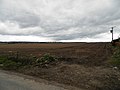
 Methven Moss - geograph.org.uk - 6248171.jpg 1,024 × 768; 348 KB
-
 Minor road across Methven Moss - geograph.org.uk - 2222317.jpg 800 × 531; 227 KB


_at_Huntingtower_Hotel_-_geograph.org.uk_-_4212106.jpg)


_crossing_the_A9_to_the_west_of_Perth_-_geograph.org.uk_-_5907227.jpg)


,_Perth_-_geograph.org.uk_-_2673868.jpg)


,_Perth_-_geograph.org.uk_-_5745524.jpg)


_-_geograph.org.uk_-_5907219.jpg)


_-_geograph.org.uk_-_2693707.jpg)


&filefrom=Minor+road+at+North+Blackruthven%2C+Tibbermore+-+geograph.org.uk+-+3933762.jpg#mw-category-media)