Category:Tibthorpe
English: Tibthorpe is a village and civil parish in the East Riding of Yorkshire, England. It is 5 miles (8 km) to the west of Driffield on the edge of the Yorkshire Wolds, it lies on the B1248 road between the villages of Bainton to the south and Wetwang to the north.
village in the United Kingdom  | |||||
| Upload media | |||||
| Instance of | |||||
|---|---|---|---|---|---|
| Location | East Riding of Yorkshire, Yorkshire and the Humber, England | ||||
| Population |
| ||||
 | |||||
Media in category "Tibthorpe"
The following 200 files are in this category, out of 208 total.
(previous page) (next page)-
 A building on Main Street, Tibthorpe - geograph.org.uk - 1046392.jpg 640 × 427; 337 KB
-
-
 A footpath to the west of Tibthorpe - geograph.org.uk - 2300247.jpg 800 × 600; 189 KB
-
 A footpath towards the B1248 - geograph.org.uk - 2305720.jpg 800 × 600; 347 KB
-
 A lay-by on the B1248, south of Wetwang - geograph.org.uk - 2333036.jpg 800 × 600; 261 KB
-
 A pile and a post - geograph.org.uk - 2275788.jpg 1,024 × 768; 141 KB
-
 A typical Yorkshire Wolds road - geograph.org.uk - 3412410.jpg 4,000 × 3,000; 2.21 MB
-
 Across Deep Dale, near North Dalton - geograph.org.uk - 4964145.jpg 427 × 640; 467 KB
-
 Along Green Lane (2) - geograph.org.uk - 2276221.jpg 1,024 × 768; 272 KB
-
 Along Green Lane - geograph.org.uk - 2276207.jpg 1,024 × 768; 251 KB
-
 Angus Farm - Barn - geograph.org.uk - 360588.jpg 640 × 480; 124 KB
-
 Angus Farm - geograph.org.uk - 1380199.jpg 640 × 480; 49 KB
-
 Angus Farm - geograph.org.uk - 1395607.jpg 640 × 446; 50 KB
-
 Angus Farm, Tibthorpe Wold - geograph.org.uk - 360576.jpg 640 × 480; 110 KB
-
 Approaching Deep Dale - geograph.org.uk - 1379074.jpg 640 × 480; 87 KB
-
 Approaching Green Lane - geograph.org.uk - 2276176.jpg 1,024 × 768; 280 KB
-
 Approaching Tibthorpe from the north - geograph.org.uk - 4139301.jpg 3,072 × 2,194; 1.39 MB
-
 Arable fields near North Dalton - geograph.org.uk - 4964156.jpg 477 × 640; 475 KB
-
 Autumn colour in Tibthorpe - geograph.org.uk - 3191383.jpg 1,024 × 768; 271 KB
-
 Autumn sown crop near Tibthorpe - geograph.org.uk - 5708075.jpg 1,024 × 768; 151 KB
-
 B1248 towards Tibthorpe - geograph.org.uk - 1395825.jpg 640 × 480; 83 KB
-
 B1248 towards Tibthorpe - geograph.org.uk - 1395840.jpg 640 × 480; 60 KB
-
 Bainton Road, Tibthorpe - geograph.org.uk - 1013201.jpg 640 × 427; 166 KB
-
 Bainton Road, Tibthorpe - geograph.org.uk - 1046373.jpg 640 × 427; 418 KB
-
 Barns at Angus Farm - geograph.org.uk - 2275086.jpg 1,024 × 768; 174 KB
-
 BN Mechanical Services - geograph.org.uk - 6521881.jpg 1,024 × 683; 535 KB
-
 Bridleway - geograph.org.uk - 270750.jpg 640 × 480; 228 KB
-
 Bridleway across Tibthorpe Wold (2) - geograph.org.uk - 2275816.jpg 1,024 × 768; 201 KB
-
 Bridleway across Tibthorpe Wold - geograph.org.uk - 2275811.jpg 1,024 × 768; 216 KB
-
 Bridleway at Deep Dale - geograph.org.uk - 6515081.jpg 1,600 × 1,065; 379 KB
-
 Bridleway at Deep Dale - geograph.org.uk - 6515084.jpg 1,600 × 1,065; 394 KB
-
 Bridleway at SE947546 - geograph.org.uk - 268971.jpg 640 × 480; 129 KB
-
 Bridleway from Green Lane - geograph.org.uk - 2108804.jpg 4,000 × 3,000; 2.8 MB
-
 Bridleway near Tibthorpe - geograph.org.uk - 1395416.jpg 640 × 495; 123 KB
-
 Bridleway near Tibthorpe - geograph.org.uk - 4964829.jpg 427 × 640; 363 KB
-
 Bridleway near Tibthorpe Grange - geograph.org.uk - 1395827.jpg 640 × 480; 89 KB
-
 Bridleway near Tibthorpe Manor - geograph.org.uk - 6521866.jpg 1,024 × 683; 457 KB
-
 Bridleway through the hedge, near Wetwang (geograph 5829590).jpg 875 × 1,024; 772 KB
-
 Bridleway to Tibthorpe Lodge - geograph.org.uk - 1430772.jpg 640 × 480; 96 KB
-
 Bridleway to Wetwang - geograph.org.uk - 776240.jpg 427 × 640; 198 KB
-
 Bridleway towards Huggate - geograph.org.uk - 1395487.jpg 640 × 480; 114 KB
-
 Bridleway towards Huggate - geograph.org.uk - 1395516.jpg 640 × 480; 166 KB
-
 Bridleway towards Huggate - geograph.org.uk - 1395522.jpg 640 × 480; 105 KB
-
 Bridleway towards Low Wood - geograph.org.uk - 6515104.jpg 1,600 × 1,065; 385 KB
-
 Bridleway towards Low Wood - geograph.org.uk - 6515107.jpg 1,600 × 1,065; 330 KB
-
 Bridleway towards Low Wood - geograph.org.uk - 6515111.jpg 1,600 × 1,065; 407 KB
-
 Bridleway towards Low Wood - geograph.org.uk - 6515125.jpg 1,600 × 1,065; 264 KB
-
 Bridleway towards Low Wood - geograph.org.uk - 6515129.jpg 1,600 × 1,065; 378 KB
-
 Bridleway towards Low Wood - geograph.org.uk - 6515135.jpg 1,600 × 1,065; 327 KB
-
 Bridleway towards Tibthorpe Wold - geograph.org.uk - 1395493.jpg 640 × 480; 65 KB
-

-
 Bus Shelter on Main Road, Tibthorpe - geograph.org.uk - 5175484.jpg 1,600 × 1,065; 811 KB
-
 Butts Lane, Tibthorpe - geograph.org.uk - 3187028.jpg 1,024 × 768; 147 KB
-
 Cadger Castle junction near Wetwang - geograph.org.uk - 1430665.jpg 640 × 480; 65 KB
-
 Chalkland Way (geograph 5976886).jpg 1,024 × 768; 144 KB
-
 Chalkland Way toward Wetwang (geograph 6103593).jpg 4,608 × 3,456; 3.47 MB
-
 Change of scenery^ - geograph.org.uk - 1379097.jpg 480 × 640; 132 KB
-
 Cottages on Main Street, Tibthorpe - geograph.org.uk - 6454349.jpg 800 × 534; 159 KB
-
 Country lane near Tibthorpe - geograph.org.uk - 13053.jpg 640 × 427; 60 KB
-
 Crop spraying near Tibthorpe Manor - geograph.org.uk - 4964178.jpg 640 × 427; 324 KB
-
 Cyclists heading to Tibthorpe - geograph.org.uk - 6521860.jpg 1,024 × 683; 407 KB
-
 Deep Dale - geograph.org.uk - 1379128.jpg 480 × 640; 121 KB
-
 Deepdale looking in the direction of Huggate - geograph.org.uk - 2275771.jpg 1,024 × 768; 139 KB
-
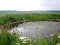
 Dew Pond on Tibthorpe Wold - geograph.org.uk - 2105736.jpg 4,000 × 3,000; 2.58 MB
-
 Driveway to Far Falls - geograph.org.uk - 2108731.jpg 4,000 × 3,000; 2.69 MB
-
 Driveway to Tibthorpe Manor - geograph.org.uk - 1380171.jpg 640 × 480; 73 KB
-
 East to Tibthorpe - geograph.org.uk - 110718.jpg 640 × 480; 103 KB
-
 Entering Angus Farm - geograph.org.uk - 2275800.jpg 1,024 × 768; 151 KB
-
 Entering Tibthorpe on the B1248 - geograph.org.uk - 2287308.jpg 800 × 600; 162 KB
-
 Entrance to Angus Farm - geograph.org.uk - 6525810.jpg 1,024 × 768; 157 KB
-

-
 Farm in Tibthorpe - geograph.org.uk - 6521882.jpg 1,024 × 683; 521 KB
-
 Farm Track and Hedgerow - geograph.org.uk - 1395633.jpg 640 × 480; 70 KB
-
 Farm Track through Potato Field - geograph.org.uk - 1395834.jpg 640 × 480; 64 KB
-
 Farm Track, Tibthorpe Wold - geograph.org.uk - 1395618.jpg 640 × 480; 94 KB
-
 Farmland East of the B1248 - geograph.org.uk - 1395639.jpg 640 × 480; 76 KB
-
 Farmland east of Tibthorpe - geograph.org.uk - 6521886.jpg 1,024 × 683; 415 KB
-
 Farmland near Deep Dale - geograph.org.uk - 2654234.jpg 4,592 × 3,448; 6.55 MB
-
 Farmland Near Low Wood - geograph.org.uk - 268962.jpg 640 × 480; 159 KB
-
 Farmland near Tibthorpe Grange - geograph.org.uk - 1395830.jpg 640 × 480; 70 KB
-

-
 Farmland South of Angus Farm - geograph.org.uk - 1395599.jpg 640 × 480; 71 KB
-
 Farmland West of Tibthorpe - geograph.org.uk - 1395626.jpg 640 × 480; 79 KB
-
 Farmland, Tibthorpe Wold - geograph.org.uk - 1395623.jpg 640 × 480; 107 KB
-
 Farmyard Scene - geograph.org.uk - 2105737.jpg 4,000 × 3,000; 3.96 MB
-
 Field edge to Tibthorpe Wold - geograph.org.uk - 2108797.jpg 4,000 × 3,000; 2.91 MB
-
 Field near Haywold Farm - geograph.org.uk - 6521855.jpg 1,024 × 683; 496 KB
-
 Fields near Tibthorpe House - geograph.org.uk - 6521877.jpg 1,024 × 683; 521 KB
-
 Fields near Tibthorpe, East Yorks. - geograph.org.uk - 725340.jpg 640 × 281; 126 KB
-
 Fields opposite Angus Farm - geograph.org.uk - 6521871.jpg 1,024 × 683; 523 KB
-
 Fields west of Tibthorpe - geograph.org.uk - 4964117.jpg 483 × 640; 345 KB
-
 Footpath near Wetwang - geograph.org.uk - 1430671.jpg 480 × 640; 66 KB
-
 Foreman's Cottage - geograph.org.uk - 1380179.jpg 640 × 480; 84 KB
-
 Gate in Deep Dale, near Tibthorpe - geograph.org.uk - 4964849.jpg 640 × 427; 353 KB
-

-

-
 Georgian Postbox, Main Road, Tibthorpe - geograph.org.uk - 5175468.jpg 1,053 × 1,600; 667 KB
-
 Green Lane (geograph 4291998).jpg 1,024 × 768; 151 KB
-
 Green Lane (geograph 5976881).jpg 1,024 × 768; 317 KB
-
 Green Lane (track) towards the B1248 (geograph 3909616).jpg 800 × 532; 229 KB
-
 Green Lane - geograph.org.uk - 1380624.jpg 640 × 480; 102 KB
-
 Green Lane near Wetwang - geograph.org.uk - 1430731.jpg 480 × 640; 143 KB
-
 Green Lane through the trees (geograph 6879867).jpg 1,024 × 768; 355 KB
-
 Green Lane to Lodge Farm - geograph.org.uk - 6525809.jpg 1,024 × 768; 101 KB
-
 Growing grain, near Tibthorpe (geograph 5829468).jpg 1,024 × 683; 758 KB
-
 Houses on Main Street - geograph.org.uk - 6521878.jpg 1,024 × 683; 477 KB
-
 Kink in the path - geograph.org.uk - 2276272.jpg 1,024 × 768; 212 KB
-
 Lane toward Tibthorpe - geograph.org.uk - 3412398.jpg 4,000 × 3,000; 2.37 MB
-
 Layby north of Tibthorpe - geograph.org.uk - 5831376.jpg 1,024 × 702; 666 KB
-
 Looking SW over the Wolds - geograph.org.uk - 53441.jpg 640 × 480; 111 KB
-
 Low Wood and Fields - geograph.org.uk - 2195159.jpg 4,000 × 3,000; 2.98 MB
-
 Main Street Tibthorpe 1.jpg 640 × 427; 174 KB
-
 Main Street, Tibthorpe - geograph.org.uk - 1395398.jpg 640 × 480; 77 KB
-
 Main Street, Tibthorpe - geograph.org.uk - 5175488.jpg 1,600 × 1,065; 541 KB
-
 Main Street, Tibthorpe - geograph.org.uk - 6525807.jpg 1,024 × 768; 168 KB
-
 Main Street, Tibthorpe, East Yorkshire - geograph.org.uk - 2300255.jpg 800 × 600; 221 KB
-
 Making hay while the sun shines^ - geograph.org.uk - 1379118.jpg 640 × 480; 97 KB
-
 Milestone in Tibthorpe - geograph.org.uk - 2192635.jpg 3,000 × 4,000; 3.35 MB
-
 Minor Road Towards the B1248 - geograph.org.uk - 1395837.jpg 640 × 480; 64 KB
-
 Minor Road Towards Tibthorpe - geograph.org.uk - 1395394.jpg 640 × 480; 67 KB
-
 Minor Road Towards Tibthorpe - geograph.org.uk - 1395588.jpg 640 × 480; 66 KB
-
 Nearing Tibthorpe - geograph.org.uk - 2192650.jpg 4,000 × 3,000; 4.03 MB
-
 New Fence alongside Green Lane - geograph.org.uk - 2276195.jpg 1,024 × 768; 250 KB
-
 North from Deepdale - geograph.org.uk - 2195222.jpg 4,000 × 3,000; 3.16 MB
-
 Not much green in Green Lane - geograph.org.uk - 2276189.jpg 1,024 × 768; 273 KB
-
 Not very secure - geograph.org.uk - 2108697.jpg 4,000 × 3,000; 3.11 MB
-
 Over B1248 to Tibthorpe Lodge - geograph.org.uk - 3958958.jpg 4,000 × 3,000; 2.88 MB
-
 Over Tibthorpe Wold to Tibthorpe Lodge Farm - geograph.org.uk - 3958940.jpg 4,000 × 3,000; 2.6 MB
-
 Part of No 2 Main Street, Tibthorpe - geograph.org.uk - 1013182.jpg 640 × 427; 207 KB
-
 Path Along Field Edge - geograph.org.uk - 364724.jpg 640 × 480; 121 KB
-
 Path and fields near Haywold Farm - geograph.org.uk - 6525815.jpg 1,024 × 768; 171 KB
-
 Path by a huge field of barley - geograph.org.uk - 6525823.jpg 1,024 × 768; 171 KB
-
 Plantation in Deep Dale - geograph.org.uk - 6525818.jpg 1,024 × 768; 197 KB
-
 Pond on Tibthorpe Wold - geograph.org.uk - 1380598.jpg 640 × 480; 94 KB
-
 Potato varieties planted near Tibthorpe - geograph.org.uk - 13058.jpg 640 × 427; 132 KB
-
 Public bridleway off Green Lane (geograph 3907846).jpg 800 × 532; 250 KB
-
 Pump on Main Street, Tibthorpe - geograph.org.uk - 6454355.jpg 800 × 567; 175 KB
-
 Pump, Tibthorpe - geograph.org.uk - 6454348.jpg 5,184 × 3,888; 5.37 MB
-
 Rabbit warren at the end of Green Lane - geograph.org.uk - 2276235.jpg 1,024 × 768; 303 KB
-
 Remains of a barn at Angus Farm - geograph.org.uk - 2275081.jpg 1,024 × 768; 201 KB
-
 Road between Tibthorpe and Huggate - geograph.org.uk - 6521869.jpg 1,024 × 683; 439 KB
-
 Road near Angus Farm - geograph.org.uk - 6521874.jpg 1,024 × 683; 427 KB
-
 Road near Tibthorpe Manor - geograph.org.uk - 6521858.jpg 1,024 × 683; 446 KB
-
 Road near West Fields - geograph.org.uk - 6521857.jpg 1,024 × 683; 436 KB
-
 Road west of Tibthorpe - geograph.org.uk - 2192621.jpg 4,000 × 3,000; 2.11 MB
-

-
 Slurry tank near Little Grange Farm - geograph.org.uk - 3909675.jpg 800 × 532; 143 KB
-
 Small parking spot near Wetwang (geograph 6599770).jpg 1,024 × 768; 202 KB
-
 Stubble field alongside B1248 (geograph 4149159).jpg 4,608 × 3,456; 4.14 MB
-
 Stubble Field and Bridleway - geograph.org.uk - 2195199.jpg 4,000 × 3,000; 2.81 MB
-
 Telephone Exchange Tibthorpe.jpg 640 × 480; 81 KB
-
 The Chalkland Way - geograph.org.uk - 1380134.jpg 480 × 640; 126 KB
-
 The Chalkland Way enters Green Lane - geograph.org.uk - 2276262.jpg 1,024 × 768; 269 KB
-
 The end of Green Lane - geograph.org.uk - 2276253.jpg 1,024 × 768; 265 KB
-
 The entrance to Angus Farm - geograph.org.uk - 2275794.jpg 1,024 × 768; 137 KB
-
 The entrance to Little Grange Farm - geograph.org.uk - 2305730.jpg 800 × 600; 216 KB
-

-
 The road from Tibthorpe to Huggate - geograph.org.uk - 2275792.jpg 1,024 × 768; 87 KB
-
 The Village Hall, Tibthorpe (geograph 3191382).jpg 1,024 × 768; 173 KB
-
 The way north out of Deepdale - geograph.org.uk - 2275776.jpg 1,024 × 768; 180 KB
-
 The Woods in Deep Dale, North Dalton - geograph.org.uk - 725343.jpg 640 × 324; 147 KB
-
 Tibthorpe - geograph.org.uk - 6521879.jpg 1,024 × 683; 469 KB
-
 Tibthorpe Crossroads - geograph.org.uk - 1013189.jpg 640 × 481; 180 KB
-
 Tibthorpe Lodge - geograph.org.uk - 5997421.jpg 1,024 × 768; 150 KB
-
 Tibthorpe Main Street - geograph.org.uk - 823788.jpg 640 × 427; 67 KB
-
 Tibthorpe Manor - geograph.org.uk - 110714.jpg 640 × 480; 148 KB
-
 Tibthorpe Manor Farm - geograph.org.uk - 6525812.jpg 1,024 × 768; 175 KB
-
 Tibthorpe UK parish locator map.svg 1,425 × 1,107; 1.68 MB
-
 Tibthorpe village - geograph.org.uk - 5783983.jpg 2,592 × 1,944; 1.81 MB
-
 Tibthorpe Village Pump - geograph.org.uk - 823969.jpg 640 × 427; 101 KB
-
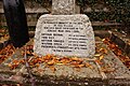
 Tibthorpe war memorial - geograph.org.uk - 5533065.jpg 768 × 1,024; 1.29 MB
-
 Tibthorpe Wold - geograph.org.uk - 1380583.jpg 640 × 460; 70 KB
-
 Tibthorpe Wold - geograph.org.uk - 360556.jpg 640 × 480; 140 KB
-
 Tibthorpe Wold - geograph.org.uk - 4964836.jpg 640 × 427; 351 KB
-
 Tibthorpe Wold Path - geograph.org.uk - 252171.jpg 640 × 480; 137 KB
-
 Tibthorpe.jpg 640 × 480; 134 KB
-
 Towards Low Wood, near Tibthorpe - geograph.org.uk - 4964122.jpg 640 × 427; 398 KB
-
 Towards Tibthorpe Lodge - geograph.org.uk - 5829584.jpg 1,024 × 706; 650 KB
-
 Track leading to Sand Pit Cottage (geograph 3909630).jpg 800 × 532; 135 KB
-
 Track to a covered reservoir - geograph.org.uk - 5708067.jpg 1,024 × 768; 129 KB
-
 Track to Angus Farm - geograph.org.uk - 1395594.jpg 640 × 480; 65 KB
-
 Track to Angus Farm - geograph.org.uk - 2192604.jpg 4,000 × 3,000; 2.98 MB
-
 Track to Craike Hill - geograph.org.uk - 1395831.jpg 640 × 480; 63 KB
-
 Track to Tibthorpe Lodge Farm - geograph.org.uk - 1395629.jpg 640 × 480; 69 KB
-
 Track to Tibthorpe Manor - geograph.org.uk - 1395579.jpg 640 × 480; 59 KB
-
 Track to Tibthorpe Wold - geograph.org.uk - 1395613.jpg 640 × 480; 80 KB
-
 Tree Shadow - geograph.org.uk - 2654253.jpg 4,592 × 3,448; 6.72 MB
-
 Trees and wheat near Tibthorpe House - geograph.org.uk - 6521875.jpg 1,024 × 683; 541 KB
-
 Uprooted Roadsign - geograph.org.uk - 2108784.jpg 640 × 480; 62 KB
-

-
 View across Tibthorpe Wold - geograph.org.uk - 2276200.jpg 1,024 × 768; 214 KB
-
 View towards Angus Farm - geograph.org.uk - 2275797.jpg 1,024 × 768; 108 KB
-
 View towards Aunham Dale - geograph.org.uk - 2276279.jpg 1,024 × 768; 163 KB
-
 Village Pump, Main Street, Tibthorpe - geograph.org.uk - 5175473.jpg 1,600 × 1,065; 856 KB
-
 Village pump, Tibthorpe - geograph.org.uk - 6454345.jpg 640 × 482; 101 KB
-
 War Memorial, Main Road, Tibthorpe - geograph.org.uk - 5174788.jpg 1,600 × 1,065; 982 KB
-
 War Memorial, Main Road, Tibthorpe - geograph.org.uk - 5174794.jpg 1,065 × 1,600; 859 KB
-
 War Memorial, Main Road, Tibthorpe - geograph.org.uk - 5174798.jpg 1,600 × 1,065; 849 KB
-
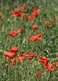 Wayside poppies, north of Tibthorpe (geograph 5831375).jpg 739 × 1,024; 745 KB
-
 Well Street, Tibthorpe - geograph.org.uk - 1013197.jpg 640 × 427; 159 KB


_-_geograph.org.uk_-_2276221.jpg)


_-_geograph.org.uk_-_2275816.jpg)


.jpg)


.jpg)
.jpg)


.jpg)
.jpg)
_towards_the_B1248_(geograph_3909616).jpg)


.jpg)

.jpg)


.jpg)


.jpg)
.jpg)


.jpg)


.jpg)


.jpg)
