Category:Tidenham
village and civil parish in Gloucestershire, UK  | |||||
| Upload media | |||||
| Instance of | |||||
|---|---|---|---|---|---|
| Location | Forest of Dean, Gloucestershire, South West England, England | ||||
 | |||||
English: Tidenham is a village and large civil parish in the Forest of Dean of west Gloucestershire, England, east of the River Wye (the Welsh border.) It straddles forest and other land including the Devil's Pulpit, a promontory with views of a largely pre-1900 architecture large village, pasture and forest by the steep meanders of the river; to the south-east it adjoins the yawning Severn.
Subcategories
This category has the following 18 subcategories, out of 18 total.
B
- Ban-y-gor Wood and Lancaut (11 F)
- Boughspring (12 F)
C
- Caswell Wood (5 F)
- Chepstow Railway Bridge (37 F)
D
- Devil's Pulpit, Gloucestershire (13 F)
L
P
- Poor's Allotment (8 F)
S
- Stroat (8 F)
T
- St Mary's church, Tidenham (11 F)
- Tidenham railway station (1 F)
- Tidenham Tunnel (14 F)
- Tintern Quarry (3 F)
W
Media in category "Tidenham"
The following 200 files are in this category, out of 847 total.
(previous page) (next page)-
 (No) light at the end of the tunnel - geograph.org.uk - 2544720.jpg 2,816 × 2,112; 2.57 MB
-
 791 bus towards Chepstow - geograph.org.uk - 6300504.jpg 800 × 600; 69 KB
-
 A brief glimpse of sky in Black Morgan's Wood - geograph.org.uk - 5969346.jpg 6,000 × 4,000; 6.42 MB
-
 A corner of Wibdon Farm, Wibdon - geograph.org.uk - 3278440.jpg 640 × 419; 66 KB
-

-
 A fork in the lane, Boughspring - geograph.org.uk - 3301603.jpg 640 × 480; 143 KB
-
 A fork in the track to Pighole Pill - geograph.org.uk - 1957082.jpg 4,288 × 2,848; 6.61 MB
-
 A lay-by on the A48 - geograph.org.uk - 4116831.jpg 2,592 × 1,944; 1.28 MB
-
 A shaft of sunlight - geograph.org.uk - 1984063.jpg 640 × 480; 276 KB
-
 A sheep in a Sedbury field - geograph.org.uk - 1940586.jpg 4,288 × 2,848; 6.26 MB
-
 A sunny Autumn day south of Boughspring - geograph.org.uk - 3729693.jpg 2,560 × 1,920; 2.89 MB
-
 A walk around the east bank of the River Wye (27) (geograph 7362553).jpg 4,228 × 3,171; 4.79 MB
-
 A walk around the east bank of the River Wye (56) (geograph 7363761).jpg 4,157 × 3,118; 2.84 MB
-
 A walk around the east bank of the River Wye (57) (geograph 7363764).jpg 4,320 × 3,240; 3.88 MB
-
 A walk around the east bank of the River Wye (59) (geograph 7363767).jpg 4,270 × 3,203; 3.81 MB
-
 A walk around the east bank of the River Wye (6) (geograph 7362064).jpg 4,320 × 3,240; 4.07 MB
-
 A48 at England boundary sign - geograph.org.uk - 3274993.jpg 640 × 480; 51 KB
-
 A48 at Severndale Farm - geograph.org.uk - 3274999.jpg 640 × 480; 31 KB
-
 A48 at Wibdon - geograph.org.uk - 3275001.jpg 640 × 480; 30 KB
-
 A48 crosses the Wye into Chepstow - geograph.org.uk - 2067229.jpg 444 × 640; 81 KB
-
 A48 crossing valley north-east of Tidenham - geograph.org.uk - 5882274.jpg 1,600 × 961; 578 KB
-
 A48 heads away from B4228 - geograph.org.uk - 2139650.jpg 640 × 542; 84 KB
-
 A48 near Sugar Loaf - geograph.org.uk - 6300490.jpg 800 × 600; 95 KB
-
 A48 near Wibdon Farm - geograph.org.uk - 6300521.jpg 800 × 600; 95 KB
-

-
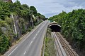 A48 road and railway tunnel - geograph.org.uk - 1959667.jpg 4,288 × 2,848; 6.22 MB
-
 A48 towards Gloucester - geograph.org.uk - 6300178.jpg 800 × 600; 136 KB
-
 A48 towards Gloucester - geograph.org.uk - 6300507.jpg 800 × 600; 83 KB
-
 A48 towards Lydney - geograph.org.uk - 3148301.jpg 1,200 × 676; 394 KB
-
 Across Beachley Road bridge, Sedbury - geograph.org.uk - 5137678.jpg 800 × 471; 91 KB
-

-
 Afon Gwy - Wye River - geograph.org.uk - 4494355.jpg 640 × 453; 64 KB
-
 Along the edge of the Gloucestershire Way, Boughspring - geograph.org.uk - 3729539.jpg 2,560 × 1,920; 2.79 MB
-

-

-
 Animal Pound Tidenham Park - geograph.org.uk - 2564819.jpg 640 × 426; 68 KB
-
 Another Kissing Gate - geograph.org.uk - 2683911.jpg 1,024 × 821; 329 KB
-

-
 Arable edge - geograph.org.uk - 2041355.jpg 640 × 480; 267 KB
-

-
 Arriving at Pighole Pill - geograph.org.uk - 1957133.jpg 4,288 × 2,848; 6.29 MB
-
 Asda Distribution Centre, Newhouse Trading Estate - geograph.org.uk - 3901835.jpg 5,472 × 3,648; 2.43 MB
-
 Atom Heart Mother (^) - geograph.org.uk - 4094671.jpg 800 × 800; 350 KB
-
 Autumn colours by the Gloucestershire Way, Boughspring - geograph.org.uk - 3729630.jpg 2,560 × 1,920; 2.9 MB
-
 Autumn tree in the sunshine, Boughspring - geograph.org.uk - 3729711.jpg 2,560 × 1,920; 3.01 MB
-
 B4228 at Boughspring - geograph.org.uk - 2041334.jpg 480 × 640; 218 KB
-
 B4228 at Boughspring 2 - geograph.org.uk - 2041343.jpg 640 × 480; 272 KB
-
 B4228 at Broadrock - geograph.org.uk - 2041371.jpg 640 × 480; 216 KB
-
 B4228 at Broadrock 2 - geograph.org.uk - 2041379.jpg 640 × 480; 243 KB
-
 B4228 at Dennel Hill - geograph.org.uk - 2037371.jpg 640 × 480; 261 KB
-
 B4228 at The Park car park - geograph.org.uk - 4621953.jpg 640 × 481; 41 KB
-
 B4228 at Tidenham Chase - geograph.org.uk - 4621950.jpg 640 × 479; 73 KB
-

-
 B4228 bend north of Broad Rock - geograph.org.uk - 4621936.jpg 640 × 480; 71 KB
-
 B4228 heading north near Boughspring - geograph.org.uk - 4621944.jpg 640 × 480; 74 KB
-
 B4228 heading towards Coleford - geograph.org.uk - 1984312.jpg 640 × 480; 232 KB
-
 B4228 near Dennelhill Farm - geograph.org.uk - 4621946.jpg 640 × 481; 79 KB
-
 B4228 nears bend in Oak Hill Wood - geograph.org.uk - 4623238.jpg 640 × 481; 84 KB
-
 B4228 passing The Park and Parson's Allotment - geograph.org.uk - 3427379.jpg 1,024 × 768; 282 KB
-
 B4228 through Oakhill Wood - geograph.org.uk - 1984306.jpg 640 × 480; 244 KB
-
 Bank Holiday country walk - geograph.org.uk - 3459494.jpg 800 × 451; 209 KB
-

-
 Basketball court, Beachley Barracks - geograph.org.uk - 6309643.jpg 800 × 600; 113 KB
-
 Beachley House - geograph.org.uk - 5150519.jpg 2,592 × 1,944; 1.74 MB
-
 Beachley Point - geograph.org.uk - 5150515.jpg 2,592 × 1,944; 1.56 MB
-
 Beachley pylon - geograph.org.uk - 3527688.jpg 600 × 800; 235 KB
-
 Beachley Road - geograph.org.uk - 5150527.jpg 2,592 × 1,944; 1.82 MB
-

-

-
 Beachley Road bus stop, Tutshill - geograph.org.uk - 5137744.jpg 800 × 770; 128 KB
-
 Beachley Road entering Sedbury - geograph.org.uk - 4877156.jpg 3,776 × 2,520; 4.05 MB
-

-
 Beachley Road, and the Offa's Dyke Path leaving Chepstow - geograph.org.uk - 4877166.jpg 3,776 × 2,520; 3.87 MB
-
 Beachley Road, Tutshill - geograph.org.uk - 4836717.jpg 1,600 × 1,067; 358 KB
-
 Beachley, Old Ferry Inn - geograph.org.uk - 5947863.jpg 1,024 × 758; 184 KB
-
 Beachley, pier - geograph.org.uk - 5947887.jpg 1,024 × 768; 169 KB
-
 Beachley, riverside - geograph.org.uk - 5947874.jpg 1,024 × 756; 183 KB
-

-
 Beside Offa's Dyke - geograph.org.uk - 2544746.jpg 2,816 × 2,112; 2.62 MB
-
 Beware of low flying helicopters - geograph.org.uk - 6300184.jpg 800 × 592; 96 KB
-
 Bird Lane, looking towards Tump Farm - geograph.org.uk - 1957050.jpg 4,288 × 2,848; 6.06 MB
-
 Bishton Farm - geograph.org.uk - 2139231.jpg 640 × 480; 59 KB
-
 Boughspring - former Wesleyan Chapel - geograph.org.uk - 542178.jpg 640 × 480; 102 KB
-
 Boughspring Cottage - geograph.org.uk - 3078961.jpg 640 × 480; 84 KB
-
 Boughspring houses, Tidenham - geograph.org.uk - 3301647.jpg 640 × 533; 105 KB
-
 Boughspring Lane junction, Tidenham - geograph.org.uk - 3301544.jpg 640 × 569; 122 KB
-
 Boulder on an old trackbed - geograph.org.uk - 6168247.jpg 1,024 × 768; 350 KB
-
 Bridge at Snipe Hill - geograph.org.uk - 1947236.jpg 2,048 × 1,536; 1.31 MB
-
 BT phonebox, Coleford Road, Tutshill - geograph.org.uk - 5603267.jpg 800 × 673; 138 KB
-
 Buddha figure - geograph.org.uk - 2756127.jpg 768 × 1,024; 201 KB
-

-
 Bunting - geograph.org.uk - 6271123.jpg 2,048 × 1,536; 1.03 MB
-
 Bus shelter by A48 near Wibdon - geograph.org.uk - 5882281.jpg 1,600 × 1,064; 609 KB
-
 Bus shelter near Tidenham - geograph.org.uk - 3280386.jpg 640 × 624; 107 KB
-
 Bus stop at the Tidenham junction - geograph.org.uk - 3280382.jpg 640 × 481; 94 KB
-
 Bus stop on A48 serving Tidenham - geograph.org.uk - 5882250.jpg 1,600 × 1,200; 750 KB
-

-
 Bus stop with no one waiting - geograph.org.uk - 2350008.jpg 640 × 480; 83 KB
-

-
 Cannon in Beachley Barracks - geograph.org.uk - 3783901.jpg 713 × 800; 187 KB
-
 Castleford Gardens, Tutshill - geograph.org.uk - 5621379.jpg 800 × 610; 139 KB
-

-

-
 Caswell Wood - geograph.org.uk - 5155875.jpg 1,024 × 575; 492 KB
-
 Change of direction - geograph.org.uk - 4048117.jpg 2,304 × 1,704; 1.72 MB
-
 Chapelhouse Wood and houses on Castleford Hill - geograph.org.uk - 1954583.jpg 4,288 × 2,848; 5.16 MB
-
 Chase House by the B4228 - geograph.org.uk - 3427370.jpg 1,024 × 513; 115 KB
-
 Chepstow 1-2 Mile - geograph.org.uk - 4686120.jpg 1,600 × 812; 291 KB
-
 Chepstow Bridge - geograph.org.uk - 5947822.jpg 1,024 × 768; 146 KB
-
 Chepstow bus in Tutshill - geograph.org.uk - 5137775.jpg 800 × 659; 105 KB
-
 Chepstow Castle - geograph.org.uk - 5582302.jpg 640 × 480; 51 KB
-
 Chepstow Castle from Tutshill - geograph.org.uk - 4512283.jpg 1,024 × 768; 300 KB
-
 Chepstow Castle, Great tower north east wall detail - geograph.org.uk - 4754645.jpg 3,678 × 2,456; 5.85 MB
-
 Chepstow Castle, Marshal's tower interior - geograph.org.uk - 4754703.jpg 4,018 × 2,985; 7.05 MB
-
 Chepstow Castle, The river Wye from the middle bailey - geograph.org.uk - 4636452.jpg 5,020 × 3,233; 7.02 MB
-
 Chepstow Castle, The river Wye from the river cliff - geograph.org.uk - 4754629.jpg 5,520 × 3,680; 6.49 MB
-
 Chepstow Castle, The river Wye from the upper barbican - geograph.org.uk - 4754694.jpg 3,678 × 2,456; 5.21 MB
-
 Chepstow Castleford Road - geograph.org.uk - 5582301.jpg 640 × 480; 129 KB
-
 Chepstow Town - geograph.org.uk - 3768643.jpg 1,600 × 1,071; 477 KB
-
 Chepstow viewed from England - geograph.org.uk - 2067218.jpg 587 × 640; 123 KB
-
 Chepstow Wye Bridge - geograph.org.uk - 2064045.jpg 640 × 480; 82 KB
-
 Choice of Tutshill or Sedbury ahead - geograph.org.uk - 2067188.jpg 640 × 480; 93 KB
-
 Church of St Mary and St Peter Tidenham - geograph.org.uk - 4498668.jpg 800 × 600; 110 KB
-
 Churchyard, Tidenham church - geograph.org.uk - 3729763.jpg 2,560 × 1,920; 2.99 MB
-
 Clawdd Offa - Offa's Dyke - geograph.org.uk - 4494363.jpg 640 × 480; 161 KB
-
 Clearing between the woodlands - geograph.org.uk - 1957097.jpg 4,288 × 2,848; 6.23 MB
-
 Cliff by the River Wye - geograph.org.uk - 2349992.jpg 480 × 640; 112 KB
-

-
 Cliffs on the banks of the River Wye - geograph.org.uk - 1163324.jpg 640 × 480; 95 KB
-
 Cliffs on the banks of the River Wye - geograph.org.uk - 1163327.jpg 640 × 480; 97 KB
-
 Coed Worgan's Wood - geograph.org.uk - 4494362.jpg 640 × 442; 122 KB
-
 Coleford Road recreation ground - geograph.org.uk - 4029544.jpg 2,304 × 1,704; 1.72 MB
-
 Coleford Road, Tutshill - geograph.org.uk - 5603243.jpg 800 × 766; 168 KB
-

-
 Converted barn at Sedbury Farm - geograph.org.uk - 1050077.jpg 640 × 480; 86 KB
-

-
 Cottages at Tidenham - geograph.org.uk - 1984324.jpg 640 × 480; 266 KB
-
 Country near The Coombe - geograph.org.uk - 5150543.jpg 2,592 × 1,944; 1.93 MB
-
 Country near Woodcroft, from the A48 - geograph.org.uk - 4116825.jpg 2,592 × 1,944; 1.33 MB
-
 Cow parsley close up - geograph.org.uk - 4094730.jpg 800 × 601; 317 KB
-
 Cows grazing on public footpath to Pighole Pill - geograph.org.uk - 1957080.jpg 4,288 × 2,848; 6.97 MB
-

-
 Crossing the River Wye - geograph.org.uk - 6214838.jpg 1,024 × 781; 131 KB
-

-

-

-

-
 Cycleway and footpath on the Severn Road Bridge - geograph.org.uk - 6052583.jpg 751 × 1,042; 353 KB
-

-

-
-

-

-

-

-
 Cyclists on the B4228 near Beacon Ash - geograph.org.uk - 5772820.jpg 1,024 × 806; 187 KB
-
 Devil's Pulpit - geograph.org.uk - 5772839.jpg 1,024 × 768; 327 KB
-
 Devil's Pulpit rock with Tintern in the distance - geograph.org.uk - 6164721.jpg 1,024 × 768; 316 KB
-
 Devils Pulpit - geograph.org.uk - 2757585.jpg 1,064 × 1,600; 695 KB
-
 Direction sign, Beachley Road, Tutshill - geograph.org.uk - 5483956.jpg 800 × 773; 165 KB
-

-
 Disused agricultural equipment - geograph.org.uk - 1940556.jpg 4,288 × 2,848; 6.35 MB
-
 Disused quarry near Woodcroft - geograph.org.uk - 3062665.jpg 640 × 480; 140 KB
-
 Disused railway bridge over the A48 - geograph.org.uk - 6300273.jpg 800 × 600; 116 KB
-
 Disused railway near Tintern Quarry - geograph.org.uk - 2544730.jpg 2,112 × 2,816; 2.65 MB
-
 Double track at Sheepcot Farm - geograph.org.uk - 3321013.jpg 1,600 × 1,200; 517 KB
-
 Driftwood Bench - geograph.org.uk - 3471313.jpg 4,138 × 2,682; 980 KB
-
 Driveway to Baddams Court Farm - geograph.org.uk - 1940671.jpg 4,288 × 2,848; 6.7 MB
-
 Driveway to the old second world war gas mask hut - geograph.org.uk - 1940789.jpg 4,288 × 2,848; 6.37 MB
-
 Dropping off the post - geograph.org.uk - 4029550.jpg 2,304 × 1,704; 1.31 MB
-

-
 Electricity substation, Tutshill - geograph.org.uk - 3456738.jpg 799 × 800; 235 KB
-

-

-

-

-
 Entrance to Badams Court Farm - geograph.org.uk - 2140579.jpg 640 × 480; 119 KB
-
 Entrance to Castle View Court, Tutshill - geograph.org.uk - 5483821.jpg 800 × 581; 101 KB
-
 Entrance to former Sedbury Laundry - geograph.org.uk - 1959638.jpg 4,288 × 2,848; 5.11 MB
-
 Entrance to the former Sedbury Laundry, Ormerod Road - geograph.org.uk - 1959648.jpg 4,288 × 2,848; 5.71 MB
-
 Entrance to Whitehalls - geograph.org.uk - 5496782.jpg 1,024 × 683; 291 KB
-
 Estuary at Pighole Pill - geograph.org.uk - 1957140.jpg 4,288 × 2,848; 6.34 MB
-
 Estuary at Pighole Pill - geograph.org.uk - 1957145.jpg 4,288 × 2,848; 6.36 MB
-
 Farm buildings, Wibdon Farm - geograph.org.uk - 6300517.jpg 640 × 389; 51 KB
-

-
 Farmhouse, High Hall Farm, Stroat - geograph.org.uk - 3278471.jpg 640 × 516; 110 KB
-
 Farmland in the Wye Valley - geograph.org.uk - 5774216.jpg 1,024 × 768; 239 KB
-
 Farmland near Madgetts Farm - geograph.org.uk - 5496808.jpg 800 × 600; 127 KB
-
 Farmland near Tidenham - geograph.org.uk - 3941900.jpg 1,600 × 1,063; 321 KB
-
 Field above Plumweir Cliff - geograph.org.uk - 5971709.jpg 6,000 × 4,000; 7.75 MB
-
 Field edge footpath near Woodcroft - geograph.org.uk - 3079087.jpg 640 × 480; 92 KB
-

-
 Fields Near Beacons Ash - geograph.org.uk - 4686196.jpg 1,600 × 1,061; 206 KB
-

-
 Fields near Old Bishton - geograph.org.uk - 6300183.jpg 800 × 600; 106 KB
-
 Firing range at the Beachley Barracks - geograph.org.uk - 6051964.jpg 800 × 585; 145 KB
-
 Flooded field entrance, Stroat - geograph.org.uk - 3230236.jpg 640 × 497; 99 KB
-
 Flush Bracket on Trig Pillar - geograph.org.uk - 2564791.jpg 1,064 × 1,600; 457 KB
-
 Footpath across The Park - and you'd be in for a muddy trek^ - geograph.org.uk - 3321031.jpg 2,560 × 1,920; 2.98 MB
-
 Footpath along the trackbed of the Wye Valley Railway - geograph.org.uk - 6217339.jpg 4,000 × 3,000; 2.55 MB
_light_at_the_end_of_the_tunnel_-_geograph.org.uk_-_2544720.jpg)


_(geograph_7362553).jpg)
_(geograph_7363761).jpg)
_(geograph_7363764).jpg)
_(geograph_7363767).jpg)
_(geograph_7362064).jpg)


_-_geograph.org.uk_-_4094671.jpg)


